RSS

Category Archives: Balochistan

The Baluch Role in the Persian Gulf during the Nineteenth and Twentieth Centuries

By Prof Dr Beatrice Nicolini
Faculty of Political Sciences,
Catholic University of the Sacred Heart,
Milan—Italy,
Email: beatrice.nicolini@unicatt.it

During the sixteenth and seventeenth centuries, evidence of the Baluch popula-tion could be found in the service of the Al Ya’rubi of Oman, mainly as mercenarytroops.’ Officers were called jam’darand soldiers sowar.2 To the Arabs of Oman, these Baluch corps constituted their military power (alshawkah) and their strength and were an indispensable tool in the conquest and maintaining of Omani tribal power. It was, however, with the Omani dynasty of the Al Bu Sa’id of Oman—starting around the first half of the nineteenth century—that the Baluch, and the coastal strip of Makran, the main region in south Central Asia of their origin, became an institutional part of the Omani governmental forces and major political leaders. Baluch tribes also settled in other Gulf areas beside Oman, and in separate villages, practicing their tribal customs and speaking their language.

PersianGulf3

Persian Gulf

Being Baluch is a question of geographical and cultural identity; therefore their integra­tion in the Arab regions of the Gulf has been always assured and stable when closely related to their original corporate role of defense force. Consequently, the role of Baluch—espe­daily Makrani—in the Arab Gulf countries has been growing and modifying itself since the nineteenth century. During the twentieth century, Baluch cultural identity, and most of all the Baluch presence in numerical terms with respect to Arab Gulf nationals, did become a significant reality, and also a cultural reality. Today there are many integration problems between nationals and nonnationals in most of the Arab Gulf countries, and the Baluch con­tribution to the richness of Gulf culture and society could represent a significant step toward future cooperation and integration through reform governmental projects. Consequently, when talking about globalization, one should keep in mind that this concept is not new for this particular region. The society of the Gulf has in fact been a “globalized” community from time immemorial; nevertheless, each ethnic group composing this cosmopolitan world suc­ceeded in preserving its own cultural identity.
In the United Arab Emirates, for example, there are today 135,700 southern Baluch (7 percent of the population) as a part of a larger community of about S million.3 Starting in the late 195os, sudden wealth made this region one of the richest of the world. Here the Baluch found work as unskilled laborers, policemen, or fishermen. Other Baluch joined the military. Still others labored in the oil fields and on the farms of the wealthy Gulf states. Although the Baluch work extremely hard, they are much better off than they were in Baluchistan, one of the poorest areas of the world. One of the main causes of the Baluch “diaspora” to the other shores of the Arabian Sea largely results from their lands of origin, which I describe together with their society’s conditions and customs.
The Baluch reside mainly in Baluchistan, a dry, desolate region in the southeastern part of the Iranian plateau. It extends from the Ker­man desert to the east of Bam and the Besha­gard mountains and to the western borders of the Sind and Punjab provinces of today’s Paki­stan. During the second half of the nineteenth century, Baluchistan was divided by the British between Iran and Pakistan.’ These two states had a dispute concerning the border dividing the two parts of Baluchistan; it was resolved by an agreement signed in 1959.5
Iranian Baluchistan is a part of the Sistan and Baluchistan provinces.’ The barren land of Iranian Baluchistan, situated on the southeast­ern side of the country, is part of “Great Baluch­istan,” with the other half located in Pakistan.? The province is divided into four regions—Sar­hadi, Sarawan, Bampur, and Makran—based on their environmental differences.
One of the main characteristics of Balu­chistan is the variation in flora and fauna that exists because of the climatic differences. This multifeatured, inhospitable land has given rise to people of different ethnos. The ethnic diver­sity is such that one can find Baluch and Brohi Arabs, Jats and Kurds, and also blacks, whose ancestors had once been brought to this land as slaves from East Africa by the Omani Arabs.’

History:
Historically it is believed that the Baluch moved to Makran from Kerman province to flee an expedition of the Seijuks during the eleventh century. At that time, the Baluch were nomads.’ They have never had a centralized govern­ment and live under a tribal system. Baluch is the name of several tribes, a small number of which live in Turkmenistan. They speak Balu­chi, believed to be a west Iranian language of the Indo-European family of languages and influenced by eastern Iranian dialects. There are two branches of northern (Sarhadi) and southern (Makrani) Baluch. The Iranian Ba­luch tribes are divided into a number of clans.'” The Iranian Baluch belong mostly to the Hanafi school of the Sunni faith of Islam. A few tribes in the Sistan area are also regarded as Baluch, but they speak a Sistani dialect, an abandoned Persian language.”
The Baluch are a people of about 6 mil­lion, scattered mainly across Pakistan (of which they occupy nearly a half), southeastern Iran, Afghanistan, and the United Arab Emirates, where they form a large immigrant community. They appear to have first occupied the center of Iran (Kerman), or perhaps even the north, before migrating toward the southeast.
Although the presence of Baluch nomadic tribes is documented before Muslim times, their current territory was populated in the past by a number of ethnic groups speaking various idioms, among which were the Dravidian lan­guages. Some would more or less consider the Baluch to be any nomadic tribe, and the latter would accept this identification, but this iden­tity was not enough for the Baluch to be able to identify themselves as an ethnically homoge­neous community.
From the end of the eighteenth century, and for all of the nineteenth century, it was these tribes of pillaging warriors who protected, hid, supported, and faithfully defended the Al Bu Sa’id of Oman. The tribal structure and clan-family relationships of their society, which was traditionally nomadic, could count on Makran, peninsular, and continental solidarity.
It was only in the eighteenth century that a Baluch national identity arose.12 It won over and brought together various tribes, essentially on the condition that they would speak the same language and share their culture. Proba­bly around that time, epic poetry was developed among the tribes, thus unifying all the groups and subgroups, whatever nuances there might have been, into an entity that today is called the Baluch people. Language is the essential factor in cultural cohesion, which is remarkable given the heterogeneous character of their society; music, too, by highlighting poetry, has been an important element in establishing cultural unity.
Baluchistan is the largest province of Paki­stan. It covers 44 percent of the land surface, an area of 347,190 square kilometers, but has a population of only 4.5 million (around 4 per­cent), making it the least populated province of the country. About half of this population lives around Quetta, the provincial capital of Paki­stani Baluchistan, located in the north, close to the border with Afghanistan. To its north and west, thousands of kilometers of barren desert and stark mountains form the borders with Iran and southern Afghanistan, while due east it is divided from the rest of Pakistan by the Kirthar and Sulaiman mountain ranges. Toward the south, along the Arabian Sea, stretch the sandy desert beaches of the Makran coast.
Most of Baluchistan lies outside the mon­soon system of weather; therefore the climate is extremely dry. The annual rainfall is about fifteen centimeters and is even less along the Makran coast. In terms of physical geography, Baluchistan has more in common with western Asia than with the Indian subcontinent. Its vis­tas of arid wastelands, great deserts, and formi­dable mountain ranges (dramatically contoured and twisted by the earth’s violent geological movements) make it a dramatic area. The dry climate combined with the natural geographi­cal features make it one of the most daunting environments for successful human habitation; thus it is sparsely populated. Many observers think that the region resembles the surface of the moon.
The most important tribes of Pakistani Baluchistan are the Brohi, Baluch, and Pathan, who speak Brohi, Baluchi, and Pushto, respec­tively. The northeast of this province receives rain and snowfall, a measurable precipitation that supports juniper forests, cultivated land, and orchards that produce apples, almonds, apricots, peaches, and grapes. Most of the peo­ple in central Baluchistan lead serninomadic lives herding sheep, goats, and camels, while others are subsistence farmers and laborers working in Punjab and Sind during the win­ter months. Some areas of the south, near the Makran coast, are famous for growing three hundred different varieties of dates!’
Covering an area of sixty-two thousand square kilometers, Makran forms the southern­most strip of Baluchistan province, with a coast­line of over six hundred kilometers. It is hard to envision the vast wilderness of this remote area, where miles of virgin beaches stretch along the sea in bright sunshine and blue skies during the winter months. Because there is hardly any rain, the few villages and settlements depend on spring water and wells. The coast has several tiny fishing villages, while main towns like Gwadar, Ormara, jiwani, and Pasni have small fishing harbors, where the fishermen can be seen com­ing in with their catch every morning and eve­ning.’ Makrani Baluch in the past traded with other maritime communities along the west­ern Indian Ocean; in fact, since ancient times Makran has held a historically strategic position as the most direct route between the Middle East and the riches of the Indian subcontinent.
Known to the ancients as Gedrosia, the Greeks were among the first recorded visitors to Makran. At the end of his conquest in 325 BC, Alexander the Great marched with his army through its harsh deserts, suffering heav­ily because of shortages of both food and water. Earlier, only Semiramis and Cyrus are known to have tried to traverse Makran’s wastelands with an army, but with devastating results.
According to the Greek historian Near­chos, Alexander did not take that route in ig­norance of its difficulties, but he chose it on learning that no one had yet traversed it with an army except Semiramis, who escaped with only twenty men of all his army, and even Cyrus, the son of Kambyses, escaped with only seven soldiers. When Alexander heard these accounts, he was seized with an ambition to outrival both Cyrus and Semiramis.15
The Greeks exerted more of a nominal influence over this region. In 305 BC Chandra Gupta defeated Alexander’s successor, Selecus Nicator, and the region fell under the control of the Mauryan empire. Later the area came under the Sassanian dynasty and remained under its control until the end of the sixth century. Raj Shah of Sind controlled the area for some time. The Arabs of Oman exercised their power over Makran from the seventh to the tenth century.
For the next seven centuries the region was under the loose control of many foreign dynas­ties, which followed one another in quick suc­cession, but their power was short lived.
Toward the beginning of the sixteenth century, the Portuguese found their way to India and captured several places along the Makran coast. They never penetrated inland and were unable to establish anything more than heav­ily defended military bases at various ports. In 1581 they destroyed Gwadar and Pasni by burn­ing the two trading and fishing villages to the ground. In the eighteenth century, Makran came under the nominal control of the khanate of Kalat, which was ruled by Nasir Khan I (the Great, 1749-95). The khanate of Kalat, which developed around the seventeenth century, was a refuge for waves of invaders coming from southwest Asia, directed to India; from the tenth to the fifteenth century Kalat and the border­ing provinces were subdued by foreign powers imposing tributes, often with the use of force; but it was not before the end of the seventeenth or the beginning of the eighteenth century that the khanate succeeded in affirming its power in Baluchistan. Once it subdued the sedentary ag­ricultural tribes and enforced tribal authority on the pastoral nomadic groups, the khanate began developing a centralized bureaucratic apparatus through territorial expansion, which included Makran.i6
It was not until the nineteenth century that the British became interested in this area, first during Napoleon’s menacing presence in Egypt and later during the time of the first Anglo­Afghan War in 1838. A British expedition was sent into the area to pave the way for the build­ing of the Indo-European telegraph line, which passed through Makran. On the line’s comple­tion in 1863, Major F. Goldsmid was posted to Gwadar as a British assistant political agent. In 1872 a firm boundary between Persia and Brit­ish Baluchistan was established.° During the twentieth century, after the creation of West Pakistan in 1947, it became a part of Pakistan itself. In 1953, Pakistan Petroleum Limited dis­covered natural gas in Sui, a town in eastern Baluchistan. For most of Pakistan, the discov­ery was a big boon: within ten years, residents in major cities were enjoying gas stoves and fur­naces. In Islamabad today, gas is cheaper than electricity. Only thirty years after discovery the gas was piped to Quetta; yet, to this day, resi­dents in Sui have no access to piped gas.

The Wastes of Creation:
Traveling to Baluchistan, one covers hundreds of kilometers of endless desert road through dust and sandstorms, where an eternal cloud of dust stands over the mountains and valleys overlooked by a sun covered in haze, an agitated atmosphere heavy with the presence of ever-existing dreadful, unexpected events. Were it not for the windswept tamarisk bushes by the road and the occasional tents set up here and there in the dust, or the bell sound­ing on a goat, the presence of humans would not be evident. It feels as if one is walking on an empty, forgotten planet in the burning heat of its blazing sand deserts and the illusive waves of the ever-existing mirages, haunted by all the devils and wicked ghosts of all time, the famous jinn.1B
“When the Lord created the universe, Ba­luchistan was formed out of its wastes.” Whether or not God created this land out of the wastes of the universe, as this Baluch proverb describes, Baluch people had been residing in some other land in the past and migrating to this land in search of shelter. Baluch people then living in the eastern region of the Caspian Sea were driven to the southern part of the country (Ker­man), from whence they were once more moved to the eastern parts and the dry deserts of Balu­chistan. Those who invaded this land forced the Baluch people to leave their green pastures and watersheds and move in tribes riding on the backs of camels and mules and carrying their hard, yet lightweight, accommodations on their saddles, leading their cattle toward this remote corner of the world in search of a refuge. The Baluch name in history is accompanied by de­scriptions of massacres and invasions. It was first mentioned in inscriptions and petroglyphs at­tributed to Darius the Great in Persepolis and Bistoun as the fourteenth province of the Achae­menian empire. It is the place Alexander turned to after his Indian conquest, in the sandy des­erts where half his weary army died. During the golden days of Islam, Arabs invaded and looted this land many times. The caliph’s commander, expressing his concern over being sent to Ba­luchistan, was quoted as saying, “You sent me to a land where her water is hidden under the ground, her dates are eaten up, and her warriors are brave. If the soldiers are few, they will be de­feated, otherwise, they shall starve to death.”19
After the Arabs came the Turkmens, Ghuzz, Mongols, and Timurids, who in turn in­vaded this land right up until the Qajar dynasty came into power in Persia in the nineteenth cen­tury, a period in which violation and oppression reached such a climax that the word Qajaris still synonymous with “stranger” and “invader.” Late in the nineteenth century, the British govern­ment of India penetrated the Persian territory, following its domination over the Sind region, under the pretext of extending telegraph lines from India to the “Oman Sea” and guarding the area. They finally succeeded in separating from Persia a part of Baluchistan, later known as Pakistan’s Baluchistan, in 1871.
In Persian Baluchistan, local khans and commanders rebelling against the central gov­ernment were thoroughly suppressed during the Pahlavi reign in the twentieth century, put­ting an end to tribal autonomy and local rulers. Since the second half of the twentieth century, the primitive lifestyle in which nature plays a decisive role, together with the background of historical invasion and confrontation with other tribes and the tax-gathering, forceful cen­tral government, has led to a call for a militant-tribal structure to defend against invaders and bring the tribes into harmony with one another and their superiority and thus win the challenge of power.2° Common people take refuge in the closed, internally consistent communities where their predetermined, ascribed socioeconomic status is guarded.

Ways of Subsistence:
Adaptation has become a necessity through generations because the Baluch live in a land of scarce water, unfavorable winds, untimely rains ending in floods, and a dry, barren soil. The sit­uation makes cattle raising more profitable than farming and migrating more suitable than set­tling. However, variations allow for oscillations between farming and cattle raising, the major economic activities in the area. Nevertheless, because of the unfavorable climate, contempo­rary migrations to other provinces and the Gulf sheikhdoms account for a supplementary source of income, together with drug smuggling and illegal imports.
Agricultural products in most regions suit­able for the purpose are as follows: date palms are planted in areas that have minimal access to water; paddy fields and nonirrigated wheat fields with a small yield can be seen near rivers; tobacco, corn, and broad bean are cultivated in the plains; and very small quantities of citrus products and tropical fruit are planted in areas with abundant water. Although farming in Balu­chistan is an ancient practice, it has never been greatly developed because of the water short­age, poor soil, lack of investment in the area to improve soil conditions (e.g., leveling steep hills located by rivers, where the soil is more suitable for agriculture), and the primitive tools and absence of advanced technology to counteract the floods and droughts. The problem of water shortage is replaced by the lack of agricultural land along the rivers. Where good soil is found, there is no water, and vice versa. Water scarcity, however, poses the main problem.21
In general, in droughts and years of fam­ine agriculture is a more reliable source of income compared with cattle raising, despite problems such as tribal rivalries and the very high taxes levied by local governments until the beginning of the twentieth century. Several fac­tors, namely, soil, water, labor, and tools, influ­ence agricultural production. In most areas the land is shared, and its potential value cannot be estimated. Landownership is accompanied by water rights, and one’s right to land where cultivation is possible is determined by one’s share in providing the water pumps or digging the qanat/kariz, a widespread system of com­plex underground networks for channeling the water present in the impervious strata at the foot of the mountains. These traditional and highly sophisticated systems are long channels dug out of the subsoil, which, by using the slight inclination of the mountain slopes, make it pos­sible to direct the water along the underground strata, channeling it toward potentially fertile terrain to make possible agricultural activity and the establishment of permanent human settlements. Obviously, the significance of these elaborate irrigation systems extends beyond the economic sphere into the social and political: ownership is linked not so much to space as to the water hours, provided according to the lunar cycle, that may be destined for irrigation of the fields.”
In an inherited water-well realm, land is not divided, nor does it have a particular value in and of itself. It is only during harvest time that one’s share of water is observed. The Per­sian Baluchistan land reform of 1961 absorbed the heads of many tribes into the central gov­ernment and thus contributed to strengthening their power. So the farmers working on their land who had a right to that land were deprived of their ownership in favor of these tribal heads who supported the government. After the Is­lamic revolution of 1979, the removal of local tribal chiefs (sardars) introduced some minor changes in landownership. Some of the people who migrated to the Arab Gulf states because of the droughts came back home and, with the money they had earned, bought the lands that had belonged to the distinguished men of the tribe. Purchase of these properties changed the face of ownership in the region to some extent. In the rural society of Baluchistan, as in other parts of Iran and Pakistan, different methods of production exist alongside one another, char­acterized mainly by historical variations of life reflecting a transitional period.

Animal Husbandry:
According to tribal beliefs and traditions, pas­tures belong to the whole tribe, but animals, such as goats, cows, and camels as well as poul­try and bees, belong to their immediate owners. There are two modes, of cattle raising in the re­gion. The first is the rural mode, in which each family keeps a limited herd in a corner of their living area, apart from their farming activities. The beasts roam in a restricted area during the day and are taken back home at night. The sec­ond is the tribal mode, in which the tribe moves with the herd to warmer areas during the cold months and returns to the cooler mountainous regions during the summer months. The tribe depends on grasslands for grazing the herd, but during the hard drought periods, after the in­fliction of sometimes heavy losses, the animals are fed with barley.
Another prevalent migration style is one in which families that own one hundred to two hundred heads of cattle move together in groups, holding three hundred to five hundred heads among them, toward pastures where they spend a few days to allow the beasts to graze on the few existing bushes and plants. Afterward, the families set off toward new grasslands. In the past, dairy products such as milk, butter, cheese, dried whey, sour milk, and yogurt, as well as wool and animal hair, were used mainly within the tribes. After a transition from a natu­ral, self-sufficient economy to a producing one, however, these products were also exchanged in the marketplace. The tribes would gain access to land, water, and pastures in the past by giv­ing a share of their crop to the khan. This pay­ment also usually included the government tax. Since the Qajar rule in the nineteenth century, the heads of the Persian Baluchistan tribes and clans have allocated one-tenth of the tribal in­come earned through cattle products to them­selves and have supplied a military force to aid the central government. The labor force among the tribes is based on the family unit and the wage-earning shepherd and is manipulated and maintained in a primitive order. Labor division among the tribes depends on age, gender (nat­urally divided tasks), and class. Women in the richest tribes have a slight role in production and daily tasks. Poorer women, by contrast, play a vital role in their families’ economy and are less restricted in their social lives.

Handicrafts:
A natural economy based on handmade articles ruled in Iranian Baluchistan before the land reform of 1961. Most products were consumed within the tribe, and raw materials and primitive tools were produced in the area. Animal skins, wool hair, hides, horns, and tree leaves mainly provided the raw materials needed for the tools used in farming, cattle raising, and maintain­ing the living requirements of the settled tribes, who formerly lived a migratory lifestyle. Tools needed to produce handicrafts either were im­proved by family members and relatives or were made to order by skilled craftsmen. In the latter case, an exchange of agricultural or dairy prod­ucts would pay for the tools.
Primitive tools were not exchanged, nor were they rented among the producing fami­lies; production organization was limited to one family or related families within a village. Labor division was natural and accompanied by a social division based on the individual’s status both in an assumed kinship system and in a real one. Products and the producing tools were for inside use and would not find their way into the market. After the land reform, some changes were introduced regarding the rules governing production, distribution, and exchange, result­ing in a greater production level for sales in the market. Consequently, handicrafts have been divided into two groups, the first related to in-ternal consumption goods, the second to prod­ucts for the market:2s
To decorate their houses, women sew coins and buttons on a piece of cloth and adorn the sleeves and the front parts of women’s cloth­ing with a kind of well-known needlework. This type of embroidery work has been common among Baluch tribes since old times and is used in the family and sent to the market for sale. Handicrafts sent to the market as well as those used within the tribe include the tegard (a type of mat used as a carpet); coins sewn on a piece of cloth for use as decoration; needle­work made to order, which is more or less ex­changed as in the past but can also be found occasionally in the market; rugs and carpets; and, to a limited extent, kilims, for which the government has provided some workshops. Pot­tery making has been done in Baluchistan since ancient times. Pottery discovered in the village of Damen in Iranshahr is now on display in the museum of anthropology in the city of Zahe­dan. Nowadays, pottery is made only in a small region, to a limited extent. Kalpuregan, a vil­lage about thirty-five kilometers to the south of Sarawan, is now famous as a pottery center in Iranian Baluchistan. Men provide the clay from the nearby hills and prepare it for production, and women make and paint the pots. The pots are made in a primitive style, without the aid of a potter’s wheel. They are dried in the sun and then painted with colorful, dotted patterns. These products are both for personal consump­tion and for sale in the market.

Gathering:
Living in the inhospitable natural conditions of Baluchistan and lacking the know-how to coun­teract the deficiencies of their surroundings, the Baluch take pleasure in the minor phenomena they find in nature. They founded a life that dates back to the dawn of civilization, when they subsisted on food provided by the fruit and plants they gathered from their parsimo­nious environment. Their diet has consisted of dates (either wild or cultivated), raw mountain grasses, onion juice, pepper juice, and bread.
Baluch make use of all that is found in na­ture. During the springtime famine, men even compete with beasts over grass. In the past few decades, keeping pace with the developing in­dustries in Iran and Pakistan, all kinds of con­sumer goods produced inside the country or abroad could be found in the remotest parts of Baluchistan. The exports consist chiefly of salted fish, fish maws, shark fins, raw wool, goat hair, hides, cotton, dates, and dwarf palm, while the imports include cotton piece goods, silk, sugar, wheat, rice, iron, and oiI.24 The rush of goods from the Gulf states, India, and Pakistan as well as those produced inside the country has had a great impact on families’ consumption, diet, clothing, and even taste and cultural val­ues. Through these various goods, such as man­made fabrics from China and great quantities of illegal alcohol from the Gulf, numerous Baluch families have become acquainted with different cultures and lifestyles and other world markets.

Plunder and Smuggling
As stated above, the land is so infertile and cul­tivation so close to impossible that despite palm plantations, cattle raising, and the recent devel­opment of irrigated farming, extra sources of income seem almost necessary. During the time when the Baluch were relatively independent and autonomous, they used to gain this income by raiding farms in nearby villages or robbing caravans traveling to or from India. Extra in­come was also supplied through smuggling and illegal imports and by selling their labor force in or out of the country, since the tribal military organization was abolished and they no longer disobeyed the law of the land. The vivid testi­monies of the Baluch plundering nature given by the nineteenth-century British explorers con­firmed the Baluch as great warriors and power­ful adversaries. They were described as capital marksmen and were notorious for their lawless habits such as the chupao (raid). Among the Nar-rhoi and the Yaramadzai, the looting was con­ducted on camels. They reached the villages at night and at dawn started the raids, using the fundamental element of surprise; captives were taken as slaves, and the route back was never the same. These raids were a permanent factor of blood revenge among Baluch tribes.25 Loot­ing brings honor to the tribal society, showing manliness, bravery, and merit and thus uniting the tribe. Smuggling plays the same role and is organized, as in the past, by warlike, militant, self-sacrificing men. It brings honor as well as solidarity to the tribe because it requires de­tailed planning and cooperation among the tribe members involved.

Migration:
Let’s travel to Dubai together, as it’s senseless without you.

—From a Baluch song
Migration is very common among the Baluch, for numerous reasons. Some migrate to the re­gion’s ports and cities or go abroad in search of food and shelter, and others to escape from the law, at the risk of losing everything. Sometimes it is simply a test of manhood, of going out into the world, or an attempt to escape the prevailing restrictive tribal system or to save some money for marriage or a new, better life. Youth tend to migrate in order to enter the labor force and fill the income gap; older people, by contrast, rarely migrate unless they no longer possess anything to guard. Pakistan, where the other half of the homeland that was divided by political games but never recognized by the Baluch is located, promises a refuge. Historical connections, to­gether with the racial, lingual, religious, and cul­tural unities as well as the similar lifestyle, family ties (most Baluch have relatives in Pakistan), and economic relations, give most Pakistani Baluch the right to ancestral land and water in Iran, and vice versa, and are considered to be the main reasons for this migration pattern.
Other factors include geographic vicin­ity, the easy crossing to Pakistan, and the lower cost of living in that country. Most migrations to Pakistan involve the whole family, whereas the Gulf states draw only the youth and the poor, often single men by themselves because of the dangers involved. In the latter cases, most mi­grants are deprived of a legal passport and cross the border through organized illegal bands that demand much money for the task.

Health:
In this rough land only the Baluch, the goat, the palm, and the camel can survive. The common poverty motivated by the lack of production and the consequent malnutrition, accompanied by the consumption of nonessential products such as tea, tobacco, and drugs, accelerate the suscep­tibility to all kinds of diseases among children and adults alike. Bread is the main food people subsist on. Contaminated drinking water plays a great role in inducing diseases. Other sources of water such as rain, rivers, springs, and Banat/ kariz are used both for drinking and for wash­ing. Rainwater in some places is collected in pools and ponds and is contaminated with par­asites and microbes. A polluted environment, together with lack of bathing and changing of clothes (especially among the cattle raisers, and not the farmers), an absence of toilets, and so on, add to this dramatic problem.

Education: A Case Study:
The individual is first educated within the fam­ily and then inside the tribe. The education re­ceived is mainly automatic and behavioral and results in socialized stereotypes. In the past, only the male offspring of the upper class would receive a formal education that would enable them to write and to read the Koran and other religious books. The modern education system that was started under the Pahlavi regime with the establishment of schools in Persian towns and cities and aimed at training children only to read and write did not succeed, because of the lack of possibilities for advanced education in small centers and the absence of educational structures. Despite the great incentives for edu-cation and the wish to save the children from poverty and tribal restrictions, and also the oc­casional governmental aid (there is even a uni­versity established in Zahedan, the center of the province), the highest percentage of literate people are among city dwellers and males. Sta­tistics related to literacy in cities show that the majority of literate people are the children of governmental officials and clerks. In Pakistani Baluchistan, the education of young females de­veloped thanks to an important element of the Rind tribe: Zobaida Jalal. Following the military coup d’etat in Pakistan on 12 October 1999 that installed the new government of General Pervez Musharraf, she was appointed general federal minister of education, women, development, social welfare, and special education. Zobaida started the first school for girls, gradually intro­ducing new cultural ideas, such as male teach­ers, and new social and political balances in the tribal local society. Zobaida fights for the eman­cipation of Islamic women through their edu­cation. She bears the typical features—round eyes, long nose, and fair complexion—of the Rind tribe, to which she belongs, and is the most famous and admired woman throughout Balu­chistan. Thanks to Zobaida’s generosity, it has been possible for me to study the Mand area, where she lives with her family, and to have the opportunity to enrich the dialogue among peo­ple, cultures, and religions.
Mand is situated in the northwestern part of Makran, close to the border with Iran. Significantly, it was in this area, where tribal traditions are deeper and more widespread, that Zobaida decided to found and direct the Zobaida Jalal Khan Primary Girls School. In the early 198os, only a few pupils attended the school, but thanks to Zobaida’s firmness and to the creation of special facilities, such as a trans­portation service and a boarding program for those girls whose families live far from Mand, she succeeded in her design. In addition to the main subjects, lessons in languages, including Baluchi, Urdu, English, Arab, and Persian, are taught; all of them are important in Pakistan, a state characterized by a multiethnic presence and a plurality of languages. The school was built and sponsored by Zobaida’s father, Jalal Khan, and today is financed by the government of Baluchistan, together with the association of many prestigious personalities throughout Paki­stan, including Bishop A. Lobo of Islamabad-Rawalpindi. The teachers are both Pakistani and European. In 1993 Zobaida’s care and de­termination overcame all obstacles to the intro­duction of a male teacher, the first in Pakistan’s women’s educational system. Zobaida’s commit­ment in the diffusion of cultural values among females of Islamic tribal societies represents a long and difficult task. This route will hopefully lead not only to better conditions for women but also to the acceptance of equal human rights for all. Zobaida represents a bright examplefor many women of this area: a Baluch woman who, having started from one of the most impover­ished and forgotten places in Pakistan, devoted her life to the people, but never forgot her own identity as an Islamic woman. Her commitment in spreading culture among women in Islamic tribal societies not only works toward female emancipation but also aims to acknowledge the values of human dignity. Hers is undoubtedly a strong testimony of the Baluch contribution to the Gulf’s development.

Accommodations:
Owing to geographic variations and differ­ent lifestyles, accommodations in Baluchistan are varied, as are other aspects of Baluch life. Houses in towns and cities have arched roofs and earthen walls. Those made of cement are either governmental offices or accommodations for government officials. Traditional houses made of palm and wild palm leaves can be observed along the desert border. Apart from the old castles, whose remnants are still visible in some regions, and the two-story buildings belonging to local tribal chiefs (sardar), accommodations in Baluchistan consist mainly of semicircular or elliptical structures made of palm leaves. They have dome-shaped roofs, which when seen from the inside are rectangular. Another type of ac­commodation has large earthen rooms with high ceilings and a fireplace, showing perfect settlement and the good status of the owner. There are no other facilities such as toilets, bath­rooms, storerooms, and so on. Still another type of accommodation belongs to the cattle-raising tribes in Baluchistan. It is woven of goat’s hair and is easy to set up and to move; twelve people can do it. A number of sticks are used to form a frame, which is then covered with a goat’s hair mat woven by the women of the tribe.

Family:
As the smallest social units, families in Baluch­istan are often extended. In cattle-raising cul­tures, women’s labor plays a greater role in the economy than it does in towns and villages. In such systems, women’s role in the division of work is quite remarkable; they are considered to be men’s equal in production. This role does not exist in towns and villages because of the differences between the cattle-raising lifestyle and the sedentary one and also because of the existence of new jobs that symbolize men as the only effective labor force in economic produc­tion. Women automatically enjoy the rights and respect due to their class, which is not an indi­cator of their role in production. In fact, they take no part in production and have darzada, or servants (in the past they had slaves), at their service. The number of women who belong to the richest tribes in towns and villages is very small. Some of these women never leave their houses. A man in Chahbahar was proud that one of the women in his family had not left her house in the past eighty years, even though so many historical events had taken place in this country. These rich women are normally seen only by their husbands and close relatives.
Despite the fact that the tribal system in migratory and sedentary groups prevents women from marrying outside their class, the development of villages and towns, new jobs, formal education, and moving out in search of money, as well as the reduced power of local tribal chiefs, has introduced some changes in local society. This has also caused changes in wealth allocation among families, leading to new cultural and economic possibilities in Ba­luch life. These changes have influenced in­tertribal marriages to some extent. Although most marriages are still arranged within tribes, polygamy is common among the rich tribes. In the majority of cases, monogamy persists as a result of the prevailing poverty. Marriages are arranged in the poor tribes for socioeconomic reasons, whereas in the rich groups the incen­tive is to strengthen political and kinship ties.

Marriage:
Wives are selected from among the young girls belonging to the same tribe as the mother of the boy to be married, and it is the boy’s mother who makes the selection. The fathers are then informed of the decision. In the past, girls and boys of the same tribe would be engaged to each other at birth. The endogamous practice, how­ever, was the most widespread. The father would inform the family and the old respected men of the decision, and on approval, they would go to visit the girl’s family. After a few visits, the girl’s father would declare his consent to the boy’s fam­ily or to the elder man who acted as mediator.
The girl and the boy who are to be mar­ried have no right to express their personal views, and at times they are not even told about the matter until before the wedding ceremony; it is their parents who declare their own wish. The marriage age for boys is between fifteen and eighteen, and for girls between twelve and fifteen. In a ceremony arranged prior to the wedding, an elder man acting as a mediator in­forms the boy’s father of the conditions set out by the father of the girl.
After mutual agreement, the bride’s fa­ther receives cash from the boy’s father in ex­change for the dowry of furniture and house­hold items such as bedding and utensils. If the bride is from a rich tribe, servants (and in the past slaves) and a few palm trees are also added to these articles. The engagement ceremony is festive, with singing and dancing. A woman from the groom’s side, perhaps his sister or his elder sister-in-law, carries a suitcase containing the groom’s gifts on her head and sings aloud some songs accompanied by the other women. The wedding may follow immediately after the engagement, or it may take place a few years later, after the groom’s return from a journey during which he has saved enough money to pay for the wedding ceremony. The ceremony can last as long as fifteen days for the rich tribe, but only a day or two for the poor people.
The relatives take part in the ceremony by presenting what they can afford in cash or as gifts. In the past, a few days and nights were spent dancing, singing, and reciting Baluch epic poems and listening to the poet and the music player until daybreak. When the wedding is over, the groom is taken to the bride’s house in a brand new Toyota, which has replaced the adorned camel of the past. A woman carrying a Koran and perfumed oil welcomes the groom at his arrival. He is a stranger in a familiar land.

Baluch Cultural Identity:
Among the many migrating groups, it is inter­esting to note the numerous African elements, mostly of slave origin, that contributed to the Baluch cultural identity. Within comparative slave history, the “Oriental” slave route was not a mild or peaceful process; the slave trade from the main ports of Sub-Saharan East Africa to the markets of Central Asia was not characterized by either small quantities or lack of violence. The historiographical debate about these issues is very intense. While much attention and research have been devoted to the history of the Atlan­tic slave trade, studies of the Asian slave trade routes have been at the center of numerous in­ternational conferences and workshops. Many publications have debated the issues concerning migration patterns of Africans in Asia and the role of the African elements in the numerous Arabian and Asian cultures and societies.”
“Negroes of Pakistan are called Makrani.”‘ Makrani is a term often used to identify black people of south Central Asia. The slave trade routes spread Africans through the Muscat port by sea and through Persia by land to Las Bela, Kharan, Kalat, and Karachi. Abyssinian origins were assumed because of the occasional traces of woolly hair and inverted lips. The African pres­ence in Baluchistan was due both to absorption and the substratum of black people: settlements of healers and sorcerers of East African origins, traced since the eighth and ninth centuries from Gujarat, possibly moved west, and succeed­ing waves of migration patterns developed from • the monsoon routes of the South Seas. Con­sequently, identity absorption has been a long and often painful process within the Baluch concept of cultural identity, potentially through African migrations to the coast of Makran and subjugation by stronger Baluch tribes by direct slave importation. Other Africans were brought to Makrani Baluchistan as captives after fights with Persia and Afghanistan. During the eight­eenth century, there were many recorded slaves in the Kharan district. Slaves were exchanged for indigo madder (a plant whose root is used as a source of dye), hides, and cotton by the tribes of Makran and Las Bela. They were also captured by the rulers of Kharan in battles with Persia and Afghanistan, especially during the eighteenth century, and others were brought to Karachi from pilgrimages to Mecca. As is well known, despite abolition in 1843, slavery flour­ished throughout the nineteenth and twentieth centuries in the western Indian Ocean. Since the beginning of the twentieth century, Africans have found their freedom and become part of a new society: a multicultural and a multireligious society composed of Sunni Muslims, Shia, and Zikris. At the beginning of the twentieth cen­tury, most of the Makranis were skilled or un­skilled laborers, craftsmen, fishermen, owners of small restaurants, schoolteachers, or drivers. After the partition, and in recent times as well, the diffusion of crime, drug and illicit alcohol smuggling, and illiteracy resulted from new il­legal routes, including human trafficking.
Most of the Baluch are very fond of music and dance, and here the African element be­comes a distinctive feature of the Baluch cul­tural identity. The drum beater, with his drums, sits in the center, and other participants dance around him. This dance—lewa—is claimed to be of African origin, and during the singing that accompanies the performance, Baluch use a combination of Arabic, African, and Asian languages. The still-complex situation of Baluchistan and its historical, institutional, and po­litical marginal position represents a challenge that appeals to ethnic and cultural identities, with the aim of shaping a better future both for this region and for the Baluch presence in the Gulf region.28
According to F. Barth’s observations, the Baluch even once settled on Arabian shores of the Gulf, attired in their dress, the females with wide and flowing sleeves and a loose bodice, in contrast to the Arabs’ more close-fitting and swung-waisted dress.29 The pantaloons are wide at the top and very narrow at the calf, whereas those of the Arabs are more straight. The em­broideries of both dress and trousers are beauti­fully colored, full of sexual and cultural symbols and significances. Baluch marry in the summer season, and Arabs avoid the summer. The Ba­luch groom buys gold for his bride, while the Arab groom gives a bride-price to his father-in-law; virginity for Baluch remains a private mat­ter, while Arabs give public proofs. The Baluch nuptial but is constructed in the bride’s home, whereas Arabs place it in the groom’s home. Baluch homes in Arabia showed a cultural vital­ity in colors that Arabs houses did not.
Baluch cultural identity is preserved in many Gulf countries, especially in the Sultanate of Oman. Here Baluch people represent the sec­ond largest cultural group after the Omani from Zanzibar. There are approximately 405,400 people of Baluch origin living in Oman.” This amounts to i g percent of the country’s popu­lation. Despite the loose contacts with their homeland, the Baluch in Oman have main­tained their ethnic and linguistic distinctions. The various Baluch groups speak different lan­guages, each with distinctive traits. Like other ethnic groups, they have attained the ranks of management. Although further research is needed on this issue, Al Ismaily and McKiernan provide information about the role of Baluch in this country and their cultural influences on managerial styles. Baluch culture in Oman suggests a more autocratic management style. Moreover, the majority of managers exposed  to the Baluch culture recognize that their management is influenced by their military service. These observations confirm the strong military tradition among the Baluch people.

Conclusion:
The Gulf’s history and its pivotal role in world politics have attracted the interest of many scholars since ancient times. The strategic role of the Gulf region has always represented a cross-cultural articulation of broad diversities, where culture and society play today a significant mean also of conflict resolution. The role of the Baluch in the Gulf was well defined during the nineteenth century as mainly a human source for the recruitment of mercenary troops especially for the sultans of Oman, and still today the sultan of Oman’s bodyguards and the Bahrain police are composed of Baluch.
Since the beginning of the twentieth century, the well-characterized identity of Baluch culture was widespread in the Gulf, with its strong Asian and African elements. The gradual process throughout two centuries of the intermingling of two main elements—military strength and cultural and political identity—contributed to an unquestionable presence and deep influ­ence of the Baluch in the Gulf’s society.
As most agree, terrorism today represents one of the major plagues to be defeated through­out the world. Within this broad and complex subject, when trying to analyze social, economic, and cultural differences like those of the Bal­uch in the Gulf region, one should tend toward a more analytical and empathic approach, in order to use it as a methodological key for re­reading and understanding what could be de­fined as one of the contemporary world’s major crises. Only by also understanding the Baluch’s main motivations for their presence in the Gulf today (my starting hypothesis) could one try to identify that kaleidoscopic character of the so-called globalized Gulf region, which as I have said is a fascinating and unique example of all the different cultures in the whole world.

References:
1. S. B. Miles, The Countries and Tribes of the Persian Gulf, 2 vols. (Glasgow: Garnet, 1994), 201-63; W. Floor, The Persian Gulf: A Political and Economic History of Five Port Cities, 1500-7730 (Washington, DC: Mage, 2000,347-51.

2.  Much of the content of my essay is the result of several sea­sons of fieldwork in Pakistani Baluchistan. The term jam’clor seems to correspond to “master of the gate” or “head consta­ble”; it has been transliterated in various ways by British sources mainly on a phonetic basis as farnadari orjemadari.

3. Joshua Project: Pakistan, www.joshuaproject.net/countries.php?rog3= PK (accessed 18 April 2007).

4.  On this subject, see, e.g., V. F. Piacentini,”Notes on the Definition of the Western Borders of British India in Sistan and Baluchistan in the Nineteenth Century,” in Yad-Nama: In memoria di Alessandro Bausani (Yad­Nama: In Memory of Alessandro Bausani), 2 vols., ed. Scarcia Amoretti and B. Rostagno (Rome: Bardi, 1991), 189-203; F. Goldsmid, “Exploration from Kurrachi to Gwadur, along the Mekran Coast,” Proceedings of the Royal Geographical Society of London 7, no. 3 0874: 91-95; and P.J. Brobst, “Sir Frederick Goldsmid and the Containment of Persia, 1863-73,” Middle Eastern Studies 33, no. 2 (1997): 197-215.

5. T. M. Breseeg, Baloch Nationalism: Its Origin and Development (Karachi: Royal Book, 2004).

6. Its main towns are Zahedan, Zabol, Iranshahr, Sar­swan, and Chahbahar.

7. Its area equals 273,661 square kilometers and sus­tains a population of about 2,388,000. It is bounded on the north to Sistan and Kerman provinces, on the south to the Gulf of Oman, on the east to Kalat, and on the west to Roudbar-e-Bashagard.

8. B.Nicolini, Makran, Oman, and Zanzibar: Three-Terminal Cultural Corridor in the Western Indian Ocean (7799-7856) (Leiden: Brill Academic, 2004).

9. See the extensive collection by J. G. Lorimer, Gaz­etteer of the Persian Gulf Oman, and Central Arabia, 8 (Calcutta: Superintendent of Government Print­ing, 1908-15).

10. The most important tribes, variously transliter­ated by British explorers during the nineteenth cen­tury, were the Baveri, Balideh, Bozorgzadeh, Riggi, Sardaar, Zaie, Shahbakhsh, Lashari, Mobaraki, Mir Morad Zaie, Narroi, Nousherwani, Brohi, Baram-Zehi, and Shir-Khanzal.

11. The notable Persian dialects were Sarbandi, Shah­raki, Sargazi, Zamlr-Farsyoon, Mir-Arab, and Sanja­rani.

12. R. Redaelli, The Father’s Bow: The Khanate of Kalat and British India (Nineteenth—Twentieth Century) (Fi­renze: Manent,1997).

13. A British explorer of the nineteenth century de­scribed the date palms and their abundance in Balu­chistan. See R. Leech, “Notes Taken on a Tour through Part of Baloochistan in 1838 and 1839 by Haji Abdun Nubee of Kabul, Arranged and Translated by Major Robert Leech,”Journal of the Asiatic Society 69 (1844): 667-706.

14. Gwadar was an enclave of the Sultanate of Oman from the second half of the nineteenth century up to 8 September 1958, when West Pakistan bought it back from Oman for f3 million. Gwadar is today a town of 80,000 people. The building of the first five-star hotel, the Pearl Continental, is almost complete, but just 20 percent of people in Baluchistan have ac­cess to safe drinking water. Pakistan and China had signed a comprehensive agreement on 16 March 2002 in Beijing undertaking the task of construct­ing Gwadar’s deep sea port according to universal standards. Islamabad expects that a fully function­ing port at Gwadar will create thousands of jobs and improve peoples’ livelihoods and thus erode tribal bonds and make the sardars (local chiefs) obsolete. Of the $250 million needed for the first phase of con-struction, Beijing provided $200 million. Six hundred engineers moved to Gwadar. The construction labor force is totally Chinese, and the exclusion of Baluchis led to a massive car-bombing in Gwadar in May 2.004 that killed three Chinese engineers. The Chinese naval presence in the Indian Ocean and the access to the Middle East markets are obviously only a part of the geostrategic relations between China and the United States in the Gulf. B. Nicolini, “Historical and Political Links between Gwadar and Muscat from Nineteenth-Century Testimonies,” in Proceedings of the Seminar for Arabian Studies, vol. 32 (London: Brepols, 2002), 281-86; Nicolini, “Gwadar: A Place to Live or a Place to Hunt?” Quaderni Asiatic’ 50 (1999): 5-13:See also Gwardar News, www.gwadarnews .com/gwadar.asp.

15. Bivar, “Gil Achemenidi e i Macedon’: Stability e turbolenza” (“The Achaemenids and the Macedo­nians: Stability and Turbulence in Central Asia”), in Asia Centrale, ed. G. Hambly (Milan: Storia Universale Feltrinelli, 1970), 30 (originally published in Zentral­asien, no.16 [Frankfurt: Fisher,1966]); M. Sordi, Ales­sandro Magno try Storia e Mito (Alexander the Great between History and Myth) (Milan: Jaca Book, 1984); J. A. Saldanha, Precis of Makran Affairs (Calcutta: Su­perintendent of Government Printing,1905).

16. Nicolini and R. Readelli, “Quetta: History and Archives; Notes of a Survey of the Archives of Quetta,” Nuova Rivista Storica 78, no. 2 (1994): 401-14.

17. See the report of the British commissioner for the joint Anglo-Persian Boundary Commission: F. Gold­smid, Eastern Persia: An Account of the Journey of the Persian Boundary Commission, 1870-1890 (London: Royal Geographical Society,1876).

18. During, ‘African Winds and Muslim Djinns: Trance, Healing, and Devotion in Baluchistan,” Year­book for Traditional Music 29 (1997): 39-56.

19. F. Piacentin i, “Traces of Early Muslim Presence in Makran,” Islamic Studies 35 (1996): 122-34.

2o. See P. Titus and C. Jahani, “Knights, Not Pawns: Ethno-Nationalism and Regional Dynamics in Post-colonial Balochistan,” international Journal of Middle East Studies 32 (2000): 47-69.

21. F. Van Steenbergen, “Water Rights as Social Con-tracts,” In Baluchistan: Terra incognita; A New Meth­odological Approach Combining Archaeological, His­torical, Anthropological, and Architectural Studies, ed. V_ Piacentini and R. Redaelli (London: British Archaeo­logical Reports, 2003).4959.

22. R. Redaelli, The Father’s Bow, 30-32.

23. S. M. al Ameeri, “The Baloch in the Arabian Gulf States,” in The Baloch and Their Neighbours: Ethnic and Linguistic Contact in Balochistan in Historical and Modern Times, ed. Carina Jahani and Agnes Korn (Wi­esbaden: Reichert Verlag, 2003), 23745.

24. R. Hughes-Buller, Imperial Gazetteer of India: Provincial Series, Baluchistan (Lahore: Sang-e-Meel, 1984), 51-53.

25. H. Potti nger, Travels in Beloochistan and Sinde (London: Langman, Reese, Orte, and Brown, 7816); C. Masson, Narrative of Various Journeys in Balochistan, Afghanistan, the Panjab, and Kalat, 4 vols. (1844; Ka­rachi: Oxford University Press0977),4:349.

26. Within the so-called diaspora studies, see, for example, W. G. Clarence-Smith, The Economics of the Indian Ocean Slave Trade in the Nineteenth Century (London: Routledge,1989); Clarence-Smith, Islam and the Abolition of Slavery (London: C. Hurst, 2006); G. Campbell, Structure of Slavery in Indian Ocean Africa and Asia (London: Routledge, 2003); E. Alpers, Ivory and Slaves in East Central Africa: Changing Patterns of international Trade to the Late Nineteenth Century (London: Heinemann, 1975); R. L. Powells, Horn and Crescent: Cultural Change and Traditional Islam on the East African Coast, 800-1900 (Cambridge: Cam-bridge University Press,1987); J. Glassman, Feasts and Riot: Revelry, Rebellion and Popular Consciousness on the Swahili Coast, 1856-1888 (London: James Currey, 1995); Glassman, “The Bondsman’s New Clothes: The Contradictory Consciousness of Slave Resistance on the Swahili Coast,”Journal of African History 32 (1991): 277-312; J. Middleton, The World of the Swahili: An African Mercantile Civilization (New Haven: Yale University Press, 1992); M. Horton and J. Middleton, The Swahili: The Social Landscape of a Mercantile So­ciety  (Oxford: Blackwell, 2000); and P. Caplan and F. Topa n, eds., Swahili Modernities: Culture, Politics and Identity on the East Coast of Africa (Trenton, NJ: Africa World Press, 2004). See also the collection of essays dedicated to these complex issues in “The African Di­aspora in Asia—Historical Gleanings,” special issue, African and Asian Studies 5, nos. 3-4 (2006).

27. J. B. Edlefsen, K. Shah, and M. Farooq, “Makranis, the Negroes of West Pakistan,” Phylon 21 (1960): u-3

28. Titus and Jahani, “Knights, Not Pawns,” 47-69.

29. F. Barth, Sohar: Culture and Society in Omani Town (Baltimore, MD: Johns Hopkins University Press, 1983),107; A. Melamid, “Batinah Coast of Oman,” Ge­ographical Review 80 0990); 431-33•

3o. S. B. Nasser Al Ismaily and P. McKiernan, inside the Omani Corporate Culture: ,4 Research in Manage-ment Styles (Muscat: Oman Economic Review, 2007),
____________________________________
Courtesy:
Comparative Studies of  South Asia, Africa and the Middle East
Vol 27, No 2, 2007
DOI 10. 1215/108920X-2007-012 @ 2007 by Duck University Press


Comments Off on The Baluch Role in the Persian Gulf during the Nineteenth and Twentieth Centuries

Posted by on December 16, 2015 in Balochistan


The Makran-Baluch-African Network In Zanzibar And East-Africa During The XIX Century

By Prof Dr Beatrice Nicolini
History and Institutions of Afroasian countries,
Faculty of Political Sciences,
Catholic University of the Sacred Heart,
Milan—Italy,
Email: beatrice.nicolini@unicatt.it

Abstract

Prof Dr Beatrice Nicolini

Prof Dr Beatrice Nicolini

Throughout the western Indian Ocean during the XIXth Century there were not just one, but people from many regions, merchandise and slave routes. They were generally divided in two main monsoon directions: one from East Africa and the Red Sea to Arabia, to India and to South East Asia, and the other in the opposite direction; consequently, slaves were not only black Africans, but also Asians.1 African slaves were imported in great numbers annually from East Africa to Oman, travelling on Arab dhows (sanbuq). Around the first half of the XIXth Century there was an extensive commerce of slaves from Ras Assir (“The Cape of Slaves”) and Pemba, and many African people were bought with cloth and dates on Zanzibar and Pemba Islands, enslaved, and transported to the Arabian Peninsula where they were mainly engaged in fishing pearls in the Persian/Arab Gulf.2 Slaves also became lords of African “reigns”, as they were considered to be more loyal than anybody else within their clans and tribes. In this regard, Omanis used to recruit mercenary troops also from the Baluch tribes, who developed a long-lived military tradition, representing a real element of power within Omani areas of influence in East sub-Saharan Africa. T his article examines the role played by the Makrani-Baluch tribes during the XIXth Century’s sub-Saharan East African apogee with the Omanis, and their influence on the social, political and economic level giving special attention to slavery.

Introduction
In the Indian Ocean religious elements, such as Hinduism in India, Buddhism in the Malaysian-Indonesian Archipelago, and the spread of Islam through short as well as long-distance trade routes, strongly influenced, and in many cases, modified the concept and use of slavery. The social, political and economic functions of slaves were generally: a) domestic patriarchal, b) productive-agricultural (bonded labour directed into intensive wet crop agriculture); c) military administrative. Within the Islamic world, armies of slave-soldiers came from Central Asia, mainly Turkish peoples from the Caucasus and from the Steppes till their islamization; while domestic slaves came chiefly from the coastal strip of East Africa.

Methodology
This article evaluates the cultural synthesis of different local realities through fieldwork and, at the same time, integrates this with the archival and bibliographical research that lies at the basis of the work itself. In this respect, the new historical perspective which tends to the relations between the coasts, islands and interior of the continents no longer a state of incommunicability, isolation and stasis but rather an intense and dynamic movement of peoples, goods and ideas—with marked effects on local societies—is also to be considered an extremely valid tool in providing a more complete and up to date interpretation of events. It is well known that studies in the history of the western Indian Ocean can no longer be considered merely as hagiographic reconstructions, but must take into consideration a number of historical political institutional aspects. These include: the presence of different ethnic, social and religious groups together with the affirmation of Arab-Omani domination between the end of the XVIIIth and start of the XIXth Century; the fundamental influence of the Indian mercantile and other Asian communities; the impact with the Swahili populations of the East African coast and the sub-Saharan areas. All of these factors must, naturally, also be considered in relation to links with Europe.

Slavery in the Western Indian Ocean
O man occupies the southeast corner of the Arabian Peninsula and is located between latitudes 16° 40′ and 26° 20′ north and longitudes 51°–50′ and 59° 40′ east. The coastline extends 1,700km from the Strait of Hormuz in the north, to the borders of Yemen in the south and overlooks the Arabian Gulf, Gulf of Oman and the Arabian Sea. The total land area is approximately 309,500 square kilometres and it is the third largest country in the Arabian Peninsula. Oman’s territory has a varied topography, consisting of plains, deserts, mountain ranges and oases. The rock matter is predominantly sedimentary and is rich in metallic mineral deposits, such as copper, chromite and gold. The two main mountain ranges are the Hajar range, running from Musandam to Ras al Hadd; and the Qara range in Dhofar, which attracts the light monsoon rains during the mid-summer months. Around 82% of Oman consists of desert. Most conurbations arise on the coast. There are many caverns in Oman and the country is home to one of the largest caves in the world, Teyq Cave, which is 250 metres in depth, 300 million metres in size. It is thought that the cave was formed as a result of several chambers collapsing due to erosion. There are several islands located in Oman’s waters, the largest of which is Masirah in the southeast which is accessed by sea. The climate differs from one area to another. It is hot and humid in the coastal areas in summer; while it is hot and dry in the interior with the exception of the higher mountains, which enjoy a moderate climate throughout the year. Rainfall is generally light and irregular; although heavy rains and thunderstorms can cause severe flooding. In the south, the Dhofar region has a moderate climate and the pattern of rainfall is more predictable with heavy monsoon rains occurring regularly between May and September. Average temperatures for the north of Oman are 32 to 48°C. from May to September; 26 to 36°C from October to April. Due to the monsoon season, June to September, Dhofar in the south of the country maintains a fairly steady year-round temperature of around 30 to 35°C. The average rainfall in Muscat is 75mm. In the Jebel al Akhdar region, the average rainfall can be from 250mm to 400mm. The monsoon season in Dhofar can bring rainfall of between 100 and 400mm.
From the descriptions of travel accounts by Europeans during the XIXth Century, the picturesque bay of Muscat was a semicircle, enclosed by the mountains and with rocks dropping down to the sea on which fortifications had been built to watch out for keeping a lookout for enemies. The town was surrounded by hills and rung round with walls and, with a green valley beyond the shore, it was a pleasant place. The hinterland of Muscat is so mountainous that, in the XIXth Century, it could only be reached on camel or donkey back. Just outside the town, the coast is mainly desert, hilly and desolate.
frican slaves were imported in great numbers annually from East Africa to Oman, travelling on Arab dhows (sanbuq). In the first half of the XIXth Century there was an extensive commerce of slaves from Ras Assir “The Cape of Slaves” and Pemba, and many African people were bought with cloth and dates on Zanzibar and Pemba Islands, enslaved, and transported to the Arabian Peninsula where they were mainly engaged in pearl fishing in the Gulf. They were forced to dive forty times a day or more and their mortality was high.
Slaves also became lords of African “reigns”, as they were considered by their masters to be more loyal than anybody else within their clans and tribes. In this regard, Omani Arabs used to recruit mercenary troops also from the Baluch tribes, who developed a long-lived military tradition, representing one of the real elements of power within Omani areas of influence in East sub-Saharan Africa.
This paper examines the role played by the Makrani-Baluch tribes during XIXth Century’s sub-Saharan East African apogee with the Arabs from Oman, and their influence on the social, political and economic level with special attention to slavery.
It is important to emphasize that the Islamic Arab world’s perception of slavery as an economic and power policy was entirely different from that of the Christian West which had undersigned the Holy Alliance and strove for abolition. In Islamic society, unlike many others, slavery was not prohibited. It even finds precise dispositions in its support in the Koran: the equality of all men before God implies clear duties also in regard to slaves, but not the suppression of slavery itself, even though it is severely forbidden to reduce another Muslim to the state of slavery. In terms of rights, no political or religious function may be performed by a slave, but owners may delegate to slaves any responsibility or task related to the exercise of their authority. Thus, the slaves of important individuals enjoyed a privileged status and could often attain higher positions of power than free men, the cases of slaves themselves becoming princes not being entirely exceptional, either. In the context of Islam, slavery is a highly-structured concept, regulated down to the smaller detail by the civil and criminal codes. As a result, it is difficult to pass judgement on the moral or physical condition of slaves in the Islamic African world as compared to those in other societies. Conditions obviously varied, and there were certainly those who attempted to escape, but there is no doubt that this institution lay at the very foundation of the entire Islamic society of the cosmopolitan commercial empire ‘founded’ on the seas by an Omani Sultan: Saiyid Saxid bin Sultan Al Bu Saxid (1806–1856). Moreover, as we have noted, it was inevitable that there would have to be a clash with the Christian West, as represented by Great Britain, over this question.3
rom the Islamic religious point of view slaves are considered persons, but being subject to their masters they are not fully responsible, and they are at the same time a thing.4 Slavery can originate through birth or through captivity, if a non-Muslim who is protected neither by treaty nor by a safe conduct falls into the hands of the Muslims. Slaves can get married: the male slave may marry up to two female slaves; the female slave may also marry a free man who is not her owner, and the male slave a free woman who is not his owner. The marriage of the slave requires the permission of the owner; he can also give the slave in marriage against his or her will. The permission implies that the master becomes responsible with the person (rakaba) of the slave, for the pecuniary obligations that derive from the marriage, nuptial gifts and maintenance. Minor slaves are not to be separated from their near relatives, and in particular their parents, in sale. The children of a female slave follow the status of their mother, except that the children of the concubine, whom the owner has recognised as his own (umm walad), and this was the case of the numerous sons of the Omani Sultans during the XIXth Century, is free with all the rights of children from a marriage with a free woman. And this rule has had the most profound influence on the development of Islamic society. The Islamic law of slavery is patriarchal and belongs more to the law of family than to the law of property. Apart from domestic slaves, Islamic law takes notice of trading slaves who possess a considerable liberty of action, but hardly of working slaves kept for exploiting agricultural and industrial enterprises.
n Swahili coast slavery was mainly characterised as an open and very much absorptive system, although during the XIXth Century the majority of slaves from the interior such as Unyanyembe and the Great Lakes region were destined to cultivations, and consequently totally excluded from any chance of paternalistic generosity from their masters. The search for a better life on Zanzibar and on the Swahili coast was tempted by slaves in many ways: those who were outside the master’s household worked in the master’s mashamba—from the French champ, or field, that is the plantations5—and were expected to take care of their subsistence, cultivating a small plot of the mashamba; the more privileged cultivated by themselves a small piece of land, paying an annual or monthly tribute to their master.6
Vibaruna were hired slaves, mainly in urban centres; they were extremely poor, but in some cases joined Hadrami Arab’s caravans and succeeded in modifying their humiliating conditions of life. The trading slaves, mafundi, craftsmen, reached a decent level of dignity, but they remained under strict control of their master, and ‘illegal’ or personal initiatives were severely punished.
In Africa slaves were thought of as less than human and, even when they embraced Islam—Sunni and never Ibadi as only the Arabs of Oman—were thought of as being less than Muslims.
The burning question of slavery went hand in hand with another and no less relevant factor.7 In the sub-Saharan East African regions, and in the eastern Mediterranean, there was no local ‘peasant class’ that could be employed on the new cultivations which European demand had induced rich landowners to introduce and which were proving to be both extremely successful and profitable (sugarcane, rice, copal, vanilla, pepper, cardamom, nutmeg and, especially on Zanzibar, cloves). Consequently, the use of slaves for tilling the land and other heavy labour on the plantations had become a question of routine; in other words, when England undertook her crusade against slavery, it was precisely this most miserable section of society which constituted the economic foundations of the entire region.
We also agree with Barendse that trade and tribe relationships between Swahili coast and Makran littoral during the second half of the XIXth Century were pre-existing to the power of the Al Bu Saxid of Oman, and highly influenced by the role of Indian—both Hindu and Muslim—merchant communities all over the region of the western Indian Ocean, who became extremely rich and powerful.8
Therefore, within this framework, the Makran-Baluch presence along the Swahili coast, apparently was closely related to their military and mercenary role within the tribes of Oman, further on developing in trading in East Africa, but this is an interesting hypothesis which requires further research.
From the end of the XVIIIth Century, and for all of the XIXth, it was precisely these tribes of pillaging warriors who protected, hid, supported and faithfully defended the Al Bu Saxid of Oman, thanks also to the tribal structure and clan family relationships of their society which, traditionally nomadic, could count on both ‘Makran’, on the today’s Iranian and Pakistani coasts, and ‘peninsular’ and ‘continental’ solidarity. From the accounts of travellers, explorers and British officials of the time—as well as from Archive documents sources—we see emerge among other Baluch tribes in Africa the Hot, the Rind and the Nousherwani.9
The Baluch tribes from Makran, a very tough people, very skilled in the use of weaponry, adaptable to climate change and environmental conditions, were pushed from the extreme misery of their country towards Persia and towards the coasts of Arabia. Here, they offered themselves as soldiers, sailors and bodyguards for a salary that, though even modest, could represent the difference between life and death for themselves and their families. During the XIXth Century the condition of life of these people was so hard that the British explorer Sykes wrote: “they are adscripti glebae and in miserable conditions, nominally receiving a third of the crop . . . only enough to keep body and soul together”.10 During the XVIIIth and XIXth Centuries the Baluch were known to British agents as ‘ferocious freebooters’, and they protected and hid the ‘Arabs’ of Oman in their desolate lands; they were mainly employed on the dhows of the Muscat rulers, or sent on military expeditions in the Omani deserts.11
anzibar is an archipelago made up of Zanzibar and Pemba Islands, and several islets. It is located in the Indian Ocean, about 25 miles from the today’s Tanzanian coast, and 6° south of the equator. Zanzibar Island (known locally as Unguja, but as Zanzibar internationally) is 60 miles long and 20 miles wide, occupying a total area of approximately 650 square miles. At that time the island of Zanzibar was administered by governors representing Saiyid Saxid bin Sultan Al Bu Saxid and exercised all power on his behalf. The military support which furnished these representatives with absolute authority over the island and its affairs, consisted of special troops of proven trustworthiness, that is to say, the Baluch corps closely tied to the Al Bu Saxid by fundamentally economic agreements. The local governors also had the support of the local, autochthonous Swahili aristocracy, mainly merchants. These came under the mwinyi mkuu, subdivided into diwan, jumbe, wazee; and were tied to the Omani elite by mutual interests in the exploitation of the resources offered by the island and the eastern shores of Africa.12 This mercantile empire, with Saiyid Saxid bin Sultan Al Bu Saxid moved its economic and political centre of gravity to Zanzibar, making control of the neighbouring islands and the nearby African coast one of the cornerstones of its vast system of interests. Many years later, the English explorer Richard Burton, would claim that: “If you play the flute in Zanzibar it will sound as far as the Great Lakes”.13 Without a shadow of a doubt, European rivalry in the Gulf and the western waters of the Indian Ocean from the start of the XIXth Century on, combined with related upheavals in power and strategy, had a decisive impact also on the deviation of the maritime routes followed by this immense commercial traffic mainly based on human flesh.
learly, however, the ability and modernity of Saiyid Saxid bin Sultan Al Bu Saxid in exploiting such political contingencies was also to carry a certain weight.
Within this framework of trade, commerce, bargaining, conflict and struggle for the control of trade in this or that valuable merchandise, the island of Zanzibar inserted itself with the dynamism of its officials, merchants, cunning adventurers and slaves. Turning once again to the question of slavery, we must remember how the very backbone of Zanzibar’s economy at this sensitive stage in its rise was formed precisely by slaves, the key element in both the local economy and the immense wealth of its merchants.
These, therefore, were the foundations on which Saiyid Saxid bin Sultan Al Bu Saxid and the Indian mercantile communities built their great commercial emporium in the face of inevitable conflict with the English in the Gulf over the question of piracy.
he contrast is self-evident between the two, profoundly different ways of perceiving objectives and strategies. On the one hand, we have an ‘Arab’ merchant prince and his traditional court of advisers, warriors, merchants and slaves and, on the other, we have Great Britain which, greatly influenced by marked public pressure, decides to launch a crusade against the slave trade and traders. In other words, an undertaking which has the aim of tearing up from the roots the real economic foundations of the entire western Indian Ocean region and of revolutionising both the traditional mechanisms of local power and traditional culture itself. We thus have a conflict between the force of superior technology and military power of the Europeans and the cunning and ambivalence of the merchant prince of Muscat and Zanzibar, Saiyid Saxid bin Sultan Al Bu Saxid, conscious though he was of his own military weakness. Since 1800, when Saiyid Saxid bin Sultan Al Bu Saxid received the model of a 74-gun ship as a present from the visiting British envoy, Major-General John Malcolm (1769–1833), from the start he recognised the importance of cultivating British friendship. And this was a relationship valued too by Britain.14
In sub-Saharan East Africa during the XIXth Century, it was believed that slavery, if we go beyond the mere capture of human beings, was also caused by the tribes of the interior accumulating debts to the slaving merchants of the coast, as well as by the recurrent periods of drought suffered along the Mrima coast, sometimes along that part facing the islands of Zanzibar and Pemba. In alternating phases, therefore, the populations ‘decided’ to travel to Zanzibar and there sell themselves into slavery.15
The slave trade practised along the East African shores had certain principal characteristics: the slaves did not come from areas of Swahili cultural influence, and were called mshenzi (pl. washenzi), that is to say, barbarians, uncivilised. They were not Muslims, as were all free Swahili within the domains of the Omani Arabs, and were the property of their owners, slavery being regulated by the principles of Koranic law.
The slaves formed a separate caste. There were watumwa wajinga, not yet assimilated into the coastal populations, the wakulia, transported as children to Zanzibar, and, in this category, also the wazalia (pl. of mzalia), those generations born on the coast and fully acculturated into coastal Islamic culture.
Those enjoying more privileged conditions were, naturally, the domestic slaves. Their relationship with their owners was more that of a member of the family than one of submission and they were called udugu yangu, my brother, and the women suria, concubines of their owners or nannies. As they were often entrusted with manual labour, household slaves thus became msimamizi, guardians, nokoa, kadamu, first or second head slaves in the spice and coconut plantations on Zanzibar and along the coasts. Others had the task of leading caravans towards the interior. The slave of the mashamba hoed the fields, sieved copal and carried the merchandise to the ports. They could also be assigned a piece of land with which to support themselves, working there on Thursdays and Fridays, the two days of rest. They were also permitted, on payment of a tax, to get married.16
The demand for slaves came, primarily, from the various parts of the Arabian Peninsula, where the cultivation of date palms called for a continuous supply of labour, but also from western India, where they were employed in local oases and on sugarcane and tea plantations from Central Asia, where cotton was beginning to be grown, as well as from various regions of the Ottoman Empire and from the American continent. African slaves were also used as domestic help or in craftwork in rich families and at the Arab courts. The demand was especially high for young women and girls to serve in the home. Slaves destined for the courts were given special training in entertaining important guests with their singing and dancing.
Another speciality was that of the eunuchs, held in particular esteem especially in the Ottoman Empire.17 These were mutilated without any regard being shown for hygiene, a fact reflected in the survival rate for those transported from Africa of only one in ten. According to Islamic law, mutilation is forbidden inside the dar al-Islam, therefore, only slaves were mutilated, with some exemptions in Central Asia and in Persia. The eunuchs were highly priced, three times more than a slave, and reached high ranks within Islamic societies. The eunuchs were harim guardians, as well as guardians of everything sacred, like the Holy Places, such as Mecca. They retained great prestige and richness; black castrated slaves were powerful figures in the Ottoman Empire and eunuchs were highly respected within the whole of dar al-Islam being very close to Muslim sovereigns.18
Great Britain was the first nation to undertake an international campaign with humanitarian goals. There remained, however, a weighty and complex knot to unravel. How could they combat slavery and, at the same time, ally themselves with the most famous and powerful protectors of the slave traders, such as Saiyid Saxid bin Sultan Al Bu Saxid who, in their turn, obtained their greatest profits precisely from this trade in human flesh?
It was around this crucial question that relations during the XIXth Century between the Omani Arab Sultan, the East India Company and Britain revolved, a problem which animated lively political debate also within the various forces in play.
The slave trade, therefore, represented a highly destabilising elements for British policy, not only on the political but also on a social and economic level. To this was added the imposing humanitarian pressure brought to bear by public opinion in Britain which forced the Government to take decisive action with the specific aim of putting an end to such trade.19

Connections between Seaboard Communities
During the XIXth Century, the growing effectiveness of British measures aimed at abolition caused a reduction in the availability of African slaves. This lack was, however, partly compensated for by Asiatic slaves, as shown by the commerce in Asian people from the coast of Baluchistan destined to be sold in the squares of Arabia during the first decades of the XXth Century.20 And this was one of the alternative, and little studied, slave routes in the western Indian Ocean.
At this point it is useful to indicate another, important factor which played a part in the impressive economic-commercial growth of Zanzibar, as well as the labyrinth of suspicion, diffidence, envy, misunderstanding and open conflict between Britain and Saiyid Saxid bin Sultan Al Bu Saxid of Oman. And here we come to that delicate and precious material which had been exported throughout the Orient since time immemorial: ivory.21
S ince the II Century BC, ivory had been exported from East Africa to the Mediterranean. From the VIIth Century A.D., India and China emerged as the main markets for African ivory. Superior to Asian ivory in quality, consistency and colour, African ivory had followed the maritime routes of the Indian Ocean until the end of the XVIIIth Century, departing from Mozambique. New fiscal burdens and taxes, however, imposed by the Portuguese at the start of the XIXth Century and termed ‘suicidal’ by Sheriff,22 together with the mercantile ascendancy of France and Great Britain in the Indian Ocean, caused a shift in the ivory trade. The ports of Mozambique having been progressively abandoned, the dealing and sale of this precious material would henceforth be conducted on the island of Zanzibar.
S tarting from the second decade of the XIXth Century, Europe entered the ivory market with its considerable demands. The splendid, shining African ivory, pure white and strong but at the same time easily worked, was increasingly sought after in the west for luxury items such as elegant elements of personal toilette, billiard balls, piano keys, elaborate jewels, fans, cutlery and clothing accessories. In that particular atmosphere of a fin de siècle Europe increasingly fascinated by all things Chinese or exotic, ivory was a must. This is made crystal clear by the fact that British imports of ivory rose from 280 tons in 1840 to 800 in 1875.
The economy of the East African interior thus witnessed an immense growth in the demand for pagazi, free men recruited from among the African tribes allied between each other (mainly Yao and Nyamwezi), and for slave porters.23 Women with small children were obliged by ‘Arab’ slave traders and Baluch soldiers and bodyguards to abandon their offspring in order to continue transporting elephant tusks.
A complex exchange network soon developed between the interior and the coast, leading to the introduction of rice cultivation in the interior in those areas under Arab dominion such as Tabora, Nyangwe, in modern day northern Congo, and in nearby Kasongo.
Later, thanks to the entrepreneurial ability of Tippu Tip, the greatest and most powerful slave trader of the XIXth Century,24 the borders of what had been identified by the English as the Ottoman Empire, pushed further to the north-west into modern-day Rwanda and Burundi. At that time, “their movement was like a snowball”.25
Another wealthy protagonist in this chapter of Zanzibar’s history, Jairam Sewji, also profited greatly from this opening up to western markets. A member of the Topan family, who was the richest and most influential merchant in Zanzibar, personally financed almost all of the caravan traffic, accepting responsibility for all the risks and eventual losses this entailed. Throughout the first half of the XIX Century, Jairam Topan represented the financial and political kingpin of all activity occurring on Zanzibar (around the year 1840, for example, he had four hundred slaves in his personal service). As such, it was with him that Europeans and Arabs had to deal. A somewhat singular political-financial phenomenon thus came into being, in the figure of Jairam Topan who concentrated Arab, Asian and European interests in his own hands, conducting as though with a baton the ancient, admirable and sophisticated system of commercial currents, connections and links of the western Indian Ocean.26
A further factor, and no less important than ivory, was the extraordinary and revolutionary expansion of clove cultivation on the island of Zanzibar. The creation of a new niche for agricultural exploitation on Zanzibar and Pemba was destined to transform the twin islands into a true commercial empire. According to English publications of the time, at the end of the eighteenth Century the introduction of cloves (Eugenya caryophyllata, of the Myrtacae, Myrtle family) altered completely the perceptions of the economic and commercial potential not, take note, in the eyes of the Europeans but in those of Saiyid Saxid bin Sultan Al Bu Saxid and his Indian protégés.
Since the II Century BC envoys from Java at the Han court of China had sucked cloves to sweeten their heavy garlic breath during audiences with the emperor. Clove plants, originating in the Moluccas, were first exploited by the Dutch who grasped the commercial value of this precious, perfumed spice which also possessed medicinal properties. Around the year 1770, the French merchant, Pierre Poivre, succeeded in obtaining a few seeds with which to start a cultivation on the Mascarene Islands. It was, therefore, the French who, at the start of the XIXth Century, introduced cloves onto the island of Zanzibar.
These initial attempts proved successful, the environment being perfectly suited to this cultivation which eventually led to Zanzibar being the primary producer of cloves in the world. From available English accounts, it appears that Saiyid Saxid bin Sultan Al Bu Saxid decided to invest his wealth and energy in a project of this kind. Such a move required both courage and faith, as the plants take from seven to eight years to reach maturity and produce the first blooms, and ten years for the first crop. As budding does not occur at regular periods and the buds themselves must be removed before flowering, harvesting occurs in three phases, between August and December. This requires numerous and skilled labour, especially as the plantations also need to be weeded in continuation.27
We must also bear in mind the fact that the cultivation of cloves was very similar to that of dates practised in Arabia and understood to perfection by the Arabs, who proceeded to acquire land on Zanzibar, mainly by expropriation to the coast of the Swahili. The management of land on Zanzibar was organised in three different categories: wanda, natural scrubland; kiambo, areas suitable for building upon; msitu, rural areas and lands surrounding villages. The legalised expropriation practised by the Arabs and a somewhat questionable interpretation of the juridical institution of usufruct often led to Swahili lands effectively being confiscated.
The mashamba of the Sultan of Zanzibar, initially concentrated around Mntoni and Kizimbani, gradually grew to include Bumwini, Bububu and Chiwini. In 1835, Saiyid Saxid bin Sultan Al Bu Saxid possessed as many as forty-five mashamba on the island.
Clove ‘fever’, with its high profit on initial expenditure, produced a real ‘Arab’ landowning aristocracy, continually financed by the Indian mercantile communities, that slowly replaced the old Swahili aristocracy. This did not, however, cause any kind of rupture, thanks to the dexterity of the Indian exponents who gradually involved the local African elite by delegating to them certain tasks and responsibilities, thus making them active participants in this major Indian Ocean business.
On the coasts of the continent, on the contrary, society experienced significant changes due to the massive influx of slaves from the interior and of Arabs and Asians from abroad (Tabora—a key site on the commercial route towards the heart of the continent—practically became an ‘Arab’ town with a considerable Baluch presence). Thus, profound differences developed between the cultural identities of the islands, on the one hand, and the continent on the other, where, from the third decade of the XIXth Century onwards, the opening up of caravan routes wrought a true revolution in economic, military, social and cultural terms.
This agricultural turning-point rapidly undermined the traditional order, and the plantations and slaves needed to cultivate them led to the phenomenon known as ‘clove fever’.
Naturally, hand in hand with the growth of the plantations went an ever increasing demand for slaves. In 1811, of the 15,000 slaves that arrived on Zanzibar, 7,000 were destined for labour on the mashamba.28 By 1822 the plants had grown to a height of roughly four and a half metres.
T his ‘clove fever’, therefore, pushed the annual number of new slaves up from 6,000 at the start of the Century to 20,000 in the second half, and it was the clove plantations which would prove vital to Zanzibar’s economic growth. Profits, in fact, rose phenomenally from 4,600 Maria Theresa thalers in 1834 to 25,000 in 1840.29 For Saiyid Saxid bin Sultan Al Bu Saxid, it was a triumph.
Britain viewed the cultivation and exportation of tropical agricultural produce with an extremely favourable eye insofar as this could represent for oriental leaders a valid economic alternative to the slave trade. The increasing number of clove plantations on Zanzibar, however, also necessitated a notable increase in the labour force. High mortality rates on the mashamba meant that almost the entire workforce had to be replaced every four years which, as we have seen, created enormous problems and far reaching changes within East African society. The confiscation of the more fertile Swahili lands, the overwhelming influx of slaves and limited numbers of the Hadimu and Tumbatu tribes present on the island resulted in these latter being relegated to the very margins of society. In addition, the arrival of Arabs, Indians and Baluch drawn by this new and profitable market further exacerbated the situation in the eyes of the English (in 1819 there were 214 Indians resident on the island).
Maritime city state of the Swahili coast had always been sustained by intimate interaction with the non-Muslims of their rural hinterlands, and this contributed also to the consolidation of the coastal identity.30
During the first half of the XIXth Century the demand for ivory came mostly from western India. The Omani Arabs exploited the old slave trade routes to the interior bringing new people to the coast of East Africa with Elephant tusks. The Mrima was the major source of ivory’s export for Zanzibar economy. The imports of cloths from India were given by the ‘Arabs’ as presents to main African chiefs of the interior and this represented a clear sign of prestige and superiority within their tribes, although agriculture remained for long periods the primary source of the Swahili coast, long before the booming introduction of commerce. Salted and smoked fish became an important item of trade: Zanzibar and Pemba islands soon developed the production of fish to provide the porters to the interior and for the very profitable exchange with ivory. Also copal resin’s demand grew during this period and was produced in Bagamoyo area and bought by the Indian traders, as well as mangrove poles for vessels to be taken to Arabia and to the Gulf.
There were three major sets of slave and ivory trade routes to the interior often safeguarded by Baluch corps: 1) the ‘southern’ route from southern ports such as Kilwa to Lake Nyasa and the highlands of the south western interior where the Nyamwezi carried tusks and other goods; 2) the ‘central’ ivory route from Bagamoyo in west and northwest directions, where the caravan trade became progressively monopolised by the Omani Arabs and by the Indian merchants; 3) the ‘northern’ route, the Masai route from Mombasa and Malindi towards Kilimanjaro where the Mijikenda were ivory hunters together with the Kamba. The Saadani caravan route did not develop an Arab merchant community, while the Pangani route led to the foundation of Ujiji around 1840 and passed through the Bondei hills and along the foot of Usambara and Pare mountains, well watered and preferred by travellers from other towns of the northern Mrima; large quantities of ivory, pembe, of soft and high quality, came from Pare and the Rift valley, and this route became the second in importance after Bagamoyo. The Taveta trading station never became dominated by coastal Muslims, as it was too dangerous.
The Nyamwezi caravan labour was cheaper than slave porters, and was seen as a way to proving manhood as initiation for young men. Caravans arrived usually in September and porters announced their approach by blowing horns and beating drums.

Mercenary Groups and Power Politics in the Western Indian Ocean
A nother important item destined to change deeply the hinterland power balances was represented by firearms: during the first half of the XIXth Century matchlocks began to appear in the hands of Omani mercenary troops, who, imported them from the Ottoman Empire and from Europe.31 The Shirazi, the Swahili important families, gradually ‘lost’ their power and were pulled apart by the Al Bu Saxid within the growing trade of Zanzibar, although they retained control of the northern caravan trade but the great wealth soon passed into ‘Arabs’ and ‘Indian’ hands. As the central route was the most controlled by Arabs, Tabora, near the heart of Unyamwezi, as we have seen above, became an ‘Arab’ town together with Ujiji. Here Baluch soldiers settled, intermarried, and soon became influencing figures. The impact of the Al Bu Saxid political power and of the Baluch military power in Zanzibar on the African hinterland was therefore destined to influencing the lives of East African men and women; considerable modifications underwent in traditional elite patterns of power relationships where client patronage perspectives never were to be the same, and where new actors were destined to emerging on the new western Indian Ocean scenario in its connections with the East African hinterland. In this regard, the ivory trade became a means of travel, adventure and wealth offering a way to modifying the status within the coastal communities. Everybody could share this ambition, but at the same time new tensions were introduced between Swahili rich families, struggling to preserve their precarious domination, and the demand of the ‘parvenus’ on whose support they relied.32
Although Great Britain in 1815, represented by Lord Castlereagh (1769–1822) had convinced the European powers to sign the agreement for abolition of the slave trade, the Arabs felt themselves in no way bound to respect its terms, and least of all Saiyid Saxid bin Sultan Al Bu Saxid.
While Britain continued on its anti-slavery crusade, motivated by the more pragmatic purpose of weakening the growing mercantile fortune of the Omani Arabs and other oriental leaders—without foreseeing the enormous wealth that would result from the agricultural conversion introduced by Saiyid Saxid bin Sultan Al Bu Saxid on Zanzibar —France, showing fewer scruples, took advantage of the situation to recapture some of its positions.
To the English, Saiyid Saxid bin Sultan Al Bu Saxid never allowed a chance to slip by to indulge in double-crossing. On the one hand he reassured the English, and on the other he courted the French with a view to them possibly supporting him against enemy Arab tribes on the islands of Mafia and Kilwa and in Mombasa.
The combination of these ideal conditions for the slave trade, furnished by the ‘Arabs’ in East Africa, was exploited to the full by French merchants. Under the Treaty of Paris in 1815, French had regained sovereignty over the island of Bourbon.33 The French explorer, Guillain, commented that: “rapports intimes qui continuaient d’exister entre l’Arabie et la côte orientale d’Afrique, où nous avons le commerce des esclaves avait lieu de temp immémorial”.34
A synergy thus developed between Saiyid Saxid bin Sultan Al Bu Saxid and France of common interest in finding new ports and commercial bases. However, after taking the potential purchase of Zanzibar and Pemba into consideration, Paris instead turned its attention towards Madagascar.35 Given the by now unrivalled supremacy of the Royal Navy, backed also by the Bombay Marine in the western stretches of the Indian Ocean, and the defeats inflicted on the pirates of the Gulf, France did not really have any other choice.36
In 1817, Lord Hastings (1754–1826), the Governor General of Bengal from 1813 to 1823, proposed strengthening Saiyid Saxid bin Sultan Al Bu Saxid and supporting his power policy in East Africa.
The choice made by the Anglo-Indian Government was without doubt influenced by the difficulties caused in that period by the continual raids of pirates in ‘oriental’ waters, by the commercial and political instability afflicting the entire region and, lastly, by the presence of the French who continued to represent a threat to Great Britain.
From a study of English documents it can clearly be seen how the fickleness and political digressions of Saiyid Saxid bin Sultan Al Bu Saxid were a constant cause for alarm among the British. They were perceived as constituting yet another element of insecurity in a region which was by this time the object of great interest and importance. Since a determined line had to be adopted, Hastings’ decision represented a firm stance in favour of Al Bu Saxid Sultan as a political point of reference for Britain, also in relation to those regions of East Africa in which the Omani Arab dynasty exercised an indirect form of control.
Throughout the XIXth Century the shame and humiliation of slavery in sub-Saharan East Africa had been imposed and exploited by numerous social groups for many lucrative purposes mainly originated from southern Arabia and western India. Amongst the many, the role played by the Baluch mercenaries coming from the southern coast of South-Central Asia, was identified initially within the Omani Arab elite. The Makrani-Baluch came to East Africa as soldiers, warriors, and body guards of the Arab leading dynasties. Later on during the XIXth Century, we presume, the Baluch, called bulushi in Kiswahili, took gradually knowledge of lands and people, intermarried with African women, and became traders themselves. The presence of Asians in East Africa, often identified by the available literature on the subject primarily with Indians, was therefore much more fragmented and diversified, due to the exercise of power within Arab societies of the time, and to the richness of the western shores of the Indian Ocean.
On the other side of the coasts of the western Indian Ocean, that is on South-Central Asian shores, slavery was practiced with similar patterns.
During the second half of the XIXth Century, more precisely in 1874, a group belonging to the tribe of the Rind from eastern Baluchistan bought domestic slaves at Gwadar;37 they came from the coasts of East Africa. This gave rise to a conflict of interests between the Rind and the representative (Naxib) of the Khan of Kalat in Kej (today’s Turbat, capital of Makran); a conflict which ended in bloodshed and saw the death of four members of the “blue-blooded tribe” of Baluchistan. Sir Robert G. Sandeman (1835–1892), the Deputy-Commissioner of Dera Ghazi Khan, affirmed that the death of four members of the Rind tribe had nothing to do with the slave trade at Gwadar. Sandeman, as described by biographers of the time was very charismatic and ambitious, understood the psychology of intertribal relations much better than his Political Agents, his representatives, as, in his opinion, they were not able to identify the real causes of tribe conflicts between the members of the Baluchistan groups.38 In this regard he reminded: “domestic slavery is a time honoured institution in Baluchistan as in other eastern countries, and much of the land is cultivated by slave labour . . . at the same time it must be remembered that many of the ideas attaching to the word ‘slavery’, which are so repellent to civilized minds, are absent from the manners of the Baluch tribes”.39 This affirmation by Sandeman could be interpreted in different ways: for example as eurocentrist and full of contempt for local populations. Nevertheless, the following elements suggested different interpretations of the “justification” of slavery in Asia within a wider scenario: the strategic importance of Baluchistan within Anglo-Russian rivalry; the second Anglo-Afghan War (1878–80); the recent construction of the telegraph line which connected Calcutta to London (Indo-European Telegraph Line) after the political consequences of the Great Mutiny in India of 1857; the growing importance of the North West Frontier of British India; the need for definition of the borders between Persia and the Khanate of Kalat which begun with the Commission directed by Sir Frederic Goldsmid in 1870 and ended with the sign of an Agreement in Teheran on 24 September in 1872.40
In 1877 Sandeman became the Agent to the Governor General and Chief Commissioner of Baluchistan. During the first years of the XXth Century, the British measures adopted against the slave trade contributed to diminishing the number of slaves from East Africa; to this reduction corresponded a new slave trade of Baluch origin, as testimonied by the trade in Asians coming from the coast of Baluchistan directed to Arabia to be sold in Arab markets during the first decades of the XXth Century.41 As clear proof, on 20 May 1903 the responsible Agent of Jask area sent a telegram to the Director of the Persian Gulf section in Karachi saying that: “a great number of them are brought to these places from the Kej district . . . not only Africans but low caste Baluchis are now being sold by petty headmen”.42 The poorest among the Baluch were sold as slaves, and the cause was the following: “the reason there is such a demand for slaves from these parts, is that the trade from the African Coast has been effectually stopped, and Baluchistan is the only place now open to them”.43 The Baluch were collected within the district of Kej and sent as slaves also in Persian territory.44 Baluch slave women had their heads totally razed, then covered with quicklime, so that their hair could not grow, rendering them perfectly unrecognizable to their own tribes, and forbidding them coming back to their places of origin.

Conclusion
To conclude, the role of Baluch mercenary groups within the slave trade in sub-Saharan East Africa was represented by a specific ethnic group who was enslaved in South-Central Asia by other groups in a much more powerful position; and this was a continuous process of shame and humiliation of weak and desperate people in this maritime part of the world, and a process of different perceptions held by various powers between the land and the seaboard areas.

Acknowledgement
I am grateful to Dr. Shihan de Silva Jayasuriya, King’s College, University of London, for her comments on a previous draft of this article.

Abbreviations
A.G.G. : Agent to the Governor-General B.A. : Baluchistan Archives, Quetta, Pakistan C.O.Q.D.A. : Commissioner of Quetta Archives, Pakistan H.S.A. : Home Secretariat Archives, Quetta, Pakistan H .S.A.—B.A. A.G.G. OFFICE Records, File 292/1874 Misc., Slavery in Baluchistan. The Gazetteer of Baluchistan (Makran), Quetta, 1906 (repr. 1986), pp. 98–101. H.S.A.—A.G.G. Office—Essential Records, Baluchistan Archives, Complaint about existence of Slavery in Baluchistan, from Capt. P. Cox, Consul and Political Agent, Maskat to Lieut. Col. C. A. Kemball, Agg. Political Resident in the Persian Gulf, 17th September, 1901, Political, 5–2/57. H.S.A.—A.G.G. Office—Essential Records, From the A.G.G. to the Secretary to the Government of India, Foreign Department, Quetta, 25 March, 1884, Report n. 942; Selections from the Records of the Government of India. Foreign Department, No. CCXI, First Administration Report of the Baluchistan Agency, Calcutta, 1886, p. 290. H.S.A.—A.G.G. Office Confidential, 1903–1905, File 23, n. 1510, Traffic in Slaves from Kej to Persia, from the Assistant Superintendent Jask Sub-Division to the Director, Persian Gulf Section, Karachi, Telegram dated 20th May, 1903. H.S.A.—A.G.G. Office Confidential, 1903–1905, File 23, n. 1510, Traffic in Slaves from Kej to Persia, from the Assistant Superintendent Jask Sub-Division to the Director, Persian Gulf Section, Karachi, Extract of a Letter n. 11 dated 28th March, 1904. H.S.A.—A.G.G. Office Confidential, 1903–1905, Traffic in Slaves from Kej to Persia, from Russell, Under Secretary to the Government of India to the A.G.G. Quetta, 1903, File 23, n. 1510.

References
1 B. Nicolini, “The 19th century Slave Trade in the Western Indian Ocean: the Role of the Baloch Mercenaries”, in Carina Jahani, Agnes Koru, Paul Titus (Eds.), The Baloch and Others: Linguistic, historical and sociopolitical perspectives on Pluralism in Balochistan, Wiesbaden (Reichert) 2008, 81–106. The transliteration of Arabic names here follow a simplified system of the Encyclopaedia of Islam, Cd Rom Edition, Brill Academic Publishers, Leiden, 1999.
2  From now on the Persian/Arab Gulf will be referred to as the Gulf.
3 On the history of slavery in Islamic African societies, amongst the many, see Lovejoy, The African Diaspora: Revisionist Interpretations of Ethnicity, Culture and Religion under Slavery; Lovejoy, Transformations in Slavery: A History of Slavery in Africa; Lovejoy, Africans in Bondage: Studies in slavery and the slave trade in honour of Philip D. Curtin; Cooper, From Slaves to Squatters: Plantation Labor and Agriculture in Zanzibar and Coastal Kenya; Pouwels & Levtzion (Eds.), The History of Islam in Africa; see the papers presented at the Conference on Slavery, Islam, and Diaspora, H. Tubman Resource Centre on the African Diaspora, Department of History, York University, Toronto, Canada, 24–26 October, 2003 where it was considered that comprehensive study on slavery was needed.
4 Schacht, An Introduction to Islamic Law, p. 127; Sheriff, “The Twilight of Slavery in the Persian Gulf”. pp. 23–37.
5 Lodhi, Oriental Influences in Swahili. A Study in Language and Culture Contacts, pp. 46–47.
6 Glassman, Feasts and Riot, Revelry, Rebellion, and Popular Consciousness on the Swahili Coast, 1856–1888, pp. 79–114.
7 On the lively debate on the question of slavery, amongst many, see Heuman, Slavery, The Slave Trade, and Abolition, in Winks (Ed.), Historiography, The Oxford History of the British Empire, pp. 315–326.
8 Barendse, The Arabian Seas: The Indian Ocean World of the Seventeenth Century.
9  Miles, Notes on the Tribes of Oman by L.C.S.B. Miles, p. 94.
10  Sykes, Ten Thousands Miles in Persia, p. 108.
11  Hourani, Arab Seafaring, p. 89.
12 Glassman, The Bondsman’s new clothes: the contradictory consciousness of slave resistance on the Swahili Coast, pp. 277–312.
13 A claim that has been interpreted in many conflicting ways. Nicolini, Makran, Oman and Zanzibar: Three Terminal Cultural Corridor in the western Indian Ocean (1799–1856).
14 Davies, The Blood-Red Arab Flag. An Investigation into Qasimi Piracy 1797–1820, p. 55.
15 Akinola, Slavery and Slave Revolts in the Sultanate of Zanzibar in the Nineteenth Century, pp. 215–228.
16 Clarence-Smith, The Economics of the Indian Ocean Slave Trade in the Nineteenth Century: An Overview; Martin, Ryan, A Quantitative Assessment of the Arab Slave Trade of East Africa, 1770–1896; Alpers, Ivory and Slaves in East Central Africa; Alpers, The East African Slave Trade; Gray & Birmingham, Pre-Colonial African Trade: Essays on Trade in Central and Eastern Africa before 1900; Manning, Slavery and African Life: Occidental, Oriental and African Slave Traders.
17 Clarence-Smith, Slavery and Islam, pp. 22 onwards; Toledano, Slavery and Abolition in the Ottoman Middle East.
18 Vercellin, Tra veli e turbanti. Rituali sociali e vita privata nei mondi dell’Islam, pp. 186–191.
19 See the extensive archival documentation contained in Thomas Clarkson Papers e Liverpool Papers, The British Library, London. McCaskie, Cultural Encounters: Britain and Africa in the Nineteenth Century, pp. 665–689.
20  H.S.A.—A.G.G. Office—Essential Records, Baluchistan Archives, Complaint about existence of Slavery in Baluchistan, from Capt. P. Cox, Consul and Political Agent, Maskat to Lieut. Col. C. A. Kemball, Agg. Political Resident in the Persian Gulf, 17th September, 1901, Political, 5–2/57. Nicolini & Redaelli, Quetta: history and Archives. Note of a Survey of the Archives of Quetta, pp. 401–414.
21 Ylvisaker, The Ivory Trade in the Lamu Area 1600–1870.
22 Sheriff, Slaves, Spices & Ivory in Zanzibar: Integration of an East African Commercial Empire into the World Economy, 1770–1873, p. 81.
23  Rockel, “‘A Nation of Porters’: the Nyamwezy and the Labour Market in Nineteenth-Century Tanzania”, pp. 173–195.
24 At the end of the XIXth Century, Hamed bin Muhammad Al Murjebi, nicknamed Tippu Tip, owned 7 mashamba and 10,000 slaves in Africa, a capital worth approximately 50,000 Maria Theresa thalers in total. Farrant, Tippu Tip and the East African Slave Trade. Tippu Tip’s family has not died out, the last descendant of this great XIXth Century slave and ivory trader was a doctor in Muscat, Oman in 1993.
25 Wilkinson, The Imamate Tradition of Oman, p. 60.
26 Nicolini, A Glimpse to Indian Merchant Communities in Zanzibar during 1800: the Topan Family through British Archival Sources, paper presented to the International Conference TADIA/UNESCO, The African Diaspora in Asia, Goa, January, 2006.
27 The cultivation of cloves on Pemba was less successful than on Zanzibar due to a cyclone which destroyed most of the plants in the first decades of the XIXth Century. Bennett, A History of the Arab State of Zanzibar, pp. 28–29.
28 Bhacker, Trade and Empire in Muscat and Zanzibar: Roots of British Domination, p. 128.
29 Clara Semple, The Society for Arabian Studies, London, affirmed that, since 1763, testimonies of German Crowns minted in Austria came from Yemen and, even earlier, from Jedda; many coins were sent on from Arabia to India during the XIXth Century. The silver content of the thalers was kept constant at 833.3/1000, therefore it was considered very reliable, unlike the Spanish dollar which was debased, although it had a higher silver content. Also the Maria Theresa thaler could not be ‘clipped’ because it had an elaborate edge inscription and this made it very popular—spreading throughout the western Indian Ocean even reaching Central Asian bazaars—and people soon began to trust it. Semple, Silver Legend, The Story of the Maria Theresa Thaler.
30  Glassman, Feasts and Riot, p. 33 on.
31  Nicolini, The Traffic of Arms and Ammunitions in the Gulf and in the Western Indian Ocean between the end of the 19th and the beginning of the 20th Century, paper presented to the International Conference ‘The Global Gulf’, Exeter University, Exeter, July 2006.
32  Glassman, Feasts and Riots, p. 78.
33  The Treaty of Paris, 20 November 1815, provided for the restitution of the island of Bourbon. Complete text in De Martens, Nouveau Recueil de Traités de l’Europe, Traité de Paix du 20 Nov. 1815 avec les Conventions Speciales, pp. 682 onwards.
34 Guillain, Documents sur l’Histoire, La Geographie et le Commerce de l’Afrique Orientale, p. 162.
35 Mosca, Il più bell’enigma del mondo: il popolamento dell’isola del Madagascar. Alcune riflessioni in merito.
36 On 23 March 1819 the Government of Bourbon stipulated a secret Treaty with the Sultan of Kilwa, under the terms of which French would provide military support to the Sultan in exchange for support in retaking Pemba, Zanzibar and the island of Mafia from Saiyid Saxid bin Sultan Al Bu Saxid for which the French would recognise the authority of the Sultan of Kilwa over the island of Pemba. This treaty was to remain only in French hands to prevent the Sultan from showing it to the English, but it never, in fact, came into effect. The Ministère de la Maison du Roi feared British naval superiority and, as a result of further political complications in Europe, the French decided not to place their relations with the increasingly important Saiyid Saxid bin Sultan Al Bu Saxid at stake.
37  H.S.A.—B.A. A.G.G. OFFICE Records, File 292/1874 Misc., Slavery in Baluchistan. The Gazetteer of Baluchistan (Makran), Quetta, 1906 (repr. 1986), pp. 98–101.
38 Piacentini & Redaelli (Eds.), Baluchistan: Terra Incognita. A new methodological approach combining archaeological, historical, anthropological and architectural studies.
39 H .S.A.—A.G.G. Office—Essential Records, From the A.G.G. to the Secretary to the Government of India, Foreign Department, Quetta, 25 March, 1884, Report n. 942; Selections from the Records of the Government of India. Foreign Department, No. CCXI, First Administration Report of the Baluchistan Agency, Calcutta, 1886, p. 290.
40 Piacentini, Notes on the Definition of the Western Borders of British India in Sistan and Baluchistan in the 19th Century, pp. 189–203.
41 H.S.A.—A.G.G. Office—Essential Records, Complaint about existence of Slavery in Baluchistan, from Capt. P. Cox, Consul and Political Agent, Maskat to Lieut. Col. C. A. Kemball, Agg. Political Resident in the Persian Gulf, 17th September, 1901, Political 5–2/57.
42 H.S.A.—A.G.G. Office Confidential, 1903–1905, File 23, n. 1510, Traffic in Slaves from Kej to Persia, from the Ass. Superintendent Jask Sub-Division to the Director, Persian Gulf Section, Karachi, Telegram dated 20th May, 1903.
43  H.S.A.—A.G.G. Office Confidential, 1903–1905, File 23, n. 1510, Traffic in Slaves from Kej to Persia, from the Ass. Superintendent Jask Sub-Division to the Director, Persian Gulf Section, Karachi, Extract of a Letter n. 11 dated 28th March, 1904.
44 H.S.A.—A.G.G. Office Confidential, 1903–1905, Traffic in Slaves from Kej to Persia, from Russell, Under Secr. to the Gov. of India to the A.G.G. Quetta, 1903, File 23, n. 1510.

Bibliography 
AA. VV. 1999 The Encyclopaedia of Islam, CD Rom Edition, Leiden: Brill Academic Publishers. A kinola , G. A. 1972 “Slavery and Slave Revolts in the Sultanate of Zanzibar in the Nineteenth Century”, Journal of the Historical Society of Nigeria. 6(2): 215–228. A lpers , E. A. 1967 Ivory and Slaves in East Central Africa. Changing Patterns of International Trade in East Central Africa to the late Nineteenth Century, Berkeley and Los Angeles: University of California Press. A lpers , E. A. 1975 “The East African Slave Trade”, Historical Association of Tanzania. 3(1). Barendse, R. 2001 The Arabian Seas: The Indian Ocean World of the Seventeenth Century, East Gate Book, New York: M.E. Sharp. B ennett , N. R. 1987 “A History of the Arab State of Zanzibar”, Studies in East African History. 3(4): 28–29. B hacker , M. R. 1992 Trade and Empire in Muscat and Zanzibar: Roots of British Domination, London: Routledge. C larence -S mith , W. G. 1989 The Economics of the Indian Ocean Slave Trade in the Nineteenth Century: An Overview, in, W. G. Clarence-Smith (Ed.), The Economics of the Indian Ocean Slave Trade in the Nineteenth Century, London: F. Cass. C larence -S mith , W. G. 2006 Slavery and Islam, New York: Oxford University Press. C ooper , F. 1980 From Slaves to Squatters: Plantation Labor and Agriculture in Zanzibar and Coastal Kenya, 1890–1925, New Haven, New York: Yale University Press. D avies , C. E. 1997 The Blood-Red Arab Flag. An Investigation into Qasimi Piracy 1797–1820, Exeter: Exeter University Press. D e M artens , G. F. 1818 Nouveau Recueil de Traités de l’Europe, Traité de Paix du 20 Nov. 1815 avec les Conventions Speciales, Tome II, 1814–15, Gottinge. G lassman , J. 1 991 “The Bondsman’s new clothes: the contradictory consciousness of slave resistance on the Swahili Coast”, Journal of African History. 32(2). G lassman , J. 1995 Feasts and Riot, Revelry, Rebellion, and Popular Consciousness on the Swahili Coast, 1856–1888, London: J. Currey. G ray , R. & B irmingham , D. 1970 Pre-Colonial African Trade: Essays on Trade in Central and Eastern Africa before 1900, London: Oxford University Press. G uillain , M. 1856 Documents sur l’Histoire, La Geographie et le Commerce de l’Afrique Orientale, 3 vols., Paris: Bertrand. H euman , G. 1999 Slavery, The Slave Trade, and Abolition, in Winks R. W. (Ed.), Historiography, The Oxford History of the British Empire, vol. V, Oxford: Oxford University Press.
H ourani , G. F.  1995 Arab Seafaring, I ed. 1951, revised and expanded edition by J. Carswell, Princeton: Princeton University Press.  L odhi , A.  2000 Oriental Influences in Swahili. A Study in Language and Culture Contacts, Göteborg: Acta Universitatis Gothoburgensis.  L ovejoy , P.  1983 Transformations in Slavery: A History of Slavery in Africa, “African Studies Series” 36.  L ovejoy , P.  1986 Africans in Bondage: Studies in slavery and the slave trade in honour of Philip D. Curtin, Madison: African Studies Program.  L ovejoy , P.  1997 “The African Diaspora: Revisionist Interpretations of Ethnicity, Culture and Religion under Slavery”, Studies in the World History of Slavery, Abolition and Emancipation. 2(1).  M anning , P.  1990 “Slavery and African Life: Occidental, Oriental and African Slave Traders”, African Studies Series. 5(2).  M artin , E. B. & R yan , T. C. I.  1977 “A Quantitative Assessment of the Arab Slave Trade of East Africa, 1770–1896”, Kenya Historical Review. 5(1): 71–91.  M c C askie , T. C.  1999 Cultural Encounters: Britain and Africa in the Nineteenth Century, in, Porter, A. (Ed.) The Oxford History of the British Empire, vol. 3, Oxford: Oxford University Press.  M iles , S. B.  1984 Notes on the Tribes of {Oman by L. C. S. B. Miles, 27 May 1881, in, Sirhan I. S. I. Sirhan (Ed.), Annals of Oman to 1728, Cambridge: The Oleander Press.  M osca , L.  1994 Il più bell’enigma del mondo: il popolamento dell’isola del Madagascar. Alcune riflessioni in merito, C.S.I.: Napoli.  N icolini , B. & R edaelli , R.  1994 “Quetta: History and Archives. Note of a Survey of the Archives of Quetta”, Nuova Rivista Storica. 78(2): 401–414.  N icolini , B.  2004 Makran, Oman and Zanzibar: Three Terminal Cultural Corridor in the western Indian Ocean (1799–1856), Leiden: Brill Academic Publishers.  P iacentini , F. V.  1991 Notes on the Definition of the Western Borders of British India in Sistan and Baluchistan in the 19th Century, in Scarcia Amoretti B.—Rostagno L. (Eds.), Yad Nama. In Memoria di Alessandro Bausani, 2 vols., Rome: 189–203.  P iacentini , F. V. & R edaelli , R. ( Eds .)  2003 Baluchistan: Terra Incognita. A new methodological approach combining archaeological, historical, anthropological and architectural studies, Oxford: British Archaeological Reports.  P ouwels , R. & L evtzion , N. ( Eds .)  2000 The History of Islam in Africa, Athens: Ohio University Press.  R ockel , S. 2 000 “‘A Nation of Porters’: the Nyamwezy and the Labour Market in Nineteenth-Century Tanzania”, Journal of African History. 41: 173–195.  S emple , C. A.  2005 Silver Legend, The Story of the Maria Theresa Thaler, Barzan Studies in Arabian Culture, 1, Manchester: Barzan Publishing.
S chacht , J.  1993 An Introduction to Islamic Law, I ed. Oxford, 1964, II ed. Hong Kong.  S heriff , A.  1987 Slaves, Spices & Ivory in Zanzibar: Integration of an East African Commercial Empire into the World Economy, 1770–1873, Athens: Ohio University Press.  S heriff , A. 2 005 “The Twilight of Slavery in the Persian Gulf”, in, A. Sheriff (Ed.), ZIFf Journal Monsoons and Migrations. 2: 23–37.  S ykes , P. M.  1902 Ten Thousand Miles in Persia, London: C. Scribner’s Sons.  T oledano , E. R.  1998 Slavery and Abolition in the Ottoman Middle East, Seattle: University of Washington Press.  V ercellin , G.  2000 Tra veli e turbanti. Rituali sociali e vita privata nei mondi dell’Islam, Venezia: Marsilio.  W ilkinson , J. C.  1987 The Imamate Tradition of Oman, Cambridge: Cambridge University Press.  Y lvisaker , M.  1982 “The Ivory Trade in the Lamu Area 1600–1870”, in, J. De V. Allen and T. H. Wilson (Eds.), “From Zinj to Zanzibar”, Paideuma. 28: 221–231.
___________________
Courtesy: Uncovering the History of Africans in Asia
LEIDEN • BOSTON 2008
© 2008 Koninklijke Brill NV

 
Comments Off on The Makran-Baluch-African Network In Zanzibar And East-Africa During The XIX Century

Posted by on December 12, 2015 in Balochistan


The Tupak Of The Jemadar: Notes On The Baluch Presence Along The Swahili Coast During The Nineteenth Century

By Prof Dr Beatrice Nicolini
Faculty of Political and Social Science
Catholic University of the Sacred Heart
Lombardy, Italy

Prof Dr Beatrice Nicolini (2)

Prof Dr Beatrice Nicolini

 Abstract
Between the end of the eighteenth and the beginning of the nineteenth century, it was the blood-red flag of the Omanis that formed a tie, and not merely in the figurative sense, between the ports of Makran-Baluchistan, the principal ports of Oman itself, and the ports along the Swahili coast from Mogadishu to Kilwa. This short note aims to re-read Baluch presence during nineteenth century’s Swahili coast during the ‘apogee’ with the ‘Arabs’ from Oman, as well as its potential influence on local society.

The Tupak was the muzzle-loading musket used by the Baluch soldiers of the Omani Sultans, and the Jemadar (Jamadar, Jam’dar) was the chieftain representative as well as the Baluch commander in the Sultans’ Omani army. The Baluch in Africa were brought between the eighteenth and nineteenth centuries by the Omani Arabs as soldiers; once settled, their culture has undergone quite a metamorphosis from the end of the eighteenth century on. Traditional Baluch lifestyle gradually melted with the Swahili one. Baluch ancestors interacted with local people and assimilated to become part of the cultural and social life of the region. It must be noted however, that they did not lose their identity. Language and culture apart, the Baluch in Africa did maintain an identity from the rest of the people.

The famous British explorer, Richard Francis Burton (1872:16-17), once said, “Of the gladdest moments in human life, is the departure upon a distant journey into unknown lands. Burton so expressed his feelings while sailing to Zanzibar during the second half of the nineteenth century.  The feelings of the Baluch soldiers sailing during much earlier times and in much different conditions from the coast of Makran to the Swahili coast1 were certainly less enthusiastic and romantic, although their sailings could have been pushed by similar emotions.

From the nineteenth century on, it was the blood-red flag of the Omanis that formed a tie, and not merely in the figurative sense, between the Omani enclave of the port of Gwadar in Makran-Baluchistan, the principal ports of Oman itself such as Muscat, Matrah, and Sur, and the Swahili coast from Mogadishu to Kilwa. This short note wishes to re-read Baluch presence during nineteenth century’s Swahili coast during the ‘apogee’ with the ‘Arabs’ from Oman, as well as its potential influence on local society. The Tupak was the muzzle-loading musket used by the Baluch soldiers, and the Jemadar was the chieftain representative as well as the Baluch commander in the Sultans’ Omani army. The Baluch in Africa were brought by the Omani Arabs as soldiers; once settled, their culture has undergone quite a metamorphosis from the end of the eighteenth century on. Traditional Baluch lifestyle gradually melted with the Swahili one. Baluch ancestors interacted with local people and assimilated to become part of the cultural and social life of the region. It must be noted however, that they did not loose their identity. Language and culture apart, the Baluch in East Africa did maintain an identity from the rest of the people.

In this regard, while many trace the African elements in Asian cultures and societies in general, and in Baluch culture and society in particular (During, 1997:39-56), we would like to re-examine the role of the Baluch elements into African culture and society. Thanks to research carried on in the Baluchistan Archives combined with research in the British Archives, and field work conducted in Pakistani Baluchistan, in the Sultanate of Oman, in the United Arab Emirates, and in the United Republic of Tanzania, Baluch presence in the Gulf and throughout the western Indian Ocean was apparently closely connected with piracy, and measures taken by the British authorities against slave trade during the nineteenth century (Nicolini and Redaelli, 1994:401-414). Illicit traffic of arms and ammunitions was flourishing on the shores of the Gulf and of the Indian Ocean, and the prohibition orders were simply ignored and weapons were obtainable in large quantities.

Starting from the nineteenth century, the level of influence on trade routes ‘controlled’ by Muslim merchants in the Gulf and in the Indian Ocean was high (Sweet, 1964:262-280; Shariff, 2001:301-318; Risso, 1995). The growing strategic importance of the Indian Ocean as a watering highway was soon to becoming the focal point of world politics, making the region the pivot of world affairs. The promotion of arms trade and its influence has been not only a source of complex relationships between different people and different cultures and religions, but also played an important role in searching for peace among all the littorals of the Swahili coast.

The coastal region of Baluchistan, Makran, since ancient times, did hold a historical strategic position as the most direct route between the Middle East and the riches of the Indian subcontinent. Covering an area of 62,000 squared kilometres, Makran forms the southern most strip of Baluchistan province. As there is hardly any rain, the few villages and settlements depend on spring water and wells (qanat/kariz) (Piacentini and Redaelli, 2003). The coast has several small fishing villages while main ports like Gwadar, Ormara, Jiwani and Pasni have fishing harbours where the fishermen can be seen coming in with their catch every morning and evening; and where Makrani Baluch used to trade with all the maritime world of the past in the western Indian Ocean.

The port of Gwadar lies on the coastal area of Makran (Nicolini, 2002:281-286). Its dry climate combined with the natural geographical features make one of the most daunting environments for successful human habitation. Therefore, it is sparsely populated. Makran was, and still represents today, a place of refuge for innumerable dissidents, rebels and fugitives. Among the first were, as stated above, the Omanis, who gradually imposed their power on the main coastal centres. The case of Gwadar was of particular interest as the town, its port and the surrounding territory were granted as a jagir (a temporary grant of land exempted from taxation) from the khans of Kalat to the Al Bu Sa’id of Oman. From a jagir Gwadar soon assumed the status of an enclave of the Sultanate of Oman.2

As close connections always existed between the two countries, the Omani presence in the Makran region eased the control of the local trade and of the regional and tribal mechanisms of power. The strategic role played by the port of Gwadar in the illegal traffic of arms and ammunitions coming from Europe to the Gulf and directed to East Africa had been essential.  So essential that during the second half of the nineteenth century, Sir Olaf Caroe did write, “The strategic value of Baluchistan, the desolation of the region is a resource”. It offers what Tucker called ‘space power’ (Brobst, 2005:82-83). It is interesting to note that, once in Africa, and having consolidated their military power on behalf of the Omani Sultans along the Swahili coast, some elements among these groups did not remain soldiers and started trading activities. Baluch settled and started different activities linked to the slave and ivory trade – the main merchandises of the time (Lobo, 2000:25; Kusimba, 1999). Therefore, Baluch role along the Swahili coast throughout 1800 was destined to considerable impact on local societies, and to significant modifications in its main motivations and objects. The result was an important contribution to Swahili culture and society, and to relevant changes within Swahili ‘traditional’ customs (Spear, 2000:339-373)3. Obviously, it must be noted that Baluch activities did not make them so wealthy according to the legendary prosperities described by most of the available literature. The wealth of the Sultans of Zanzibar, as well as the luxury of their court was different in reality. Consequently, Baluch role has been studied as closely, and often exclusively, related to the military and defensive role within the groups of Oman. It is believed that Baluch groups were found only along the Swahili coast littorals and in the islands of Zanzibar and Pemba; but they developed trading relationships into the hinterland of East Africa. Only few Arabs went to the interior of Africa, e.g. traders like for example Tippu Tip and his father who claimed to be Arabs. Swahili settlements were also viewed as Arab mainly due to the Islamic nature of their behaviour. The close connections between the Omani Sultans and their Baluch soldiers and body guards represented the crucial issue; the loyalty was the prerequisite for the recognition by the Arabs of Oman to their soldiers, and from the nineteenth century onwards, descendants of Baluch soldiers were absorbed into new categories and played new roles within Swahili society and economy (Middleton, 1992:97).

Starting from the end of the eighteenth century and for all of the nineteenth, as already stated, it was precisely the warriors of these South-Central Asian groups who protected, hid, supported and faithfully defended the Al Bu Sa’id of Oman, thanks also to the tribal structure and clan-family relationships of their society which, traditionally nomadic, could count on both ‘Makran’, on encompassing today’s Iranian and Pakistani coasts, as well as ‘peninsular’ and ‘continental’ solidarity. From the accounts of travellers, explorers and European officials of the time, we see emerging among other groups of Baluch along the Swahili coast the Hot, the Rind and the Nousherwani (Miles, 1881:94). These three groups were identified in archival available sources, although we assume that other Baluch groups were present on the field and in battles both in Arabia and in Africa.

The Baluch from the coastal Asian region of Makran were pushed from the extreme misery of their country towards Persia and towards the coasts of Arabia. Here, they offered themselves to the Omani Sultans as soldiers, sailors and bodyguards for pay that, though even modest, could represent the difference between life and death for them and for their families. During the nineteenth century the condition of life of these people in Makran was so hard that the British explorer Sykes vividly described it as terrible and miserable.

At that time, the islands of Zanzibar and Pemba were administered by governors representing Sa’id bin Sultan Al Bu Sa’id (r.1806-1856) and exercised all power on his behalf. The military support furnished by these representatives with extensive authority over the islands and their affairs, consisted of special troops of proven trustworthiness, that is to say, Baluch corps ‘closely tied’ to the Al Bu Sa’id by fundamentally economic agreements. The loyalty these Baluch soldiers had for the Omani ruling family at a time when there was much anarchy amongst the groups of Oman, earned them lasting trust with the Sultan who deployed them to guard all his palaces and interests in the region.

The first settlers on the East African coast were, as stated above, the Baluch soldiers, who until the establishment of the Sultanate in the 1840s, maintained army posts in the major centres of Mombasa, Zanzibar and Pemba. These men inter-married with the local Waswahili and were quickly assimilated into their culture and society. They were later followed by whole families who left Baluchistan in the hope of finding better life along the Swahili coast, which arose at the time as an important manufacturing centre and only later became the hub of international maritime trade with Asia (Kusimba, 2008:22). Most of the Baluch came from Kasarkand, although their brothers later followed them in from Sarbaz, Lur and Muscat. Although the life and times of Baluch on the Swahili coast during 1800 is quite obscure, it seems however that Mombasa was the major Baluch settlement at the time. According to Lane (Lane, 1993:133-141), it is believed that the first non-African to go into Maasailand was a Baluch, so too was the first non-African to be welcomed into the royal court of the Kabaka of Buganda. As they moved inland, the Baluch founded cluster communities in Djugu and Bunia in the Congo; Soroti, Arua and Kampala in Uganda; and Iringa, Tabora, Mbeya and Rujewa in Tanzania; probably there was a Baluch family in almost every main Swahili town.

The Baluch settled in Mombasa and developed a more cosmopolitan lifestyle, preferring to engage in small real estate ventures and trade, or keeping employment with the Omanis and later, the British. Those who lived in the fertile hills of Uganda and Tanzania flourished in the farming and trading industries. The mercantile skills and business acumen of the Baluch earned them high regard amongst the various communities in which they settled. This can also be said of the small but vibrant Nairobi community.

Since the first half of the nineteenth century, the Bulushi (pl. Mabulushi) Swahili communities – mainly from Persian origins – settled in Saa-teeni, outside Zanzibar town, in Fort Jesus in Mombasa, and later on in the Unyanyembe. The introduction of military terms such as jemadari (commander), singe (bayonet), bunduki (rifle), habedari (attention), have been identified into Kiswahili from Persian Baluch (Lodhi, 2000:62).

In regard to the political leadership along the Swahili coast, during the nineteenth century the local Omani-Arabs governors on main African trading ports often enjoyed the support of the local, autochthonous Swahili aristocracy, mainly merchants. They were tied to the Omani elite by mutual interests in the exploitation of the rich resources, offered by the eastern shores of Africa (Glassman, 1991:277-312; Lodhi, 2000).

Without a shadow of a doubt, European rivalry in the Gulf and in the western waters of the Indian Ocean from the start of the nineteenth century on, combined with related upheavals in power and strategy, had a decisive impact also on the deviation of the maritime routes followed by slave trade. Clearly, however, the ‘ability’ of the Omani Sultan in exploiting such political contingencies was also to carry a certain weight. These, therefore, were some of the causes on which Sa’id bin Sultan Al Bu Sa’id and the Asian mercantile communities, both Muslim and Hindu, built their commercial emporium in the face of inevitable conflict with the English in the Gulf over the question of piracy (Davies, 1997; Risso, 1995; Nicolini, 2006).

A complex exchange network soon developed between the interior and the Swahili coast, leading to the introduction of rice cultivation in the interior in those areas under ‘Arab dominion’ such as Tabora, Nungwe, in modern-day northern Congo, and in nearby Kasongo. On the coasts of the continent, on the contrary, local societies experienced significant changes due to the massive influx of slaves from the interior and of Arabs and Asians from abroad. Tabora, a key site on the commercial route towards the heart of the continent practically became an ‘Arab town’, with considerable Baluch presence (Reid, 1998:73-89). Thus, considerable differences developed between the cultural identities of the coast and the islands, on the one hand; and the interior of the continent on the other, where, from the third decade of the nineteenth century onwards, the opening up of caravan routes wrought a ‘revolution’ in economic, social and cultural terms.

Maritime ports of the Swahili coast had always been sustained by intimate interaction with the non-Muslims of their rural hinterlands, and this contributed also to the consolidation of the coastal identity (Glassman, 1994:33). Nevertheless, Rockel reminds us that Unyamwezi, the heart of the ivory trade and the home of most male caravan porters, was not a major source of slaves; rather, it was a region that imported slaves. Caravans arrived at the coast usually in September and porters announced their approach by blowing horns and beating drums (Rockel, 2000:173-195; Rockel, 2006).

Another important item destined to alter the power balances was represented, as stated above, by firearms, the Tupak of the skilled Baluch Jemadar, soldiers. During the first half of the nineteenth century matchlocks began to appear in the hands of Omani mercenary troops – composed also of Baluch – who imported them from the Ottoman Empire and from Europe. As is well known, Omani interests did not converge only on the island of Zanzibar and on the seaboard of the mainland in front of it; the Al Bu Sa’id, and their Baluch troops, moved down to Mozambique (Hawley, 1982:29-39; Pouwels, 2002:385-425). In this regard, a clear sign of the consistency of the Omani military aspirations along the coasts of East Africa during the first half of the nineteenth century were the political and diplomatic initiatives between the Portuguese and Oman. In 1830 the representatives of the Lisboa Crown in Lourenço Marquez (the present Maputo) sent to the Sultan of Oman what follows:

“27 de Março de 1830,  Relaçao dos artigos enviados para o imamo de Mascate, com indicação do respectivo valor: 1 espingarda de 2 canos e um par de pistolas também de 2 canos (150 pesos), uma bengala de abada con castão de ouro (70 pesos), una moldura com vidro para o retrato do rei (10 pesos); para embaixador do imamo havia sido dispensido o valor de outra bengala (20 pesos) e de um par de pistolas de um cano (12 pesos)”. 4

Tabora, near the heart of Unyamwezi, as we have seen above, became an ‘Arab’ town together with Ujiji. Here Baluch soldiers settled, intermarried, and soon became powerful figures. There were obviously considerable modifications in the traditional elites’ patterns of power relationships, where client-patronage perspectives never were to be the same, and where new actors were destined to emerging on the new western Indian Ocean scenario in its connections with the East African hinterland. Everybody could share this ambition but at the same time new tensions were introduced between Swahili rich families, struggling to preserve their precarious domination, and the demand of the ‘parvenus’ on whose support they relied (Glassman, 1991:277-312).

Throughout the nineteenth century the shame and humiliation of slavery in East Africa had been imposed and exploited by numerous social groups for many lucrative purposes mainly originating from southern Arabia and western India. Baluch were part of this framework. To this regard, the British explorer Stanley wrote:

“… this personage with a long trailing turban, was Jemadar Esau, commander of the Zanzibar force of soldiers, police, or Baluch gendarmes stationed at Bagamoyo. He had accompanied Speke and Grant a good distance into the interior, and they had rewarded him liberally. He took upon himself the responsibility of assisting in the debarkation of the expedition, and unworthy as was his appearance, disgraceful as he was in his filth, I here commend him for his influence over the rabble to all future East African travellers …” (Stanley, 1872).

And from another British testimony by Lieutenant General R.S.S. Baden-Powell: “… The first visitor from the outer world to come into the Uganda was a Baluch soldier, named Isau bin Hussein, of Zanzibar, who, in 1849 or in 1850, flying from his creditors, finally reached the court of Suna, King of Uganda. On account of his beard they named him ‘Muzagaya’ (‘The Hairy One’), and he became a power in the land. Through him the people there first heard of the Arabs and of white men, of whose existence only vague reports, treated as fairy tales, had hitherto reached them. The rumour arose among them that they too were originally descended from a white race …” (Kirkland, 1998).

During the second half of the nineteenth century, the growing effectiveness of British measures aimed at abolition caused a reduction in the availability of East African slaves. This lack was, however, partly compensated for by Asiatic slaves, as shown by the commerce in Asian people from the coast of Baluchistan destined to be sold in the squares of Arabia. And this was one of the alternative slave routes in the western Indian Ocean.

We confirm the theory which maintains that in the Indian Ocean, people of African origin may have moved to India and to the Gulf as free people as well as slaves – more than 70% (about 1,500) of soldiers in Oman were African from East Africa – and Asians were moved to Africa and Southeast Asia as slaves or moved as traders or indentured labourers (Mujitaba, 2000; Jayasuriya and Angenot, 2008). Here the Baluch moved as Jemadari, as soldiers, and as body guards to the Omani Sultans, and represented with their firearms their military and defensive strength in Africa. Later on, they settled and started different economic activities; the Baluch did acquire social status and considered themselves ‘better than the Africans’, while on the South-Central Asian coasts they were enslaved themselves by other ethnic groups in a much more powerful positions (Nicolini, 2007:384-396).5 To conclude, the role of the Baluch on the Swahili coast was deeply interconnected with the role played by the Omani Sultans; therefore, they were mercenaries within the slave trade along the Swahili coast during the nineteenth century which was generally ‘controlled’ by Omani-Arabs and was represented by many diversified groups. It was an endless process of power relationships within slave societies in the Indian Ocean. The conservation of Baluch cultural identity in Africa is a peculiarity of some descendants of the nineteenth century courageous Asian warriors although restricted to few small enclaves.

Our sincere hope is that the history of the Baluch, for a too long time considered the “black fellows” of the Gulf (Peterson, 2004: 32-51) will acquire the dignity it deserves also within Indian Ocean history, and will not remain a history still mere footnotes at best.

References
1  With the broad term Swahili coast, we would like to identify a cultural space which stretches from Cape Guardafui to Cabo Delgado. See for example Middleton, J. (1992). The World of the Swahili. An African Mercantile Civilization. New Haven: Yale University Press, pp.184-200.
2 Report of the British Commissioner for the joint Anglo-Persian Boundary Commission: F. Goldsmid, Eastern Persia: An Account of the Journey of the Persian Boundary Commission, 1870-1890. London. 1876. Goldsmid, F.J. 1863. Report by Col. Goldsmid on the Claims of Persia, Khelat and Muscat to Sovereign Rights on the Mekran Coast, Political Department. Bombay. 19 December.  3 The intense debate on the role of the Swahili culture and civilization is not the main focus of this note. Amongst the many, see for example T. Spear. 2000. Swahili History and Society to 1900: A Classified Bibliography. History in Africa. Vol. 27: 339-373; D. Nurse & T.J. Hinnenbush. 1993. Swahili and Sabaki: A Linguistic History. University of California Publications in Linguistics. 121. Berkeley and Los Angeles. University of California Press; M. Horton. 1996. Shanga. The Archaeology of a Muslim Trading Community on the Coast of East Africa. Memoirs of the British Institute of East Africa. 14. London. The British Institute in Eastern Africa; T. Spear. 2000. Early Swahili History Reconsidered. The International Journal of African Historical Studies. Vol. 33, No. 2: 257-290; R.L. Pouwels. 2001. A Reply to Spear on Early Swahili History. The International Journal of African Historical Studies. Vol. 34. No. 3: 639-646; C.M. Eastman, 1971. Who Are the Waswahili? Africa: Journal of the International African Institute. Vol. 41. No: 228-236; P. Caplan & F. Topan (Eds.) 2004. Swahili Modernities. Culture, Politics and Identity on the East Coast of Africa. Trenton N.J. Africa World Press; F. Shami & G. Pwiti (Eds.) 2000. Southern Africa and the Swahili world Studies in the African Past. Dar-es-Salaam University Press; J. Middleton. 1992. The World of the Swahili. An African Mercantile Civilization. New Haven. Yale University Press; E. Gilbert, 2002. Coastal East Africa and the Western Indian Ocean: Long-Distance Trade, Empire, Migration, and Regional Unity, 1750-1970. The History Teacher. 36. 1: 67 pars; C.M. Kusimba. 1999. The Rise and Fall of Swahili States. Walnut Creek. Altamira Press.
4 Santana, F. (1967). Documentaçao Avulsa Moçambicana do Arquivio Histórico Ultramarino, II, Centro de Estudos Históricos Ultramarinos, Lisboa 63, p. 683.
5 Quetta Archives H.S.A. – A.G.G. Office – Essential Records. Baluchistan Archives. Complaint about existence of Slavery in Baluchistan, from Capt. P. Cox, Consul and Political Agent, Maskat to Lieut. Col. C. A. Kemball, Agg. Political Resident in the Persian Gulf, 17th September, 1901. Political 5-2/57.

Bibliography 

Brobst, P. J. (1997). Sir Frederick Goldsmid and the Containment of Persia 1863-73. Middle Eastern Studies, London. Vol.33, No.2, pp.197-215. Brobst, P. J. (2005). The Future of the Great Game Sir Olaf Caroe, India Independence, and the Defence of Asia. Ohio:The University of Akron Press. Burton, R. F. (1872). Zanzibar, City, Island and Coast. London: Tinsley Brothers. Caplan, P. and Topan, F. (Eds.) (2004). Swahili Modernities. Culture, Politics and Identity on the East Coast of Africa. Trenton N.J. Africa: World Press. Davies, C. E. (1997). The Blood Arab Red Flag. An Investigation into Qasimi Piracy 17971820. Exeter: Exeter University Press. De Silva Jayasuriya, S. and Angenot, J. P. (2008). Uncovering the History of Africans in Asia. Leiden: Brill Academic Publishers. During, J. (1997). African Winds and Muslim Djinns. Trance, Healing, and Devotion in Baluchistan. Yearbook for Traditional Music, Vol.29, pp.39-56. Eastman, C. M. (1971). Who Are the Waswahili? Africa: Journal of the International African Institute. Vol.41, No.3, pp.228-236. Gilbert, E. (2002). Coastal East Africa and the Western Indian Ocean: Long-Distance Trade, Empire, Migration, and Regional Unity, 1750-1970. The History Teacher, Vol.36, No:1, p.67. Glassman, J. (1991). The Bondsman’s New Clothes: The Contradictory Consciousness of Slave Resistance on the Swahili Coast. Journal of African History, Vol.32, pp.277312. Glassman, J. (1994). Feasts and Riot. Reverly, Rebellion, and Popular Consciousness on the Swahili Coast, 1856-1888. Portsmouth: Heinemann. Goldsmid, F. J. (1863). Report by Col. Goldsmid on the Claims of Persia, Khelat and Muscat to Sovereign Rights on the Mekran Coast, Political Department, Bombay. Hawley, D. (1982). Some Surprising Aspects of Omani History. Asian Affairs, Vol.3, No.1, pp.28-39. Horton, M. (1996). Shanga. The Archaeology of a Muslim Trading Community on the Coast of East Africa. Memoirs of the British Institute of East Africa. London: The British Institute in Eastern Africa. Kirkland, C. (1998). Some African Highways: An Electronic Transcription. Electronic Text Research Centre. Minneapolis: University of Minnesota. Kusimba, C. M. (2008). Leadership in Middle-Range African Societies. Unpublished paper. Kusimba, C. M. (1999). The Rise and Fall of Swahili States. Walnut Creek: Altamira Press. Lane, P. J. (1993). Tongwe Fort. Azania, XVIII, pp.133-141. Lobo, L. (2000). They Came to Africa. 200 Years of the Asian Presence in Tanzania. Dar es Salaam: Tanzania Printers. Lodhi, A. (2000). Oriental Influences in Swahili. A Study in Language and Culture Contacts. Goteborg: Acta Universitatis Gothoburgensis. Middleton, J. (1992). The World of the Swahili. An African Mercantile Civilization. New Haven: Yale University Press. Miles, S. B. (1984). Notes on the Tribes of Oman by L.C.S.B. Miles, 27 May 1881. In Sirhan, I.S.I. Sirhan (Ed.) Annals of Oman to 1728. Cambridge: Cambridge University Press.
Mujtaba, H. (2000). Afro-Asia in Pakistan. Historic, Political and Intellectual Linkages between Africa and Pakistan. Samar. 13: winter/spring. Nicolini, B. and Redaelli, R. (1994). Quetta: History and Archives. Note on a Survey of the Archives of Quetta. Nuova Rivista Storica. Year LXXVIII. II, pp.401-414. Nicolini, B. (2002). Historical and Political Links between Gwadar and Muscat through Nineteenth Century’s Testimonies. Proceedings of the Seminar for Arabian Studies (PSAS). London, Vol.32, pp.281-286. Nicolini, B. (2006). The Traffic of Arms and Ammunitions in the Gulf and in the Western Indian Ocean between the End of the 18 and the Beginning of the 19 Century. Unpublished paper presented to The Global Gulf Conference, Exeter University. th th Nicolini, B. (2007). The Baluch Role in the Persian Gulf during the 19th and 20th Centuries. Comparative Studies of South Asia, Africa and the Middle East. University of Toronto. Vol.27, No.2, pp.384-396. Nurse, D. and Hinnenbush, T. J. (1993). Swahili and Sabaki: A Linguistic History. University of California Publications in Linguistics. Berkeley and Los Angeles: University of California Press. Peterson, J. E. (2004). Oman’s Diverse Society: Northern Oman. Middle East Journal, Vol. 58, No.1, pp.32-51.  Piacentini, V. and Redaelli, R. (Eds.) (2003). Baluchistan: Terra Incognita. A New Methodological Approach Combining Archaeological, Historical, Anthropological and Architectural Studies. Oxford. British Archaeological Reports (BAR). Piacentini, V. (1991). Notes on the Definition of the Western Borders of British India in Sistan and Baluchistan in the 19th Century. In Scarcia, A. B. and Rostagno, L. (Eds.) Yad-Nama. In memoria di Alessandro Bausani, 2 Vols. Rome. Pottinger, H. (1819). Relazione di un viaggio nel Beloutchistan e in una parte della Persia. Verona, Sonzogno. 3 Vols. Pouwels, R. L. (2001). A Reply to Spear on Early Swahili History. The International Journal of African Historical Studies, Vol.34, No.3, pp.639-646. Pouwels, R. L. (2002). Eastern Africa and the Indian Ocean to 1800: Reviewing Relations in Historical Perspective. The International Journal of African Historical Studies, Vol.35, No.2/3, pp.385-425. Quetta Archives H.S.A. (1901). Essential Records. Baluchistan Archives. Complaint about Existence of Slavery in Baluchistan, from Capt. P. Cox, Consul and Political Agent, Maskat to Lieut. Col. C. A. Kemball, Agg. Political Resident in the Persian Gulf, 17th September, 1901. Political, 5-2/57.  Reid, R. (1998). Mutesa and Mirambo: Thoughts on East African Warfare and Diplomacy in the Nineteenth Century. The International Journal of African Historical Studies, Vol.31, No.1, pp.73-89. Risso, P. (1995). Merchants and Faith. Muslim Commerce and Culture in the Indian Ocean. Boulder: Westview Press. Rockel, S. J. (2000). A Nation of Porters: The Nyamwezi and the Labour Market in Nineteenth Century Tanzania. Journal of African History, Vol.41, No.2, pp.173-195. Rockel, S. J. (2006). Carriers of Culture: Labour on the Road in Nineteenth Century East Africa. Portsmouth: Heinemann. Santana, F. (1967). Documentaçao Avulsa Moçambicana do Arquivio Histórico Ultramarino. II Centro de Estudos Históricos Ultramarinos. Lisboa, 63. Shami F. and Pwiti G. (Eds.) (2000). Southern Africa and the Swahili World Studies in the African Past. Dar es Salaam University Press. Sheriff, A. (2001). Race and Class in the Polities of Zanzibar. Afrika Spectrum, Vol.36, No.3, pp.301-318.
Sheriff, A. (2007). Message to ZIORI (Zanzibar Indian Ocean Research Institute) supportes. 20 December. 2007. http://www.ziori.org. Spear, T. (2000). Swahili History and Society to 1900: A Classified Bibliography. History in Africa, Vol.27, pp.339-373. Spear, T. (2000). Early Swahili History Reconsidered. The International Journal of African Historical Studies, Vol.33, No.2, pp.257-290. Stanley, H. M. (1872). How I found Livingstone. Travels, Adventures and Discoveries in Central Africa Including Four Months Residence with Dr. Livingstone. London. Sweet, L. E. (1964). Pirates or Polities? Arab Societies of the Persian or Arabian Gulf, 18th century. Ethnohistory, Vol.11, No.3, pp.262-280. Sykes, P. M. (1902). Ten Thousands Miles in Persia. London: C. Scribner’s Sons.
____________________________________________
Courtesy: https://www.researchgate.net/profile/Beatrice_Nicolini/publications?sorting=newest&page=2

 
Comments Off on The Tupak Of The Jemadar: Notes On The Baluch Presence Along The Swahili Coast During The Nineteenth Century

Posted by on December 11, 2015 in Balochistan


Maritime Indian Ocean Routes: The Role of Gwadar/ Gwātar

By Prof Dr Beatrice Nicolini
Faculty of Political and Social Science
Catholic University of the Sacred Heart
Lombardy, Italy

Abstract (Italian)

Prof Dr Beatrice Nicolini

Prof Dr Beatrice Nicolini

Fra le principali rotte dell’Oceano Indiano – sia marittime sia terrestri – Gwadar, divisa nella seconda metà del XIX secolo dalla Commissione Britannica per le Frontiere fra la baia orientale persiana di Gwātar e quella occidentale di Gwadar, rappresentò una delle principali vie di comunicazione tra il Medio Oriente ed il Subcontinente Indiano, giocando un ruolo strategico nel commercio di schiavi, avorio, datteri e spezie dall’Africa orientale e dalla Penisola araba verso l’Asia centrale e viceversa. Tanto Gwātar quando Gwadar, sulla regione costiera del Makrān, sono state definite scientificamente terra incognita.

History
long the shores of the Western Indian Ocean, trade relations between the people of the Asian, Arabian and East African coasts were innumerable and deeply intelinked. Such links and relationships of trade and power were to be sought in those elements that constituted the close equilibrium of the Indian Ocean, that is, in the monsoons, in the presence of commercial thalassocracies (the well known ‘merchant-states’), in the predominance of mercantile laws, and in the trade routes of spices, ivory and slaves. Starting from the sixteenth century onwards, the European desires for conquest of commercial monopolies in the slave trade, and in all those factors essential to the creation of multiple ties, contributed to the consolidation of a ‘red thread’ which would link three continents: Europe, Asia and Africa. Oman international trade activities during four centuries – 1500 to 1800 – saw irresistible waves of political leaders, brave seafarers, valorous merchants and adventurers in an escalating competition between leaders and merchants from every part of Asia and Africa as well as of Europe and the newly United States. During the period that saw the rise of European powers in the Indian Ocean, according to available historiography, a ‘revolution’ occurred from which new protagonists emerged along the Asian, Arabian and African regions. Against this backdrop, the gradual emergence of new Omani dynasties resulted from the polarization that followed the struggle against the Portuguese presence in the Persian/Arab Gulf and in the Indian Ocean. This gave rise to gradual and discontinuous processes of unification among the Omani groups, traditionally divided and in conflict with each other, which came to the fore in the progressive affirmation of what we could define as the international power of the Omani Arabs in the Gulf and in the Indian Ocean. The history of Oman international trade relations has been closely connected mainly to the maritime routes across the Western Indian Ocean: sailing the Gulf and the Western Indian Ocean had always been dependent on the fact that the winds occur in an annual sequence with great regularity. The balance created by the monsoons was achieved over the space of a year with the following rhythm: from December to March the monsoon blows from Arabia and the western coasts of India in the north-east, pushing as far as Mogadishu. The winds are light and constant, the climate hot and dry. In April the monsoon starts to blow from the south-west, from Eastern Africa towards the coasts of the Gulf, the climate cooler but much more humid. The rains are mainly in April and May, while the driest months are November and December. Until the nineteenth century, sailing from Arabia in November in a south-south-westerly direction took thirty to forty days in ideal weather conditions while, in December, thanks to the stabilization of the monsoon, the voyage took only twenty to twenty-five days. Consequently, thanks to the monsoons the international trade relations of Oman had been historically through the sea; although we must remember that Oman trades were intense through land as well. Maritime coastal trades, as well as long distance trades, constituted the expressions of an economy that was already highly sophisticated, developed and organized; therefore, the necessity of control of these sea trade routes represented a crucial element: a political element. Starting from the eighteenth century onwards, groups from the interior gradually began to settle on the coastal new centres.

Makrān
Suddenly the traveler comes upon a desert plain before the sea, where there are many boiling mud pools. Everything in the Makrān coastal region blends together in a kind of colourless mass; the sand, the houses, the people – the poverty. What is striking though, is the brightness of the veils and of the Baluch dresses of the Makrani women who walk around the old Arab-Indian-African market. This fascinating place is the ancient Ismaili (Khojas) community centre; the Ismailis played a crucial role in the history of the port town and still detain a determined power in the local society.

The role played by Gwadar within the framework of the slave, ivory and spice trade coming from East Africa had been crucial. And the African element is still very evident in this ex-Omani enclave; music has many African overtones and is played with African instruments. The dances, performed only by men dressed as women, start with some rupees placed on the top of your head, and the dancer moves around slowly picking the money up.

In front of Gwadar port there is Ashtola Island, explored by McGregor in 1877-78. It is a wild and beautiful island, with a high mountain that ends in a plateau. Here people tell the legend of the white horse of the Prophet, as remembered by the presence of a shrine. Guater (also Gwadar, Pers. Govāter) is a little known locality at the southeastern corner of Iran on the border with Pakistan. Gwātar (Gwuttur) (25° 10’ N. 61° 33’ E.) must not be confused with Gwadar (25° 6’ N. 62° 19’ E.). Since the British Commission definition of the borders in 1871-2 Gwātar bay, on the eastern shore, remained within the Persian borders; while Gwadar, on the western shore, about fifty miles west of Gwātar (De Cardi, p. 164; Potter, p. 139), is today part of Pakistan.

Gwadar is a small port on the neck of a hammer-headed promontory on the Makrān coast, about 250 miles east of Muscat (Hay, pp. 433443); it included the Persian town of Gwātar, the Persian port, and the whole sandy peninsula of that name, covering an area of about 307 square miles (Hughes-Buller, p. 280); it has been one of the main routes of communication between the Middle East and the Indian Subcontinent, together with a strategic role within slave, ivory, dates, and spice trade from East Africa and from the Arabian Peninsula, directed to Central Asia and vice versa (Saldanha, p. 19). One of the earliest detailed source that specifically names Gwātar/Gwadar within Gedrosia region is Anabasis Alexandri by Arrianus of 325 B.C. (Roberts, p. 187). Together with Pasni, a fishing village on the Makrān coast – today in Pakistan – , Gwadar was attacked and burnt by the Portuguese in 1581 (Stiffe, pp. 610-12; Badalkhan, pp. 153-169). In 1739, Taki Khan, Nāder Shah’s general (1736-1747), captured it (Hughes-Buller, p. 48; Miles, p. 252). In 1784 Mir Naṣir Khan I (1749-95), the khan of Kalāt, granted as a “jagir” (lease), a temporary grant of land exempted from taxation the port of Gwadar to Saʿid Solṭān b. Aḥmad Āl bu-Saʿid of Oman (r. 1792-1804) who ruled on Muscat, on a trust basis (Ross, p.113; Piacentini and Redaelli, pp. 3349). In 1784 half of the revenues on Gwadar belonged to the Gički family of Makrān (Broome, pp. 221-45); while Gwātar was nominally under the Persian influence through Jadghāl Baluch tribe chiefs (Pottinger, p. 30; Macgregor, p. 24; Rubin, pp. 59-72).

On the occasion of the construction of the Indo-European Telegraph Line, investigations made by the Makrān, Sistān and Persia Boundary Commission, directed by Sir Frederick Goldsmid (1818-1908) (Goldsmid, pp. 269-297), juridical-territorial claims were advanced (Soli, pp. 329-351).

On 24 January 1862 Mir Faqir Moḥammad Bizenjō, chief of the Bizenjō tribe of Makrān and ally of the Khan of Kalāt, who was representative of Kēč, signed a treaty with Goldsmid for the safety of the passage of the telegraph line through Makrān; the representative also granted to Goldsmid the safety of the lands belonging to Mir Bayan Gički, chief of the Gički family. At the beginning of 1863 Ebrāhim Khan, the Persian military governor of Bampūr, wrote letters to Saʿid Ṯowayni Āl bu-Saʿid of Oman (r. 1856-66), grandson of Saʿid Solṭān b. Aḥmad Āl bu-Saʿid of Oman, and to the Omani Arab deputy (wālī), named Mahomed (Leech, p. 702), of Gwadar suggesting not to give their approval to the prosecution of the telegraph line to the British before a Persian consent. Numerous raids followed, and the British were obliged to send forces to protect their political agents in Gwadar (Harris, pp. 169-190). Only in 1868 the Persian Government accepted to give up its “rights of sovereignty” on the oasis of Kēč and on Gwadar as part of the Kermān province: it was better for British India to border with Persia than with a tribal territories such as of Kalāt (Khazeni, pp. 1399-1411).

In 1863 Reverend George Percy Badger was put in charge of the Boundary Commission to investigate on the intricate question of the borders in this area (Badger, pp. 1-8); he considered politically advisable that Gwadar remained within Omani hands, with a well armed fleet strong enough to defend it, rejecting the hypothesis of restoration to the Khanate of Kalāt, who was unable to protect this important strategic port against Persian claims. During the second half of the nineteenth century Gwadar was at the same time: an enclave of  the Sultans of Oman, a place of interest for the Gički family from Kēč Makrān, a strategic observatory for the British Government along the coast of Makrān in Persian direction, and a station of the Indo-European Telegraph Line. On 24 September 1872, joined by the Persian Commissioner Mirzā Maʿṣūm Khan, (Piacentini, p. 200) the British Boundary Commission fixed the demarcation of the frontier, starting from the bay of Gwātar to the west of Gwadar, between Persia, Makrān and Sistān (Brobst, pp. 197-215; Nicolini, pp. 4-23).

Only on 8 September 1958, and for three million pounds, the request of the Khans of Kalāt to restore the “jagir” (lease) on Gwadar granted from Mir Naṣir Khan I of Kalāt to the Āl Bu-Saʿid of Oman, was finally satisfied. The price for a town, the price for an important harbour and a strategic base that has belonged to the Omani Sultans since 1784. Since that period, close relationships subsisted between the Āl bu-Saʿid of Oman and the Baluch tribes of the coastal area of Makran.

Slave Trade
During the second half of the nineteenth century, more precisely in 1874, a group belonging to the tribe of the Rind from eastern Baluchistan bought domestic slaves at Gwadar;1 they came from the coasts of East Africa. This gave rise to a conflict of interests between the Rind and the representant (Na’ib) of the Khan of Kalat in Kej (today’s Turbat, capital of Makrān); a conflict which ended in bloodshed and saw the death of four members of the “blue-blooded tribe” of Baluchistan. Sir Robert G. Sandeman (1835-1892), the Deputy-Commissioner of Dera Ghazi Khan, affirmed that the death of four members of the Rind tribe had nothing to do with the slave trade at Gwadar. Sandeman, as described by biographers of the time was very charismatic and ambitious, understood the psychology of intertribal relations much better than his Political Agents, his representants, as, in his opinion, they were not able to identify the real causes of tribe conflicts between the members of the Baluchistan groups. In this regard he reminded: “domestic slavery is a time honoured institution in Baluchistan as in other eastern countries, and much of the land is cultivated by slave labour … at the same time it must be remembered that many of the ideas attaching to the word “slavery”, which are so repellent to civilized minds, are absent from the manners of the Baluch tribes”.2 This affirmation by Sandeman could be interpreted in different ways: for example as eurocentrist and full of contempt for local populations. Nevertheless, the following elements suggested different interpretations of the  “justification” of slavery in Asia within a wider scenario: the strategic importance of Baluchistan within Anglo-Russian rivalry; the second Anglo-Afghan War (1878-80); the recent construction of the telegraph line which connected Calcutta to London (Indo-European Telegraph Line) after the political consequences of the Great Mutiny in India of 1857; the growing importance of the North West Frontier of British India; the need for definition of the borders between Persia and the Khanate of Kalat which begun with the Commission directed by Sir Frederic Goldsmid in 1870 and ended with the sign of an Agreement in Teheran on 24 September in 1872.

In 1877 Sandeman became the Agent to the Governor General and Chief Commissioner of Baluchistan. During the first years of the twentieth century, the British measures adopted against the slave trade contributed to diminishing the number of slaves from East Africa; to this reduction corresponded a new slave trade of Baluch origin, as testimonied by the trade in Asians coming from the coast of Baluchistan directed to Arabia to be sold in Arab markets during the first decades of the twentieth century.3 As clear proof, on 20 May 1903 the responsible Agent of Jask area sent a telegram to the Director of the Persian Gulf section in Karachi saying that: “a great number of them are brought to these places from the Kej district … not only Africans but low caste Baluchis are now being sold by petty headmen”.4 The poorest among the Baluch were sold as slaves, and the cause was the following: “the reason there is such a demand for slaves from these parts, is that the trade from the African Coast has been effectually stopped, and Baluchistan is the only place now open to them”.5 The Baluch were collected within the district of Kej and sent as slaves also in Persian territory.6 Baluch slave women had their heads totally razed, than covered with quicklime, so that their hair could any more grow, rendering them perfectly recognizable to their own tribes, and forbidding them to coming back to their places of origin. The role of Baluch mercenary groups within the slave trade in sub-Saharan East Africa was represented by a specific ethnic group who was enslaved in South-Central Asia by other groups in a much more powerful position; and this was a continuous process of shame and humiliation of weak and desperate people in this maritime part of the world, and a process of different perceptions held by various powers between the land and the seaboard areas.

Gwadar/ Gwātar
Gwadar today belongs to the jurisdiction of the Government of Baluchistan – Home and Tribal Affairs Department, within the Makran Division. As a consequence, the definition of Makran as a Tribal Area forbids tourists, especially westerners, to travel throughout this region without a N.O.C. (no objection certificate). Gwātar remained a fishing village within the Persian borders where today aquaculture and shrimps are farmed; in Pakistan instead, since 1964, the Gwadar Deep Sea Port Project was a dream of Pakistani government; after the collapse of the Soviet Union and the newly formed Central Asian republics – together with the rich transAfghan pipelines – China finally largely financed ($200 millions) and built the Gwadar Port Project first phase in January 2006 (Axmann, pp. 268-274). Although the Pakistani Gwadar should become a twenty-first century reality equipped with a highway and oil and natural gas pipelines (Kaplan, pp. 64-94), connecting both “horizontal” (Iran, Pakistan, China) and “vertical” (Afghanistan, Central Asia) strategic and economic interests, the traditions of the Makrāni and Baluch groups, still remain politically but not culturally divided.

Abbreviations
A.G.G.: Agent to the Governor-General B.A.: Baluchistan Archives, Quetta, Pakistan C.O.Q.D.A.: Commissioner of Quetta Archives, Pakistan H.S.A.: Home Secretariat Archives, Quetta, Pakistan

References
1 H.S.A. – B.A. A.G.G. OFFICE Records, File 292/1874 Misc., Slavery in Baluchistan. The Gazetteer of Baluchistan (Makran), Quetta, 1906 (repr. 1986), pp. 98-101.
2 H.S.A. – A.G.G. Office – Essential Records, From the A.G.G. to the Secretary to the Government of India, Foreign Department, Quetta, 25 March, 1884, Report n. 942; Selections from the Records of the Government of India. Foreign Department, No. CCXI, First Administration Report of the Baluchistan Agency, Calcutta, 1886, p. 290. 3 H.S.A. – A.G.G. Office – Essential Records, Complaint about existence of Slavery in Baluchistan, from Capt. P. Cox, Consul and Political Agent, Maskat to Lieut. Col. C. A. Kemball, Agg. Political Resident in the Persian Gulf, 17th September, 1901, Political 5-2/57.
4 H.S.A. – A.G.G. Office Confidential, 1903-1905, File 23, n. 1510, Traffic in Slaves from Kej to Persia, from the Ass. Superintendent Jask Sub-Division to the Director, Persian Gulf Section, Karachi, Telegram dated 20th May, 1903. 5 H.S.A. – A.G.G. Office Confidential, 1903-1905, File 23, n. 1510, Traffic in Slaves from Kej to Persia, from the Ass. Superintendent Jask Sub-Division to the Director, Persian Gulf Section, Karachi, Extract of a Letter n. 11 dated 28th March, 1904. 6 H.S.A. – A.G.G. Office Confidential, 1903-1905, Traffic in Slaves from Kej to Persia, from Russell, Under Secr. to the Gov. of India to the A.G.G. Quetta, 1903, File 23, n. 1510.

Bibliography

F. Arrianus, Anabasis Alexandri, in E.I. Robson, Anabasis Alexandri, The Loeb Classical Library, Cambridge, 1933, repr. 1958, 2 vols, vol. 2, p. 187.

M. Axmann, “Phoenix From the Ashes? The Baloch National Movement and its Recent Revival,” in C. Jahani, A. Korn, and P. Titus, eds., The Baloch and Others. Linguistic, Historical and Socio-Political Perspectives on Pluralism in Baluchistan, Wiesbaden, 2008, pp. 261-292.

S. Badalkhan, “Portuguese Encounters with Coastal Makran Baloch during the Sixteenth Century. Some References from a Balochi Heroic Epic”, Journal of the Royal Asiatic Society, Third Series, vol. 10, n. 2, Jul., 2000, pp. 153-169.

G.P. Badger, Memorandum by the Rev. G. P. Badger on the Pretentions of Persia in Beloochistan and Mekran, drawn up with especial reference to her Claim to Gwadar and Charbar, London, 1863, pp. 1-8.

F. Barth, Sohar. Culture and Society in an Omani Town, Baltimore, 1983.

P.J. Brobst, “Sir Frederic Goldsmid and the Containment of Persia, 1863-73”, Middle Eastern Studies, vol. 33, n. 2, Apr. 1997, pp. 197-215.

C.E. Davies, The Blood Arab Red Flag. An Investigation into Qasimi Piracy 1797-1820, Exeter, 1997.

B. De Cardi, “A New Prehistoric Ware from Baluchistan”, Iraq, vol. 13, n. 2, Autumn, 1951, pp. 63-75.

H. Furber, Rival Empires of Trade in the Orient 1600-1800, Minneapolis, 1976.

G. Geary, “Through Asiatic Turkey,” in P. Ward, ed., Travels in Oman, New York, 1987, pp. 35-53.

F.J. Goldsmid, “Notes on Eastern Persia and Western Beluchistan”, Journal of the Royal Geographical Society of London, 1867, vol. 37, p. 269-297.

C.P. Harris, “The Persian Gulf Submarine Telegraph of 1864”, The Geographical Journal, vol. 135, n. 2, 1969, pp. 169-190.

R. Hay, “The Persian Gulf States and Their Boundary Problems”, The Geographical Journal, vol. 120, n. 4, Dec., 1954, pp. 433-443. G.F. Hourani, Arab Seafaring, Princeton, 1951.

R. Hughes-Buller, The Gazetteer of Baluchistan (Makrān), 1st ed., Quetta, 1906; repr. Quetta, 1986.

J.C. Hurewitz, ed., Diplomacy in the Near and Middle East. A Documentary Record: 1535-1914, 2 vols., vol. I: European Expansion, Princeton, 1956, pp. 68; 77; 78.

R.D. Kaplan, Monsoon: The Indian Ocean and the Future of American Power, New York, 2010, pp. 64-94.

A. Kazeni, “On the Eastern Borderlands of Iran: The Baluch in Nineteenth Century Persian Travel books”, History Compass, vol. 5, n. 4, 2007, pp. 1399-1411.

R. Leech, “Notes taken on a Tour through part of Baloochistan in 1838 and 1839 by Haji Abdun Nubee of Kabul”, Journal of Asiatic Society of Bengal, vol. 13, part 2, 1844, pp. 667-706.

J.G. Lorimer, Gazetteer of the Persian Gulf, Oman, and Central Arabia I. Historical Part, Calcutta, 1915.

C. Macgregor, Wanderings in Baluchistan, London, 1882, p. 2S.B. Miles, “Journey from Gwadur to Karachi”, The Journal of the Royal Geographical Society, vol. 44, London, 1874, pp. 163-82.

S.B. Miles, The Countries and Tribes of the Persian Gulf, London, 1919, repr. 1994, p. 252.

B. Nicolini, Makran, Oman and Zanzibar: Three-Terminal Cultural Corridor in the Western Indian Ocean (1799-1856), Leiden, 2004.

V.F. Piacentini, “Notes on the Definition of the Western Borders of British India in Sistan and Baluchistan in the 19th Century”, B. Scarcia Amoretti, L. Rostagno, eds., Yād- Nāma in memoria di A. Bausani, vol. 1, Rome, 1991, pp. 189-203.

V.F. Piacentini and R. Redaelli, Baluchistan: Terra Incognita. A New Methodological Approach combining Archaeological, Historical, Anthropological and Architectural Studies, Oxford, 2003.

L. Potter, “The Consolidation of Iran’s frontier in the nineteenth century”, in R. Farmanfarmaian, ed., War and Peace in Qajar Persia: implications past and present Oxford, 2008, pp. 125148.

H. Pottinger, Relazioni di un viaggio in Belouchistan e in una parte della Persia, Milan, 1819, 3 vols, vol. 2, p. 30.

R. Redaelli, The Father’s Bow. The Khanate of Kalat and British India (19th-20th Century), Florence, 1997.

E.C. Ross, “Captain’s Ross Reports about Mekran, 1865-68”, Selections from the Records of the Bombay Government, new series, n. 111, Byculla, 1868, p. 113.

M. Rubin, “The Telegraph and Frontier Politics: Modernization and the Demarcation of Iran’s Borders”, Comparative Studies of South Asia, Africa, and the Middle East, vol. 18, n. 2, 1998, pp. 59-72.

J.A. Saldanha, Persian Gulf Précis. Précis on Makrān Affairs I, Calcutta, 1905.

S. Soli, “Communications, Qajar irredentism, and the strategies of British India: The Makran Coast telegraph and British policy of containing Persia in the east (Baluchistan)”, Part I, Iranian Studies, vol. 39, n. 3, Sept. 2006, pp. 329-351.

A.W. Stiffe, “Ancient Trading Centres of the Persian Gulf: IV Maskat”, The Geographical Journal,vol. 10, n. 6, Dec., 1897, pp. 608-618. P. M. Sykes, Ten Thousands Miles in Persia, London, 1902.

Wilks, Historical Sketches of the South of India, 3 vols., London, 1810.

L’Autore
Beatrice Nicolini Ph.D. She has a Degree in International Relations and Comparative Government, Harvard University, USA, and graduated in Political Science, Catholic University, Milan, Italy; Ph.D. in History of Africa, Siena University, Italy. She teaches History and Institutions of Africa and she is member of Ph.D. School Committee ‘History and Politics’, Faculty of Political and Social Sciences, Catholic University, Milan, Italy. Her researches focused on connections between South-Western Asia, the Persian/Arab Gulf, and Sub-Saharan East Africa. The history of the Indian Ocean, slave trade routes, development issues, are her main research topics through archive and fieldwork investigations. She received grants and recognitions from the Sultanate of Oman and from UK for her studies, and contributed to the historical section of the new Museum of Muscat. She did publish 100 publications, most of them peer-reviewed in English, and some of them also translated in Arabic. Among her publications, B. Nicolini (2012), The First Sultan of Zanzibar. Scrambling for Power and Trade in the Nineteenth Century Indian Ocean. M., Wiener, Princeton; B. Nicolini (2013), Re-reading the role of Oman within its International Trade Relations from 16th to the 19th centuries, in S., Wippel (Ed.) (2013), Regionalizing Oman, Springer Science, Dordrecht.

__________________________________
Courtesy: Quaderni Asiatici 102 – giugno 2013

 
Comments Off on Maritime Indian Ocean Routes: The Role of Gwadar/ Gwātar

Posted by on December 11, 2015 in Balochistan


The British Advent in Balochistan

Javed Haider Syed
Assistant Professor,
Department of History,
Quaid-i-Azam University, Islamabad.

An Abstract
On the eve of the British advent, the social and economic infrastructure of Balochistan represented almost all characteristics of a desert society, such as isolation, group feeling, chivalry, hospitality, tribal enmity and animal husbandry. There was hardly any area in Balochistan that could be considered an urban settlement. Even the capital of the state of Kalat looked like a conglomeration of mud dwellings with the only royal residence emerging as a symbol of status and power. In terms of social relations, economic institutions, and politics, society demonstrated almost every aspect of tribalism in every walk of life.
The British Advent in Balochistan This paper, therefore, presents a historical survey of the involvement of Balochistan in the power politics of various empirebuilders. In particular, those circumstances and factors have been examined that brought the British to Balochistan. The First Afghan War was fought apparently to send a message to Moscow that the British would not tolerate any Russian advances towards their Indian empire. To what extent the Russian threat, or for that matter, the earlier French threat under Napoleon, were real or imagined, is also covered in this paper.
A holistic account of British advent in Balochistan must begin with “The Great Game” in which Russia, France, and England, were involved. Since the time of Peter the Great (1672-1725), the Russians were desperately looking for access to warm waters. The Dardanelles were guarded by Turkey. After many abortive attempts, Russians concentrated on the Central Asian steppes in order to find a route to the Persian Gulf as well as the Indian Ocean. The British perceived the Russian advances in Central Asia as a threat to their Indian empire because of the ancient historical, religious, and cultural linkages between Central Asia and South Asia. This linkage goes all the way back to the period of the Indus Valley civilization. Successive Indian rulers from Chandragupta Maurya onwards pursued a “forward” policy towards Central Asia. In turn, successive Central Asian leaders and people penetrated South Asia during the latter’s long periods of internal weakness. Both the areas were particularly linked since the Sultanate period. Apart from religious, cultural and linguistic links, commercial relations were perhaps the most important. Although the British did not want to lose the trade with Central Asia, they were apprehensive of possible influences emanating from the Muslim population of the region. No wonder, Russian advances in Central Asia were cause for much concern in London. By the end of the eighteenth century, the Russians had occupied the Central Asian steppes and, in fact, had started sending diplomatic missions to Iran, Afghanistan, Sindh and the Punjab, which was an independent state under Maharaja Ranjit Singh.
These developments were complicated by Napoleon’s invasion of Egypt in 1798. The French had lost their Indian territories and were now keen to make up for the lost “French prestige in India.”1 After his initial success in Egypt and Syria, Napoleon had sent missions to the Qajar Shah of Iran, Fateh Ali Shah (1797-1834). His chief envoy, M. Jaubert, persuaded the Qajar King to seize Georgia from Russia. A military mission was also sent to train the Iranian Army.2 The other area of the French contact was Mysore under Tipu Sultan who was fighting a desperate war against the British. After Tipu’s defeat and death in 1799, the French concentrated on Iran. In 1807, the Russians defeated the Iranians at Arpatch and under the humiliating Treaty of Fars,3 Iran lost more territory to Russia. They also lost faith in the French pledges of help against the Russians. The British did not wait for long to take advantage of the changed situation. After the Treaty of Fars, the British Resident in Basra offered the Shah of Iran 125, 000 rupees and several diamonds from George III to fight the Russians.4 Not only that, the Governor General of India sent Mountstuart Elphinstone, the Governor of Bombay, who was well versed in Eastern languages, to Peshawar where the ruler of Kabul, Shah Shuja-ul-Mulk, had his winter capital. In 1809, he managed to extract a treaty of mutual defense between the British and the Afghans.5
Although the battle of Waterloo in 1815 put an end to the French threat to British India, the Russian presence remained effective in the region. Indeed, they emerged as the major rivals of the British in Asia. The Iranians tried to recover their lost territories from the Russians but invariably ended up loosing even more, whereas the Anglo-Persian Treaty of 1814,6 which promised military and financial aid to the Iranians in wake of a foreign aggression, did not change the situation. In fact, when Shah Abbas Mirza Qajar tried to recover part of the Caucasus in 1826,7 with the help of the British, it again resulted in a disastrous defeat. To add to their woes, the British never fulfilled their commitments. By the Treaty of Turkmanchai in 1828,8 the Russians not only gained full control of the South Caucasus but also received a heavy indemnity from the Iranians (equal to 15 million dollars)9 along with external territorial rights and commercial advantages. It seemed that the British had some sort of understanding with the Russians and in fact wanted to weaken Iran so that it would no longer pose a threat to the British interests in India and Afghanistan. In fact, one may argue that this attitude was typical of the British policies and postures in this region. On the one hand, they signed treaties with Iran for help in case of foreign invasion and, on the other, with Afghans against the Iranians, as was evident in Elphinstone’s contacts with Shah Shuja.
In 1809, however, Shah Shuja was replaced, and after unsuccessful attempts to seek help from different rulers of the area, he fled to Lahore in 1813. After five years, he became a British pensioner.10 By now, the Sikhs, under Ranjit Singh had become a formidable power and the British sought their help in reinstating Shah Shuja to the throne of Kabul. However, after many years of civil war the Afghans acknowledged Dost Mohammad Khan as the Amir. In the process, of course, the Afghans had lost their territories in Sindh and Balochistan. The Mirs of Sindh and the Khans of Balochistan had broken away from the influence of Kabul.
During the turmoil and uncertainty in Afghanistan, the Sikhs had occupied Peshawar in 1834. In 1836, Amir Dost Mohammad Khan defeated the Sikhs and had almost recovered Peshawar but instead of occupying the city, he sought British approval. He sent a letter to the new Governor General, Lord Auckland, and asked permission for retaining Peshawar. In the words of Louis Dupree, a noted scholar on Afghanistan, “Auckland replied that the British government followed a consistent policy of non-interference in the affairs of independent nations.”11 Ironically, “Auckland himself,” according to Fraser Tytler, “in fact, was responsible for the First Afghan War”.12 Yapp also agreed with this assessment. According to him, “Auckland went to war to safeguard the internal rather than the external frontier.”13 He dispatched Captain Alexander Burnes to sort out the Afghanistan situation. Burnes arrived at Kabul in 1837. He declared that the objective of his mission was to restore commercial relations between India and Central Asia and to “workout the policy for opening River Indus for commerce.”14 Amir Dost Mohammad Khan wanted British help in recovering Peshawar, only to realize soon that British would do nothing at the expense of their relationship with the Sikhs.
Interestingly, on December 19, 1837, a Russian diplomat, Captain Ivan Vickovich, arrived at Kabul with letters from the Russian government (the Czar also wrote a letter in response to a letter sent by Amir Dost Mohammad through Mirza Husain) ostensibly for the same purpose that Burnes had come.15 In order to make the British position absolutely clear, Burnes, the British envoy delivered the following ultimatum to Dost Mohammad Khan on March 6, 1838:
You must desist from all correspondence with Persia and Russia: you must never receive agents from (them) or have ought to do with him without our sanction: you must dismiss Captain Vickovich with courtesy: you must surrender claims to Peshawar on your account as that Chiefship belongs to Maharaja Ranjeet Singh: you must also respect the independence of Candahar and Peshawar and cooperate in arrangements to unite your family.16
Although the Amir agreed, but Burnes, refused to spell out the terms particularly with reference to Peshawar. Disappointed and frustrated, Dost Mohammad Khan entered into negotiations with the Russian representative. Meanwhile the Russians continued to help the Iranians in the siege of Herat and pledged more help in the future.17 These events in Herat and Kabul made the British reassess their policy in the area, which ultimately led to their occupation of Balochistan. Since Iran was wooing the Russian ambassador to the embarrassment of the British, Lord Auckland sent an army to Persian Gulf to occupy Kharaj Island in June 1838. In the same month, a treaty was signed between the British Governor General, the Sikh ruler (Ranjit Singh), and Shah Shuja.18 The treaty stipulated that with the Sikh and the British help, Shah Shuja would rule Kabul and Qandahar. Herat would remain independent. In turn, Shah Shuja would recognize the Sikh government in the Punjab, in North-West Frontier including Peshawar and Kashmir, but excluded from further advances against the Amirs of Sindh. Shah Shuja surrendered himself before the British and aligned his destiny with the Indian subcontinent, rather than with Central Asia. The GovernorGeneral was convinced that “a friendly power and intimate connection with Afghanistan, a peaceful alliance with Lahore and an established influence in Sindh are objects for which some hazard may well be run.”19
Consequently, the British raised a large military force known as the “Army of Indus,”20 at Ferozpur to attack Afghanistan and install Shah Shuja on the throne of Kabul.21 Consequently, so-called First Afghan War started in 1839. As the present study is not directly related with the causes of the war which brought the British into Balochistan, the discussion will be confined to the route that this army took and how this invasion affected the people and rulers of Balochistan.
When the time came for the Indus Army to attack Afghanistan, Ranjit Singh not only withdrew his pledge to support this mission but also refused to let Lt. General Sir J. Keane, Commandant of the Indus Army, to march through his territory. General Keane had to find an alternative route (almost threefold longer and through difficult terrain) through Sindh and Balochistan. Keeping in view the hostile environment in terms of supplies, General Keane denuded Balochistan of much of its meager resources to keep his army moving.22
The British had already signed a treaty (March 1839) with the Khan of Kalat who honoured this agreement to the best of his abilities. The army reached Quetta in March 1839 for its onward journey to Qandahar. General Keane took Qandahar without a fight on April 26, and then moved towards Ghazni, which was occupied on July 22, 1839. On August 7, 1839, the army entered Kabul along with Shah Shuja without any resistance.23 Dost Mohammad Khan fled to Bukhara.
During this period, two important events influenced the future. Ranjit Singh died in 1839, and thus the British prospects of occupying the Punjab became brighter. Secondly, the British realized that Shah Shuja was extremely unpopular among the Afghans and if they withdrew their forces, he would be dethroned. It was, therefore, decided to maintain a British garrison in Afghanistan. Realizing the difficulty of persuading the Afghan chiefs to accept a British ‘stooge’ as their leader, William Macnaghten was sent to do the job. Almost every conceivable move was made to reconcile the people to Shah Shuja but in vain. In a letter to Captain Macgregor, he confessed:
I have been striving in vain to sow ‘Nifaq’ (dissension) among the rebels and it is perfectly wonderful how they hang together.24
Finally, in desperation, the British decided to leave Afghanistan and their retreat proved the foolishness of the adventure. Their retreat began on January 6, 1842. In addition to the hazards of the freezing weather, the resistance and the attacks of the local people combined to make this retreat one of the most humiliating and bloody in the history of wars. The sole survivor, Dr. Brydon, saved the gory details for the future historians.25
The disastrous aftermath of the First Afghan War proved to be even more disastrous for Sindh and Balochistan. The British had realized the importance of both these areas for their Afghan and Central Asia policy. The logistic importance26 of the area especially the coastal areas of Balochistan attracted them for pursuance of their forward policy westward. They wanted to capture a suitable port, i.e., Jiwani which was on few days cruise from their stronghold, Bombay. They had already acquired Karachi port facilities in 1820s. They were also aware of the vulnerability of the political and administrative set-up of the local rulers. Thus, they lured the Brahui Khan of Kalat to enter into various treaties with the British starting from 1839 to help reinforce their position in this area.
On March 28, 1839, the British had entered into a treaty with the Khan of Kalat to provide a passage and supplies to the Army of Indus on way to Qandahar through Shikarpur, Jacobabad (Khangarh), Dhadar, Bolan Pass, Quetta and Khojak Pass.27 The son of a deposed vizier, Akhund Mohammad Hasan, secretly opposed it. Even the Khan did not like such terms of the treaty, which included acknowledgment of the supremacy of Shah Shuja, his reinstallation in Kabul, to collect and protect supplies of British troops and to get in return an annuity of 150,000 rupees. The Army of Indus faced problems when passing through the Bolan Pass as they were attacked by the tribes of Kachhi and Bolan and it was alleged that all was done at the instigation of Akhund Mohammad Hasan. The British held Mir Mehrab, Khan of Kalat (18171839), responsible for this “violation”. General Willshire, on return from Qandahar, proceeded towards Kalat and deposed the Khan. Mir Mehrab Khan was killed fighting and the British occupied Kalat on November 13, 1839.28 Now it was established that Akhund Mohammad Hasan was, in fact, a protege of the British, and, in order to avenge the removal of his father by the Khan, he had informed the British of the machinations of the Khan.29
Had Mehrab Khan acted like Ranjit Singh and made an alliance with Amir Dost Mohammad Khan perhaps the future history of the area would have been different. However, with the passage of time, the British involvement increased and they gradually attained and strengthened their control in Balochistan through further treaties, military expeditions and intrigues. They installed a teenager, Shahnawaz Khan, a distant relative of Mehrab Khan as the new ruler with Lt. Loveday as Regent and started the dismemberment of Balochistan by giving Quetta and Mastung to Shah Shuja and Kacchi to the rulers of Sindh. But as soon as the British forces left Kalat the tribal sardars revolted and Nasir Khan II (1840-1857), son of Mehrab Khan was enthroned.30 By signing a treaty on October 6, 1841,31 the Khan of Kalat agreed that the British Government would station troops in Kalat, control its foreign relations and rule the State with the British Resident. Within the next few years, the British had annexed Sindh (1843) and the Punjab (1849) and now there was hardly any possibility for the Khan to look for a potential ally in the neighbourhood.32
After many abortive attempts to adopt an effective Afghan policy, the British realised that it was in their best interest to keep the pressure through the frontiers to make sure that the Russians did not succeed in their efforts to move towards Herat and then to Qandahar. Most of the diplomatic correspondence and the concern of the travellers manifested the danger of Russian advance in that region. Nonetheless, we also come across some evidence which suggested that some tacit agreement existed between Moscow and London about the extent to which the two would not pose a threat to each other.
But when the Iranians, encouraged by the Russians, occupied Herat in 1853, it was considered as a clever Russian move. The British immediately moved to establish friendly relations with Amir Dost Mohammad Khan of Kabul through the Treaty of Peshawar, which was signed on March 30, 1855.33 But before that, the British had concluded a treaty with the Khan of Kalat on May 14, 1854,34 which abrogated the treaty of 1841. The new treaty recognized the Khan as an independent ruler while he was expected to oppose the enemies of British and to be friendly with their supporters. Their foes and friends were not named; however, it was clear that the Khan would act as a close ally of the British. In return, the British promised to pay an annual subsidy of 50,000 rupees and to provide military help in case of foreign invasion. This treaty was signed at Mastung, by which Khan’s authority was recognized over the areas from south of Kalat to Arabian Sea and west of Sindh to Iran including Las Bela. According to a British source, “In 1854, when war was anticipated between England and Russia, to strengthen the position on the frontier, a fresh treaty was made.”35 This treaty was further strengthened in 1862 when the boundary between Balochistan and British India was defined and Kalat was declared as a neighbouring state of India. The subsidy was also doubled.36
Another treaty was signed in 1863 which also sought pledge from the Khan to safeguard the British installations. The British Government agreed to pay 20,500 rupees per annum to the Khan for the establishment of posts and development of traffic along the trade routes.37 In this year, the Khan received further boost from the death of Amir Dost Mohammad Khan, the ruler of Kabul. In fact, the British Agent in Qandahar reported to the government that Khan of Kalat, Mir Khudadad Khan (1857-1893) had offered the province of Shal (Quetta) to the ruler of Qandahar if the latter would assist him in consolidating his position at Kalat.38
By now, the British had realized that, for the Khan to be an effective and successful ruler, it was essential that he should have the best of relations with the Sardars of different tribes in his area. If this relationship was good and friendly, the Khan would feel secure. If there was mistrust or enmity between the Khan and the Sardars, the former would either look for help from the British or from the neighbouring rulers. Therefore, it was stipulated that it would be better if the British presence was secured in that area to ensure that this relationship remained good and cordial as well as to keep an eye over the activities of the Khan. It was in view of this that the British occupied Quetta in December 1876, and a new treaty was signed. It was a renewal of 1854 treaty with a few supplementary provisions and was named as the Treaty of Kalat. Some of the provisions of this treaty were: 1. A British Agent would permanently reside at the court of Kalat. 2. The British Agent would use his good offices to settle any dispute between the Khan and the Sardars so that the peace of the country is not disturbed; and 3. The British Government would be at liberty, by arrangement with the Khan, to construct in Kalat territory such lines of telegraph or rail roads, which might be beneficial to the interest of the two governments.39
This treaty was literally imposed on the Khan by the special representative of the Governor-General, Sir Robert Sandeman. It is reflective of the way the British influence in affairs of Balochistan had increased. It is pertinent to point out that John Jacob had written on July 28, 1856, to the Viceroy, Lord Canning, “we should continue to exert such influence which is absolutely necessary and it would neither be advisable nor necessary to assume, in these respects, greater power, either in nature or extent than we now virtually possess or exercise.”40 But, now, the situation had changed and the British had assumed more power in this region than was envisaged before the Uprising of 1857.
This treaty was essentially concerned with the relationship between the Sardars and the Khan, but neither for this treaty nor for the treaty of 1854, were consultations with the Sardars deemed necessary. These treaties were between the British and the Kalat Khanate, yet the Sardars were mentioned with the Khan as parties. 41 This treaty, of course, led to the construction of telegraph and railway lines through the Kalat territory. Sandeman, who was Deputy Commissioner of Dera Ghazi Khan, was instrumental in stationing a British garrison at Quetta. The subsidy of the Khan was increased to rupees thirty thousand per annum with the appointment of Sandeman as Agent to the Governor General with his headquarters at Quetta. On February 21, 1877, the foundation of the Balochistan Agency was laid.42 The British extended their influence around Quetta and the Bolan Pass and the Khan’s control was reduced to nominal.43
In order to understand subsequent events in Balochistan, we have to take into account how the British perceived their interests in Afghanistan. As discussed earlier, the relevance of the vast territory of Balochistan to the British Empire became manifest during the First Afghan War (1839-1842), which, was apparently fought to protect Afghanistan from the Russian influence. Since Balochistan provided easy access to Qandahar and Herat, developments in Afghanistan and Central Asia shaped the British policy towards Balochistan. A loyal and friendly Balochistan definitely meant a safe and reliable launching pad for the necessary interventions in Afghanistan and even in Iran. We shall see how the ‘Great Game’ shaped the destiny of Balochistan after the Second Afghan War.
The First Afghan War was fought on the pretext of the presence of a Russian diplomat in Kabul. It needs to be noted that at that time the Russians were more than two thousand miles away from the Afghan border. The Russians kept advancing in Central Asia without eliciting any reaction from the British. By 1872, they had subdued Khiva, Bukhara, Samarqand, and Turkistan. Instead of strengthening Afghanistan, the British had annoyed the Afghan ruler by awarding the Sistan proper (about 950 square miles, with a population of 45,000) to Iran and leaving the Outer Sistan, and the district on the right bank of Helmand, to Afghanistan as a result of the deliberations of the Siestan Arbitrary Commission in 1872.44 It is true that Siestan was, initially, a part of the Iranian territory but had been attached at different periods to Herat and Qandahar.45 Amir Sher Ali (ruler of Afghanistan) did not approve these arrangements. The British Viceroy, Lord Northbrook (1872-75), anticipating more trouble, refused to accept Amir Sher Ali’s nominee, Abdullah Jan, as heir-prince.
The new Viceroy, Lord Lytton, added fuel to the fire when he demanded that the Amir of Kabul should accept a British Resident at his court. On the Amir’s refusal, he invaded Afghanistan in 1878, and thus the Second Afghan War started. How the fate of Balochistan was tied to the British adventures in Afghanistan is obvious from the role and activities of Sir Henry Rawlinson. In 1868, Rawlinson had advised his government to “occupy Quetta, gain control of the Afghan area by subsidizing the Amir in Kabul, and establish a permanent British Mission in Kabul to keep the Russians out.”46 After the occupation of Quetta, Rawlinson pressed for another war against Afghanistan.
The Second Afghan War, like the First Afghan War, was started on the pretext of keeping the Russians out and feeding the home government with the fear of Russia. Ironically, the declared policy of the British in Afghanistan since the outbreak of the Crimean War (18531856) was “to build up a strong, friendly and united Afghanistan which should serve as a buffer between the British and the Russian aggrandizement.”47 Apparently, not only was Russo-phobia unfounded but also some tacit understanding existed between the two powers. For example when Amir Sher Ali asked the Russians for help against the British during this war, he was advised to make peace with the British. Frustrated, the Amir had to escape to Turkistan. He died near Balkh on February 21, 1879.48
Amir Sher Ali was succeeded by his son, Amir Yaqub Ali Khan in 1879. In order to prevent further advances of the British, Amir Yaqub Ali acceded to their demands in the Gandamak Treaty that was concluded on May 26, 1879.49 This treaty added the districts of Kurram, Pishin and Sibi to the British Empire along with permanent control of Khyber and Michni passes. The British were also given Loralai and the Pashtoon territories lying to the north and east of Quetta. A British Resident was to reside at Kabul. The Amir was prohibited to engage with any foreign power without approval of the British. He was granted 600,000 rupees stipend in return. Not only the treaty extended the boundaries of Balochistan, it reduced Afghanistan to dependency.
This was a very important development because now the British had established themselves on the western frontiers of Balochistan which sandwiched the Khan and the Sardars between British India and British Balochistan. Now the British frontier stood across the Khojak Range to Chaman near Qandahar. Within the next decade, a broad gauge railway line was constructed up to Chaman by tunnels through the hilly areas. In the words of Edward Oliver, “Baluchistan thus became the first point of advance in the pursuit of Forward Policy.”50
The next decade saw the establishment of the contours of the British administration in Balochistan, which remained intact, more or less, for a long time. The near eastern part of Balochistan, inhabited mostly by the Pashtoons, came under the direct administration of the Balochistan Agency. The southern part of Balochistan remained predominantly Baloch in population, whereas the Brahuis were concentrated in the highlands. Further division of Balochistan took place in 1877 whereby some Baloch tribes of the Derajat were put under the Punjab administration. These tribes included Buzdar, Khetran, Khosa, Leghari, Mazari, Qaisrani, etc.51
In order to finalize the demarcation of the border between Balochistan and Afghanistan, a “Baluch-Afghan Boundary Commission”, was instituted in 1895. Colonel McMahon brought to a successful conclusion the demarcation of Durand Line from Gomal to Koh-i-Mulk Siah. The latter is tri-junction of British India, Afghanistan and Iran. Sir Thomas Holditch proposed a boundary between Balochistan and Iran in consultation with the Iranian Commissioner. The Administration Report of Baluchistan Agency 1886 gives the background to this situation.52 The report describes in detail the dissensions among the Makrani Chiefs that invariably led to the raids on Iranian territory. In order to put an end to these raids, the Iranians brought these areas under their control and imposed tribute on these tribes. With the passage of time, they extended their claims over Kej and its dependencies, which were under the suzerainty of the Khan of Kalat.
In order to remove the threat of the raiders and to demarcate the areas under the Khan, the British government and the Shah of Iran had already approved a proposal in Tehran in September 1871. According to the memorandum by the British Commissioner, Major General Goldsmid, Panjgur, Parum, and other dependencies with Kohuk. Boleidee, including Zamiran and other dependencies; Mand, including Tump, Nasirabad, Kej, and all districts, Dehs, and dependencies to the eastward; and Dasht with its dependencies as far as the sea, were declared to be beyond the Persian frontier.53
By the end of the nineteenth century, the British had consolidated their hold on Balochistan, reduced the Khan of Kalat to the status of a vassal, and secured their borders with Iran and Afghanistan through rail and road links, and cantonments.
It is interesting to note the way the British saw the role of the Khan of Kalat and the Balochi Sardars. In a memorandum, Sir Robert Montgomery described the political structure of Balochistan and advised the British Government to strengthen and secure the position of the Khan of Kalat. According to him, “this would secure not only our borders of Sindh and the Punjab against the inroads of Baloch robbers, and the plunder of travellers and merchants to and from our territories to Central Asia but also to the protection of India itself against the possible dangers from the direct or stimulated advance of Persia.”54 He conceded that the revenues of Balochistan were not sufficient for the Khan and the Sardars to effectively manage the affairs of the confederacy. But since there was the British Resident in Kalat, he suggested, “Would it not be possible to make arrangements for the subsidizing of inferior chiefs guaranteed and secured by English power, through English payment? It is my opinion that great political advantages may be gained by the extra grant of the subsidy to the Khan.”55
This preoccupation with the subsidies seemed to be the cornerstone of the British policies. Though nominal, these subsidies, nonetheless, gave the British Resident an upper hand in the affairs of the state administration. Sir Henry Green, a Political Agent at Kalat, proudly mentioned the effect of these subsidies on his status: “The Chiefs and people seem to think that I and the Khan should divide the throne equally, but I have told the Khan that I want to place the power I have gained over his people in his hands.”56 This situation had shaped Lord Lytton’s “Forward Policy”. It appears that this policy also inspired Lord Lytton’s Afghanistan policy, “It had been the policy of Lord Lytton’s government to subdivide the Kingdom of Afghanistan, on the grounds that no Chief could be found sufficiently strong to rule the whole country and secondly, that it was necessary on the line of Quetta, Qandahar, and Herat.”57
While this policy proved successful for the British, it became a handicap for the Khan especially when the subsidy was withdrawn. Again, Henry Green’s reflections on the position of the Khan are revealing. Green had assumed his office when the Khan was only twelve years old. This provided him enough opportunities to win his confidence. He wrote:
The Khan is absolutely powerless to exert unaided by any physical force over his unruly Chiefs and their followers: he can but rule by setting Chief against Chief and the tribe against tribe, and he can only do this with the assistance of money and by its use maintaining on his side the most powerful of his Chiefs. By depriving him of his subsidy we have reduced him to equality with the weakest of his Sardars. We have deprived the country of any semblance of a head.58
It was under these circumstances that the Khans operated under British supremacy. The diplomatic skills of the British officers were not wanting when it came to giving the Khans a sense of false pride. For example, on January 1, 1877, the Khan of Kalat (Khudadad Khan 18571893) and various Sardars of Balochistan were invited to attend the Imperial Assemblage at Delhi. Robert Sandeman was the Agent to the Governor General (hereafter AGG), in Balochistan. In his account, he mentions how these local chiefs were overwhelmed with the railway and telegraph system and how for the first time they realized the strength of the British Government. The Khan, the Jam, and the Sardars from Balochistan were placed apart from the other Indian chiefs as distinguished strangers. When the Khan resented this discriminatory treatment and complained to Sandeman that he was not even considered worthy of receiving a banner which was presented to every other prince, “I (Sandeman) was desired to assure His Highness that no slight of any kind was intended; on the contrary the reason that he had not received a standard was that he occupied the position of a Sovereign Prince entirely independent of the British Government. The Khans and the Sardars were satisfied with this explanation.”59 Lord Lytton also paid return visit to the Khan whereas the native Indian Princes were not granted this high protocol.
The British did not follow a clear and consistent policy in their relations with the Khan and the Sardars. They acted according to the given situation and demand of the circumstances. Thus, at times, they humiliated them, as indicated above. At times, they were honoured and decorated. For example, Lord Lytton admitted Khan Khudadad Khan to the rank of a Knight Grand Commander of the Most Exalted Order of the Star of India. Some Sardars also received honours.60
However, such gestures were mostly extended in the time of war or any other grave crisis which demanded loyalty, and support of the local rulers. On special occasions, pleasantries were exchanged. Sandeman wrote to the Khan of Kalat before he went on leave in 1881: “I pray you to think of this sincere friend who is ever with you like a second kernel in one almond”. In response, the Khan acknowledged Sandeman’s contribution to the settlement of disputes of the frontier tribes, opening up the trade routes, administration of the country and the peace of its inhabitants.61 However, not all Khans acted with dignity and self-respect. Mostly it depended on their status and standing with the Baloch Sardars. Khudadad Khan, in particular, was so weak and servile that when Colonel Colley, the Military Secretary to the Viceroy, brought a letter to the Kalat Darbar on October 10, 1887, the Khan “received the viceregal letter under a salute of twenty guns and pressed the document to his forehead.”62
In this context, it would be worth exploring a little further how the British really perceived the position and status of the Khan. Did they consider Balochistan as a protectorate, a confederacy of different tribes under the Khan or a divided state between directly administered areas and the region under the Khan? Indian rulers normally found it to their advantage to maintain a high level of ambiguity towards turbulent border regions. This was often deliberate as it allowed the paramount power greater freedom of action. This freedom was necessary for the center to avoid getting drawn into conflicts too often. Surprisingly the British were not clear about the real status of Balochistan and its rulers. For example, Colonel Graham, the Commissioner of the Derajat and Colonel Phayre, the Political Superintendent of the Upper Sindh Frontier, were not even sure whether Balochistan was a confederacy or a state with a sovereign ruler. The Administration Report of 1886 reflected this confusion. Indeed, in its estimate the view to be taken of the conduct of the Sardars towards the Khan during the prolonged struggle between them, which involved so much loss of life and property, depended entirely on the answer to be given to this question:
If the Khan were a supreme ruler, the Sirdars were rebels without excuse for their rebellion; but if the Khan were the head of a confederacy, of which the Sirdars were members, the latter must be regarded as men engaged in an earnest endeavour to defend their liberties and privileges.63
In an earlier Conference held at Mithankot in February 1871 on question of the relations of the Khan of Kalat towards the Sardars of Balochistan, the British administrators expressed conflicting opinions. Sir W. Merewether and Captain Harrison, Political Agent at Kalat regarded the Khan as a supreme ruler and the Sardars as his subjects and feudatories. On the other hand, Colonel Phayre, Police Superintendent of Sindh, held that the Khan was no more than the head of a confederacy. He could not rule without the support and countenance of the British Government. Robert Sandeman and Colonel Graham were of the same opinion.64
During his feuds with the Sardars, the Khan used to ask for the British armed intervention to settle the problem. However, unless the British interest demanded such an intervention, the Viceroy would not oblige.65 On one occasion, the Khan told the Political Agent, Major Harrison, that if he failed to obtain assistance from the British Government, he would have to ask Afghanistan or Iran for aid. The Political Agent reminded the Khan of the article 3 of the Treaty of 1854, which restricted him from entering into negotiation with other States without the consent of the British Government. He also told the Khan that the Viceroy would not extend any help unless the Kalat government was established on a just basis, the rights of his subjects were properly cared for, and their grievances enquired into and redressed. As a matter of fact, he had simply conveyed to him what the Viceroy had observed: “If we were to intervene in force to support his authority, it would be necessary to enquire into and guarantee the rights of those whose alleged grievances have driven them into what may possibly be a justifiable rebellion.”66
This policy was certainly meant to ensure that the Khan would not emerge as a strong leader. The British wanted to keep for themselves the role of the final arbiter between the Khan and the Sardars without committing their soldiers to strengthen the office of the Khan. Hence, the memorandum on his powers and the responsibilities of the British government clearly stated that:
It was not the duty of the British Government to settle by armed intervention the administration of the Kalat, or to adjust the quarrels between the Khan and his nobles or to help the Khan to assert nominal suzerainty over recalcitrant tribes; and that His Excellency in Council would only give moral and material support.67
In fact, the memorandum clearly curtailed the powers of the Khan by suggesting that, “we shall take our own measures, without reference to him, to protect our territories and the lives and properties of our subjects; that any of his subjects who may commit offences in British territory and be apprehended there, will receive the utmost penalty of the Law.” 68
That does not mean that the British did not intervene in the feuds between the Khan and the Sardars. Often, they settled the disputes, but, each time, the Khan’s financial and administrative powers were further curtailed. The real author of this policy was Sandeman who ensured that the Khan had no right to a financial contribution from the Sardars. He was allowed income only from crown lands and custom duties, after paying the share to the local Sardars. The Sardars remained supreme in their own tribes whereas inter-tribal feuds were adjudicated by Jirga in which the Khan did not enjoy any special privileges. Thus, for all practical purposes, the Agent to the Governor-General was the real head of the Baloch Confederation. The glory of the Khan’s status was confined only to rituals of his court where “His Highness is still the nominal head, the Sarawan and Jhalawan Chiefs still sit on his right and left in the Durbars. And till he (Sardar) is invested by the Khan with the robe of succession, a Sardar, is not legitimized as a representative of his tribe”.69
With the passage of time, the AGG assumed the power of nominating the Sardars, summoning of Jirgas for the settlement of intertribal disputes, and the general observation of law and order in the country. The British believed that the AGG commanded more respect and obedience than the Khan in spite of the fact that in certain parts of the tribal areas like Sarawan and Jhalawan, the Khan was still respected.70 The presence of five thousand British soldiers at the Quetta Cantonment further strengthened the position of the AGG. The local chiefs were either ruled through the Khan or received money from the AGG, either as pension compensation for custom dues or for rendering services in the levies. Whenever either the Khan crossed his limits, in internal matters or in relation to the British interest, he was changed and replaced by a son or brother, whatever the requirement. On March 29, 1893 Mir Khudadad Khan was imprisoned and his son, Mir Mahmud Khan II (1893-1931), was placed on the throne of Kalat.71 Mir Khudadad died in captivity on May 21, 1907 at Pishin.72 The Khan functioned virtually like a dummy and the British AGG, in the name of the Khan, passed practically all court and administrative orders.
However, these measures were in no way endearing to either the Khan or some Sardars. Khan of Kalat, Mir Mahmud Khan II, for example, though weak, could not hide his feelings against the British. “He neither went to visit a British official nor went out of his way in welcoming them. On the contrary, he is reported to have encouraged many anti-British uprisings in Balochistan. Realizing his failure in regaining his lost prestige, he died in his palace on November 2, 1931”.73 His several abortive attempts to regain his powers through all possible means did not earn him a good name in the annals of Baloch history. One nationalist Baloch author however, declared all his reign of thirty-eight years as “shameful” and described him as the “Prince of Darkness.”74
The British had established themselves as rulers of Balochistan without much opposition. They received enthusiastic support from the loyal Sardars during the First World War. Official communications showed that the Khan and his associates offered recruits, camels, and, in certain cases, even cash to finance the British war efforts. Though there were reports of the presence of Turkish and German agents in Balochistan, Iran and Afghanistan, yet there was no major uprising in favour of Turkey in Balochistan during the war. The British, however, highlighted and exaggerated the German threat. In 1915, the infamous, future “butcher” of Jallianwala Bagh (1919), Amritsar, BrigadierGeneral Dyer was sent to Balochistan to deal with the threat. The British thought that Germans would invade India through Balochistan, and would ultimately break their Indian Empire. In 1916, the “German agents” allegedly killed two British officers, Lt. Horst and Lt. Hughes in Makran,75 which resulted in the unleashing of several punitive expeditions under General Dyer.76 The areas particularly hit were Jhalawan, in 1915-16 and Marri-Bugti areas in 1918.77
The whole Pashtoon belt adjacent to the Afghanistan border, including the Zhob, Qila Saifullah, Loralai, Sanjawi areas were up in revolt at the advent of the Third Afghan War in 1919. Although the war lasted hardly a week or so, the British had to face a staunch resistance from the Pushtoon freedom fighters in Balochistan. Among Pashtoons, there is a long list of such freedom fighters but the place of Shahjahan Jogazai was the most prominent of all.78
The first two decades of the twentieth century witnessed many developments that affected the people of Balochistan significantly. PanIslamic movement, the Khilafat movement, and the Third Afghan War directly affected the people, particularly the Pashtoons. The Bolshevik Revolution in Russia replaced the Czarist threat to the British Empire with an ideology that was directed against the capitalist and the colonial West. The British forces were kept engaged quelling various disturbances during this period. During 1915-1919, the British faced revolts from both Baluch and Pashtoon tribes. They mounted about fifteen major expeditions and several minor expeditions to subdue the defiant forces in Balochistan.79
But there were some developments that helped ease British relations with Russia and Afghanistan, and thus allowed them more freedom to deal with the situation in Balochistan. The Durand Line80 was drawn under a treaty signed on November 12, 1893 between Sir Mortimer Durand on behalf of the British India and Amir Abdul Rahman of Afghanistan.81 In 1887, the Ridgeway Line, named after Sir West Ridgeway, fixed the northern boundaries of Afghanistan and Russia.82 Thus, Afghanistan emerged as the buffer state lying between the Imperial British India and the Czarist Empire (after 1917, the Soviet Union) in Central Asia.83

Conclusion
In summation, several conclusions can be drawn from the above lines. First, it can be said that by the time political activities began in India on a large scale, Balochistan was still struggling to cope with the advent of the new British administrative set-up. After the death of Mir Mahmood Khan on November 2, 1931,84 his brother, Amir Azam Khan was taken out of captivity, and installed as the Khan of Kalat. Lord Willingdon, the Viceroy of India, visited Balochistan to install the new Khan himself. A Grand Durbar was held at Quetta on April 26, 1932 for the purpose.85 Khan Amir Azam Khan died in December 1932 and his son, Mir Ahmad Yar Khan, succeeded him in 1933, who eventually helped the transformation of Balochistan from a British dependency to a part of Pakistan.
Secondly, the British had employed the policy of ‘divide and rule’ by keeping the Khan under their supervision, curtailing his powers, and acting as intermediaries between the Sardars and the Khan. Instead of establishing a clearly demarcated role for the Khan and the tribal chiefs, they ensured that confusion and complications existed between their relationships. They had established their rule in Balochistan but continuously faced opposition from different tribes.
Thirdly, the British never lost sight of their initial objective in occupying Balochistan which was to guard the frontiers of India against possible intrusions from the mountain passes, which separated the subcontinent from Iran and Afghanistan.
Fourthly, since the major victims of British colonialism in India were Muslims, the British wanted to ward off any linkages between the Muslim world and Muslim India. They achieved this through a clever use of strategic points in Balochistan, demarcation of boundaries, and actively intervening in the affairs of the two neighbouring Muslim states of Afghanistan and Iran.
Fifthly, though in the traditional sense, the Russian and the French threats were over, the Bolshevik Revolution of 1917, the emergence of Germany as a major power, and, Turkey being its ally, never let the British sit comfortably in the saddle of power. All this indeed determined the nature of administrative patterns of the British rule in Balochistan.
Finally, one has to agree with Embree in context with the continuing policy of Pakistan towards Balochistan, “In any case the new state of Pakistan, for better or worse, lives with realities that link it with the great transformation of politics that took place in the sub-continent in the mid-nineteenth century”.86

References

1  Louis Dupree, Afghanistan (Karachi, 1977), p.362.
2  Percy Sykes, The History of Persia (London, 1969), Vol.II, p.298.
3  Dupree, Afghanistan, p.363.
4  Ibid.
5  Fraser Tytler, Afghanistan (London, 1967), p.80.
6  Muhammad Anwar Khan, England, Russia and Central Asia (Peshawar, 1963), p.4.
7  Tytler, Afghanistan, p.81.
8  Sykes, The History of Persia, Vol.II, p.319.
9  Ibid.
10  Dupree, Afghanistan, pp.365-368.
11  Ibid., p.369.
12  Tytler, Afghanistan, pp.84-85.
13  M.E. Yapp, Strategies of British India; Britain, Iran and Afghanistan 1799-1850 (New York: 1980), p.253.
14  John William Kaye, A History of the War in Afghanistan (London: 1874, 2nd ed, New Delhi, 1999), Vol.I, p.18.
15  J.I. Norris, The First Afghan War, 1838-1842 (Cambridge: 1967), p.134. It is amazing to see that both the hostile envoys paid visit to each other and were combined together at Christmas Dinner at Burnes’ residence in 1837.
16  Dupree, Afghanistan, p.371.
17  Kaye, A History of War, p.269.
18  Ibid., pp.319-23.
19  A.T. Embree, ed. Pakistan’s Western Borderlands (Karachi, 1979), pp.30-31. He was further of the view, “to extend the British influence into Afghanistan so that Russian dominance not be extended throughout the area.”
20  Ibid., pp.404-406.
21  Dupree, Afghanistan, p.377.
22  Mir Naseer Khan Baluch Ahmadzai, Tarikh-i-Baloch wa Balochistan (Quetta, 2000), Vol.VI, pp.49-50.
23  Dupree, Afghanistan, p.378.
24  L/P&S/5. Enclosures to Secret Letters Received from India, Vol.82. January 9, 1842, No.9. India Office Records (British Library), London.
25  Baluchistan and The First Afghan War, pp.375-76.
26  For best account of the logistic and strategic importance of the area consult, M.E.Yapp, Strategies of British India.
27  Ahmadzai, Tarikh-i-Baloch, Vol.VI, pp.57-58. It must be pointed out that Alexander Burnes negotiated this treaty. For text of the treaty see, C.U. Aitchison, A Collection of Treaties, Engagements and Sanads Relating to India and Neighbouring Countries, Baluchistan (Delhi, 1933), Vol.XI, pp.350-51.
28  Ibid., pp.67-68.
29  Ibid., pp.79.
30  A.B. Awan, Baluchistan: Historical and Political Processes (London: 1985), p.62.
31  Aitchison, A Collection of Treaties, Vol.XI, pp.351-52.
32  The Press List of Old Records in the Punjab Government Secretariat, Lahore, Serial No.2346,
33  Dupree, Afghanistan, p.401.
34  Hughes, The Country of Baluchistan, pp.216-17. See also Aitchison, A Collection of Treaties, Vol. XI, pp.352-353.
35  First Administration Report of the Baluchistan Agency (Calcutta, 1886), p.4.
36  Aitchison, A Collection of Treaties, Vol.XI, pp.357-58.
37  Ibid., pp.358-60.
38  The Press List of Old Records, Serial No.2346. Dated September 16, 1863.
39  First Administration Report, pp.54-55. Also see, Aitchison, A Collection of Treaties, Vol. XI, pp.362-64.
40  H.T. Lambrick, John Jacob of Jacobabad (Karachi, 1975), p.412.
41  Ibid. p.413. T.H. Thoronton, Acting Foreign Secretary to the Govt. of India in the year 1877, states that, “while the treaty of 1854 is between the British Government and the Khan of Kalat alone, in the Treaty of 1876 the Sardars are mentioned with the Khan as parties”. Col. T.H. Thoronton, Sir Robert Sandeman (London, 1895), p.93.
42  Ibid.
43  Mir Ahmad Yar Khan ‘Mukhtasar Tareekh Qaum-i-Baloch Wa Khawanee-i-Baloch (Quetta, 1970), p.61. Also Edward Oliver, Across the Border: Pathan and Biloch (London, 1890), pp.22-23.
44  Sykes, The History of Persia, Vol.II, pp.363-64.
45  Ibid.
46  D. Ghose, England and Afghanistan: A Phase in their Relations (Calcutta: 1960), p.10.
47  First Administrative Report, p.88.
48  Dupree, Afghanistan, p.409.
49  First Administrative Report, pp.77-78.
50  Oliver, Across the Border, p.123.
51  Mir Khuda Baksh Bijrani Marri Baluch, Searchlight on Baluchis and Baluchistan (Karachi: 1974), pp.18-20.
52  First Administrative Report, p.9.
53  Ibid.
54  Political & Secret Department, L/P&S 18 A, pp.6-20 Memorandum by Sir Robert Montgomery on the Punjab and Scinde Frontier, Khelat, etc., February 7, 1870.
55  Ibid., p.7.
56  Lambrick, John Jacob of Jacobabad, p.412. The ruling Khan was Mir Khudadad Khan. The letter was written to John Jacob.
57  First Administrative Report, p.88.
58  Political and Secret Department, L/P&S 18 A.7. Major General Sir Green to Colonel Bruce, London, February, 18, 1875, pp.5-7.
59  First Administrative Report, p.56.
60  Ibid. Following it, the Government of India published its Resolution on February 21, 1877, ordering the re-establishment and extension of the Baluchistan Agency. Robert Sandeman was appointed the Agent to the Governor General.
61  A.L.P. Tucker, Sir Robert Sandeman; Peaceful Conqueror of Baluchistan (Lahore, 1979), p.58.
62 Col. T.H. Thoronton, Sir Robert Sandeman (London: 1895), p.58.
63  First Administrative Report, pp.15-17.
64  Ibid.
65  Ibid., p.31.
66  Ibid. Robert Sandeman further noted in this respect: “His Excellency in Council has long ceased to expect from the Khan any efficient action towards the establishment of even responsible Government. During the last 17 years, the British Government has done everything in its power to strengthen his hands and enable him to fulfil his treaty obligations. Extra subsidies have been given; he has received from us presents of money. The Viceroy with distinctions has received him. In short everything has been done by the British Government that could have been done to raise him in the estimation of his subjects, and enable him to discharge all the duties which devolve upon him as the ruler of the Kalat State but all has been of no avail.”
67  Ibid., p.20.
68  Ibid., p.36.
69 Ibid., p.9 “But in the essential questions of the nomination of the Sardars, the summoning of the Jirgas for the settlement of inter-tribal disputes and the general preservation of peace in the country, the Agent to the Governor General was recognized all over Baluchistan as having taken the place of the Khan, and his mandate naturally commanded a great deal more respect and obedience than did ever of His Highness (the Khan). Moreover, the Sardars looked to the AGG for protection against the Khan. The fact of the matter was that the Khan had no right to money contribution from the Sardars, though they were bound to fellow him to battle against a foreign foe. He derived his income from Crown Lands, from custom dues, to a share of which the local tribes were in place entitled, and to a very small extent from land revenue shared with local Chiefs. He had no power over the lives and property of the tribesmen outside what may be called the crown domains. The Chiefs settled disputes in their own tribes, and Jirgas of all the Chiefs adjudicated disputes between men of different tribes by Jirga. On very important occasions, the Khan presided the Jirgas. Such a state of affairs naturally led to infighting and feuds between the Khan and Sardars. Indeed since Sir Sandeman’s Missions in 1876-77, the AGG has practically taken the place of the Khan as head of the Baluchistan or Brahui Confederation.”
70  Ibid., p.9.
71  Ahmadzai,  Tarikh-i-Baloch, Vol.VI, pp.562-63. He is also blamed,” An ogre and had executed his 3500 subjects. Minor theft charges were stoned to death. Vizier’s 90 years old father was hacked to death.” Charles C. Trench, Viceroy’s Agent (London: 1987), p.87.
72  Ibid., p.569.
73  Ibid., p.216.
74  Sardar Mohammad Khan Baluch, The Baluch Race and Baluchistan (Quetta: 1958), p.45.
75  Sykes, The History of Persia, Vol.II, pp.441-53.
76  Dyer, R.E. The Raiders of the Sarhad (London: 1921), Personal account of his 18 month expedition in Balochistan.
77  Ibid., pp.454-55.
78 Abdul Rahman Ghour, Hamari Jido Jihad (Quetta: 1995), pp.11-13. The Pashtoons had been residing in Zhob, Loralai, Harnai, Quetta and Pishin districts of Baluchistan for thousands of years. They had resisted the invaders throughout the ages. In 1338, the Kakars of the area had fought against Peer Mohammad, the grandson of Amir Taimur. Ahmad Shah Abdali had assigned the Sardari of Zhob to a pious Jogazai, Baqaneka and entitled him as “Badshah-i-Zhob”. The Jogazais fought against the British also. The most active person against them was Shahjahan Jogazai. He inflicted heavy losses on them. He fought two major battles with the British. In 1879, a British force of about one thousand troops under General Biddulph challenged Shahjahan Jogazai’s 500 men at Baghao near Sanjawai. The British wanted to occupy Loralai. But the Jogazai force equipped with primitive swords repulsed the well-armed troops.  Consequently, till the next year, the British could not dare another expedition. On August 16, 1880, Colonel T.W. Pierce was sent at the head of 300 soldiers of Bombay Infantry. Shahjahan Jogazai and Sardars Faiz Mohammad Khan Panezai led Panezais, Sarangzais and Kakars of Zhob. The ill-equipped indigenous tribals repulsed the British army in three hours tough fight. The last two battles of 1883 and 1884 are very remarkable which were fought at Thal Chotali against the British. Shahjahan Jogazai stood victorious in these fights and the British had to bear heavy losses. Shahjahan fought the British till his death. The British had acknowledged his bravery.
79  Embree, Pakistan’s Western Borderlands, p.33. Also see “Frontier and Overseas expeditions From India,” Vol.III (Calcutta: 1910), pp.325-41.
80  Percy Sykes, Sir Mortimer Durand (London, 1926). The Durand Line running between Afghanistan and Baluchistan marks a common border of about 720 miles. It is considered one of the best-demarcated and easily recognizable boundary lines in the world. The British historian Fraser Tytler regards it “Illogical from the point of view of ethnography, strategy and geography.” Tytler, Afghanistan, P.188. Lawrence Ziring is of the view, “Durand Line met some of the defensive needs of the British Indian Empire”. Lawrence Ziring, Pakistan the Enigma of Political Development (Colorado: 1980), p.149.
81  Dupree, Afghanistan, p.424.
82  Ibid.
83  Ahmadzai, Tarikh-i- Baloch (Quetta: 2000), Vol.VII, p.216.
84  Ibid., p.256.
85  Ibid., p.267.
86  Embree, Pakistan’s Western Borderlands, p.40.
________________________________________

Courtesy: Pakistan Journal of History and Culture, Vol.XXVIII, No.2 (2007) 

 
Comments Off on The British Advent in Balochistan

Posted by on December 11, 2015 in Balochistan


The British Raj: Fighting The Marris And The Khetrans

The Duki Column of the Marri Field Force, Baluchistan.
February to April 1918

Baluchistan in 1918

The Baluchistan Province of British India was a large but thinly inhabited territory that bordered southern Aghanistan, south-east Persia and the approaches to the Straits of Hormuz leading into the Persian Gulf. The Province was administered directly by the Indian Political Service, as was the North-West Frontier Province immediately to the north. During the Great War both of these Provinces were targeted by German agents positioned in neutral Persia who used gold and intrigue to spread disaffection against British rule.

The Marri tribe of eastern Baluchistan had a history of resistance to the British. The tribesmen were long-bearded and long-haired and lived in a remote, barren area that was relatively untouched by economic progress or the war. In 1917 Marri chiefs had travelled to Quetta for a visit by the British Viceroy and there probably they had been led to believe by other more devious chiefs that there were no British soldiers left in India as all had gone to the war. Then the British Political Agent asked for Marri recruits for a tribal levy, this caused anger and the Marris swore to refuse this British request. In February 1918 this anger was translated into action and an attack was mounted on Gumbaz Fort.

1

The interior of Fort Gumbaz

The attack on Gumbaz Fort

Thirty men from the 3rd Skinner’s Horse were garrisoning Gumbaz Fort when news of trouble brewing in the Marri region was received at regimental headquarters in Lorelai.  On 17th February 1918 Major J.R. Gaussen CMG, DSO was despatched with 50 more men to reinforce Gumbaz, and this group arrived at the fort the following day.  The fort and surrounding area appeared quiet and the resident Political Officer, Lieutenant Colonel F. McConaghey, was living in his bungalow some distance away.  However towards evening Gaussen sensed impending violence and he persuaded the Political Officer to move into the fort.

Gaussen’s appreciation for the defence of the fort with just 80 men had decided him not to attempt a perimeter defence but to concentrate his men in the two flanking towers; he commanded one tower and Lieutenant H.B. Watson (Indian Army Reserve of Officers attached to 3rd Skinner’s Horse) commanded the other.  At 2300 hours on 19th December several hundreds of mainly sword-wielding Marris suddenly attacked, scaled the fort walls, and then hurled themselves against the towers.  Mullahs had promised the tribesmen immunity from infidel bullets and the Marris were fearless.  The intensity of the fighting can be gauged from the citations for the two Indian Orders of Merit (2nd Class) that were later awarded:

No 786 Dafadar Lal Singh, 3rd Skinner’s Horse

This non-commissioned officer showed the greatest gallantry and power of command in action on the night of 19th-20th February 1918.  He exposed himself continually to fire, directing fire and rallying his men, till severely wounded.  When the non-commissioned officer who had charge of the key of the magazine had been cut down, and the key lost, he at once volunteered to go down and force open the magazine, ammunition being needed.  When wounded, he was placed under the little cover available but a second bullet inside the post struck him in the brain and killed him.

No 1334 Lance Dafadar Khem Singh, 3rd Skinner’s Horse

When his post was attacked from the rear, he at once rushed out to the head of the ladder and resolutely defended it from a mob of Marris, shooting down several and holding the ladder unaided until the attack was beaten off.

2

Marri Country

The first assault was halted but minutes later fresh waves of Marris vigorously attacked again until they too were driven out of the fort by rifle fire.  A third and final attack was mounted at 0200 hours 20th February but this also eventually withered under the intensive rifle fire of the defenders.  As they departed the Marris showered curses on their infidel foes and carried away some of their own casualties, but even so 200 dead or wounded tribesmen were found lying in and around the fort as dawn broke.  The regimental history does not record the casualties sustained by 3rd Skinner’s Horse.

This had been a very savage action and it was later included in the Official List of Battles and Actions of the Great War.  For gallantry displayed in commanding the towers James Robert Gaussen received a Companionship of the Most Eminent Order of the Indian Empire (CIE), as did Frank McConaghey who had been fighting alongside him, and Harold Boyes Watson was awarded a Military Cross.

The Marri Field Force

The Marris continued attacking government buildings and induced the Khetran tribe to join them; the Khetranis joined in wholeheartedly and burned down buildings at Barkhan on 7th March.  But on 28th February the government had sanctioned punitive measures.  Lieutenant General R. Wapshare CB, CSI ordered a Field Force to concentrate at two locations: Duki for operations against the Marris and Dera Gazi Khan for operations against the Khetrans.  Brigadier General T.H. Hardy commanded at Duki and Brigadier General P.J. Miles commanded at Dera Gazi Khan.  Details of the major units that were most active in the two columns can be extracted from the list of recipients of the Battle Honour shown at the end of the article.

3

Marri Nawab with retainers

The Deri Ghazi Khan (or Rakhni) Column

 The 1st Battalion of the 55th Coke’s Rifles (Frontier Force), commanded by Lieutenant Colonel H.E. Herdon, de-trained at Deri Ghazi Khan on 4th March 1918.  The four rifle companies were class-composed of: Dogras, Sikhs, Punjabi Mussulmans and Pathans; the Pathan company was half Yusufzais and half Khattacks.  Colonel Herdon was ordered to move to Fort Munro, 90 kilometres away and on top of a 1,800 metre-high escarpment; the battalion departed on 5th March.  The following day news was received of an impending attack on Fort Bhar Khan, 100 kilometres distant.  Colonel Herdon marched towards Fort Bhar Khan with half of his battalion but after travelling 16 kilometres further news was received that the Fort Bhar Khan garrison had escaped to Kher.  Colonel Herdon now set his compass towards Kher, and by marching through a pitch-black night accompanied by heavy rain and mist his half-battalion reached Kher at 0130 hours on 7th March.  The men had no greatcoats or blankets and no food was available, whilst the only huts there were fire-damaged.  On the next day the other half of Coke’s Rifles reached Kher, and a rudimentary supply line was established.  Over the next few days the battalion picqueted the roads to Girdo and Rakhni.

On 15th March around 3,000 Marris and Khetranis, mostly swordsmen, attacked Fort Munro.  Coke’s Rifles marched hard to get there in time, accompanied by Centre Section (2 guns) of 23rd (Peshawar) Mountain Battery.  The tribesmen got into some bungalows near the fort and occupied an adjacent hill.  Centre Section was commanded by Captain T.F. Hennessy and he provided fire support, firing 32 rounds at 1550 metres range whilst two companies of Coke’s Rifles attacked and dispersed the enemy.  Coke’s Rifles had four men wounded, one mortally, by sword cuts.

The next day more troops arrived and the Force moved to Rakhni from where punitive columns destroyed villages, cut crops, seized cattle and took many prisoners.  The 12th Pioneers, commanded by Lieutenant Colonel J.S. Hooker, supported the infantry by road and camel-track construction, and often by accompanying columns to use pioneer expertise in demolishing villages.  The region was dry and very hot by day, but the temperature dropped to freezing conditions by night.

Sapper engineering support

As well as the pioneer support both the Bengal and the Bombay Sappers & Miners provided sub-units for heavier military engineering tasks.  Captain H.E. Roome, Royal Engineers, commanded the 52nd Company, Bengal Sappers & Miners, whilst Captain M.G.G. Campbell, Royal Engineers, commanded the 72nd Company, Bombay Sappers & Miners.  The sappers improved water supplies and communications generally, bridging ravines, destroying enemy fortified towers and erecting camp defences.

The Duki Column

Units in the column de-trained at Harnai and concentrated at Duki by 18th March, when the order of battle was:

·        Column Headquarters
·        One Squadron 3rd Skinner’s Horse
·        One section of 23rd (Peshawar) Mountain Battery
·        One section of Sappers & Miners
·        1st Battalion The South Lancashire Regiment
·        107th Pioneers
·        2nd Battalion 2nd King Edward’s Own Gurkhas, with one platoon from 3rd Battalion 5th Gurkha Rifles attached
·        Detachments from the 71st Punjabis, the only Christian battalion in the Indian Army.
·        A Machine Gun Company, motor cycle mounted.
·        Two sections of a Field Ambulance.
·        A detachment of Mule Corps.
·        A detachment of Bikaner Camel Corps, an Imperial Service unit provided by the Princely State of Bikaner.

Rain fell heavily on Duki and there was little shelter.  The South Lancashires, commanded by Lieutenant Colonel A. De Vere Willoughby-Osborne, was an all-British unit on the peace-time ration scale. The battalion suffered because it was impossible to make local purchases as there were no local suppliers in sight.  The British soldiers were each issued with half a kilogram of atta flour (milled from semi-hard wheats) with which to make chapatis, but they needed friendly help from the Indian units before anything resembling a chapati appeared.  At Duki it was decided to forget about the motor cycles as there were no roads ahead of the column, so the machine gun sections were converted to pack-animal transport and the ammunition belts were carried in packing cases by mules and camels.  The former motor cyclist riders had worn the soles off their boots cornering on their bikes, and being in no condition to march a long distance they persevered as far as Kohlu where they stayed as a garrison. The 107th Pioneers, commanded by Major W.P.M.D. McLaughlin initially picqueted the road by day between Harnai and Ashgara, garrisoning posts along them.  One night a company camp at Torkhan was surrounded by hostile Marris, but the pioneers’ rifle fire drove off the tribesmen at a loss of one Pioneer wounded.  The 107th then marched with the Duki column.

The column advanced on 18th March to Gumbaz, the scene of the February attack, where mules were allocated to carry greatcoats.  Meat was driven ‘on the hoof’ and the herdsmen had to be constantly chivvied to keep up with the column.  Next morning Nurhan, the entrance to the Marri country, was reached and a reconnaissance party observed many stone-built sangars (protective firing positions) on the crests of hills controlling the valley that had to be used as a route; however the sangars were not manned.  That night heavy rain soaked the greatcoats and blankets which resulted in unstable mule-loads that constantly slipped during the following day; the wet blankets froze stiff during the following night.

4

The two British guns lost to the Marris in 1840 

Air support

Air co-operation planes had appeared overhead. These were BE2c aircraft from Nos 31 and 114 Squadrons, Royal Air Force; two planes were based at Sibi, two more at Duki and a further five at Deri Ghazi Khan. The first sortie, on 1st March, was a plane armed with a Lewis gun and four small bombs that went looking for a reported 3,000-strong lashkar (fighting group) of Marris approaching from Chandia. The plane made no contact, and this was fortunate as the reported lashkar was in fact the audience dispersing after a sports meeting at Chandia. However operationally the planes could look for enemy groups and drop messages on the columns with details of enemy locations or directions of travel, and they could bomb villages and camps. On 24th March Kahan, capital of the Marri district, was bombed and 14 armed tribesmen were killed. The threat offered by the aeroplanes was a significant deterrent and helped in eventually subduing the inadequately armed belligerents.

Securing Watwangi Pass

On 22nd March the column secured and marched through the very steep-sided Watwangi Pass, leaving half the Gurkhas there to secure the route and operate punitive columns. Lieutenant Colonel A.B. Tillard, the Gurkhas’ commanding officer, stayed with his headquarters at Zrind at the top of the pass. The two companies of Gurkhas that marched onwards with the column were commanded by Captain E.J. Corse Scott. Kohlu was reached where the revenue and levy posts had been burned out. Here the column halted for a few days, the motor cyclists in their by-now imitations of boots were left as a Line of Communication garrison whilst infantry columns destroyed local villages and crops and collected any weapons seen.

Confiscated herds of livestock were attached to the column and moved on with it to Bor, where torrential rain all night prevented cooking and allowed the livestock to escape. To recover the stock 40 South Lancashire volunteers who claimed equestrian status were mounted on transport mules, with pack-saddles and rope stirrups, and sent back towards Kohlu. However as soon as the mules decided to move up a gear from walking to trotting the countryside was littered with dismounted soldiers and riderless mules; it took two hours to reform the detachment. The mules were then walked to Kohlu where the herds had faithfully returned, and a sheep or two or three were requisitioned to provide grilled lamb chops with the chapatis that evening.

It took all of the next day to return to Bor as the herds were very hungry and stampeded towards grazing whenever they saw it; by now few of the equestrian volunteers wanted to ever ride again. Bor was totally fly-infested and when eating, speed and dexterity with spoon and fork were essential to prevent the swallowing of swarms of flies. Also the water was brackish and purgative, keeping all ranks on the run. Everyone kept on good terms with the re-supply convoy commander who always brought a barrel of sweet water up with him.

The action at Hadb 

As 4th April dawned news came in of a strong lashkar (fighting group) of around 1,500 Marris positioned at Hadb to bar the route to Mamand.  The lashkar was occupying sangars on the crest of a long upward-running spur.  A reconnaissance was made resulting in a decision to attack directly with two companies of Gurkhas and one company of South Lancashires, supported by the mountain gunners.

5

Marri Nawab signs terms with General Hardy

A Gurkha company and a South Lancashire platoon climbed the spur and the steep ground at its head whilst two other South Lancashire companies manoeuvred to be able to fire into the Marris’ flank as they retired.

As the British assault troops crested the ridge and engaged the sangars the Marris broke and retreated, leaving up to 100 dead on the ground; many wounded were carried away.  Shells from the mountain guns and the kukhris and bayonets of the assaulting troops had all done deadly work in and around the sangars.  This was the only stand made by the primitively-armed Marris against the Duki Column.  Five British soldiers had been wounded.  Subadar Gamer Sing Gurung and 2403 Lance Naik Dhanraj Gurung, both of 2/2nd King Edward’s Own Gurkhas, were later Mentioned in Despatches

Submission

The Duki Column moved on to the Marri capital of Kahan without further opposition, arriving on 18th April.  During the following day the Political staff got to work and on 2nd May accepted the formal submission of the Marri Nawab and tribal headmen.  A similar acceptance from the Khetrans was accepted at Barkhan on 7th May.  By now hot weather had arrived, with temperatures reading 110 degrees in the shade.

Whilst at Kahan the gunners came across two British 12-pounder howitzers that had been spiked and abandoned after a disastrous encounter with the Marris in 1840.  The guns were hauled back to Quetta where one of them adorned the Royal Artillery mess there for several years.

As hostilities had ended the Duki Column marched back towards Duki.  The 55th Coke’s Rifles was met at Chappi Kach, complete with tents, a proper scale of rations, and beer; the 55th was generous towards its companions-in-arms.  At Harnai station a Munro Canteen had been set up, manned by ladies from Quetta; after appreciating the canteen contents and the kindness of the staff the column entrained for Quetta.  Uniforms were torn and patched, and boots were disintegrating, but after three months of marching across the unforgiving Baluchistan terrain all ranks were fit, slim, and content.

Lieutenant Colonel Arthur De Vere Willoughby-Osborne, The South Lancashire Regiment, was later Mentioned in Despatches and also received a Companionship of the Most Eminent Order of the Indian Empire (CIE).

6

The Jirgah deciding Marri & Khetrani guilt for the uprising.

Battle Honour

These twelve regiments and units were awarded the Battle Honour Baluchistan 1918, but those underlined did not elect to carry the honour; the units and sub-units from these twelve that were employed in the 1918 Marri Field Force are shown bracketed:

§ The South Lancashire Regiment (1st Bn);
§ The Kent Cyclist Battalion (1st/1st Bn);
§ Skinner’s Horse (3rd Skinner’s Horse);
§ The Peshawar Mountain Battery (23rd (Peshawar) Battery);
§ The Bengal Sappers & Miners; (52nd Company);
§ The Bombay Sappers & Miners; (72nd Company);
§ Madras Pioneers (81st Pioneers);
§ Bombay Pioneers (12th Pioneers and 107th Pioneers);
§ The Frontier Force Rifles (1st/55th Coke’s Rifles);
§ The 2nd Gurkha Rifles (2nd Bn);
§ The 4th Gurkha Rifles (1st Bn).

SOURCES:

Frontier and Overseas Expeditions from India, Volume III, Baluchistan and the First Afghan War (http://archive.org/details/frontieroverseas03indi )

The History of Skinner’s Horse by Major A.M. Daniels.

History of the 2nd King Edward’s Own Goorkhas (The Sirmoor Rifle Regiment), Volume II, 1911-1921. By Colonel L.W. Shakespear.

History of the Bombay Pioneers by Lieutenant Colonel W.B.P. Tugwell.

The Frontier Force Rifles, 1849-1946 by Brigadier W.H. Condon OBE.

Official History. The War in the Air, Volume Six by H.A. Jones.

(The above six titles are available as re-prints from The Naval & Military Press Ltd.)

Unattributed Article in the Queen’s Lancashire Regiment Museum Archives, The Marri Field Force 1918.

Ich Dien: The Prince of Wales’s Volunteers (South Lancashire Regiment) 1914-1934 by Captain H. Whalley-Kelly. Gale & Polden, Aldershot 1935.

Regimental Journal Article: The Defence of Fort Gumbaz February 1918 by Lieutenant Colonel K.C. Cradock-Watson, Skinner’s Horse.

Reward of Valour. The Indian Order of Merit, 1914-1918 by Peter Duckers. Jade Publishing Limited, 1999.
The Indian Political Service . A Study in Indirect Rule by Terence Creagh Coen KBE, CIE. Chatto & Windus, London, 1971.

The History of the Indian Mountain Artillery by Brigadier General C.A.L. Graham DSO, OBE, DL, psc. Gale & Polden Ltd, Aldershot, 1957. (http://archive.org/details/IndianMountainArtillery)

The Indian Sappers & Miners by Lieutenant Colonel E.W.C. Sandes DSO, MC.

The Battle Honours of the British and Indian Armies 1662-1982 by H.C.B. Cook. Leo Cooper, London, 1987.

Indian Army List, January 1919.

London Gazettes Nos 31235 (pages 3586-87) of 17 March 1919, and 31903 (pages 5581-83) of 18 May 1920.

(An edited version of this article appeared in a recent issue of Durbar, the journal of the Indian Military Historical Society http://imhs.org.uk/ . Gratitude is expressed to the Royal Geographical Society for the use of their photographs, and to Matthew Broadbridge for drawing attention to the Cradock-Watson article.)

 
Comments Off on The British Raj: Fighting The Marris And The Khetrans

Posted by on December 10, 2015 in Balochistan


The British Raj: Operations in Mekran 1898 – 1902

Introduction

At the turn of the 19th Century, the Mekran area of northwest India (now Pakistan) and adjacent southeast Persia was a remote dry strip of land running along the northern coastline of the Gulf of Oman and the Arabian Sea. This was, and remains today, one of the most hostile and inaccessible regions in the world. Mountains rising to over 10,000 feet formed a backdrop to the coastal desert. Habitation inland followed watercourses that ran through gorges in the hills where date gardens could be irrigated. Coastal communities existed on fishing and smuggling, with Muscat, in Oman across the Straits of Hormuz, being a major source of illegally-imported weapons. The camel provided a transport resource, as well as milk and meat. The standard of living was very low, bordering on wretched, for many inhabitants. The people were hardy and lawless Muslim Baluch tribesmen who resisted outside interference and who constantly intrigued and fought amongst themselves.

In the British-administered portion of Mekran government of a sort was achieved by tribal treaty supervised by British Political Agents. The British presence was most evident on the coast where a telegraph line ran from Persia to Karachi. However, by 1898, British survey parties were working inland.

Deployment for operations in 1898

In January 1898, conflict broke out in Kej, where the Hindu Nazim Diwan Udho Das (a district administrator who reported to the ruler of the region, the Khan of Kalat) was disliked and disrespected by the Baluch sardars (leaders) Baluch Khan and Mehrab Khan Gichki. The latter, with the complicity of Baluch Khan, attacked Diwan Udho Das on 6th January, imprisoned him in Kalatuk Fort and looted his treasury. Meantime, the unsuspecting British had deployed four surveyors, with Punjabi civilian support staff, into the Kolwa and Kej valleys, depending on the Baluch sardars’ levies for security.

On 9th January, the camp of one of the surveyors, Captain J.M. Burn, Royal Engineers, was attacked by local tribesmen. The fifteen-man levy escort team, commanded by Rhustam Khan, brother of Mehrab Khan Gichki, stood aside as sixteen support staff were slaughtered. The attackers and the escort party then seized thirty-five rifles and 15,000 Rupees. Captain Burn had been sleeping on a hill three miles away, and he was alerted by one of his men who had escaped from the camp. Burn started off on foot to Balor, thirty-five miles away. At Balor he sent messengers to alert the other surveyors, and he obtained a camel to ride to Urmara, whence on 11th January he telegraphed a report to Brigadier-General T.A. Cooke, the Officer Commanding Sind District, at Karachi.

Within two hours of the report’s arrival, a military response was initiated. Lieutenant-Colonel R.G.C. Mayne, commanding 30th Bombay Infantry (3rd Baluch Battalion), was ordered to proceed with 250 men to Urmara, seventy-five miles east of Pasni. Transportation was provided by the tug Richmond Crawford, with a local boat in tow carrying followers, baggage, 400 rounds per rifle, and rations for one month. Three British officers and one medical officer accompanied Mayne. Parties from the 21st Bombay Infantry were despatched to Chabbar and Jask in Persian Mekran to protect British telegraph facilities in those locations. Meanwhile those sardars wishing to avoid direct conflict with the British escorted the three remaining surveyors and their men into Urmara. At Urmara, Colonel Mayne landed his men, horses and supplies by using local bunder boats (ship-to-shore coastal boats). More troops were being organised to join Colonel Mayne, and Pasni was chosen as the operational base. From Pasni, a direct route led north to Mehrab Khan’s fort at Turbat and the nearby fort at Kalatuk where Nazim Diwan Udho Das was jailed. Colonel Mayne marched on 19th January with his men along the 100 miles of telegraph line to Pasni, repairing the line as he went.

27th Baluch LI. On front row Lt Grant DSO is 4th from left and Subadar Hamid Khan IOM is 7th

27th Baluch LI. On front row Lt Grant DSO is 4th from left and Subadar Hamid Khan IOM is 7th

The hostile sardars had sent instructions that the British were not to be offered camels to assist with transportation, but the British Political Agent for South-East Baluchistan, Major M.A. Tighe, quickly found camels for Colonel Mayne. None of the beasts were strong due to recent droughts in the region and many died under the pressure of work. By 27th January 1898, Colonel Mayne had under his command at Pasni the 30th Bombay Infantry (400 rifles), a section of No 4 Hazara Mountain Battery (two 7-pndr guns), and eighty-eight transport mules. Two days later the following troops left Karachi to join Colonel Mayne: 6th Bombay Cavalry (half-squadron); 30th Bombay Infantry (eighty rifles, tasked with guarding telegraph facilities at Urmara, Pasni and Gwadur); Bombay Sappers and Miners (one British and one Indian officer with twelve other ranks); No 42 Field Hospital (‘C’ and ‘D’ Sections); an additional twelve transport mules.

The advance on Turbat

Colonel Mayne left Pasni with his men and the two mountain guns on 27th January, knowing that Baluch Khan intended to block his advance to Turbat.  Four dry and dusty days later at 08.00 hours, the column came across the hostile Sardars and 1,500 of their men on hills 300 feet (ninety-one metres) above the mouth of a narrow six-mile long defile.  When the advance guard under Lieutenant N.R. Anderson got within 850 yards of the enemy, it came under breech-loading rifle fire. Captain A. LeG. Jacob, with fifty rifles, was deployed onto a hill on the enemy’s left flank where he met stiff opposition.

An artist's sketch of the British Army in Baluchistan

An artist’s sketch of the British Army in Baluchistan

Lieutenant J.H. Paine and his gunners now delivered destructive blows by blasting the sardars’ forces with shells.  Colonel Mayne sent Captain R. Southey with fifty rifles to drive the enemy off low hills to the left (west) of the defile.  At that moment Lieutenant H.T. Naylor appeared with thirty-two sabres from the 6th Bombay Cavalry.  He had double-marched up from Pasni towards the sound of the guns.  He and his men were deployed dismounted to support Southey.  Colonel Mayne now moved his main body forward to seize the mouth of the defile whilst Captains Southey and Jacob got behind the enemy on their respective flanks.  The guns moved forward to support the assault and fired case shot (exploding cannisters containing metal fragments) into all the enemy positions.  This was a demoralising blow as the sardars’ men had not previously faced effective artillery fire, and after taking hundreds of casualties the enemy ranks quickly thinned out as men fled.  However some of the sardars were made of sterner stuff, as suddenly Baluch Khan and a group of his ghazis (warriors who fought for Islam) jumped out of cover, discarded their rifles, drew their swords, and shouted ‘Allah! Allah!’ as they charged at Captain Jacob’s group.  Some got to within twenty paces of Captain Jacob before they were all shot down.  Captain Jacob himself killed Baluch Khan with a revolver shot. The action was over by 11.45 hours and Colonel Mayne’s men moved tactically through the defile.  The enemy had lost up to 250 tribesmen killed and about the same number wounded.  Baluch Khan and four other Khans were dead.  The cavalry had lost one man wounded, the gunners had lost one man killed and one man wounded, and the 30th Bombay Infantry had lost two men killed and ten wounded, one of whom later died.  Lieutenant Naylor and his cavalry re-mounted and pushed on to the River Kej where they skirmished, killing four and wounding five of the enemy.  Colonel Mayne and his main body approached Turbat Fort at about 16.30 hours, fired a few shells into the fort, and camped for the night.  During the hours of darkness the fort’s defenders, led by Mehrab Khan Gitchi, withdrew into the hills. Mayne’s column occupied the fort the next day, the 1st February.

Demolitions

The detachment of Bombay Sappers and Miners, under Lieutenant W. Bovet, arrived twenty-four hours later, having marched forty miles that day.  There was no rest for them as they immediately marched with Colonel Mayne another thirty miles to Charbak, and blew up the towers of the fort there.  
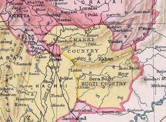
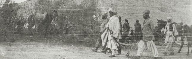
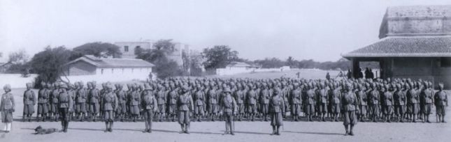
On 7th February Lieutenant Bovet’s men used their gun-cotton to demolish forts at Gushtang, Kaor-i-Kalat and Kala-i-Nao, the adjacent villages having already been burnt by the infantry on 2nd February.  Visits were made to the other valleys of the hostile sardars and a flying column under Major G.E. Even was sent north to the higher Bolida valley where the forts at Chib and Koshk were demolished, whilst the Bet fort was occupied.  Major Even then seized Kalatak fort and released Diwan Udho Das.
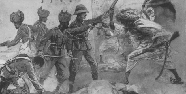
Colonel Mayne marched to Tump, where the fort was surrendered by the defenders, and then on towards Mand near the Persian border.  Here Lieutenant S.G. Knox, Political Assistant at Kalat, interviewed the headmen and chiefs of the area, obtaining their signatures on an agreement acknowledging their loyalty to the Khan and their willingness to remit revenue to him.  On the return journey, Phulabad fort was demolished. At Turbat Lieutenant Knox held a durbar which was attended by the headmen of Kej and Mekran.  Fines totalling 50,000 rupees were inflicted, which had to be paid within three years.  As part of the punishment, none of the local crops that the sepoys and sowars had consumed during their marches around the region were to be paid for.

The withdrawal from Mekran

Baluch Infantry in the 1890s

Baluch Infantry in the 1890s

Having acted in a decisive and energetic manner, demonstrating how lethal artillery fire can be and how damaging gun-cotton can be (a total of thirteen forts were demolished), Colonel Mayne split his force into three groups.A small detachment of the 30th Bombay Infantry remained in Mekran to support the Kalat State troops who garrisoned the forts at Turbat, Kalatak, Tumo and Bet.  A column under Captain Jacob composed of the cavalry, mountain gunners, sappers, and ninety rifles marched back to Quetta via Kalat, demolishing forts at Sharak, Nag, Ser and Hor Kalat on the way.  Colonel Mayne and the remainder of his command marched to Urmara and then sailed to Karachi aboard I.M.S. Canning.

Awards for the 1898 operations

Order of the Bath (Companion, Military Division)
Lieutenant-Colonel R.C.G. Mayne, 30th Bombay Infantry
Distinguished Service Order
Captain A.LeG.Jacob, 30th Bombay Infantry
Lieutenant J.H. Paine, Royal Artillery
Indian Order of Merit (3rd Class)
Subedar Ahmed Khan, 30th Baluch Infantry: For conspicuous gallantry in action at Gok Parosh, in Mekran [sic], on the 31st January 1898. The Subedar was with the left flank attack, with Captain A.LeG. Jacob, and showed conspicuous gallantry and courage in leading a small party of his men, in the face of heavy odds, against superior numbers of the enemy, and dislodging them from strong positions.
Brevet rank of Major
Captain Robert Southey, 30th Bombay Infantry
Mentioned in despatches
Lieutenant H.T. Naylor, 6th Bombay Cavalry
Lieutenant J.H. Paine, R.A. No 4 (Hazara) Mountain Battery
Jemadar Shaikh Khuda Baksh, No 4 (Hazara) Mountain Battery
Lieutenant H.H. Turner, Royal Engineers (Transport Officer)
Major G.E. Even, 30th Bombay Infantry
Captain R. Southey, 30th Bombay Infantry
Captain A. Le G. Jacob, 30th Bombay Infantry
Subadar Ahmad Khan, 30th Bombay Infantry
Jemadar Fazl Shah, 30th Bombay Infantry.
Lieutenant S.G. Knox, Political Agent.

The 1901-1902 operations – the situation in Mekran

In an attempt to control banditry along their common border during the cold weather of 1901-1902, the Persian government agreed to co-operate with British forces.  Local Lieutenant-Colonel H.L. Showers, Political Agent at Kalat, and his escort party moved to meet the Persians on the border.   The escort commander was Major M.J. Tighe, D.S.O., 27th Baluchis. The troops in the escort were: 27th Baluch Light Infantry (300 rifles); 5th Bombay Cavalry (Scinde Horse) (fifty sabres); a section of the 9th (Murree) Mountain Battery (two 7-pounder guns); a detachment of Bombay Sappers and Miners (twenty-one all ranks from No. 4 Company).

Illustrated London News sketches of the Nodiz action, Nodiz Fort

On 16th December 1901, Captain Showers’ party arrived in Turbat and met Colonel C.E. Yate, the Agent to the Governor-General Baluchistan.  Colonel Yate stated that cross-border outlaws had seized Nodiz Fort which was located about eight miles west of Kalatak.
The Nazim of Kej and his forces had been besieging the fort for over fifty days, but without artillery they could not assault it.  Major Tighe was requested to assist the Nazim’s forces.

The following day Major Tighe went to reconnoitre Nodiz Fort, accompanied by Lieutenant J.B. Corry, Royal Engineers, commanding the Bombay Sappers and Miners detachment.  The Nazim showed them the fort which was a substantial one, and Major Tighe decided that he needed the guns to be brought up before an assault commenced.   On 19th December, reconnaissances were made by all the infantry officers, and the next day at 09.00 hours the guns arrived under the command of Lieutenant E.G. Hart, Royal Artillery.  The gunners were given an hour to rest before the assault began.

Camp Orders regarding Attack on Nodiz Fort
Major M.J. Tighe, Nodiz, the 20th December, 1901

The attack on Nodiz fort will take place this morning, immediately after the arrival of the mountain guns from Turbat. The orders for the attack are as under.
i. A guard of forty rifles will be detailed to guard the camp. Particular attention should be paid to the karezes (underground water channels) west of the camp.
ii. The Nazim’s levies will be directed to occupy their present sangars round the fort, and on no account to leave them.
iii. The guns, with an escort of ten rifles, will take up a position to the south-east of the fort, and will have as their objectives:
(a) The loop-holed tops of the west flank towers;
(b) The top of the main tower; when the tops of the west flank towers have been demolished, the Officer Commanding the guns will sound his battery call.  This will be the signal to the infantry that the gun fire has been turned from the west flank tower to the main tower.
(c) Captain Hulseberg, 27th Baluch Light Infantry, will guide the guns to the position selected, and will rejoin the infantry.
iv. The infantry will be disposed as follows:
(a) Forty rifles, covering party—Lieutenant Grant (27th Baluch Light Infantry)
Sappers and Miners—Lieutenant Corry
Fifty rifles, supports
The whole under Captain Hulseberg
Eighty rifles reserve, at disposal of Officer Commanding. This will form the main infantry attack, which will be directed on the south-west bastion of the fort, through the date groves.
(b) Fifty rifles under Lieutenant Orton will push their way to the east side of the fort and occupy the mosque which is outside the fort, or take up such a position as will prevent the enemy escaping.
(c) The cavalry will take up a position in rear of the guns, ready for pursuit.
(d) Hospital and reserve ammunition with the reserves.
(e) The position of the Officer Commanding will be with the supports.
v. The battery call will be the signal for the gun-cotton party to advance.
vi. No bugles will be sounded except by order of the Officer Commanding.
vii. Sketch of position will be given to all British Officers.

Illustrated London News sketches of the Nodiz action

Illustrated London News sketches of the Nodiz action


Lieutenants Grant and Corry raced to be the first through the narrow breach, which only allowed one man at a time to pass through.  Naik Baryam Singh and Sapper Noor Din, both Grant’s men, followed them through and this quartet killed eight of the enemy before the defenders organised a response. By this time, Subedar Hamid Khan, 27th Baluchis, with about thirty of his men, had also entered the fort.  An enemy sniper in the tower above put down effective fire onto the attackers, and enemy groups wielding swords counter-attacked both flanks.  This resulted in Grant and Corry and three sepoys being shot and wounded.  Unable to hold their position, the storming party dragged their wounded and the loose rifles back through the breach.  The first assault had been repulsed.

Major Tighe then ordered his infantry up to the fort walls, and the sepoys used their bayonets to rive loop-holes through which they could shoot.  The guns were ordered forward into a date grove only 100 yards from the fort.  Here they had line-of-sight to the forts’ roofs – the weak points.  The roofs were shelled until they were set on fire, causing them to collapse onto the defenders. Major Tighe’s bugler sounded ‘Cease Fire’ and then ‘Attack,’ and Captain Hulseberg and his Baluch infanteers swarmed into the fort again, quickly overcoming opposition.  The surviving sixty-three defenders surrendered inside the fort or to Lieutenant Orton on the east side.  Fourteen enemy dead and seventeen wounded lay on the floor of the fort.  Thirty-three of the captured enemy were Persian.

During the assault, Major Tighe’s force expended 154 artillery shells, 1,830 rifle rounds and thirty-six pistol rounds.  The action was over at 13.25 hours.  The force had lost three sepoys killed, two British officers and six sepoys severely wounded, with a few more men slightly wounded.  The fort was now knocked down with gun-cotton.

Awards for the attack on Nodiz Fort

Distinguished Service Order
Lieutenant J.B. Corry, Royal Engineers
Lieutenant G.P. Grant, 27th Baluch Light Infantry
Brevet rank of Lieutenant Colonel
Major M.J. Tighe, D.S.O., 27th Baluch Light Infantry
Indian Order of Merit 3rd Class
Subedar Hamid Khan, 27th Baluch Light Infantry
1991 Naik Baryam Singh, No. 4 Coy, Bombay Sappers and Miners
1967 Sapper Noor Din, No. 4 Coy, Bombay Sappers and Miners

The medals of Major John Beaumont Corry DSO (held in a private collection)

For conspicuous gallantry in action on the occasion of the capture of Nodiz Fort in Mekran, on the 20th December 1901, when they accompanied Lieutenant J.B. Corry, R.E., and Lieutenant W.O. [sic] Grant, 27th Baluch Light Infantry, in the fore of the storming party, and engaged the enemy’s swordsmen.

 A heavy fire was opened on them from the towers, and both the British officers and several men fell wounded. The subedar and the two sappers [sic] named above stood their ground, and by their gallant conduct saved the lives of both officers and men.
Mentioned in despatches
Lieutenant E.F. Orton, 7th Bombay Lancers
Lieutenant J.B. Corry, Royal Engineers
Lieutenant E.G. Hart, Royal Artillery (Murree Mountain Battery)
Captain H. Hulseberg, 27th Baluch Light Infantry
Lieutenant G.P Grant, 27th Baluch Light Infantry

Major John Beaumont Corry DSO

Major John Beaumont Corry DSO

The next stage in operations was for Colonel Showers to make contact with a Persian delegation at Bampur on the Indo-Persian border in order to agree upon joint measures to limit lawlessness in Mekran. In effect, the Political Agent’s Escort became a flying column of all arms, with a total strength of close to 600 officers, other ranks and followers. Hampered by a train of more than four thousand camels required to carry the requisite ammunition and provisions for man and beast, it stretched back over ten miles. As it progressed through the harsh Baluchistan landscape, it carried out a number of diversions to survey the territory. It was fortunate that the country was generally quiet, the fall of Nodiz having made a deep impression on the local tribesmen. They were plentifully armed with magazine rifles acquired via Muscat, mostly manufactured by B.S.A. in Birmingham, and it would have been difficult to protect the column’s lengthy tail from well prepared ambush.

Lieutenant George Patrick Grant wearing his DSO

Lieutenant George Patrick Grant wearing his DSO

Forts linked with known bandits were destroyed en route, and there was only one place that threatened to put up any resistance.  Near to the meeting point with the Persians was the fort of Magas, still in outlaw hands. The Persians had been unable to negotiate the surrender of the fort, but when the British troops approached the defenders melted away into the surrounding hills. From their supposedly safe retreats, the bandits continued to menace the loyal sirdars, and Colonel Showers took the time to send the sirdars help. One of the more dangerous episodes in this process took place near Magas on the 9th February 1902.

Havildar Subhay Khan, 27th Buluch Light Infantry, with a party of thirteen men, had been sent by Colonel Showers from Magas to assist the sirdars. Taking with him three days’ food, he boldly proceeded into the hills and coming across a party of the enemy who fired at him, promptly attacked and dispersed them, killing five and wounding four. Continuing his advance, he captured over 300 head of animals, all of which he brought in safely to Magas. It was a swift and bold raid against an enemy, who imagined himself secure in his mountain fastness, and it had a most salutary effect.  For his gallantry and leadership, the havildar was advanced to the 2nd Class Indian Order of Merit. By the time the Escort returned to its depots, the infantry had marched distances varying from 1,200 to 2,000 miles. In their turn, the cavalry was proud to report that they had covered eighteen hundred miles in six months and had not lost a single horse or mule.

Conclusion

Although Mekran remained relatively quiet after the final departure of the British troops, the events at Nodiz had persuaded the British government that the Khan’s troops were unfit to keep order in the country, and the Mekran Levy Corps was formed.  The strength of the Levy Corps was 137 cavalry and 203 infantry.  The Headquarters was at Panjgur (180 men) with detachments at Diz, Parom, Mand, Suntzar and Jiwani.  The commander of the Corps was the Assistant Political Agent.  The expenses of the Corps were met from Imperial funds.

When the Great War started German agents in Persia encouraged insurgency over the border in India and across the Straits of Hormuz in Oman.  This resulted in disaffection in the Mekran Levy Corps and resulted in attacks on British positions in Mekran and Oman. Later in the war, in the Spring of 1918, the British had to send a Field Force to subdue rebellious Marri tribesmen in Baluchistan.

Dedication

The author dedicates this article to his Baluch comrades, particularly those killed or wounded in action, who served with him in the war in Dhofar Province, Sultanate of Oman, between 1973 and 1975  Baluch men flocked in their thousands to the Sultanate’s recruiting office in Gwadur, Mekran, seeking enlistment in the Sultan’s Armed Forces.  They provided an effective temporary pool of military manpower during critical times.  Nowadays their contribution is sadly fading from military memory.  As A.E. Housman wrote:

These, in the day when heaven was falling,
The hour when earth’s foundations fled,
Followed their mercenary calling,
And took their wages, and are dead.

Their shoulders held the sky suspended;
They stood, and earth’s foundations stay;
What God abandoned, these defended,
And saved the sum of things for pay.

Sources
Frontier & Overseas Expeditions from India, Volume III, Pt. 1, Baluchistan (Intelligence Branch, Army HQ India, 1908);
The Indian Sappers and Miners, Lieutenant-Colonel E.W.C. Sandes DSO, MC, R.E. (Chatham 1948);
The History of the Indian Mountain Artillery, Brigadier C.A.L. Graham, DSO, OBE (Aldershot 1957);
History of the Baloch Regiment 1820 – 1939, Major-General Rafiuddin Ahmed (Abbotabad 1998);
Capital Campaigners : The History of the 3rd Battalion, The Baluch Regiment, Lieutenant-Colonel E.W. Maxwell, CIE (Aldershot 1948);
Prince of Wales’s Own, The Scinde Horse, 1839-1922, Colonel E.B. Maunsell (published privately by the Regimental Committee, 1926);
Report and Diary on the Mekran Expedition, Bt-Lieut.-Colonel M.J. Tighe, DSO (B.E.S. Press, Bombay 1902);
London Gazette: despatches; Indian Army List – various editions.

An edited version of this article appeared in a recent issue of Durbar, the Journal of the Indian Military Historical Society ( http://www.imhs.org.uk/index.html )

 
Comments Off on The British Raj: Operations in Mekran 1898 – 1902

Posted by on December 10, 2015 in Balochistan


Producing Tribal Balochistan: Sovereignty and Rule in a Colonial Frontier State

By Hafeez Jamali
University of Texas, Austin

District Map Balochistan


A key question in recent historiography of South Asia has been the production of people and production of space-time through the apparatuses of colonial rule and their persistence in the post-colonial period of nationalist rule (Chatterjee 2006; Goswami 2004). However, most of these studies have focused on ‘regulation’ or ‘settled’ districts of India where British control was relatively uniform and the administrative machinery sufficiently well-oiled to introduce projects of ‘improvement’. One the one hand, where the British did encounter adivasi or indigenous peoples of India as in Jharkhand, their presence or activities did not impinge on strategic imperial interests and the problem of their regulation was subsumed within the broader question of district management. On the other hand, in the frontier territories of Balochistan and the Tribal Areas of North West Frontier Province, colonial authorities had to operate in an environment over which they had less than full control. Moreover, in these territories, at the edge of the empire, the question of protecting imperial interests from the unhealthy influence of rival European powers such as Russia and France and the defense of British India haunted the imperial self much more. Thus, colonial authorities were faced with the problem of securing the attachment to their cause of reluctant tribesmen who had historically shown only nominal allegiance to any central authority and defied it openly whenever the opportunity was offered. My archival research in the British library suggests that in the case of colonial Balochistan (or Kalat Khanate), a frontier state, the exercise of rule was based on a mix of relations of force (sovereignty) and methods of rule (consent).

The method of indirect rule inaugurated by Robert Sandeman, Agent to the Governor General and first Chief Commissioner of Balochistan, is understood both by colonial writers as well as contemporary historians/ analysts/ opinion-makers of Balochistan (Nicolini, Redaelli, etc.) to have solved the problem of subduing the Baluch frontier1. It is popularly believed to have been an exercise in empire-light or a form of rule which\ involved a minimal expenditure of force and depended, for the most part, on the consent of the governed. However, a closer scrutiny of the archive – including comments by Sandeman’s contemporaries and successors on his administrative methods- suggests that it was far more intrusive and relied much more on the strategic use of military force than has been made out so far. More importantly, it brought together or fused disparate Baloch territories and tribes (and cut-out/separated others) to engender or produce a territory “Balochistan” and a particular subject of colonial rule, the ‘Baloch tribal’ with specific characteristics which required particular administrative methods of dealing i.e. through ‘tribal jirgas’ or councils of elders. Ostensibly, the ‘tribal jirgas’ were native institutions through which the colonial state gave Baloch people a certain degree of autonomy in resolving their differences and managing their internal affairs. However, in actual  practice the Jirgas were supervised by British officers or their native assistants (like Rai Bahadur Hittu Ram, Sandeman’s Assistant) and served to integrate the Baloch tribesmen, especially the tribal elite, into the structures of empire through which they learned to submit to colonial rule2. Over time, these arrangements led to the near total dismantling of the pre-colonial relations between the Khan of Kalat, his Sardars and ordinary Baloch tribesmen and by the end of colonial period the Khan had become a mere figure-head with no real power and the fulcrum of power in Balochistan shifted from the Khan’s headquarters at Kalat to the British Agent’s headquarters at Quetta.

The fault-lines of Sandeman’s method of rule become particularly evident in the case of colonial governance in Mekran region of Balochistan. The anthropological knowledge that Sandeman and his contemporaries had acquired about Baloch people through their encounters with Marri and Bugti tribes on Sind-Punjab frontier and with Brahui tribes of central Balochistan became questionable in managing the affairs of Mekran. Unlike the rest of Kalat, which was a Khanate, Mekran was a Hakomate although it was formally under Kalat jurisdiction. It had a clearly delineated class/status structure with a fractious elite or Hakum class at the top, independent Baloch landowners and herdsmen in the middle, and agricultural tenants/cultivars, fishermen, servants and slaves at the bottom of the social hierarchy. Tribal affiliation did not carry the kind of force or weight in dealings of people in Mekran which it did elsewhere in Balochistan. As a result, the British Political Agents’ attempts at resolving issues through tribal Jirgas and soliciting bonds of good behavior were repeatedly frustrated by non-compliance on behalf of the local actors. So the archival evidence pertaining to Mekran is particularly useful in studying colonial rule in Balochistan. Moreover, since the British perception of a Russian attack or advance from Persia/Iran was less alarming than was the case in Afghanistan, colonial rule in Mekran is marked by a certain lack of coherence and disunity of purpose and method. The affairs of Mekran were managed by multiple authorities based in Karachi (Sindh), Muscat (Persian Gulf) and Quetta (Balochistan)3.

Another important consideration here is the emergent grammars of citizenship, sovereignty and territoriality in Balochistan / Mekran at the moment of the colonial encounter. The pre-colonial relations were expressed in terms of matrimonial alliances between ruling families, payment of annual tribute, reception at the Durbar, conferring of Khillats/ titles, reading of the Friday sermon (Khutba) in the name of the ruler, etc. It was  a discontinuous body-politic animated by relations of in/fidelity, genealogical affinity, etc. as opposed to strictly delimited/mapped territory and uniform extension of sovereign authority. Matrimonial alliances and kinship relations did not necessarily span geographically contiguous areas/territories or correspond neatly to distinct/exclusive spheres of influence of various sovereigns to whom the local chiefs professed or owed allegiance4. Moreover, while Persia and Muscat had recorded documents, treaties, etc. to show for their claims over territory, Baloch claims over territory were argued in the form of genealogical and rhizomic maps that were recorded in popular memory and supported by limited documentation in the form of Sanads.

It appears that the colonial encounter transformed these relations in two important respects in Mekran region. On the Persian side of Mekran there was a more rapid assimilation of and a greater willingness to adopt the trappings of modernity and its territorial imagination due to Persia’s long encounter with French and British empires and a relatively stable historical/cultural past or memory of statehood. From the beginning of 19th  century onwards, Qajar monarchs of Persia were steadily modernizing their army andre-asserting their claims on Afghan and Baloch territories eastward of the Persian heartland5. They sent regular military expeditions to discipline the recalcitrant Baloch Sardars of Mekran, exact tribute, and force them to declare allegiance to the Persian monarch6. Persian authorities’ ultimate (although rather ambitious) object was to bring the entire intervening Baloch territories between British India and Persia under their control (Shahvar 2006; Hopkins 2007)7.

In the Baloch Khanate of Kalat, on the other hand, contradictory forces were at play. Initially (i.e. 1839-76) British policymakers sought to treat the Khan of Kalat as a sovereign ruler of all Baloch territories and to this end gave him a generous subsidy, encouraged him to keep a standing army comprised of mercenary soldiers, and discouraged Baloch Sardars (chiefs of individual tribes) from dealing directly with colonial authorities or soliciting British intervention against the Khan. This policy failed  spectacularly as the Sardars felt that the British government was curbing their independence by making them bear the Khan of Kalat’s heavy yoke. Subsequently (1876- 1948), however, British policymakers took a U-turn in the face of growing Russian threat in Central Asia (so-called Great Game). They intervened directly and decisively in the affairs of Balochistan by declaring the Khanate as a confederate structure where the Khan of Kalat was merely ‘first among equals’ viz a viz his Sardars.

In sum, the British sought to uphold the stability or maintain the status-quo of the indigenous political arrangements (system of rule) in Balochistan (rather than attempt to modernize it) based on their own anthropological understandings of Baloch society8. These understanding tended to vary over time based on the influence of ambitious frontier officers like John Jacob and Robert Sandeman and the changing perception of threat from Russia in London. Through these categories, colonial authorities sought to ‘locate’ and ‘fix’ the fluid dynamics of inter-tribal relations and the complex skein of alliances and multiple allegiances in Balochistan in imperial space-time. The acceptance of the British offer of ‘mediation’ by Baloch Sardars and the Khan of Kalat in 1876 appended them formally and irreversibly into the orbit of British rule in India (Redaelli 1997)9. This process enabled British administrators like Sandeman to inscribe an imperial margin or frontier in the ‘savage’ space of Balochistan where careers could be made and honors won10 (Dutta 2003).

Reference:

1 Some contemporary authors have tried to raise Sandeman from the dead in a bid to give strategic advice for pacifying the insurgents fighting the US military and Pakistani authorities in the tribal areas of Pakistan and Afghanistan.

2 I do not wish to imply here that British intervention was entirely an externally imposed grid of relations. Baloch Sardars (tribal chiefs) actively sought for colonial ‘protection’ or ‘mediation’ and participated enthusiastically in structures of colonial rule. The integration of Baloch tribesmen into colonial governance structures was facilitated by the relatively stable relations of mutual obligations and respect of authority between Baloch Sardars and ordinary tribesmen. This trait was repeatedly praised by colonial writers on Balochistan who characterized the Baloch as ‘frank’, ‘generous’ and ‘hospitable’ as opposed to the Pashtuns who were declared ‘fanatic’, ‘priest-ridden’ and ‘bigoted’. Some of these characterizations are still quoted favorably by Baloch nationalists.

3 For instance, during the period 1860-79, British authority in Mekran region was maintained by the Assistant Political Agent at Gwadar who was considered “Assistant to the Resident, Persian Gulf, for the country between Gwadur and Jask; as well as Assistant to the Political Agent, Maskat, for Gwadur affairs; and Assistant to the Agent to the Governor General, Baluchistan for the Mekran possessions of the Khan of Khelat”. Reference J.A. Saladana (1905) Précis of Mekran Affairs.

4 For instance, the Nawab of Kharan- a powerful Sardar in western Balochistan- simultaneously professed allegiance to and received subsidies from the Amir of Afghanistan and the Shah of Persia while his territory was ‘legally’ part of Khanate of Kalat.

5 During the second half of 19th century, Persian government repeatedly sought the help of Britain as well as France to send in their military officers to train its army in techniques of modern warfare. The Shah also requested the British to supply him with Naval warships and help train a nascent Persian Navy. Moreover, at the height of Ango-Russian rivalry, the Persian Government gave an extraordinary lease/ concession to a British industrialist to set up a cotton processing factory in Bushire.

6 See Najmabadi’s Story of the Daughters of Quchan. Baloch, Turkoman and other nomad tribes of Persian borderlands were inscribed in mainstream Iranian cultural memory as savage and barbarian raiders who would loot caravans and abduct Persian girls to sell them into slavery or reduce them to domestic servitude. There was and still remains in Iran unstinting popular support for Tehran’s oppressive measures against the Baloch. Among Mekran Baloch, however, there is a counter-memory of Tehran’s atrocious military expeditions for the exaction of tribute. These punitive raids would lay the country to waste and reduce the ordinary people to starvation. In Balochi language, the word ‘Qajar’- literally the Qajar rulers of Persia- is a metaphor for wanton cruelty and depredation.

7 Soli Shahvar (2006) Communications, Qajar Irredentism and the Strategies of British India: The Mekran Coast Telegraph and the British Policy of Containing Persia in the East. Iranian Studies: 39:3. B.D. Hopkins (2007) The Bounds of Identity: the Goldsmid Mission and the Delineation of the Perso- Afghan Border in the Nineteenth Century. Journal of Global History: 2.

8 Reference Mahmood Mamdani’s argument in “Beyond the Native and Settler as Political Identities: Overcoming the Political Legacy of Colonialism” in the context of Africa. Mamdani argues that for colonial authorities in Africa, the ‘improvement’ of natives did not only mean modernizing them according to European standards, but in certain cases, helping them stay true to their ‘authentic’/native’ traditions which implied propping up of indigenous governance structures by colonial authorities.

9 Redaelli, Ricardo (1997) The Father’s Bow: the Khanate of Kalat and British India. Manent.

10 Disraeli’s famous declaration that the East was a career (quoted in Said 1973) was exemplified by Sandeman’s career in Balochistan. As British Prime Minister in 1876, Disraeli gave wide-ranging powers to the Viceroy, Lord Lytton, who was to give his full backing to Sandeman’s proposals for intervention in Balochistan under the rubric of the “Forward Policy”. The supposed object was to prevent a Russian attack on India from the direction of Afghanistan by establishing forward military posts on the mountain passes at the gates of Afghanistan at the Khyber, Gomal, Tochi (NWFP) and Bolan (Balochistan) backed by military cantonments/garrisons in Peshawar and Quetta. These proposals were considered ill-advised and dangerous by some of Sandeman’s colleagues such as Major Loch and his immediate supervisor Sir William Mereweather, the Commissioner in Sind. From an obscure frontier officer reporting to the Commissioner in the 1870s, Sandeman became the first Agent to the Governor General (AGG) in Balochistan who reported directly to the Viceroy in Delhi. See also Simanti Dutta (2003) Imperial Mappings in Savage Spaces: Balochistan and British India. Delhi: B.R. Publishing Corp.

Select Bibliography:
Primary Sources:
a) India Office Records (IOR), British Library
Agent to Governor General’s Office (1886) Raids: Deputation of Col Reynolds, PA
Southern Baluchistan to Mekran. IOR/R/1/34/3
Agent to Governor General’s Office (1888) Raids: Proposals for the Future
Management of Rind tribe. IOR/R/1/34/5
Agent to Governor General’s Office (1888) Raids: Mr. Crawford, PA Southern
Balochistan’s tour in Mekran and Panjgur. IOR/R/1/34/8
Burne, O.T. (1869) Memorandum on Persia. IOR/L/PS/20/MEMO40/1
Goldsmid, F.J. (1962) Mission to Mekran. IOR/L/PS/20/MEMO39/7
Moore, A.W. (1868-1875) Memoranda on Central Asian Question.
IOR/L/PS/20/MEMO21
Ross, E.C. (1905) [1866] Report on the nature of Trade at Gwadur and the probable
amount of its Revenues. In J.A. Saldanha Precis of Mekran Affairs, pp
113-117. Calcutta; Office of the Superintendent of Government Press.
(1868) [1865] Memorandum of Notes on Mekran. In Selections from the
Records of Bombay Government No. CXI. Byculla: Education Society’s
Press. IOR/V/23/248, No 111
(1884-1889) Report on the Administration of the Persian Gulf Political
Residency and Muscat Political Agency. Calcutta; Office of the
Superintendent of Government Press. IOR V/23/42 No. 190.
Saladanha, J.A. (1905) Precis of Mekran Affairs. Calcutta: Government of India
(Foreign Department). IOR/L/PS/20/C244
(1906) Précis on Slave Trade in the Gulf of Oman and the Persian Gulf,
1873-1905. Simla: Government of India, Foreign Department. )

b) Parliamentary Papers (Blue Books), British Library:
House of Commons (1877) Biluchistan No.1 Papers Relating to the Affairs of Khelat.
IOR/L/PS/20/B23/1
Biluchistan No 2. Papers relating to the treaty concluded
between the Government of India and the Khan of Khelat,
on the 8th December 1876. IOR/L/PS/20/B23/2
(1878) Biluchistan No 3. Papers relating to the re-organization
of the Western and North-Western Frontier of India.
IOR/L/PS/20/B23/4

c) European Manuscripts (Private Papers) Collection, British Library
Goldsmid, F.J. Papers of Maj-Gen Sir Frederic Goldsmid, Madras Army 1839-75,
including material relating to his work on the Perso-Baluch and Perso-Afghanistan
boundaries Mss Eur F134
Jacob, John J. Papers of Maj. Gen. Sir John Jacob relating to the Persian War.
Keyes, Terence. Papers of Brig-Gen Sir Terence Keyes, Indian Army 1897, Indian
Political Service 1903-33. Mss Eur F131
Mereweather, W.L. Papers of Sir William Mereweather, Bombay Army 1841,
Council of India 1877-80. Mss Eur D625

d) Private Papers Collection at South Asian Study Center, University of Cambridge
Showers, H.L. Box 4. Personal files of Captain H.L. Showers (1862-1916) kept
while he was Political Agent. Showers Family Collection (1781-1904)

e) Home Secretariat Archives (HAS), Quetta, Pakistan:
Agent to the Governor General in Balochistan (1898) Slavery in Balochistan.
AGG/V.I 164.
Agent to the Governor General in Balochistan (1898) Kardar of Panjgur’s Report on
the Causes Which Led to the Rising in Mekran 1897-98. AGG/V.I 20.
Agent to the Governor General in Balochistan (1890) Confidential Order Regarding
Action to be Taken in Cases of Slavery. AGG/V.I 34.
Books and Journal Articles:
Bokhari, M. (Ed.) ( 1997 [1906]) Gazetter of Balochistan: Mekran District. Quetta, Pakistan:
Gosha-e-Adab Publications.
Chatterjee, P. (1993). The Nation and Its Fragments: Colonial and Postcolonial Histories.
Princeton studies in culture/power/history. Princeton, N.J: Princeton University Press.
—. 2004. The Politics of the Governed: Reflections on Popular Politics in Most of the
World. University seminars/Leonard Hastings Schoff memorial lectures. New York:
Columbia University Press.
Dutta, S. (2002). Imperial Mappings– in Savage Spaces: Balochistan and British India. New
Delhi: BR Publishing Corporation.
Goldsmid, F.J. (1876). Introduction. In St. John, Lovett and E. Smith. Eastern Persia: An
Account of the Journeys of the Persian Boundary Commission. London: Macmillan and
Company.
Mamdani, M. (2001). Beyond Settler and Native as Political Identities: Overcoming the
Legacy of Colonialism. Comparative Studies in Society and History, 43(4): 651-664.
Nicolini, B. (2007) Baluch Role in the Persian Gulf during the Nineteenth and Twentieth
Centuries. Comparative Studies of South Asia, Africa and the Middle East, 27 (2):
384-396.
— (2006). The Makran-Baluch-African Network in Zanzibar and East Africa during the
XIXth Century. African and Asian Studies, 5(3-4): 347-370.
— (2004). Makran, Oman and Zanzibar: Three Terminal Cultural Corridor in the Western
Indian Ocean (1799-1856). Penelope-Jane Watson Tran. Leiden: Brill Academic Publishers
Onley, J. (2007) The Arabian Frontier of British Raj. London: Oxford University Press.
Redaelli, Riccardo (1997) The Farther’s Bow: the Khanate of Kalat and British India
(19th-20th Century). Frenze, Italy: Manent.
…………………………………………………………………………………………………………………………
Hafeez Jamali is a graduate student in anthropology at the University of Texas, Austin  (hafeezjamali@gmail.com)


Comments Off on Producing Tribal Balochistan: Sovereignty and Rule in a Colonial Frontier State

Posted by on June 23, 2014 in Balochistan


AN ANALYSIS OF THE DIFFERENT THEORIES ABOUT THE ORIGIN OF THE PASHTOONS

Scholars
………………….
Dr. Hanif Khalil
Assistant Professor NIPS
Quaid-e-Azam University Islamabad

Javed Iqbal
 Lecturer, Pashto Department
University of Balochistan Quetta

ABSTRACT
The Pashtoons is an ancient race, nation or tribe on this earth having its own identity, specific values, norms and traditions and a peculiar charm since thousands of years. To trace the origin of the Pashtoons various theories have been presented by renowned scholars in different periods. In these theories, the theory of Israelies and the theory of Arian Tribes became very hot and famous for academic discussions among the historians and researchers.
In this paper along with other miscellaneous theories, these two famous theories have been discussed with references and evidences. At the end the conclusion has been given and the most acceptable theory has been pointed out.

INTRODUCTION
The topic is under discussion since very long that who are the Pashtoons and what is the origin of the Pashtoons? To trace to origin of the pashtoons various theories have been presented by some eminent scholars, researchers, historian and linguist. But this question has not been answered yet scientifically with proved evidences. However some theories came under discussion in this respect. In these the most popular theories are as under
1. The Pashtoons are from semitic races and belong to the Israelies.
2. The Pashtoons are the descendents of Qatora, the wife of Hazrat Ibrahim (P.B.U.H).
3. The Pashtoons are basically from Greek races.
4. The Pashtoons are from Arian tribes.

Some other theories have also been presented and analyzed but the following two theories became most popular and always remain under discussions of researchers in different times.
1. the theories of Bani-Israels
2. the theories of Arians
In this discussion we will try to analyze these two major theories and to trace the most acceptable theory about the origin of the Pashtoons.
The Theory of Bani Israelies
The first famous and old theory about the genealogy of the Pashtoons is that they are Bani Israel. We find this theory for the first time in Makhzan-e-Afghani written by Niamat Ullah Harvi, a scholar at the court of the Mughal Emperor Jahangir. He has completed his research about 1612 A.D. Most of the other historians and writers in their books and writings followed this theory, which was presented by Niamat Ullah Harvi. In these historians and writers the most popular Pashtoon writer Afzal Khan Khattak, the grandson of Khushal Khan Khattak in his Pashto book Taareekh-e-Murrassa, and Hafiz Rahmat Khan in his history book, containing the genealogies of the Pashtoons, Khulaasat-ul-Ansaab, followed and accepted this theory without any analysis and criticism and made this theory as the base and fundamental evidence of their writings. Famous orientalist and historian Olaf Caroe repeats the story in his book the Pathans. In the words of Olaf Caroe.
“The Afghan historiographers maintain that Saul had a son named Irmia (Jeremiah) who again had a son named Afghana, neither of course known to the Hebrew Scriptures. Irmia, dying about the time of Saul’s death, his son Afghana was brought up by David, and in due course in Solomon’s reign, was promoted to the chief command of the army. There follows a gap of some four centuries to the time of the captivity. Since Bakhtunnasar is mentioned, one must presume that the reference is to the second captivity early in the sixth century B.C, that of Judah from Jerusalem, and not the first captivity over one hundred years earlier, that of Israel by Shalmaneser the Assyrian, from Samaria, If this is so, it rules out any suggestion, often made, that the Bani Israel, the sons of Afghana, are in any way connected with the lost ten tribes. Nevertheless the theory of the ten tribes has had its notable supporters. In its aid it was suggested, originally by Sir, William Jones, pioneer of oriental studies in Warren Hastings, time that the Afghans are the lost ten tribes of Israel mentioned by the prophet Esdras as having escaped from captivity and taken refuge in the country of Arsarath, supposed by that elegant scholar as identical with the modern Hazarajat, the Ghor of the Afghan historians. But the reference in the afghan chronicles to Nebuchadnezzar makes nonsense of any identification with the ten tribes. The truth is that Muslims commentators of the seventeenth and eighteenth centuries were not well up in the history of the Hebrews. They make no distinction between Israel and Judah, and do not seem even to be aware that there were two captivities.” ( Caroe:1958:5)
Olaf Caroe also quotes Raverty who was an excellent scholar of Pashto literature as well as the history of the Pashtoons. Caroe admitted him as the last pleader of this theory in English writers. He narrates about the concept of Roverty as:-
“The last pleader for the Bani Israel tradition in English is the redoubtable Raverty. Referring to Cyrus, the first of the Persian Achaemenids, he notes that it was customary for the great King to transport a whole tribe, and sometimes even a whole nation, from one country to another. The Jews were even a stiff-necked race, and he asks form credence to the possibility that the most troublesome anong them had been moved to the thinly peopled satrapies of the Persian Empire where they would be too far away to give trouble. It is not possible he asks, that those Jew who could make their escape might have fled eastward, preferring a wandering life in a mountainous country with independence to the grinding tyranny of Cyrus successors and their satraps? In facts there was no other direction in which they could have fled”( Caroe:1958:6-7)
Our scholars linked the historical background of this theory, related to Hazrat Suleman, Saul, Talut, Armia and Barkhia and Afghana, to Hazrat Khalid Bin Walid and Qais Abdur-Rasheed, who is considered as the old grandfather of Pashtoon tribes, Saraban, Ghorghashts, and Beetan. Sir Olaf Caroe writes about this historical background in the following words.
“The Afghan chroniclers would have it that Khalid Bin Walid, the most famous of the Prophet’s Ansar (companions) and the first great Arab conqueror, belonged to the tribe of the descendants of Afghana resident near Mecca. (All other Muslims tradition states him to have been an Arab of the Makhsum family of the prophet’s tribe of Quraish.) On conversion to Islam, while the Prophet was still alive and before Khalids conquest of Syria and Iraq, Khalid either proceeded in person, or sent a letter, to his kinsmen of the Bani Israel settled in Ghor, to bring them tidings of the new faith and an invitation to join the Prophet’s standard there resulted a deputation of a number of representatives of the Afghan of Gohar, led by one Qais, which proceeded to meet the prophet at Medina. This Qais is said to be descended from Saul in the thirty-seventh generation, an under-generous allowance for a period of some seventeen hundred years. This Qais and his comrades then waged war most gallantly on the Prophet’s behalf. TLe chronicle proceeds:
The Prophet lavished all sorts of blessing upon them; and having ascertained the name of each individual, and remarked that Qais was a Hebrew name, whereas they themselves were Arbas, he gave Qais the name of Abdur Rashid and observed further to the rest that, they being the posterity of Malik Talut, it was quite proper and just that they should be called Malik likewise… and the prophet predicted that God would make the issue of Qais so numerous that they would out vie all other people, that their attachment to the faith would in strength be like the wood upon which they lay the keel when constructing a ship which seamen call Pathan; on this account he conferred upon Abdur Rashid the title of Pathan also.” ( Caroe:1958:7-8)
Renowned historian and researcher Sayyed Bahadur Shah Zaffar Kakakhel also narrated this background in his Pashto book Pukhtana da Tareekh pa Rana kay (The Pashtoons in the perspective of history). He explained the story of Qais Abdur Rasheed and also criticized the theories of Bani-Israel at the end. Bahadur Shah Zaffar explains that
“All the Pashtoons got entered into Islam. The Holy prophet Hazrat Muhammad (P.B.U.H.) prayed for them and changed the name of their leader Qais into Abdur Rasheed. Hazrat Muhammad (P.B.U.H.) gave him the title of Bathan. It means the leader of the boat of his nation. Hazrat Khalid bin Walid married his daughter Sara Bibi with Abdur-Rasheed than Qais came back to his own area and in his area he started to preach Islam. He died in 41 Hijri at the age of 77 during a war. He had three sons, the eldest Saraban, the second Beetan, and the third Ghurghasht. These three being the ancestors of the various branches of the Pashtoons” (Kakakhail: 1981:32-33)

Criticism on this theory
As mentioned earlier that along with Bahadur Shah Zafar Kakakhel some other historians and writers presented this theory that Pashtoons are from Semitic races and they are Israelies. But a number of scholars rejected this theory with new evidences and authentic sources. First of all we must quote Sayyed Bahadur Shah Zafar Kakakhel who are of the opinion that “There is no solid proof to accept this theory, even in Arabian history or in Islamic history”(Kakakhail: 1981: 35). An another scholar Dr. Abdur-Raheem author of the Afghans in India, wrote about this theory “The theory of the Semitic origin of the Afghan does not stand the serious analysis. The resemblances in features cannot be considered as providing scientific criterian for grouping different peoples into one race. The Sumerian resemble the Aryans in features through they are not considered to have any affiliation with Aryan people. The portraits of the koshan kings found their coin has the same type of feature but they are certainly neither Afghans nor Semitic” (Abdur-Raheem: 1969: 43)
Similarly the author of “History of Afghanistan” Sir Percy Cycks also criticized the theory of Bani Israel in the following words.
“A protest must here be made against the erroneus view that the Afghans are members of lost tribes of Israel, which various writers including Bellew and Holdich advocated. Actually this theory is of purely literary origin and is merely an example of the wide spread customs among Muslims of claiming descent from some personage mentioned in the Quran or some other sacred work. In the case of the Afghan they claim Malik Talat or king Savl their ancestor. Among the reasons advanced in support of this claim are noticably curved noses of the Afghan but this peculiarity is equally striking in the portraits of the koshan monarch of the first century A.D who had no Hebrew blood in their veins.” (Percy: 1973:78)
Renowned orientalist James.W. Spain quoted some other European scholars who had been discussed in their writings that Pashtoons are basically belonged to Semitic races. He narrates that “The idea that the Pathans were descended from the nation of Israel was encouraged by their tight tribal structure, their stark code of behaviour, their strikingly Semitic features, their bearded patriarchal appearances, and their predilection for biblical names (acquired from the Holy Quran): Adam, Ibrahim, Musa, Daud, Suleiman, Yaqub, Yousaf, Esa, and the rest. It was a favourite subject of speculation by British soldiers, administrators, and missionaries, and persisted in memoirs and travel books well into the twentieth century.
The only trouble is that it was not true. I feel something of a coward saying this here in a book written half a world away from the Frontier, when I know that I would never have the courage to say it to a Pathan. Nevertheless, we must face the facts, although, happily, the facts about the Pathans are anything but prosaic. The myth of the Semitic origins of the Pathans was debunked more than a hundred years ago by Bernhard Dorn, Professor of Oriental Literature at the Russian University of Kharkov, in a book with the interesting title, A Chrestomathy of the Pashto or Afghan language, which was published by the Imperial Academy in Saint Petersburg in 1847. The most recent and comprehensive treatment of the subject appears in the Pathans by Sir Olaf Caroe, a former British governor of the North West Frontier Province ” (Spain:1972:28-29)
James .W. Spain further says that in the connection of the Pashtoons to Semitic races, the tale of the Qais is not authentic. This story is based on mythical traditions. He wrote “This is not to say that the genealogies should be ignored or taken lightly. They were first set down by Persian speaking chroniclers at the court of the Moghul emperors in the early part of the seventeenth century. The sophisticated Moghul historians, possibly impressed by the same outward signs of Semitic connections that misled the British two hundred years later, apparently made up the decent of the border tribes from the mythical Qais and improvised a connection for Qais with Saul of Israel” (Spain:1972: 29) In the same way English writer G.P Tate also argues that this so-called genealogy of the Pathans was compiled under the religious influence on the Pathans, which has no historical evidence. He writes in his book, the Kingdom of Afghanistan in the following words:-
“The origin of the tribes who call themselves Afghans has attracted a great deal of attention, owing to the fact that they claim to be the descendants of Jews, who had settled in Ghor; and the various clans refer their origin to some one of the three sons of Qais, the chieftain of that community, who is said to have been the 37th in descent from Saul, king of Israel, Owing to intercourse with the Jews settled in Arabia, so the story goes, Qais was induced to visit the Prophet Muhammad, who won the Jewish Chief to Islam, and bestowed on him to the name of Abdur Rashid, and the title of Pathan. This last is a mysterious word which cannot be traced to an origin in any known language, but it is believed to means either or both, the rudder, or the mast of a ship. So say those who have committed the genealogy of the Afghans to paper. The conversion of Qais is not mentioned in the history of Islam. The so-called genealogy of the Afghans was complied at a time when all the races of Mankind were believed to have been the offspring of the first man and woman created by the Almighty and the eponymous ancestor of every tribe appears at some stage in the genealogy, which there seems every reason to believe was concocted in the 15th century A.D., probably when the Afghans began to attain to power in India. The main feature in it is the alleged Jewish ancestry of all the tribes, and this belief must have been very strong for the retention of the legend, when the tables of descent were complied. All that can be said at present is that the legend has preserved the memory of a fact which has dropped out of history. It is not improbable that there may have been a Hebrew community in Ghor.” (Tate:1973:10)
We have seen in the above mentioned references that the theory of Bani Israel about the origin of the Pashtoons is not reliable and nor it is based on authentic evidences. But this theory remained under discussion for a long time among the scholars of Pashtoon history. However at the mid decades of 20th century (AD) a new theory has been presented by some scholars of Afghanistan, Pakistan as well as some orientalists. This Theory was that Pashtoons are from Arian races or Pashtoons are Arians in origin.

Are Pashtoons Arians?
As mentioned earlier with quoting a few references that the theory of Bani Israelies has been criticized by some eminent scholars and historians. Thus this theory has been rejected by presentation of the theory of Arians put forward by some orientalists and some Afghan writers and historians. In orientalists Morgan Strine and Dr. Trump were in favour of this theory. In Afghan writers Professor Abdul Hai Habibi and Bahadur Shah Zaffar in Pakistani historians accepted and explained the theory of Arians in detail.
According to this theory the Pashtoons is the branch of the Arian tribes which are known in history as Indo Arian tribes. Actually the Indic branch is divided in two major parts named Indo European and Indo Arian and then the Indo Arian branch is divided in two sub branches named Indo Iranian and Indo Arian. Pashtoons are belonged to the branch of Indo Iranian. This theory is based on the words “Pashtoon” (name of nation or tribe) and Pashto (name of the language of that tribe or nation). The scholars and historians of Indus civilization have found these words in Vedic literature especially in Rig-Veda, the Holy Book of Arian tribes and Hindus. According to Bahadar Shah Zafar “In Rig-Veda the word phakt or phakta were used for the geographical surrounding of the Pashtoons. “Phaktheen” was used for Pashtoon. Initially Phakthean was converted into Pashteen and than into Pashtoon. It is also mentioned in Rig-Veda that Pashtoons used to stay in Bactria (Bakhtar) the old name of Pashtoon area and the present Afghanistan for so many years. In Bactria the Pashtoons are known as the inhabitants of Bakhd. After that the city of Balkh in the present Afghanistan became famous because of these Pashtoons as stated by some Greek historians they were known as pakteen and pashteen, and these words resembled with word Pashtoon and Pashtoonkhwa. So for the first time Mr. Lasan accept the resemblance between the words paktnees and Pashtoon. Keeping in view all these facts it became believable that the Pashtoon nation was a branch of the Arian tribes and their languages was one of the languages of Arian stock”(Kakakhail:1981:33)
We have seen in the above mentioned references that the scholars of modern era emphasized that the theory of Bani Israelis loses it authenticity and the theory of Arians can be considered comparatively authentic with solid evidences. Although some contemporary scholars are inclined to declare that Pashtoons are related to Greeks. In these scholars a Pashtoon intellectual Ghani Khan argues in his book the Pathan A Sketch that “The oldest relics, you see are of distinctly pre-Greek period. They are the same in conception and style as those of the united provinces or Orissa, e.g. the features of dolls and gods two things the humanity has of mixing up are most unlike those of Pathans of today. But when we came to Buddhist and the features of the dolls Budhas and Kings and saints take the likeness of those of the Pathans of today. The great ferocity of the Pathan will be a reaction to a rather long dose of Buddhist non-violence” (Khan: 1990:4)
But in the presence of Arians theory and the availability of supporting evidences the theory of Greeks also could not been accepted. As a whole a majority of scholars, researchers and linguists are stressing to prove that Pashtoons are from Arian tribes.

CONCLUSION
Although it has been explained in detail the historical references and the validity of evidences proved that Pashtoons can be considered from Arian races. However it is also mandatory and should make it clear that the Pashtoon tribes have their own peculiar charm and specific values. On the base of these peculiarities we can consider the Pashtoons as an individual tribe or nation in Arian tribes or a specific tribe of South Asian nations.

REFERENCES
Caroe, Olaf, The Pathans, Oxford University Press Karachi, 1958.
Kakakhel, Syyed Bahadur Shah Zafar, Pashtoon Taareekh Kay Aienay Main (Pashtoons in the light of history), Abdur Rasheed Press Gujrat, 1981.
Abdur-Raheem, Afghans in India, Oxford University Press Karachi, 1969.
Percy Cycks, Sir, History of Afghanistan, Oxford London, 1973.
Spain, James W., The way of the Pathans, Oxford University Press Karachi, 1972.
Tate, G.P. The Kingdom of Afghanistan a Historical Sketch, Indus publications Karachi, 1973.
Khan, Ghani, The Pathans – A Sketch, Pashto Adabi Society Islamabad, 1990.

 
Comments Off on AN ANALYSIS OF THE DIFFERENT THEORIES ABOUT THE ORIGIN OF THE PASHTOONS

Posted by on December 21, 2013 in Balochistan


The Archaeology of Southeastern Balochistan

By: Ute Franke Vogt

1 Introduction

Balochistan is Pakistan’s largest province(1). It is marked by a rugged, highly differentiated environment with many different habitats (2). The Makran Range in the south divides the interior from the coastal plain. A number of successive mountain chains run from the Arabian Sea to the Hindukush, and form a barrier towards the fertile Indus plain in the east. These mountains enclose interior highland bassins and deserts and are intersected by many river valleys (3,4).

Southeastern Balochistan is characterized by narrow river valleys which only occassionally provide space for alluviation, and thus agriculture. The catchment areas are smaller and, due to the high gradient of the tributaries, the seasonal floods are often destructive and wash away the soil (5). In such a harsh and barren environment, irrigation through channels, qanats, or seasonal flooding is an essential prerequisite for settlement (6).It thus developed early as an essential measure for the production of crops required by a growing population. The rising number of settlements from the beginning of settled life in the 6th millennium through the mid-third millennium BC witnesses the success of food production through farming and pastoralism. Pioneering archaeological fieldwork in this region was carried out by the great explorer Sir Aurel Stein, Hargreaves, W.Fairservis,B. de Cardi, J.-M.Casal, G.Dales, the Dept. of Archaeology and Museums, Karachi, and a couple of other explorers. The French excavations at Mehrgarh, Nausharo and Pirak in the Kachhi plain revealed a long culturalsequence from the Neolithic Period through the Iron Age. While another French Mission resumed work in Makran after a 30 year long gap in the late 80ies, southeastern Balochistan had remained a “white spot” on the archaeological landscape.

In winter 1996-7, the Joint German-Pakistani Archaeological Mission to Kalat was founded to re-openwork in this area. To date, three seasons of exploration were carried out in the plain of Las Bela, in the Kanrach and the Greater Hab (Hab, Saruna, Bahlol, Loi, Talanga) River valleys, and long the eastern foot of the Kirthar Range, covering altogether about 1900 square kilometers. As a result of this work, more than 300 archaeological sites were discovered and documented (7,8,9). Many of them were threatened by destruction. The large number of prehistoric settlements, the size and sophisticated lay-out of some of them came as a surprise: nowadays the area is barren and inhabited by a few people. Interestingly, the sites indicate that a development from village to town and then to camp, and from agriculture to migratory pastoralism took place.

2 Background

The prehistoric period was certainly the most prosperous period in this cycle: during in the earlier 2nd millennium BC, the settlements were abandoned and no human traces left, whereas after a short intermezzo during the Historic Period, the sites clearly reflect that away from the cultural, economic, and political centers, migratory pastoralism and a nomadic life-style was the only mode of subsistence and land use. The earliest site, Adam Buthi, dates to the 4th millennium, but the early 3rd millennium BC was a period of grow thin terms of number and size of settlements (Rakhia Kot). Many sites appear to be associated with dams. The pattern is very similar during the later 3rd millennium, but then occupation was either restricted to a small area of an earlier site, or sites were newly founded. This late Kulli occupation to which the largest number of sites in southern Balochistan belong, co-existed with the Indus Civilization (Kanri Buthi). The presence of quite a number of town-like settlements added a new and unexpected dimension to this cultural complex and to an area which so far had remained in the shadow of the Indus Civilization. These new and exciting findings require a rethinking of models of interaction and center-periphery relations between these two areas.

After 1900/1800 BC the Indus Civilization disintegrated into several regional cultural complexes. In southeastern Balochistan, however, the settlements and irrigation systems were abandoned. No sites dating to the subsequent centuries were found. The only possible explanations are major population movements or a large-scale and enduring shift in subsistence economy and lifestyle. However, while the transition to a mobile lifestyle is attested to by hundreds of camp sites during the Islamic period, the second millennium BC is devoid of any human remains. Likewise, none of the known regions experienced a massive influx of people during that time. On the contrary, areas such as Sindh and Punjab obviously experienced the same development.

The next traces of settled life date to the so-called Historic Period. However, although some of the Achaemenian and Greek, Mauryan, Kushana, and Sasanian rulers and historians mention southern Balochistanin their records, archaeological correlates for their presence are rare: Settlement types, pottery and small finds are rather unknown and if no coins are at hand, dating is a hazardous undertaking (Hadera Dhan). Diagnostic links to the north, where Pirak and the Swat Valley are well explored and Buddhist sites flourished have yet to be found. Many of them were threatened by destruction. The large number of prehistoric settlements, the size and sophisticated lay-out of some of them came as a surprise: nowadays the area is barren and inhabited by a few people. Interestingly, the sites indicate that a development from village to town and then to camp, and from agriculture to migratory pastoralism took place.

The Islamic Period is marked by a few settlements and fortifications which are located in central areas of Las Bela and Sindh Kohistan or strategic positions in the Hab Valley(13), while no sites other than seasonal camps (14) which are marked by hundreds of “stone benches” and sherd clusters werefound In the interior mountain valleys. These sites date to the 12/13th century AD, the 17/18th cent. and the British Period. The transition to a tribal society, and several conflicts and raids between different tribes and ethnic groups which also caused large-scale migrations were probably major forces behind this development. The Historic and Islamic Period are times of both cultural and economic growth, and of political strength and conflicts. Many sites in Sindh, Punjab, and the NWFP mirror this development in one way or the other. Both affected the administrative and political centers, among which Bela, Nal-Kaikanan, and Khuzdar are the most important in this region, but not the remote mountain areas which until very recently were the sole domain of migrating tribes and clans.

3 Las Bela

The plain of Las Bela, or the Porali trough, is a triangular lowland embankment. Only in this plain true mounds are found. Sites located on the gravel plains have very shallow cultural deposits. Despite the rather fertile environment, the number of sites was surprisingly low. The most important prehistoric settlements are Adam Buthi, Niai Buthi, and Balakot. Balakot which is located 80km south of Bela on the Khurkera plain, is the only prehistoric settlement south of Bela. Adam Buthi, Muridaniand sites dated to the Historic period and the so-called Edith Shahr Aand B Complexes are situated north of Bela, closer to the mountains bordering the plain towards Jhalawan, while Niai Buthi lies more towards west. These zones are environmentally very different (16).

Apart from one Islamic site, Kaiara Kot, which was first noted by A. Stein, and sites dating back to the British Period, the southern central and eastern portions of Las Bela are devoid of archaeological sites. This part is flooded during rains and, south of Sirinda Lake, through tidal waters, turning the whole area into a large, in accessable mud plain (17). These conditions seem to make the presence of sites unlikely, but, considering the fact that the plain level on the Khurkera plain has risen since 3000BC by about 8m, lower sites might well be buried under sediments in the central portion. The sedimentation rate appears to be much lower there, but the palaeo-drainage pattern of the perennial Porali and its tributaries and overflow channels has not yet been studied.

4 Fourth Millenium BC:3500 – 3000 BC

Adam Buthi

Adam Buthi is the earliest site discovered in southeastern Balochistan (18, 19). It was occupied around the mid-4th millennium BC and abandoned around 3000BC, well before the height of the ancient Indus Valley Civilization. It is a small (0.14 hectares), but high mound (7.5 meters). The sections revealed several phases of super-imposed, well-built stone houses terraced along the slope of the mound (20,21,22). Pottery is not very abundant.

The vessels are partly hand made, but the slow wheel was also used (23, 24). The shapes and the shiny red to violet slips resemble Kile Ghul Mohammad pottery from northern Balochistan, but, in general, the assemblage is a distinctive local production. The surface of the site is covered with several blades and flakes indicating an extensive silex industry (25,26,27).

5 The Third Millenium BC:3000-2500 BC

Niai Buthi

Niai Buthi is the most impressive early 3rd millennium BC site in the plain of Las Bela. It is 13ha large and 13m high (31). Two trenches were opened in 1999 (32, 33,34). Virgin soil was not reached, but the levels exposed at plain level correspond to the last phase of occupation at Adam Buthi. In addition to purplish slipped unpainted pottery, Togau B and Kechi Beg pottery was found (35). Two trenches were opened in 1999 (36, 37,38). During the early 3rd millennium BC. the site reached its maximum extension. Well-built stone and mud brick architecture was exposed in the sections and on the surface. In the east, several stone-lined hearths and dump pits containing animal bones and a large number of discarded and broken pots were excavated (39, 40,41).

Apart from the typical buff “Nal”-pottery with black paint, fine orange and coarser household wares (42,43),polychrome vessels, partly still complete, were unearthed (44,45,46,47). A single Faiz-Mohammad Grey ware sherd (48) and a chlorite fragment with an imtricate design are important finds since they provide cultural links to the north and the west. The pottery changes through the levels. Polychrome sherds are outlasted by monochrome Nal wares and in the upper layers of trench II carinated bowls with hammer-head rims and reddish-brownish slips foreshadow the later Kulli pottery (49). A typical motif is the single-bracket design which becomes a hallmark of the late 3rd millennium BC occupation (50, 51).

Balakot
Balakot, which is located in the southeastern Bela plain, was excavated between 1973 and 1976 by G.F.Dales, of the University of California, Berkeley. It is the only properly excavated site in the region. Despite its small size (ca. 4.5 hectares), the site is thus of crucial importance due to its long Early Harappan cultural sequence which is now dated to between 3100/3000 and 2600 BC. It is the southernmost find spot of Quetta- and Nal-pottery, but has also many affinities to Amriin Lower Sindh.
Although the transition to the Harappan period (II) is stratigraphically not very clear, there appears to be a gap. Despite some pottery forms which continue into the later third millennium BC, the classical Harappan pottery appears suddenly and fully fledged at the site. Kulli elements are also present, but not as pronounced as at Nindowari or the many Kulli sites found in the Kanrach, Hab- and Saruna Valleys.

Murda Sang

Murda Sang is the largest prehistoric site in the Kanrach Valley (53). It was discovered in 1997 and trial trenched in 1998. The nucleus of the settlement consists of houses grouped along lanes and streets. This central portion is about 6ha large, but scattered occupation and a kiln area cover altogether ca. 35ha. The eastern edge is eroded by the Kanrach River (55). Two dams were found to the north of the site and we assume that fields were located there. The site and the whole valley are overlooked by a fortification built on top of a terrace hill at the southern edge of the site.

The soundings revealed two main periods of occupation, the lower with three very compact building phases, the upper one with two. The ground was terraced with gravel and pottery before construction. The ground was terraced with gravel and pottery before construction. Houses have a stone foundation, but mudbricks were also used (54,56), the roof was covered with mud-smeared reed. The pottery from the earlier occupation is very similar to that from the earlier levels of Balakot I (57,58,59,60). An AMS date run on charcoal suggests a dating into the very early third millennium BC. After 2700/2600 the site was abandoned. The uppermost, badly preserved occupation dates to the later Kulli period. Very small parts of the site were re-used during the late Islamic or British period. A very large platform-house site of the Historic Period was built over scattered houses and possibly fields north of the main settlement.

A sounding revealed a sequence of finely banded sand and mud layers (61). This evidence and the accumulation of humus above the old gravel surface indicate frequent flooding (62). Most probably, the river and wadis which have deeply cut their bed into the rock, flew at a very different level 5000 years ago. A substantial change in the topography and drainage pattern since the 3rd millennium BC thus appears likely.

6 Later Third Millenium BC Sites
Kulli

Most sites in northern and central Balochistan were abandoned around 2600 BC. This development is probably related to the expansion of the Indus Civilization. Southern Balochistan, however, continued to be inhabited by a people labelled “Kulli.” This cultural complex is named after a site in Kolwa which was discovered by Aurel Stein. Since then, several other sites became known from Makran to southern Kalat, to Nausharo in the Kachhi plain, and to the eastern foot of the Kirthar Rangein southwestern Sindh. Some motifs and vessel shapes found in southeastern Iran and on the Arabian Peninsula, are sometimes also linked to the Kulliand seen as indications for long-distance contacts.

Several Kulli sites were discovered in our survey area (64). As a matter of fact, this phase coincided with the maximum number of settlements. The large number of settlements along with the developed plan and large size of a couple of sites, in particular in the Hab- Saruna Valley, added a new and unexpected dimension to this complex. The lay-out of some sites resemble the plan of Harappan sites: rows of houses are built along lanes and streets, which are sometimes paved. Sometimes, stairs provide access to upper terraces (65). Building materials were large ashlars or boulders, and the houses are often preserved to a considerable height. Many of these sites are located in strategic positions, on top of mountains or terrace hills, overlooking the valleys and controlling the plains and passes (66).Other sites are small hamlets built in the open plain. Although they have no defenses, they are of a very compact appearance. Most sites are associated with dams.

Bakkar Buthi
Bakkar Buthi is a small Harappan site located in the Kanrach Valley, a remote area bordered by the Mor and Pab Ranges. The site overlooks the valley from a terrace hill above the Kharari River, nearthe watershed of the Windar River (67). It was founded on the alluvium, but a small early third millennium BC site was discovered across the Kharari. Bakkar Buthi comprises of a fortified southern partand a couple of houses and working spaces which are obviously related to chert production to the north (68). Two trenches dug in 1998 revealed several building phases built above a fine grained alluvial silt deposit (69)). Whereas the mud, brick and stone walls of the earlier phases were well-built (70,71), the standards decline in the uppermost level where pottery and broken stones were also used for building (72).

The site is remarkable for its lay-out and the predominantly Harappan character of the pottery. Much of the pottery is identical to pottery from urban centers such as Mohenjo-Daro and Harappa, but wasters indicate also a local production (73,74,75,76,77). Kulli elements (78,79) are more prominent than at Balakot, but, altogether, the assemblage is clearly different from that found on “classical” Kulli sites. A date between ca.2400 and 2000 BC is supported by the radiocarbon samples. (80,81,82,83,84). About 200m to the south, in an old and now dry meander of the Kharari Riveran impressive dam blocked the river just before its entrance to the Kanrach Valley. The huge dam which is the eastern most in a series of three dams, betrays a well advanced level of hydraulic engineering (85).

Greater Hab Valley
Following the Hab River from its mouth at the Arabian Sea towards north, the wide and fertile valley slowly rises and becomes intersected by spurs and several tributaries. North of the Bhootani Petrol Station, at the entrance to the Wirahab Valley, the typical topographical features, such as large north-south running river valleys and steeply rising mountain ranges take shape. The Andhar Range (86) which is marked by a flat top and deep fissures, rises to 1250m amsl, while the Kirthar and Khude Ranges reach 1400 meters and 1600 meters above sea level. The Hab Valley is wider and less steep than the Kanrach Valley. It thus has better potential for the accumulation of sediments and agriculture.

During the surveys carried out in 1998 and 1999, 106 sites were discovered. Chronologically and culturally, they belong to the same horizon as the sites in the Kanrach Valley and the Las Bela plain. No real mounds were found, but, in general, the settlements tend to be larger than in the other areas (87, 88), and in Sind Kohistan. This is in particular true for the Kulli sites which cluster in large numbers between Dureji and Barag, and at points where tributaries such as the Loi, Bahlol, and Saruna Rivers enter the Hab Valley. Nowhere were similarly large, nucleated towns found in such large numbers (89, 90,91,92).These settlements apparently formed a network controlling the access routes between Sindh and interior Balochistan. Unvariably, they are associated with dams, some of which are true masterpieces of construction (93,94). The pottery and objects found at these sites are clearly related to Harappan types (95, 96,97,98), but the fabric is usually coarser, the variety of shapes and motifs is smaller, and a number of local elements are also present.

7 Historic Period

Subsequent to the Kulli occupation, all sites in southeastern Balochistan were abandoned. Not even remains of camp sites were discovered. The next archaeological traces belong to the so-called Historic Period. Very little is known about this time beyond the few cultural, religious, and political centers which are located in the northern areas of Pakistan, and in Punjab and Sindh. The lack of archaeological correlates to historic references dating back to Achaemenian, Greek, Parthian, Sasanian, Hindu and Buddhist times, makes the dating of these remains difficult and only very slowly a cultural sequence takes shape. The sites belong to three different structural, cultural, and probably chronological horizons.

Northern Las Bela and the Kanrach Valley produced a number of enigmatic large and small sites with a very peculiar architecture and plan. Up to 120 structures, which can reach lengths of more than 40 meters without being more than 6 meters wide, were built on rectangular boulder and gravel platforms oriented along the cardinal axes. Their lay-out makesthem look like “giant’s tombs” (99). The houses have annexes and, occassionally, stairs (100). Sometimes, two structures are linked through a shared wall. At least one circular building is usually present in these “platform house-sites”. At some sites, a couple of buildings is associated with flat extra-mural or elevated intra-mural boulder pavements. On these pavements, bone splinters, predominantly human, but also animal bones, were scattered (101).

Some structures had a small stone cists at one end. Manybone fragments carry traces of cremation. An AMS dating run on bones from Kariya Buthi in the Hab Valley provided a date of 3500-2000 BP cal. These sites cluster in northern Las Bela (Welpat) and the Kanrach Valley, while in the much larger Hab Valley only one site was found (101).Compared with prehistoric sites, the amount of pottery is very small. Most common are coarse, handmade, gritty wares. Finer fabrics are the exception. Decoration is confined to applied and then punched or impressed bands (101),or to a purplish slip.

Another historic horizon is marked by Londo pottery, a type widely found throughout Balochistan to Iran (102).The pots are made of a rather gritty fabric which carries thick, often glossy slips of various shades of red and brown. They are painted in tonesof red, brown and in black with geometric patterns, scrolls and spirals. Figurative designs were only found at some sites (103,104,105). The most typical pottery was found at large sites with mudbrick-architecture in the plains (106, 107),but also at sites like Nindowari and Londo which comprise of stone architecture. Only a few typical Londo sherds were found at large, deflated sites on the gravel plains along the Kanrach River where the pottery is usuallya coarse, unpainted fabric. Here, a black painted buff pottery is more common (108, 109, 110).Typical Londo ware was not found at platform house sites, but a couple of coarse sherds provide a link between these types of sites.

Londo sherds with spirals and scrolls were also found in Iran and Makran. There, many sherds were excavated from cairns. Although cairns are also a common feature in southeastern Balochistan, none of the cairns opened by our mission (109, 110) and by de Cardi yielded any Londo pottery. It is known that cairns were in use until recently; attributing a date without finds is therefore very unreliable. It appears most likely, that the Londo horizon in this large region is not a single, homogeneous cultural complex. Up to now, the variety which is reflected by the structures and the pottery is not more than an impression. It is sufficiently evident, however, to underline the need to differentiate this amorphous cultural complex which only slowly takes shape. Accordingly, suggested datings have widely shifted through time. Recent research has narrowed the margins to a couple of centuries before and after Christ. Two new radio carbon samples read 360 – 170 BC cal. and 180 to 50 BC calibrated. The third structural type of sites are large rectangular buildings which are built with huge ashlars. They are usually isolated. Associated with them was a coarse, red slipped pottery which occasionally also occurs at Londo settlements.

8 Islamic Period

After Mohammad Ibn al-Qasim had conquered Makran and Sindh in 712 AD, many sites continued, or started, to flourish (113,114, 115,116). However, as during the previous times, very little is known about the peripheral and remote areas. In Sindh Kohistan, the Hab Valley, and in the plain of Las Bela we found the remains of a few settlements or fortifications which can be dated to the 12th/13th and the 17th/18th century AD, but in the Kanrach, Bahlol and Loi Valleys no such sites were discovered.

The only remains are hundreds of camp sites, marked by a few stones which were aligned to benches, and by a few potsherds (117,118, 119). The pottery is similar to types found in southern Sindh, in the Indus delta and in Banbhore. The date applied to this red micaceous, black painted pottery ranges between the 13th and 18th century AD. Whether this shift to pastoralism is related to the immigration of the Baluch tribes from thewest, to the invasion of turkish tribes such as the Ghaznavids and Mongols who destroyed the oasis cultures of interior Makran and caused larger population movements towards Sindh, or to an overall change in the economic, social and political structure is unknown. In the 17th century AD, Mir Ahmad, the leader of a Brahui tribal confederation founded the Ahmadzai Khanat of Kalat, to whom the Jam of Bela paid tribute.

 
Comments Off on The Archaeology of Southeastern Balochistan

Posted by on September 12, 2013 in Balochistan


Zikri Dilemmas:Origins, Religious Practices, and Political Constraints

By Sabir Badal khan

The Zikris (locally pronouncedzi gr¯ı) are a minority Muslim group found exclusivelyamong the Baloch population with the main concentration in south-western PakistaniBalochistan. Zikris have at times faced violence and political assaults from non-Zikris,and their beliefs and practices have been misrepresented. This trend has continued inrecent years as Zikris have come under increasing pressure from Islamic fundamental-ists. The purposes of this paper are to provide a more accurate account of the likelyhistorical development of the Zikri faith, describe Zikri rituals and prayers, andhighlight the oppressive situation Zikris face today.

Zikris in Balochistan

The Zikri faith arose in Makran in the late 16th century and later flourished there. Noprecise figures are available on the number of the Zikris because they are counted underthe general title of Muslim in the census reports in Pakistan (MALIK 2002:11). Theirpresent number may be estimated at around 600,000 to 700,000 with more than 100,000living in Karachi, and a considerable number in interior Sindh (M OHAMMAD2000).Besides Makran, Zikris are found in large numbers in the Mashkay and Gresha areas of Khuzdar district, throughout Awaran district and in many parts of Lasbela district (GULKHANNASIR1982:233; AZAD2003:371, 389). Some Zikris have also migrated to theArabian Gulf peninsula where the majority live in the Sultanate of Oman.2
Until the first half of the 20th century Zikris were estimated to be about half of Makran’s population3, and there were Zikris in almost all major towns in Makran.Owing to constant persecution and forced conversions, presently there are many townswith no Zikris at all.4
The Bulaida valley (40 km north of Turbat) in Kech district may be taken as anexample. It had entire villages of Zikris until the early 20th century. Now, however,there is not a single Zikri family left in major towns there. The last major attack onZikris in Bulaida took place in 1980 when an outlaw from Iranian Balochistan,Shahmurad (called Shahmuk5by the Zikris), declared jihad against them. He killedmany Zikris and forced others to convert to Sunni Islam until he was killed by someZikris.6
A few Zikri families escaped from Bulaida and settled in the Kech valley,others migrated to the Balgitar valley, where Shahmurad pursued them and killed fivemore. The last remaining Zikri family from Bulaida found it hard to stay there andmigrated to Turbat a few years back.7
A large number of Zikris also used to live in Iranian Makran, where Kaserkand, Gihand Sarbaz were their major centres (BALOCH1996:237; cf. CURZON
1966/II:260).However, very few are to be found in that part of Balochistan today (cf. ZANDMOQADDAM1991:322).8 The last major group was driven away from there when acertain Qazi Abdullah Sarbazi declared jihad against them in the 1930s, which resultedin a major massacre (cf. ZANDM OQADDAM
1991:252). Iranian Zikris left their home-land, abandoned their possessions, and migrated to eastern Makran where the Zikriswere still strong in number (ABDUL GHANIBALOCH1996:102; HOSHANG1991:22). Inspite of their decision to avoid conflict with the Sunni clerics, the Sunni mullahsattacked the village of Jakigwar with 100 armed men one morning in 1936, killing ShayGulabi, a spiritual leader of the Zikris, along with six of his family members(DURRAZAI 2005:102, NORAIEE, this volume). Their homes and properties were distributed as war booty (m¯ al-i ˙gan¯ımat ) (see ABDUL GHANI BALOCH 1996:103-105,110). Abdul Ghani Baloch, whose family came from Jakigwar in Iranian Makran, writes that prior to this killing and forced migration, hundreds of other Zikris were killed from time to time in the areas of Farod, Baftan and Kishkaur by fanatic Sunnis at the instigation of mullahs (ABDUL GHANI BALOCH1996:105; cf. DURRAZAI2005:102-03).The Zikris are almost exclusively speakers of Balochi.9
Some are found among theBrahui speaking tribes but none are from the other ethno linguistic groups of the region, which probably indicates a local origin of this branch of Islam. For this reason,PASTNER /PASTNER1972:235 have described Zikrism as a uniquely Baloch religion, and many Baloch nationalists and intellectuals depict it as the national religion of the Baloch, and a Zikri as the archetypal Baloch.10 Members of the Zikri sect are found in most Baloch tribes (A ZAD 2003:389),11 with the exception of the tribes living on the eastern sides of Kalat and Khuzdar districts (which more or less corresponds to the areaof Eastern Balochi as definded by E LFENBEIN 1966, 1989:637). 12

References
1 This paper is primarily based on my field notes taken during various trips to Balochistan when I wascollecting material about the folklore and oral traditions of the Baloch. Most of the data used herecome from interviews held at Koh-i Murad and elsewhere in Turbat, Gwadar, Pasni, Ormara andKarachi in September 2005. Very sincere thanks are due to all my informants, but especially to M.Ishaq Durrazai, with whom I spent many hours discussing issues related to the Zikris, consulting hismanuscripts and searching through his notes. Special thanks are also due to Profs. Adriano Rossi andAlberto Ventura of Università degli studi di Napoli, “l’Orientale” (Italy) for reading earlier drafts of this paper and making valuable comments. Needless to say, I am the only one responsible for anyshortcomings and the opinions expressed here.

2 BALOCH 1996:223; A BDUL G HANI B ALOCH 1996:21; H OSHANG 1991:22. A BDUL GHANI BALOCH
1996:21 probably overestimates the number of Zikris at one million while H ARRISON 1981:187 putsit at 500,000 to 700,000 in the early 1980s (cf. also B RESEEG 2004:77; Library of Congress report
http://countrystudies.us/pakistan/35.htm). BUZDAR 1986-87:5 writes “approximately one-fourth of theMakran population are members of the Zikri community”; A HMED 1987:51 gives the same figure.

3. SeeBDGS VII:112, B ALOCH 1996:224, and the British traveller Charles M ASSON (1844:294) on thedistrict of Kech. L ORIMER (1915/I,2:2150-2151) notes Zikris “dominated the whole of Makr¯an up toJ¯ask until 1740”, and B UZDAR (1986-87:5) says that “historically, Makran has been the bastion of theZikri sect of Islam”. He believes that “the main reason behind the invasion of Makran by NaseerKhan of Kalat was to stop the spread of this new sect”, while G UL K HAN NASIR (1993:60) opinesthat Nasir Khan’s aim was to bring Makran under his domain and unite all Baloch areas into a singleBaloch state. The Zikri state of Makran was consolidated under one of the last rulers of the Malikdynasty, continued with the Bulaidais in the early 17th century, and terminated with the Gichkis inthe second half of the 18th century. By defeating Malik Dinar Gichki, the last Zikri ruler of Makran,Nasir Khan conquered all western Baloch territories previously occupied by the Zikri rulers (cf.P
OTTINGER 1816:250; BDGS VII:47-49; S POONER 1989:626; GUL KHAN NASIR 1993:56ff.).
4 .BDGS VII:121 observes that the faith was already on the decline in the early 20th century.
5 The diminutive may be used to convey a pejorative meaning (see B ADALKHAN 2003:296).
6 .For more information on Shahmurad, see HOSHANG 1991:41, and Zikri issue of Makran 1995:2;DURRAZAI
2005:110-11.
7 .Interview with head of the family in Turbat, summer 2004.
8 .Some Zikris are said to be found in Garmen Bet, Jugri Bet, Saidabad, Kahurburz and Kishkaur areasin western Makran but their number is reported to be very small (H OSHANG 1991:22). ZAND MO-QADDAM 1991:322 also reports some Zikris in the Bahu Kalat area belonging to the Rais tribe. Saeed Saeedi informed me (Turbat, February 2006) that there are about 500 Zikris in the Garmen Bet area.His late father, Haji Karim Bakhsh Saeedi, gave them protection during attacks by a Sunni mullah.
9.Cf.KAWSAR 1968:35; DAMES 1981:340; B OSWORTH1981:222; GULK HAN NASIR1982:233; and B ALOCH 1996:248, n. 5.
10 .See A DENAG 1999:132; GUL KHAN NASIR 1982:233; BALOCH 1987:72, and MALIK2002:11.
11 .There are Zikris from the following tribes: Rind, Rais, Mullazai, Hot, Sangurr, Kalmati, Gishkauri,Nohani, Darzadag, Mengal, Bizanjo, Mahmad Hasani, Kurd, Sajidi, Maldar, Banr, Hangara, Gorgej,Shaikh Ahmadi, Sasoli, Sumalani, Kambarani, Gurgunari, Omarani, Umrani, Kahdai, Sopakk,Syahpad, Jadgal. This list is far from being complete as my 2005 stay in Pakistan was too short todo a more exhaustive investigation. This data is based on my interviews carried out in Kech, Gwadarand Karachi (in Karachi, I met office bearers of the All Pakistan Muslim Zikri Anjuman). See also GUL KHAN NASIR 1982:233; HOSHANG 1991:23; BALOCH 1996:224; AZAD 2003:368, 389.
12. SHAH M UHAMMAD MARI 2000:397 mentions about 100 Zikris among the Bugti tribe in Sui villageof Dera Bugti district, but this seems questionable, as I did not hear of any among the Bugtis duringmy visit to the region in 1991.

 
Comments Off on Zikri Dilemmas:Origins, Religious Practices, and Political Constraints

Posted by on June 1, 2013 in Balochistan


A historical survey of the Baloch of Sistan

A village in Seistan region

By: Behrooz Barjasteh Delforooz

Historically, the arrival of the Baloch in Sistan is not very clear, but accord- ing to early muslim writers, the mountains southeast of Kerman were mainly inhabited by people who did not speak Persian and lived in goat-hair tents keeping flocks. In the 11th and 12th centuries, due to the invasion of Kerman by the Saljuqs, the Baloch began to migrate eastwards, beyond Makrān to Sind and Punjab in several waves. These migrations continued for the next five centuries.

On historiographic and linguistic evidence, the Baloch have probably immi- grated from the north (Spooner 1989:607). According to an early muslim geographer, Istakhri (10th century), the Baloch lived in a separate district of Kerman and in two districts of Sistan (ibid.:606). However, the first migra- tions from the Caspian area seem to have started earlier, likely in late Sasa- nian times, and to have continued in several independent waves over several centuries. Therefore, these areas, i.e. some districts in Kerman and Sistan, may have been occupied by Baloch migrants by the 8th century (Elfenbein
1989:634).

The Baloch in Sistan and those living southeast and southwest of them kept in touch throughout the centuries. This can be proved by the spread of heroic ballads such as those of the Čākar cycle and Mīr Hammal Jīhand which were formed mainly in the south during the last quarter of the 15th century and throughout the 16th century (ibid.:640-641) but which are also found among the Baloch in Sistan The old historical ballads of the Baloch probably go back to the 16th century and provide them with a ‘true Islamic’ genealogy (Jahani & Korn 2009:634). According to these ballads, the Baloch are of Arabic origin from Aleppo and after a seemingly imaginary period of fighting on the side of Imam Hussein against the Caliph Yazid at Karbalā, they left Karbalā and reached Sistan where they settled in the region of Rūdbār in peace under the rule of “Šams- al-Dīn” who was friendly to them. Because of the next ruler, “Badr-al-Din”, who was hostile to them, some of the Baloch went southeastward and some went southwestward (Elfenbein 1989:640).

The migrations back and forth may have continued during the next centuries because of different reasons. The last ones happened at the end of the 19th and the beginning of the 20th centuries from Sistan to Turkmenistan (Axenov 2006:19), as well as in Reza Shah’s time, from 1928 onwards, from Iranian Balochistan to Pakistani Balochistan. Migration also took place at different times during the 20th century from Sistan to Khorasan and Golestan provinc- es, mainly because of prolonged droughts and, in 1979 and subsequent years from Afghanistan to Iran after the Soviet invasion.

The exact size of the Baloch population in Sistan is not known since there are no statistical data according to ethnic groups, but an approximate estima- tion is possible. According to the Statistical Centre of Iran (SCI) the popula- tion of Sistan and Balochistan in 1385/2006 was 2 405 742 which is predict- ed to have increased to 2 733 205 by 1389/2010. The population of Iranian Sistan with its two cities, i.e. Zabol and Zahak according to the latest statis- tics from 2006 is shown in Table 1.1. Our estimation for the Baloch popula- tion is at least 25% of the whole population of Sistan, i.e. about 100 000. They mostly live near the Afghan border.

Table 1.1. Population of Iranian Sistan

1385/2006

• Zabol

Urban : 153 742

Rural : 174 593

Unsettled : 982

Total : 329 317

• Zahak

Urban : 11 401

Rural : 60 061

Unsettled : ?

Total: 71 462

• Total : 400 779

The Central Statistics Organization (CSO) of Afghanistan gives the popula- tion 148 000 for the Nimruz province in 2009, 61% of which are Baloch, i.e. about 90 000. They nowadays mostly inhabit the valley of the river Hilmand in Nimruz including five main districts, i.e. Chaharburjak, Zaranj, Kang, Chakhansur, and Khash Rod.1 The total population of the Balochi speakers is therefore likely to amount to about 200 000 both in Iranian and Afghani Sistan altogether.

1.2

1.2.1 The Balochi language

The position of Balochi among Iranian languages From a historical point of view, Balochi belongs to the so-called north- western group of Iranian languages which also includes other new Iranian languages such as Kurdish, Zazaki, Gilaki, Mazandarani, and Taleshi, whereas Persian, Lori, Bakhtiari, etc., are classified as south-western Iranian languages.2 Geographically, Balochi is now spoken in the south-eastern part of the Iranian language area. The north-western group shares some charac- teristics with each other and with the Middle Iranian language Parthian (Korn 2003:49). Korn (2005:329-330) puts Balochi, in addition to Kurdish, in a position between the north-western and the south-western Iranian lan- guages and calls them “Transitional western Iranian languages”. She further suggests more studies on the historical morphology of Balochi and the histo- ry of neighbouring Iranian languages in order to confirm this position.

1.2.2 Balochi dialects

Axenov (2006: 21-22) gives a brief history of the scientific dialect divisions suggested for Balochi from 1889 to 2003. Here we are going to mention the latest and the most scholarly accepted divisions and subdivisions of the Ba- lochi language (see Map 1.2). The three main dialects of Balochi are West- ern (or Rakhshani), Southern (or Makrani), and Eastern Balochi (Barker & Mengal 1969:I:xxv; Carleton & Carleton 1987:9; Jahani 2001:59, 2003:117; Jahani & Korn 2009:636). Elfenbein (1966) divides Balochi into six major dialects on the basis of pho- nology, morphology, syntax, and lexicon. Later, he repeats the same dialect description with the correction of Loṭūnī to Lāšārī as the name of one of these dialects (Elfenbein 1989:636-637). The six dialects from north to south are:

1) Raxšānī with its three subdialects: a) Sarhaddī (including Balochi of Sistan = BS and Balochi of Turkmenistan = BT); b) Panǰgūrī; c)
Kalātī
2) Sarāwānī
3) Lāšārī
4) Kēchī
5) Coastal dialects
6) Eastern Hill Balochi
Jahani and Korn (2009:637) consider Sarāwānī and Panǰgūrī as transitional dialects between Western and Southern Balochi in Iran and Pakistan, respec- tively.

The Balochi of Sistan (BS) which the corpus data for this thesis are in, can be classified as belonging to the Sarhaddī subdialect of the Raxšānī or West- ern group of Balochi dialects.

1.2.3 The number of Balochi speakers

Due to the lack of appropriate census data, the exact number of speakers of Balochi is unknown. Estimations which are now twenty years old were made by Jahani (1989:93) and Elfenbein (1990/I:1). These give between 4.5 and 4.8, and 3.5 million Balochi speakers, respectively. Considering all limita-tions for such an approximate calculation, this number should have increased by up to 7 to 10 millions by 2010.

The Balochi speaking area covers a vast territory stretching north to south from Mari in Turkmenistan to the Gulf States and west to east from the south-eastern part of Iran to the lower Indus. The main areas where the Baloch live are in the Province of Sistan and Balochistan in Iran, the Prov- ince of Balochistan in Pakistan, and the Provinces of Nimruz and Hilmand in Afghanistan as well as in the United Arab Emirates and Oman. In each of the above mentioned countries, Balochi is under the influence of local languages and the national language of that country.

1.3 Previous research on the Balochi of Sistan

Studies of Balochi are numerous and date back to the nineteenth century, but almost all of these early studies are on Balochi dialects in Pakistan. For this study, we just review previous works on BS and BT since we consider them as closely related subdialects of Rakhshani. I. I. Zarubin published two col- lections of folktales, Beludžskie skazki, from BT in 1932 and 1949. The tran- scribed stories are followed by a Russian translation. In 1963 Josef Elfenbein published A Vocabulary of Marw Baluchi which contains all the words oc- curring in the published Marw texts including those of Zarubin’s texts.

Elfenbein’s work ‘Report on a Linguistic Mission to Helmand and Nīmrūz’ in 1979 drew attention to the Balochi dialect in Afghan Sistan. After that, two works dedicated to this dialect were published in 1980 and 1989, respec- tively. The first one is Baluchi by Tetsuo Nawata with short texts and a brief description of the phonology and morphology, and the second one is Aus dem Leben eines jungen Balutschen von ihm selbst erzählt by Georg Buddruss (1988) with an oral text (a life story) told by a young Baloch from Afghani Sistan plus a grammatical sketch and a glossary. During the recent decade two other articles were published in 2003 and 2009 on BS. Both of them, i.e. ‘Some Thoughts and Material on Balochi in Afghanistan’ and ‘Code-Copying in the Balochi language of Sistan’ were written by Lutz Rzehak. Rzehak and Naruyi edited Balochi Gālband: Balochi-Pashto-Dari- English Dictionary written by Abdul Rahman Pahwal and published it as new edition in 2007. This dictionary is based on the Balochi dialect in Af- ghani Sistan. There are also a number of books and articles on the Baloch ethnicity in Afghanistan (see Afghanistan Bibliography, pp. 23-24)3.

The most recent work dedicated to BT, which is closely related to BS, is a Ph.D. thesis, The Balochi Language of Turkmenistan: A corpus-based grammatical description. It was written by Serge Axenov and defended in 2007 at Uppsala University. This work is the most complete analysis of the morphology and syntax of BT so far. In addition to the above mentioned works, there are a small number of other works on ethnography of the Baloch in Turkmenistan, and the phonology and morphology of BT (see Axenov 2006:25f).

It can be seen that the works on BS are few and that no discourse study has been conducted on this dialect or any other dialect of Balochi.

1.4 Purpose of the study

A considerable amount of research has been done on Balochi syntax, pho-nology and morphology, but, as stated in the previous section, no research has been undertaken on Balochi discourse structure.

This work can therefore be considered as the first one which focuses on some discourse features ofBalochi oral narrative texts. First, the term ‘discourse’ refers to a broad area of human life, and has received various interpretations for scholars working in different disciplines such as sociolinguistics, psycholinguistics, computa- tional linguistics, etc. A linguistic approach to ‘discourse analysis’ is taken in this study. Secondly, like any other language, Balochi, on the one hand, uses linguistic devices to produce patterns in communication and, on the other hand, these patterns have correlations with the circumstances in which they occur, which are only explainable at the discourse level rather than at the grammatical level. In other words, we are going to see how speakers of BS convey meaning in their speeches, and how the addressees understand meaning from the uttered speeches. This work deals with various discourse features, such as constituent order, grounding and information flow, cohesion, represented speech and referenti- ality realized by linguistic means in the sentence structures found in BS nar- ratives. The present study is based on a corpus of 25 oral narrative texts listed in §1.6. Appendix 2 contains ten of these texts with glossing and trans- lation. Among the significant features of these oral texts (or spoken dis- courses) we can mention are modifications to cater to the audience, sponta- neous talking and face-to-face encounters, etc., which usually leads to ex- tralinguistic signals such as gesticulation, and rhythm and intonation in speech.

As stated above, this is the first study of discourse structure in Balochi. As a consequence, this work is introductory and it follows the approach to dis-course analysis proposed by Dooley and Levinsohn (2001).

1.5 Theoretical remarks

Whereas syntactic analysis tries to determine what are the properties of well- formed sentences, discourse analysis investigates what are the properties that make for well-formed texts in a language. Hence, the alternative name for discourse analysis is text linguistics. This type of research is concerned with the structure of texts and deduces its explanations for this structure from within natural texts produced by native speakers. These can be oral or writ- ten texts. According to de Beaugrande and Dressler (1981:3-10) a text is defined as a communicative occurrence which meets seven standards of tex- tuality. These are cohesion, coherence, intentionality, acceptability, informa- tivity, situationality, and intertextuality.

There are many approaches to discourse analysis and most approaches focus on a particular aspect of text formation. The approach to text linguistics or discourse analysis taken in this work is based on Dooley and Levinsohn’s Analyzing Discourse: A manual of basic concepts (2001) (henceforth D&L). Instead of applying a narrow aspect of text linguistics they take an eclectic and practical approach to discourse research. Their work demonstrates a methodology for investigating the following aspects of text composition: coherence, cohesion, thematic groupings and thematic discontinuities, the activation status of discourse referents, the discourse-pragmatic structuring of sentences (e.g. topic and focus), foreground and background information, signalling relations between propositions, and the tracking of participant reference. Their approach has been developed over many years and has been successfully applied by field linguists to languages where little or no dis- course research has been undertaken.

According to Levinsohn (2007:2-4), text linguistics has three basic key con- cepts that motivate the analysis of texts:

1. Choice implies meaning.
2. There is a difference between semantic meaning and pragmatic ef fects.
3. There are default versus marked phenomena.
The first concept is one of the basic principles of a functional approach to text linguistics, which stipulates that any author has the option of expressing the same concept in more than one way which cannot be considered as just stylistic variations. The second principle is about the difference between semantic meaning of expressions in a given language and the pragmatic ef- fects of expressions in relation to their user. Semantics is the property of expressions in a given language: what does expression X mean? It is the inherent or natural meaning of the expression. Pragmatics is meaning in rela- tion to the user of the expression: what does the speaker mean by X? The third concept is about the contrastive use of default and marked constituents in clauses and sentences. A marked form is a non-basic or less natural form.
An unmarked form is a basic, default form. Markedness can apply in differ- ent linguistic domains, such as the phonological, morphological, syntactic, or semantic domains. At the discourse level explanations are sought for the use of marked features at this level.

Roberts (2009:51) says that D&L assume that the way a text is linguistically organized reflects how the discourse content is stored as a mental representat- ion in the mind. They also take into account that a discourse occurs in a con- text. Other things that go into the hearers’ mental representation of a discourse are their prior knowledge of the way things happen in the real world and their expectations of what the speaker means. In addition, such knowledge and ex- pectations will be based heavily on culture-specific experience.

The dimensions of discourse structure we cover in this study include:
• discourse-pragmatic structuring of sentences
• foreground and background information and highlighting
• deixis in discourse
• logical relations between propositions
• the reporting of conversation
• participant reference and activation status of discourse referents

It is important to mention that for the main research topic of this dissertation Roberts’ (2009) application of D&L’s methodology to Persian is consulted. We apply this same methodology in this study of discourse structures in our Balochi text corpus.

1.6 Material

The language data used for this work are oral narratives. These narratives include folktales, fables, parables, real-based stories, and religious stories.
They are all third person narratives. The data were recorded during 2000 to 2005 in Sistan and transcribed phonemically into a Latin script presented in Tables 1.3 and 1.4. All the language examples in the dissertation are given in this phonological transcription. More than a hundred stories, ethnographic texts, classical and modern poetry, epics and common speech on various topics were recorded and transcribed. Out of this material, 25 oral texts have been used as linguistic data for the dissertation. The data are presented in the book in such a way as to make the corpus accessible also to researchers to other fields of linguistics than text linguistics and Iranian languages. Poetic texts were not included in the present study because of the peculiarities of the poetic language.

The data were recorded from several male informants aged between 40 to 60. They are from both Iranian and Afghan Sistan although the informants from Afghan Sistan are in the majority as they still continue the tradition of storytelling. All the informants were aware that their speech was recorded for an investigation of the Balochi language and folklore, and that the texts might be published later. Only one of the informants had an academic educa- tion and the others were either illiterate or had a traditional religious educa- tion, which means that they could read and write basic religious texts.

1.7 Layout of the study

Structurally this work is organized into eight chapters, a bibliography and two appendices. The present chapter, chapter one, is devoted to a brief ac- count of the classification of the Balochi language within the family of Irani- an languages, different approaches to dialect division of Balochi, previous research on BS, purpose, method and material used in the study. In the intro duction a short historical survey of the Baloch of Sistan as well as infor-mation about their settlements in the Sistan area are also given.
Chapter two introduces the reader to the discourse-pragmatic structuring of sentences in BS. In this chapter, concepts such as sentence articulation, left- dislocated elements, right-dislocated elements, and order of constituents in the clause in BS are discussed and exemplified. The discourse functions of these various marked constructions are also discussed. Chapter three shows how different syntactic devices can distinguish foreground and background information in BS oral texts. In this chapter some devices which are used in BS narratives for highlighting are also illustrated. Chapter four examines the deixis of time and place and how the concept of proximal and distal deixis applies across a range of deictic elements. In proximal deixis the report of the event is in some way near to the deictic centre of the event and in distal deixis the report of the event is distant to the deictic centre of the event.
Chapter five examines some basic connectives and how they link proposi- tions in the discourse context. Chapter six deals with represented speech. It is found that as well as direct and indirect reported speech, some examples of semi-direct speech occur in BS texts. Semi-direct speech has properties of both direct and indirect speech. Chapter seven illustrates how different par- ticipants are introduced into a discourse and how their activation status is signalled throughout the discourse. The three activation states discussed are active, accessible and inactive. An important analysis in this chapter is find- ing out what is the participant reference tracking strategy employed in BS discourse. Finally, the last chapter of the study presents conclusions from the presentation and discussions in the previous chapters.

Reference

1.http://www.cso.gov.af/demography/population.htmn
http://www.mrrd.gov.af/nabdp/Provincial%20Profiles/Nimroz%20PDP%20Provincial%20pro
file.pdf

2. Historically, Iranian Languages are divided into three periods: Old (before Alexander’s
invasion), Middle (after Alexander until the Arab invasion), and New (after the Arab invasion
until now).

3. http://afghanistan-analyst.org/Documents/AfghanistanBibliography2010.pdf [Retrieved 29
July 2010]

 
Leave a comment

Posted by on July 22, 2012 in Balochistan


Archaeological sites and monunents in Balochistan

Kacchi
1. Pirak mound, Village Kolachi, Kachhi.
Kalat
2. Nindo Damb, Ornach Valley, Tehsil Wadh, Kalat.
Kharan
3. Fort wall of Jalawar Pass, Jhalawar, Kharn.
4. Fort of Azad Khan (Kharan Fort), Kharan twon, Kharan.
5. Pally Kalat, Washbohi, Kharan.
6. Nauroze fort, Nauroze Kharan.
7. Aneient tomb, Jhalawar, Kharan.
8. Har-o-Goke, Garuk, Kharan.
Lasbella
9. Ancestral graveyard of Jam of Lasbella, Babrs, Lasbella.
10. Tomb of General Muhammad Ibn-e-Haroon, Bela town, Lasbella.
11. Tombs at Hinidan, Pir Mubarakm Lasbella.
12. Chowkhundi (Rumi) graves, Bhawani Sarai, 5 miles from Hub Chowki, Lasella.
Loralai
13. Tordheri site, Tordheri, Loralai.
14. High cound, Dabarkot, Loralai.
15. Pre-historie mound, Harian Haider Zai, Loralai.
Nasirabad
16. Damb Judeir or Judeir-jo-daro, Deh Jodher No.2 between Jhatpat and Dera Murad Jamali,
Nasirabad.
Quetta
17. Mound No. 2, Village Samangali, west side of Airport, Quetta.
18. Mound No.1, Village Kotwal Near Killi Gul Muhammad, Quetta.
19. Mound No. 3, Damb Sadat, 14 miles from Quetta, Quetta.
20. Mound No. 5, Ahmad Khan Zai, Quetta.
21. Mound No. 6, Shahi Khan, near Pir Ballo or Sariab Road, Quetta.
22. Mound No. 7, Kachlak on Chaman Road, Quetta.
23. Mound NO. 8, Village Samali (Dosak-i-Khasyan), Quetta.
24. Mound No. 9, Village Metar Zai, Quetta.
25. Mound No. 10, Shaikh Manda on Chaman Road, Quetta.
26. Mound No. 11, Village Vauhisar, Quetta.
Sibi
27. Quaid-i-Azam Residency Building, Ziarat, Sibi.
Kech
1. Fort of Miri
2. Fort of Tump
3. Fort of Turbat
4. Kech e Chennal
5. Koh e Murad

 
Comments Off on Archaeological sites and monunents in Balochistan

Posted by on June 12, 2012 in Balochistan


State of education in Balochistan

By: Mir Balach Baloch

In modern times, no government, and particularly an economically shattered country like Pakistan, could control a massive land and its people through outdated colonial policies and an oppressive regime

Pakistan’s strategic heartland and resource-rich province Balochistan is deprived and suffering from all types of social, political and economic crises. Unbearably mismanaged and misgoverned by Islamabad’s puppet leaders, Balochistan is only thriving in the field of institutional corruption, appalling human rights violations, mutilated corpses and endless political violence.

The major concerns of Balochistan are rarely mentioned and highlighted in the Pakistani media. Centuries-old perceptions and rhetoric coined by the colonial rulers and followed by the current establishment is widely repeated by the less-informed and mostly controlled media persons, journalists and TV anchors.

Along with other appalling issues, education in Balochistan has always been intentionally neglected by the federal and provincial puppet regimes. The recent spate of violence, started in 2001 and escalated into a full-fledged civil war during 2005, has unimaginably resulted in worsening meagrely available education resources and institutions.

Indiscriminate military operations, condemnable killings and intimidation of teachers by armed groups, a corrupt regime, daily protests, strikes and growing insecurity among the Baloch youth has resulted in a sharp decline in the quality of education.

Over the last six decades, the federal government very successfully and uninterruptedly established a security network consisting of naval bases, cantonments, airfields and strategic developments but when it comes to education, Islamabad’s colonial mindset always blames the Baloch people and so-called Sardars for the poor and outdated education network and facilities.

In the words of former Senator and Baloch leader, Sana Baloch: “How can a region progress when it has more soldiers than teachers, more garrisons than universities, more naval bases than science and research centres and more funds for extermination rather than training? In Balochistan today, the Frontier Corps (FC) cantonments outnumber colleges, there are more police stations than vocational training centres and more checkposts than government high schools.”

This is the exact cause of frustration among the Baloch youth that in this modern age Balochistan has all modern security arrangements but when it comes to its demand for just rights, education and graceful employment the same security institutions are being used to intimidate and torture them.

The poorly designed education system in the province is further destroying the life of thousands of students. At an early age, in the public schools they are compelled to read and write in Urdu, which is not even recognised at the provincial and federal public service structure. With 43 percent of the total national territory and vast natural resources, Balochistan happens to be the largest province of Pakistan. But the province has the lowest literacy rate.

The province also has the smallest number of educational institutions, according to the NES: “Out of the total number of institutions, 48 percent are to be found in the Punjab, 22 percent in Sindh, 17 percent in Khyber Pakhtunkhwa and 5 percent in Balochistan.”

No doubt, students in Balochistan have eagerness and talent but lack of proper institutions, modern teaching techniques and guidance are stumbling blocks in their career. If the government of Pakistan is truly sincere and wants to win the hearts and minds of the Baloch people and particularly enraged youth, they have to focus and modernise Balochistan’s education system rather than the FC and police. They have to ensure slow but steady social change through education, not by force. They have to focus on recruiting more qualified teachers than soldiers, building modern schools and institutions rather than expending security networks.

In modern times, no government, and particularly an economically shattered country like Pakistan, could control a massive land and its people through outdated colonial policies and an oppressive regime.

The only way out of Balochistan’s appalling crisis is to develop a social and economic bond between the Baloch and the state by increasing the Baloch people and Baloch youth’s stake in the system. If the FC, Coast Guard, Navy, police and all government security consists of non-locals, what option and trust will the Baloch youth have in the state system?

Trust and respect must be mutual and investment in the social sector, particularly in modern education, and the security sector must be just and fair.

 
Comments Off on State of education in Balochistan

Posted by on January 17, 2012 in Balochistan


A Brief History of Baluch Tribes

“…Such a system might work well so long as there was a strong ruler in Kalat, but once his power diminished, the natural result was civil war…”

R. Hughes-Buller, 1901

The tribes inhabiting Baluchistan came under the identical pressures influencing the tribes of Afghanistan during their violent histories. Living at the crossroads of Central Asia had one great disadvantage, and this involved the repeated and serial invasions by migrating tribes pressed from their original homelands and armies bent upon conquest. Generally, these invasions came from the west – along the same route of the tribal migrations. In southern Afghanistan, individual tribes began to organize themselves into larger aggregations in hopes of defending themselves against the repeated threats emerging from the west of their tribal areas. Only the armies of Alexander the Great entered the region using the “northern route,” and even he chose the more obvious southern route as his men struggled to depart from Central Asia. The terrain of the south, less the large desert areas, wasban ideal invasion route and army after army used it.
The Baluch tribes also migrated into the region from the west. Their traditions say they originated from the vicinity of Aleppo, Syria, while scholars studying comparative linguistics suggest their origin in an area of the Caspian Sea, possibly a waypoint with extended residence before being pressed further east by the arrival of more aggressive migrants. Regardless, the Baluch tribes were present in Baluchistan in 1000 A.D. and were mentioned in Firdausi’s book, Shahnamah (the Book of Kings), and like all invading armies they were described as being aggressive, “like battling rams all determined on war.”1
As the last of the migrating tribes to arrive, the Baluch had to displace or assimilate the tribes that were already present and occupying the land. Opposed by the powerful Brahui2 tribes, the Baluch were able to overcome them until an extended civil war broke out between the Rind and Lashari Baluch tribes which weakened them substantially.
After defeating the Brahui under their chief, Mir Chakar of the Rind tribe in approximately 1487, the Baluch kingdom was destroyed in the 30- year civil war between the Rind tribe and its rival, the Lasharis. The Baluch had expanded eastward as they spread into modern Pakistan’s Sind and North-West Frontier Province (NWFP) before being halted by the powerful Mughals of India. The names of Dera Ghazi Khan and Dera Ismail Khan serve as reminders of the Baluch presence in these areas in the 16th century.3
Once they were weakened by civil war, the Baluch tribes fell under the control of the population they once defeated – the Brahui – whose leaders became the powerful Khans of Kalat. Any attempt at understanding of the Baluch tribes requires a careful review of the role played by the Brahui ethnic group. Kalat was well-positioned to divide the two large branches of the Baluch tribes, making them easier to control. To the north of the Brahui and Baluch tribes are broad areas under the control of the Pashtuns – the Kakar, Tarin, Pani, and the Shiranis that occupy Zhob, Quetta-Pishin, Loralai, and Sibi districts as well as the vicinity of Takht-i-Sulaiman.4
The presence of these martial tribes, combined with their allied tribes in Afghanistan, effectively blocked the weakened Baluch tribes from a northward expansion while the Khan of Kalat’s Brahui tribes kept them divided. And the Khans were also limited in options they might consider:
“The rulers of Kalat were never fully independent. There was always … a paramount power to whom they were subject. In the earliest times they were merely petty chiefs; later they bowed to the orders of the Mughal emperors of Delhi and to the rulers of Kandahar, and supplied men-atarms on demand. Most peremptory orders from the Afghan rulers to their vassals of Kalat are still extant, and the predominance of the Sadozais and Barakzais was acknowledged as late as 1838.”5
But the Brahui tribes, speaking Dravidian and not integrated within the Baluch tribes, were able to control the larger and warlike Baluch. More was involved than the Khan’s geographical location. British officer R. Hughes-Buller explained in a section of the 1901 Baluchistan gazetteer: “The Brahuis consist, in fact, of a number of confederated units… of heterogeneous and independent elements possessing common land and uniting from time to time for the purposes of offense or defence, but again disuniting after the necessity for unity has disappeared. “Thus the two bands which unite the confederacy are common land and common good and ill, which is another name for a common blood feud.
“At the head of the confederacy is the Khan, who, until recent times at any rate, appears to have been invested in the minds of the members of the confederacy with certain theocratic attributes, for it was formerly customary for a tribesman on visiting Kalat to make offerings at the Ahmadzai Gate before entering the town. Below the Khan, again, are the leaders of the two the two main divisions, who are the leaders of their particular tribes, and at the head of each tribe as a chief, who has below him his subordinate leaders of clans, sections, etc.
“Such a system might work well so long as there was a strong ruler in Kalat, but once his power diminished, the natural result was civil war…”6
The Brahui not only out-organized the Baluch tribes, they managed to form alliances that further strengthened them. First, they were allied with Persia’s Nadir Shah, then with Ahmad Shah Durrani during the Pashtun invasions of India, before forming an alliance with the British that left the Khans of Kalat in charge of Baluchistan until Pakistan gained its independence in 1947. But once the powerful and influential Khans were removed from their positions from which they controlled Baluchistan, R. Hughes-Buller’s prophecy became self-fulfilling as a series of civil wars and rebellions continued throughout Pakistan’s history.
Hughes-Buller also wrote that “…the welding together of the tribes now composing the Brahui confederacy into a homogeneous whole was a comparatively recent event…. Their traditions tell us that they acquired Kalat from the Baloch, and that they were assisted in doing so by the Raisanis and the Dehwars … the assistance given by the Raisanis is to be noted because the Raisanis are indisputably Afghans.”7
“Welding together tribes” and forming external alliances that allowed the Brahui Khan of Kalat and his forces to maintain significant levels of control over the larger, more populous Baluch and Pashtun tribes found in Baluchistan. Their position, alone, in Kalat allowed the Brahui to split the two large Baluch tribal divisions and this system provided much of the stability that made Baluchistan far more governable than nearby Afghanistan. In 1955, it all changed. Kalat had survived through its alliances, if not its outright subjugation to powerful external forces, such as Nadir Shah’s Persians, Ahmad Shah Durrani’s Pashtuns, and Robert Sandeman’s Imperial British Army, but the newly formed Pakistan was less reliable as an ally. As Pakistan’s ability to control its internal politics, its partially independent “states” were absorbed into Baluchistan to form one of Pakistan’s four provinces in 1955.8
Unfortunately, the “Iron Law of Unintended Consequences” resulted in increasing instability. This was predicted by Hughes- Buller in 1901 in his essay on the Brahui that appeared in the 1901 Baluchistan census: “So long as there was a strong leader in Kalat … once his power was diminished, the natural result was civil war.” More unfortunately, the increasing instability soon started to draw nearby Afghanistan into the political and military fray.
The key question that emerges is simple. If the British realized the importance of the Khans of Kalat in the tribal balance of power that was so critical to Baluchistan’s stability, why did Pakistan’s new rulers miss this? The removal of the stabilizing impact of the Khan of Kalat whose prestige and semi-theocratic influence left a power vacuum in the wake of this unfortunate decision that was soon filled by individual tribal leaders and Hughes-Buller’s “natural result” was not long in coming. Pakistan’s largest political grouping, those speaking Punjabi, were intent upon creating a modern nation-state and Baluchistan had ports and considerable natural resources that were unavailable elsewhere in new Pakistan. Independent states with ports and natural resources were not to be tolerated by the Punjabis.9
When the Brahui Khan of Kalat refused to join the newly created state of Pakistan in 1947, Kalat was swiftly occupied by Pakistan’s army in 1948 – provoking a first rebellion that was led by the Khan’s brother, Prince Karim Khan.10 Unfortunately, nearby Afghanistan was landlocked, lacked the region surrounding Gwadar port, an area ruled by Oman at the time. Equally unfortunate for future Afghanistan-Pakistan relations, Prince Karim Khan and his followers relocated into sanctuaries within Afghanistan’s nearby Kandahar Province. Relations between the ancient state of Afghanistan and the new country of Pakistan had already been poisoned by demands for the creation of Pashtunistan, a vassal state for the Afghans that would have stretched from today’s North-West Frontier Province’s northern limits southward to the Arabian Sea. These conflicting claims developing over Baluchistan resulted in Pakistanis becoming increasingly angry as Afghanistan’s Durrani monarchy began to refer to the region as “South Pashtunistan.” Prince Karim Khan’s arrival in Afghanistan did little to settle the frayed nerves among Pakistan’s new and inexperienced leadership.11
Prince Karim Khan’s short-lived revolt failed because of his inability to attract foreign support for the creation of an independent Baluchistan.
Britain worked to ensure that Pakistan remained stable while the Afghan royal government remained unable to support Karim Khan alone. Stalin’s Soviet Union remained interested, but was non-committal because they felt the greater opportunity for Soviet expansion lay with Pakistan. As a result, Karim Khan was forced to return to Kalat where he continued his rebellion until he and his small group of followers were captured and jailed – by Pakistanis. In the wake of this unsuccessful revolt, relations between Pakistan and Afghanistan became increasingly bitter and as Pakistan’s Punjabis took greater control of Baluchistan’s resources, the Baluch tribes began to build grievances – toward Pakistan. Unfortunately, seeds of a lasting type were being sown in very fertile tribal soil. Now the significantly weakened Brahui tribes were no longer able to act as a buffer between the Baluch tribes while tense relations between old Afghanistan and new Pakistan grew to the point that reconciliation was unlikely to occur. On one side, Afghanistan wanted to see the creation of “Greater Pashtunistan” that would provide both resources and access to ports for the landlocked nation while Pakistan knew the Afghan goal would result in the loss of half of their national territory, leaving its two remaining provinces, Punjab and Sind, unable to survive economically – and militarily. Pakistan had just fought its first war with India and the concept of “Greater Pashtunistan” became a lasting national survival issue for Pakistan.
This situation worsened as Pakistan’s dominant population, the Punjabis, began to complain that Baluchistan comprised 40 percent of Pakistan’s territory, but contained only four percent of its total population. Baluchistan’s tribes failed to recognize the Punjabi logic as a series of rebellions continued, culminating – to date – in a four-year outbreak of fighting in which Pakistan’s new army engaged the Baluch tribes that once fought a 30- year civil war among themselves.
Another careful observer of tribal behavior, British officer C. E. Bruce who spent 35 years in the region following his father’s 35 years, provided useful insights into the relationship between the tribes and the emerging town-based and generally “de-tribalized” inhabitants:
“…the politically minded of the official class, to which must be added the ‘middlemen,’ as well as the ‘intelligentsia,’ were jealous of the tribal leaders. ‘They looked upon them as revolutionaries and against the interests and aspirations of the educated classes.’ For, as Sir Henry Dobbs pointed out, ‘Civil officials are mostly educated Orientals brought up in towns, who have a great dislike and suspicion of the tribes, the tribal organization, and the tribal chiefs, and more often than not are out to destroy them by every means in their power.’ Written of Irak [sic], it was equally true of the frontier.”12

Bruce also wrote about the position of the tribal leaders regarding the growing animosity with the emerging town elites:
“Up to now you have always worked through us. Just because a man can read and write it does not necessarily mean that he is a better man or that he can control our tribes better than we can. Yet these are the men you are putting over our heads and deferring to. And what have been the results?”13
Here lies the clue to understanding the tension between the rural tribes and the urban classes, led by Pakistan’s Punjabis, as they looked at the land and resources under the control of tribal chiefs from the Baluch and Pashtun ethnic groups. The process controlled by the urban elites that began in 1947 is still underway that was described by C. E. Bruce:
“…more often than not are out to destroy them by every means in their power.”
By 1973, Pakistan’s government had run to the limits of their patience with the Baluch tribes. Prime Minister Zulfikar Ali Bhutto imposed central rule, arrested the principal Baluch leaders, and ordered 70,000 troops into the province. A student of Baluchistan’s politica, Selig Harrison, wrote accurately about this stage of the Baluch rebellion:
“At the height of the fighting in late 1974, American-supplied Iranian combat helicopters, some of them manned by Iranian pilots, joined the Pakistani Air Force in raids on Baluch guerrilla camps. These AH-1J Huey-Cobra helicopters provided the key to victory in a crucial battle at Chamakung in early September when a force of 17,000 guerrillas of the Marri tribe, one of the 27 major Baluch subdivisions, were decimated. “… Allowing for distortion by both sides, nearly 55,000 Baluch were fighting in late 1974, some 11,500 of them in organized, hard core units. At least 3,300 Pakistani military men and 5,300 Baluch guerrillas as well as hundreds of women and children caught in the crossfire, were killed in the four year war…. “Although military conflict between the Baluch and the central government dates from the creation of Pakistan in 1947, the wanton use of superior firepower by the Pakistani and Iranian forces during the 1973-1977 conflict instilled in the Baluch feelings of unprecedented resentment and a widespread hunger for a chance to vindicate their martial honor.”14
By this time, Baluch guerrillas had been allowed to shelter in Afghanistan, once again implicating the Afghan government in the eyes of Pakistan’s leaders. But the impact was greatest on the Baluch tribes, especially the Marri tribe that suffered a military defeat and heavy losses at the hands of the Pakistani and Iranian air forces – that flew American helicopters. For the Baluch tribes, not only was their tribal territory now split and occupied by Pakistan, Iran, and Afghanistan, instead of becoming Greater Baluchistan, their resources were now being appropriated for use in Pakistan’s larger provinces, Sind and Punjab.
One of the Baluch leaders predicted the future from his safe haven in Afghanistan:
“If we can get modern weapons,” said guerrilla leader Mir Hazar at the Kalat-i-Ghilzai base camp in southern Afghanistan, “it will never again be like the last time…. Next time we will choose the time and place, and we will take help where we can get it….”15

Low level insurgent operations continued until 2005 when an event occurred to galvanize the Baluch tribes into action. A female Baluch doctor was raped by four Pakistani soldiers guarding the Sui gas fields at Dera Bugti. Instead of the Marri tribe attacking Pakistani forces, this time it wasthe Baluch Bugti tribe doing the fighting.16 Time magazine provided details:
“In Pakistan’s Baluchistan province, nothing is held in higher regard than a woman’s honor, and the allegations of rape have the rough-and-tumble province, rich with natural gas fields, up in arms literally. Baluch tribesmen have attacked a refinery and pumping station at the Sui gas fields, have sabotaged the pipeline that sends the natural gas to the rest of Pakistan, have blown up railway lines, and have rocketed the provincial capital, Quetta. In response, President Pervez Musharraf has
sent 4,500 paramilitary troops, backed by 20 tanks and nine helicopter gunships, to Baluchistan to try to restore order. It will be a tricky mission. ‘This could be our last battle,’ Baluch tribal chieftain Attaullah Khan Mengal told Time. ‘At the end of it, either their soldiers will be standing alive, or we will.’ “…Workers at PPL reported the incident to Akbar Khan Bugti, the Nawab (or ruler) of the powerful Bugti clan. He says they told him the assailants were four soldiers in the Pakistani army. (Government troops protect the gas facilities.) Says the Nawab: ‘This gang rape took place on our land, in our midst. It has blackened our name.’ “The Nawab says he is taking the woman’s violation personally, and he can muster 4,000 armed men to back him up. Other leaders from the Mengal and Marri tribes have vowed to join him in his campaign for justice.”17
Soon, Akbar Bugti and some Marri leaders were killed in attacks by the Pakistani military. A Pakistani newspaper reported the details, but left out the reason for the revolt, the rape of the Baluch doctor:
“Nawabzada Baramdagh Bugti, grandson of Nawab Bugti, was among the dead but Agha Shahid Bugti said he couldn’t confirm the report. A private TV channel said that Mir Balaach Khan Marri was also killed in the operation. However, the report could not be confirmed. Mr. Durrani also said that Nawab Akbar Bugti had been killed along with two of his grandsons, adds Online.
“According to the sources, security forces started the operation in Bhambhoor area three days ago using heavy weapons and helicopter gunships. On Saturday, the sources said, more troops were inducted into the operation and helicopter gunships shelled the area throughout the day. “The sources said that helicopter gunships targeted the Chalgri area of Bhambhoor mountains and dropped troops who took action in the area. Armed militants of Marri and Bugti tribes resisted the troops and heavy fighting was reported for several hours.”18
And the survivors of the Pakistani raid? As usual, they went across the border into Afghanistan’s sanctuaries in what may be an implicit warning by the Afghan government to the Pakistanis to halt their alleged support for the Taliban insurgency or face a Baluch insurgency quietly supported by Afghanistan. Akbar Bugti’s grandson19 and probable heir, Brahmdakh Bugti, took the usual route into the safety across the border, but this only adds
to the tension between Afghanistan and Pakistan while both the Bugti and Marri tribes took casualties from the Pakistani army attacks. This will ensure a ready supply of antagonized militant tribesmen who will be available to rally to support the first charismatic leader to emerge against the Pakistan government that remained determined “more often than not are out to destroy them by every means in their power,” as C. E. Bruce’s words became prophetic. He knew that the “middlemen” living in towns believed that tribes must be eliminated as social organizations if new nation states are to survive and his prophecy is clearly playing out in Baluchistan.
The dictum “more often than not are out to destroy them by every means in their power” appears to have played itself out as well among the Brahui since they seem to have vanished from the tribal and political scene. The very ethnic group that assembled a powerful confederation to control the Baluch tribes is no longer a major participant and is usually reported as being assimilated into the Baluch tribes. There was no doubt in the reports filed by R. G. Sandeman in 1869:
“…with reference to the present disturbed state of Khelat, and the effect it has on the Khan’s hill subjects, the Murrees, Boogtees, &c…. The whole of Beloochistan, from Humund (a town of Dera Ghazee Khan) to the sea, was under the sway of Nurseer Khan of Khelat, a chief noted for his justice and prowess. He kept the Murrees, Boogtees, and other tribes resident along the Kafila route from Central Asia, as in good order as he did the people of the plains….”20
Another report showed the authority of the Khans of Kelat:
“…Still there is the fact … that the Shum Plain belongs chiefly to the Murrees and Boogtees (nominal subjects of the Khan of Khelat….”21
But all of the tribal balance of power shifted dramatically when the Pakistanis absorbed Kalat. The last Brahui leader, Ahmad Yar Khan, declared Kalat independent in 1947 and Pakistan’s army occupied Kalat and forced the Khan to sign the accession documents.22 Since then, the Brahui influence in Baluchistan has nearly vanished and observers of the slowly evolving insurgency in Baluchistan should remember the following:
“Such a system might work well so long as there was a strong ruler in Kalat, but once his power diminished, the natural result was civil war…”

The Baluch
(Baloch, Balooch, Beluch, Biluch)
Tribal Structure
The Baluch ethnic group is comprised of approximately 15-25 independent units, more akin to confederations than tribes. Baluch tribal hierarchies are somewhat loosely defined, being based more on alliance and location than tribal identity. Largely independent from one another, each tribe recognizes a clear internal hierarchical structure, a characteristic that differentiates the Baluch from the more egalitarian neighboring Pashtun tribes. This hierarchic structure greatly impacts Baluch tribal unity and interaction with other groups. The Baluch have traditionally been more responsive to both internal and external authority and more willing to incorporate outsiders than Pashtun tribes.
The Baluch are broadly divided into eastern and western linguistic groupings with the Brahui ethnic group falling between. The western Baluch tribes, referred to as Mekrani Baluch after the Mekran region, is the smaller of the two and includes those tribes located in Mekran Division, Kharan District of Kalat Division, Chagai District of Quetta Division in Baluchistan, and those living in southeastern Iran and southwestern Afghanistan. Most of the tribes of the eastern grouping, referred to as Sulaimani Baluch after the Sulaiman Range, are located primarily in Sibi Division, Baluchistan.
Others live in Nasirabad Division, Baluchistan, and large numbers live outside Baluchistan in Punjab and Sindh Provinces. A few also live in the North-West Frontier Province. The western or plains Baluch have historically been seen as more peaceful than the eastern or hill Baluch.
The British who dealt with the Baluch from the mid-1800s to mid-1900s saw both the western and eastern Baluch as easier to manage than the Pashtun tribes to the north and northeast. Stereotypes of the independent, egalitarian Pashtun with a strong sense of Pashtun identity contrast with those of the less independent, more hierarchical Baluch who mix more freely with other tribes. The stereotypes still exist, even among the Baluch and
Pashtuns themselves. Pashtun tribes usually claim descent from a common ancestor and recognize a familial-like bond within their division, clan, and tribe. They also recognize a very strict common set of characteristics that make one a Pashtun, including speaking Pashtu and following the Pashtun code or Pashtunwali. The Baluch on the other hand define their tribe according to more political and geographic criteria: loyalty to an authority and common location. Anyone choosing to live under the authority of the tribal chief can be considered a part of the tribe. An outsider wishing to join a Baluch tribe or section first moves into a Baluch tribe’s area, shares in the tribe’s good and ill fortune, is eventually able to obtain tribal land, and is fully admitted upon marrying a woman from the tribe.
The tendency of Baluch tribes to take on outside groups or members, and likewise for groups or members to leave one tribe for another, makes establishing a basis for a tribal hierarchy difficult. One often encounters the same sub-element split between two or more tribes. To further complicate matters, elements sometimes change their names or take on the name of their host, even in the case where they are not ethnically Baluch. In many parts of Baluchistan, it is popular to be considered a Baluch, so non-Baluch will sometimes take on Baluch tribal names, and after many years, may become considered as such. For example, Gichkis, Khetrans, and Nausherwanis are considered to be of non-Baluch origin (Khetrans do not even speak Baluchi), and yet multiple sources list them as Baluch in tribal hierarchies.


The structure within each Baluch tribe follows a more or less common pattern:23


I. Tuman/Toman (Tribe):
The Baluch are divided into tumans led by a tumandar/ tomandar (chief).24 The term tuman also refers to a Baluch village.

A. Para/Phara (Clan): Tumans are divided into paras led by a mukadum/ mukadam (headman or chief).

1. Pali/Phalli (Sept or Division): Paras are divided into palis led by a headman, sometimes called a wadera.

a. Family: Palis are sometimes further divided into family groups led by the head of the family, sometimes called a motabar.
A grouping called a sub-tuman occurs in some cases between tuman and para and is a large clan or sub-tribe, having its own significant sections akin to clans. Examples of these are the Haddiani clan of the Leghari tribe, the Durkani and Lashari clans of the Gurchani tribe, the Ghulmani clan of the Buzdar tribe, the Shambani clan of the Bugti tribe, and the Mazarani clan of the Marri tribe.
According to legend, when the Baluch first arrived in Baluchistan, they were united under one headman, one Jalal Khan, but soon split either along ancestral lines or based on which headman they chose to follow as they spread north and east across Baluchistan. Some sources indicate the Baluch are essentially made up of three or five main tribal groupings, though these vary according to the source. Some list the Narui, Rind, and Magzi, some the Rind, Magzi, and Lashari, and some the Rind, Hot, Lashari, Kaheri, and Jatoi.25 In addition to these, there were several other unaffiliated Baluch tribes. These divisions seem to serve little purpose today. Though a Baluch tribe may hearken back to their Rind or Lashari origins, they are independent of these tribes.

Analysis of multiple sources indicates the following are the primary Baluch tribes in Pakistan:26

PAKISTANI BALUCH

Bugti:
Durrag/Nothani/Khalpar/Masori/Mondrani/Notheri/Perozani/Raheja/Shambani.
Bugti (aka Bughti): An eastern Baluch tribe located almost exclusively in Dera Bugti District of Sibi Division, Baluchistan. A few also live in Sibi District of Sibi Division and Barkhan District of Zhob Division. The Bugtis, along with the Marris, Dombkis, and Jakranis, are known as the “hill tribes” and have historically been more independent and warlike than the rest of the Baluch. In the past they raided their neighbors, including those in Sindh and Punjab Provinces, and were the most troublesome Baluch tribes for the British. Today the Marri and Bugti tribes lead the Baluch nationalist movement, along with the Mengal Brahuis. As of 1951, there were approximately 31,000 Bugtis..

Buledi:
Gholo/Hajija/Jafuzai/Kahorkani/Kotachi/Lauli/Pitafi/Raite.
Buledi (aka Boledi, Bolidi, Buledhi, Bulethi, Burdi): Originally located near the coasts of Iran and Pakistan, the Buledi moved north and east into Kalat Division, Baluchistan and northern Sindh, near the Indus River, having been pushed out of Mekran by the Gichki tribe. Some likely remained in Sistan va Baluchestan Province, Iran and Mekran Division, Baluchistan. Most sources list the Buledi as belonging to the eastern Baluch, but some list them as western. One source lists them as a Rind clan. As of 1951, there were approximately 12,500 Buledis.

Buzdar:
Gulman/Namurdi.
Buzdar (aka Bozdar): Located in Dera Ghazi Khan District, Punjab. The Buzdars are of Rind descent, but have become an independent tribe.

Chandia:
Chandia (aka Chandya): Located primarily between the Indus River in Sindh and the Baluchistan border where they have reportedly assimilated with the local inhabitants. They also reside in Dera Ismail Khan District of the North-West Frontier Province and Muzaffargarh District, Punjab. They may have originally been a Leghari Baluch clan.

Dombki:
Baghdar/Bhand/Brahmani/Dinari/DirKhani/Fattwani/Gabol/Galatta/Galoi/Ghaziari/Gishkaun/ Gurgel/Hara/Jekrani/Jumnani/Khosa/Lashari/Mirozai/Muhammandani/Shabkor/Singiani/Sohriani/Talani/Wazirani.
Dombki (aka Domki, Dumki): An eastern Baluch tribe located primarily in the vicinity of Lahri in Bolan District of Nasirabad Division,Baluchistan, but also found in Sindh. The Dombkis are hill tribes, and like the Marri and Bugti, carried out raids against their neighbors up to the late 1800s. The Dombki, Marri, Bugti, and Jakrani tribes often feuded with and raided one another, but sometimes allied against other tribes or the British. Dombkis are reputedly the storytellers of the Baluch and the recorders of Baluch genealogy. As of 1951, there were approximately 14,000 Dombkis.

Drishak:
Drishak: Located primarily in the vicinity of Asni in Dera Ghazi Khan District, Punjab. The plains tribes between the eastern border of Baluchistan and the Indus River in Punjab and Sindh, including the Drishaks, Gurchanis, Lunds, and Mazaris, suffered most from the raids conducted by the hill tribes, the Bugtis, Dombkis, Jakranis, and Marris. The plains tribes generally cooperated with the British who controlled Punjab and Sindh
from the mid-1800s to mid-1900s.

Gichki:
Dinarzai/Isazai.
Gichki (aka Ghichki): A western Baluch tribe located primarily in Panjgur District of Mekran Division, Baluchistan. The Gichkis are not ethnically Baluch, likely originating in Sindh or India as Sikhs or Rajputs, but now speak Baluchi and have become assimilated into the Baluch. The Gichki likely also absorbed a number of smaller Baluch tribes in the Mekran region. The Gichki reportedly entered Mekran around the end of the 17th century and, though a small tribe, by inter-marrying and using other tribal militias, soon became a powerful tribe in the area. In the late 1700s, the Brahui Khan of Kalat seized control of the Mekran region, but allowed the Gichki chiefs to manage it as a state within the Khanate. In the late 1800s,
the Nausherwanis, who had entered western Baluchistan from Iran and settled in Kharan District of Kalat Division, expanded into Mekran, reducing Gichki power until the British checked their advances. As of 1951, there were approximately 3,500 Gichkis.


Gurchani:

Chang/Durkani/Holawani/Hotwani/Jikskani/Jogiani/Khalilani/Lashari/Pitafi
/Shaihakani/Suhrani.
Gurchani (aka Garshani, Gorchani, Gurcshani): Located in the vicinity of Lalgarh, near Harrand in Dera Ghazi Khan District, Punjab. They are reportedly originally descended from the Dodai, a once important tribe that no longer exists. The Gurchani tribe has over time absorbed elements of the Buledi, Lashari, and Rind Baluch. The plains tribes between the eastern border of Baluchistan and the Indus River in Punjab and Sindh, including
the Drishaks, Gurchanis, Lunds, and Mazaris, suffered most from the raids conducted by the hill tribes, the Bugtis, Dombkis, Jakranis, and Marris.
The plains tribes generally cooperated with the British who controlled Punjab and Sindh from the mid-1800s to mid-1900s.

Hot:
Singalu.
Hot (aka Hut): Located primarily in central Mekran Division, Baluchistan, but also found in the vicinity of Bampur in Sistan va Baluchestan, Iran. They are a significant tribe in both areas. According to legend, they are one of the five original Baluch tribes, descended from Jalal Khan, the others being the Jatoi, Kaheri, Lashari, and Rind tribes, though others say they are the aboriginal inhabitants of the Mekran region and are not ethnic Baluch.

Jamali: Babar/Bhandani/Dhoshli/Manjhi/Mundrani/Pawar/Rehanwala/Sahriani/Shahaliani/ Shahalzal/Taharani/Tingiani/Waswani/Zanwrani.
Jamali: An eastern Baluch tribe located primarily in northern Sindh, but also found in Nasirabad Division, Baluchistan, on the border between Baluchistan and Sindh. As of the late 1800s, they were reported to be a small, poor tribe of farmers and herders, numbering about 2,500. As of 1951, there were approximately 15,000 Jamalis.

Jatoi:
Jatoi (aka Jatui): A wide-ranging Baluch tribe located in the following areas: Nasirabad Division, Baluchistan; Dera Ghazi Khan, Lahore and Muzaffargarh Districts, Punjab; Dera Ismail Khan, North-West Frontier Province; and northern Sindh. According to one source, they are no longer a coherent tribe but are spread among other Baluch tribes. According to legend, they are one of the five original Baluch tribes, descended from Jalal Khan, the others being the Hot, Kaheri, Lashari, and Rind tribes.

Kaheri:
Bulani/Moradani/Qalandrani/Tahirani.
Kaheri (aka Kahiri): A small, eastern Baluch tribe located in Nasirabad Division, Baluchistan. According to legend, they are one of the five original Baluch tribes, descended from Jalal Khan, the others being the Hot, Jatoi, Lashari, and Rind tribes.

Kasrani:
Kasrani (aka Kaisrani, Qaisarani, Qaisrani): Located in the Sulaiman Range along the northwestern border of Dera Ghazi Khan District, Punjab. The most northerly of their clans resides on the border of Dera Ghazi Khan District, Punjab and Dera Ismail Khan District, North-West Frontier Province. They are reported to be originally descended from the Rind tribe.

Khetran: The Khetran tribe is not Baluch and so is not included in the Baluch tree, but they are closely associated with the Baluch and warrant some mention. Like the Gichki, they are thought to be of Indian origin, but unlike the Gichki who have taken on the Baluchi language, the Khetran speak an Indian dialect akin to Sindhi and Jatki. Some sources class the Khetran among the Baluch hill tribes, as they formerly shared the same propensity for raiding as the Bugtis, Dombkis, Jakranis, and Marris. The Khetrans allied with the Bugtis against the Marris when conflicts arose, though conflicts and alliances among hill tribes were short-lived. As of 1951, there were approximately 19,500 Khetrans.

Khosa:

Balelani/Khilolani/Umrani.
Khosa (aka Kosah): An eastern Baluch tribe located in Nasirabad Division, Baluchistan, Dera Ghazi Khan District, Punjab, and in the vicinity of Jacobabad in northern Sindh. Some sources list them as a Rind clan, though one source claims they are of Hot descent. As of 1951, there were approximately 11,300 Khosas.

Lashari:
Alkai/Bhangrani/Chuk/Dinari/Goharamani/Gulllanzai/Mianzai/Sumrani/ Muhammadani/SPachi/Tajani/Tawakalani/Tumpani/Wasuwani.
Lashari (aka Chahi, Lashar, Lishari): An eastern Baluch tribe located primarily in Baluchistan, but also found in small numbers in the vicinity of Bampur in Sistan va Baluchestan, Iran. According to legend, they are one of the five original Baluch tribes, descended from Jalal Khan, the others being the Hot, Jatoi, Kaheri, and Rind tribes. The Rinds and Lasharis, originally enemies, allied and conquered the indigenous populations of modern Kalat, Nasirabad, and Sibi Divisions in the 16th century. As of 1951, there were approximately 11,000 Lasharis.

Leghari:
Chandya/Haddiani/Haibatani/Kaloi/Talbur.
Leghari (aka Lagaori, Lagari, Laghari): Located primarily in Dera Ghazi Khan District, Punjab, but also found in Barkhan District of Zhob Division, Baluchistan and possibly in northern Sindh. According to one source, the Leghari are a Rind Baluch clan.

Lund:
Ahmdani/Khosa/Lund/Rind.
Lund (aka Lundi): Located primarily in Dera Ghazi Khan District, Punjab. The Lund is a large tribe divided into two sub-tribes, one located at Sori and the other in Tibbi. The Sori Lunds are more numerous than the Tibbi Lunds. The plains tribes between the eastern border of Baluchistan and the Indus River in Punjab and Sindh, including the Drishaks, Gurchanis, Lunds, and Mazaris, suffered most from the raids conducted by the hill tribes, the Bugtis, Dombkis, Jakranis, and Marris. The plains tribes generally cooperated with the British who controlled Punjab and Sindh from the mid-1800s to mid-1900s.

Magzi: Ahmadani/Bhutani/Chandraman/Hasrani/Hisbani/Jaghirani/Jattak/Katyar/Khatohal/ Khosa/Lashari/Marri/Mughemani/Mugheri/Nindani/Nisbani/Rahajs/Rawatani/Sakhani/
Shambhani/Sobhani/Umrani.
Magzi (aka Magasi, Magassi, Maghzi, Magsi): An eastern Baluch tribe located primarily in Jhal Magsi District of Nasirabad Division, Baluchistan. The Magzi were historically farmers but occasionally committed raids against neighbors. They, along with the Rinds, accepted the authority of the Khan of Kalat in the late 1700s. The Magzis and Rinds, who border one another occasionally, feuded in the past. The Magzis, though fewer in number, defeated the Rinds in 1830. As of 1951, there were approximately 17,300 Magzis.

Marri:
Bijarani/Damani/Ghazni/Loharani/Mazarani/Miani.
Marri (aka Mari): An eastern Baluch tribe located almost exclusively in Kohlu District of Sibi Division, Baluchistan; some also reside in northern Kalat and Nasirabad Divisions in the Bolan Pass area. The Marris, along with the Bugtis, Dombkis, and Jakranis are known as the “hill tribes” and have historically been more independent and warlike than the rest of the Baluch. In the past they raided their neighbors, including those in Sindh and Punjab Provinces, and were the most troublesome Baluch tribes according to the British. Today the Marri and Bugti tribes lead the Baluch nationalist movement, along with the Mengal Brahuis. As of 1951, there were approximately 38,700 Marris.

Mazari:
Balachani/Kurd.
Mazari: An eastern Baluch tribe located primarily in the vicinity of Rojhan in southern Dera Ghazi Khan District, Punjab, and between the Indus River and the border of Sibi Division, Baluchistan in northern Sindh. The plains tribes between the eastern border of Baluchistan and the Indus River in Punjab and Sindh, including the Drishaks, Gurchanis, Lunds, and Mazaris, suffered most from the raids conducted by the hill tribes, Bugtis, Dombkis, Jakranis, and Marris. The plains tribes generally cooperated with the British who controlled Punjab and Sindh from the mid-1800s to mid- 1900s. Prior to British rule, the Mazaris were known as “pirates of the Indus” because of attacks they conducted and fees they extorted from traders on the river. Most recently, following the rape of a female doctor at the Sui gas facility in 2005, the Bugti, Marri, Mazari, and Mengal Brahuis joined forces and attacked the facility, resulting in gas shortages throughout Pakistan.

Nausherwani (aka Naosherwani, Nawshirvani): The Nausherwani tribe is not Baluch and so is not included in the Baluch tree, but they are closely associated with the Baluch and warrant some mention. Their origins are obscure, but they have now fully merged with the Baluch. They primarily inhabit Kharan District of Kalat Division, Baluchistan and Sistan va Baluchestan, Iran. The Nausherwanis, who nominally fell under the authority of the Khan of Kalat, were the most powerful tribe in the Kharan area as of the early 1900s. Around that time the British checked their efforts to expand south into the Mekran region.

Rakhshani:
Rakhshani (aka Bakhshani, Rakshani, Rekhshani): A western Baluch tribe located in Kharan District of Kalat Division and Chagai District of Quetta Division, Baluchistan and along the Helmand River in southern Afghanistan. There are also Rakhshanis in eastern Baluchistan, Sindh, and Iran. Some list the Rakhshani as a Rind Baluch clan and others as a Brahui tribe.27 The Rakhshanis of Kharan were loyal to the Khan of Kalat and well-disposed toward the British as of the early 1900s. As of 1951, there were approximately 35,000 Rakhshanis.

Rind:
Buzdar/Chandia/Gabol/Godri/Gulam/Bolak/Hot/Jamali/Jatoi/Khosa/Kuchik/Kuloi/Lashari/
Leghani/Nakhezal/Nuhani/Raheja/Rakhsani.
Rind: The Rind is a western Baluch tribe. Their headquarters is reportedly in Shoran in Jhal Magsi District of Nasirabad Division, but they are also located in Quetta and Mekran Divisions in Baluchistan, Dera Ghazi Khan, Muzaffargarh, and Multan Districts in Punjab, and Dera Ismail Khan District in North-West Frontier Province. Many other Baluch tribes claim to be Rinds or descended from Rinds. Many of those listed as Rinds are now completely independent and have long-since moved away from the Rind core. This could account for sources reporting such a wide geographic distribution of the tribe. According to legend, the Rind tribe is one of the five original Baluch tribes, descended from Jalal Khan, the others being the Hot, Jatoi, Kaheri, and Lashari tribes. The Rinds and Lasharis, originally enemies, allied and conquered the indigenous populations of modern Kalat, Nasirabad, and Sibi Divisions in the 16th century. They, along with the Magzis, accepted the authority of the Khan of Kalat in the late 1700s. The Magzis and Rinds, who border one another, occasionally feuded in the past. The Magzis, though fewer in number, defeated the Rinds in 1830. As of 1951, there were approximately 26,400 Rinds.

Umrani:
Balachani/Burian/Dilawarzai/Ghanhani/Jonghani/Malghani/Misriani/Nodkani/Paliani/
Sethani/Sobhani/Tangiani.
Umrani: A small eastern Baluch tribe located primarily in Nasirabad Division, Baluchistan. Some may also live between the Indus River and eastern border of Baluchistan in Sindh. As of 1951, there were approximately 2,400 Umranis.

The Baluch in Afghanistan for the most part have different names and groupings from those in Baluchistan and are not usually included in the Baluch tribal lists provided by British sources from the 1800s and 1900s. The only Baluch tribe tha seems to inhabit territory on both sides of the border is the Rakhshani. The Baluch in Afghanistan are mostly nomads living primarily in Nimruz Province, along the banks of the Helmand River and on the western border of Afghanistan between Kala-i-Fath and Chakhansur (Zaranj). Some sources place them all along the southern border of Afghanistan in Nimruz, Helmand, and Kandahar Provinces, with small pockets farther north in Farah, Badghis, and Jowzjan Provinces. The following are the most commonly mentioned Baluch tribes in Afghanistan:28

AFGHAN BALUCH

Gorgeg:

Gorgeg (aka Gargeg, Ghurchij, Gorgaiz, Gorget, Gurgech, Gurgeech, Gurgich): Located in southern Afghanistan along the Helmand River. According to one source, the Gurgech (Gorgeg) are a section of the Rakhshani Baluch.

Kashani:
Kashani: Located in southern Afghanistan along the Helmand River.

Manasani:

Mamasani (aka Muhammad Hasani, Muhumsani): Located in southern Afghanistan along the Helmand River and in Farah Province. There are also some Mamasani located in Mekran Division, Baluchistan, Pakistan, but their relationship to one another is unclear.

Nahrui:
Nahrui: Located in southern Afghanistan.

Rakshani: Gurgech/Jianzai/Sarai/Usbakzai.
Rakhshani (aka Bakhshani, Rakshani, Rekhshani): Located in southern Afghanistan. They are divided into the following sections: Badini, Jamaldini, Gurgeh, Jianzai, Usbakzai, Saruni, Betakzai, Sarai, and Kalagani.

Reki:
Reki (aka Rek, Rigi, Riki): According to legend, the Reki remained behind in Persia (Iran) when the majority of the Baluch tribes moved into Baluchistan. Many still remain in Iran, but according to one source, some live in central Baluchistan, Pakistan, and southern Afghanistan.

Sanjarani:

Sanjarani (aka Sinjarani): Located in southern Afghanistan in Nimruz and Helmand Provinces, along the Helmand Valley. The Sanjarani Baluch claim to have originally come from Baluchistan about 1800. Some are also located in Iran.

The following are Baluch tribes in Sistan va Baluchestan Province, Iran:29

IRANIAN BALUCH

Baranzai:
Baranzai: Located in Sistan va Baluchestan. They may be of Pashtun origin.

Damani:
Yarmuhammadzai.

Damani: Located in Sistan va Baluchestan. The Damani are divided into the Gamshadzai and Yarmuhammadzai sections. Some may also be located in Baluchistan, Pakistan.

Garmshadzai:
Arzezai/Jehangirzai/Kerramzai/Muhammadzai.

Hot:
Hot:
Located in along the coast in Sistan va Baluchestan, Iran and also in Mekran Division, Baluchistan, Pakistan. As of 1923, they were reported to be the largest Baluch tribe living in Iran. Many of them were nomadic.

Ismailzai:

Ismailzai: Located in Sistan va Baluchestan. Most are nomadic. The Reki tribe borders them to the east. They are noted to be stricter in their religious observances than their neighbors.

Kurd:
Kurd (aka Kurt): The Kurds are thought to be identifiable with the Kurds currently located in northwestern Iran, northern Iraq, and southern Turkey. They were reportedly induced (presumably by the Shah of Persia) to settle in Sarhad, Sistan va Baluchestan in order to keep the Baluch in check. However, they got along relatively well with the Baluch and conducted raids against Persian as well as Baluch territory. While acknowledging their Kurdish origins, they now refer to themselves as Baluch.

Lashari:
Lashari: The Lasharis are a well-known Baluch tribe in Baluchistan, Pakistan, but some are nomadic and live in Iran around Bampur in Sistan va Baluchestan, Iran. The relationship between the Lasharis in Iran and Pakistan is unknown.

Nausherwani:

Nausherwani: Though not originally a Baluch tribe, some sources list the Nausherwanis as such or as a Rind Baluch clan. The Nausherwanis listed as Baluch lived in Sistan va Baluchestan as of 2003. They enjoyed close ties to the Nausherwanis in Baluchistan, Pakistan.

Rais:

Rais: Located primarily along the Iranian coast in Sistan va Baluchestan. Some also live in Mekran Division along the Pakistan coast in Baluchistan.

Reki: Natuzai.
Reki (aka Rek, Rigi, Riki): As of the late 1800s, the Reki were said to be numerous and scattered over southern Iran and between Kuh-i-Taftan Mountain and the Helmand River. They were primarily herders. Reki are also located in Afghanistan, but their relationship with the Iranian Reki is unknown.

Taukhi: Gurgich/Jamaizai/Saruni.
Taukhi: Located in Sistan va Baluchestan. Many of the Baluch tribes in Iran hearken back to Taukhi origins. It is unclear if Taukhi is a separate tribe or a hereditary group encompassing several tribes.

Geography

According to tradition and historical evidence, the Baluch entered their present territory from the west—some legends claim from as far west as Syria—arriving in Mekran in approximately the 7th century. From there they spread north into Kalat Division and east into Sindh and Punjab Provinces. They currently inhabit parts of Baluchistan, Sindh, and Punjab Provinces, Pakistan, parts of southeastern Iran, and parts of southern and northwestern Afghanistan. Some also live in the Middle East, and some may live in Turkmenistan and Tajikistan. Pashtun tribes border them on the north and northeast, Punjabis and Sindhis on the east, and Persians on the west. The Brahui ethnic group, residing in Kalat Division, interrupts the Baluch tribal extent within Baluchistan. Most Baluch practice limited nomadism, though some are settled agriculturalists. The Baluch inhabit an area that varies geographically from mountains, to plains, to deserts, and climatically from semi-arid to hyper-arid. As of 1981, approximately half of the Baluch resided in Baluchistan Province. A high percentage resided in Punjab and Sindh Provinces and Sistan va Baluchestan Province, Iran, and fewer lived in Nimruz, Helmand, Badghis, and Jowzjan Provinces, Afghanistan and the North- West Frontier Province, Pakistan. Some have migrated to the Middle East, primarily to Oman, and Baluch speakers can be found in Turkmenistan and Tajikistan. As of the early 1900s, one quarterof the population of Sindh Province was estimated to be Baluch. As of the late 1800s, the Baluch held most of Dera Ghazi Khan District, Punjab Province. However, as of the early 1900s, the Baluch living to the east of the Indus River in Sindh and Punjab no longer spoke the Baluchi language and had more or less assimilated with their neighbors.
Traditionally, many Baluch were nomadic herders who practiced limited agriculture. Though
cultivation has increased with improved irrigation, many Baluch, especially in the Chagai area of Quetta Division, are still nomads. As of the early 1900s, most Baluch in Zhob Division were nomads, though they were beginning to acquire land. Even settled Baluch tend to view themselves as a nomadic people, the term “Baluch” often being used to refer to nomads in general. During times of droughts, normally settled Baluch might migrate to a more prosperous tribal area, where they would receive assistance from fellow tribesmen. Nomadic Baluch live in blanket tents called ghedans/gedans/gidans, made of goat hair and
generally consisting of 11 pieces, about three feet wide by 15-24 feet long. The pieces are stitched together and stretched over curved wooden poles.
Wealthy families use a separate ghedan to shelter their livestock, but most families live with their animals in the same ghedan. A group of ghedans constituted a tuman. Some hill nomads live in small groups in three to four-foot high loose stone enclosures covered by a temporary roof of matting or leaves. The Kachhi Plain in Nasirabad Division is a common winter residence for nomadic Baluch, Brahui, and other tribes.

The Baluch have at one time occupied, and likely continue to occupy, the following areas:

Afghanistan
Badghis Province:
As of the late 1800s, there were approximately 650 families of Baluch who claimed to have moved there from Baluchistan Province..

Farah Province:
The Mamasani Baluch resided in Farah Province as of the early 1900s.

Helmand Province:
Most Baluch live along the Helmand River. – Deshu.

Jowzjan Province:
A very small number of Baluch lived in Jowzjan Province as of the late 1800s. – Shebergan.

Kandahar Province

Nimruz Province:
Most Baluch live along the Helmand River or around Chakhansur (Zaranj) near the Iranian border.
– Chahar Burja
– Chakhansur (Zaranj)
– Rudbar.

Iran
Sistan va Baluchestan

Oman
Pakistan
• Baluchistan
– Kalat Division:

As of 1951, 79,398 Baluch resided in Kalat Division, in Kalat, Kharan, and Lasbela Districts. A few Baluch also live in Khuzdar and Mastung Districts.

– Mekran Division:
As of 1951, 71,840 Baluch resided in Mekran Division.

– Nasirabad Division:
The Baluch reside in Jhal Magzi District and in southern Bolan District. Some may also live in or migrate to Nasirabad District. They occupy the following villages, among others: Gandava, Bhag, Dadhar, Lahri, Shoran, and Jhal. Some hill Baluch from the east may still winter in the Kachhi Plain in Nasirabad Division.

– Quetta Division:
The Baluch are scattered over the southern portion of Quetta District, Quetta Division. They also reside in Pishin, Killa Abdullah, and Chagai Districts. Many of the Baluch living in Chagai are nomads. As of 1951, 13,233 Baluch resided in Quetta Division.

– Sibi Division:

As of 1951, 110,953 Baluch resided in Sibi Division, most in Kohlu and Dera Bugti Districts.

– Zhob Division:
The Baluch reside in Barkhan and Musa Khel Districts and in the Duki and Sinjawi Sub Divisions of Loralai District.
As of 1951, 25,107 Baluch resided in Zhob Division, most in Loralai District.

• North-West Frontier Province:
Most Baluch in the North-West Frontier Province reside in the vicinity of Dera Ismail Khan.

• Punjab:
The Baluch primarily occupy the area of Dera Ghazi Khan, between Baluchistan (Zhob and Sibi Divisions) and the Indus River. A few Baluch also reside in Multan, Muzaffargarh, and Lahore.

• Sindh:
The Baluch primarily occupy the area between Baluchistan (Sibi and Nasirabad Divisions) and the Indus River.

Tajikistan

Turkmenistan

United Arab Emirates

The following are the significant features and towns found in Baluch areas:
Rivers:

Helmand River,
Nimruz and Helmand Provinces, Afghanistan.

Hingol River,
Lasbela District, Kalat Division, Baluchistan Province, Pakistan.

Indus River:
The Baluch live mostly to the west of the Indus River in Punjab and Sindh Provinces, Pakistan.

Sori River:
There are multiple streams and rivers in Sibi Division, Baluchistan Province, Pakistan named Sori, but the primary is located in Dera Bugti District and flows southeast toward the Indus River.

Valleys:

Kalat Valley,
Kalat Division, Baluchistan Province, Pakistan. Baluch, along with Brahuis, Dehwars, and Babi Pashtuns reside in the Kalat Valley.

Mountains:
• Bugti Hills,

Dera Bugti District, Sibi Division, Baluchistan Province, Pakistan. The Bugti tribe resides in the Bugti Hills.

Central Mekran Range,
Kech District, Mekran Division, Baluchistan Province, Pakistan.

Chagai Hills,
Chagai District, Quetta Division, Baluchistan Province, Pakistan. Many Baluch living in Chagai are nomads.

Giandari Range:
The Giandari Range is located on the border of Baluchistan (Dera Bugti District, Sibi Division) and Punjab Provinces, Pakistan. It is part of the end of the Sulaiman Range. The Bugti tribe inhabits the area.

Kirthar Range,
Sindh Province, Pakistan. The Kirthar Range is located to the east of Khuzdar District of Kalat Division, Baluchistan.

Marri Hills,
Kohlu District, Sibi Division, Baluchistan Province, Pakistan. The Marri tribe resides in the Marri Hills.

Mekran Coast Range,
Gwadar District, Mekran Division, Baluchistan Province, Pakistan.

Ras Koh Hills,
Baluchistan Province, Pakistan. The Ras Koh Hills are located on the border between Kharan District of Kalat Division and Chagai District of Quetta Division. The Baluch living in the Ras Koh Hills are principally nomads.

Sulaiman Range,
Pakistan: The Sulaiman Range runs north and south through Pakistan, roughly parallel to the Indus River, ending in Baluchistan in the Giandari Range and the Marri and Bugti Hills.

Passes:

• Bolan Pass,

Bolan District, Kalat Division, Baluchistan Province, Pakistan: The Bolan Pass has strategic significance as the major communication route between Afghanistan and Punjab and Sindh Provinces, and the coast of Pakistan. It is located at approximately latitude 29 30’ N. and longitude 67 40’ E., about five miles northwest of the town of Dadhar. The pass itself is a succession of narrow valleys between high ranges. The Bolan River runs through it. Some Marri tribesmen live in the area of the Bolan Pass.

Plains:

Kachhi Plain,
Nasirabad Division, Baluchistan Province, Pakistan: Some Baluch inhabit the Kachhi Plain, and some tribes, including the Marri and Bugti Baluch, migrate there in the winter.

Ports:
Gwadar Port,
Gwadar District, Mekran Division, Baluchistan Province, Pakistan: Gwadar Port is located on the Arabian Sea at the entrance to the Persian Gulf. The port is extremely significant strategically and economically, and control of it has caused contention both historically and in the present day. Construction to make Gwadar a functioning deep sea, warm water port began in 2002, and it became fully functional on 21 December 2008. Baluch nationalist groups have opposed the port’s construction, due to concerns the Baluch people will not benefit from its opening. They contend the government of Pakistan will employ the thousands of people required to operate the port from outside Baluchistan, primarily from the Punjab, which will disenfranchise the Baluch residents and also drastically alter the demographics of the area. Many Baluch fishermen have already suffered due to not being able to access their of Oman, who had been forced to flee Oman. Sultan-bin-Ahmed eventually returned to Oman and became Sultan but retained claims on Gwadar, which resulted in a dispute over whether Gwadar had been loaned or permanently gifted to him. Oman eventually sold it back to Pakistan in 1958.

Ormara,
Gwadar District, Mekran Division, Baluchistan Province, Pakistan: Location of Pakistan naval base.

Pasni,
Gwadar District, Mekran Division, Baluchistan Province, Pakistan: Location of Pakistan naval base.

Significant Towns:
Dadhar,
Bolan District, Nasirabad Division, Baluchistan Province, Pakistan: Dadhar is located at the southern entrance of the Bolan Pass.

Dera Bugti,
Dera Bugti District, Sibi Division, Baluchistan Province, Pakistan: Dera Bugti is a relatively small town, but serves as the headquarters of the Bugti tribe.

Gandava,
Jhal Magzi District, Nasirabad Division, Baluchistan Province, Pakistan

• Jhal,
Jhal Magzi District, Nasirabad Division, Baluchistan Province, Pakistan.

Kahan,
Kohlu District, Sibi Division, Baluchistan Province, Pakistan: Kahan is a relatively small town, but serves as the headquarters of the Marri tribe.

Kalat,
Kalat District, Kalat Division, Baluchistan Province, Pakistan: Brahuis are the primary residents of Kalat, but some Baluch reside there as well. Kalat is the headquarters of the Brahui Khan of Kalat.

Quetta,
Quetta District, Quetta Division, Baluchistan Province, Pakistan: A mixed population of Baluch, Brahui, and Pashtun tribes reside in Quetta, along with many muhajirs (immigrants who came from India during Partition). Quetta is the headquarters of the Taliban’s senior leadership..

Shoran,
Bolan District, Nasirabad Division, Baluchistan Province, Pakistan.

Sibi,
Sibi District, Sibi Division, Baluchistan Province, Pakistan.

Military Installations:
Baluchistan nationalist groups are opposed to Pakistan army presence in Baluchistan and contend the Baluch are proportionately under-represented in the Pakistan military in general.

• As of 2006, there were military cantonments in the towns of Quetta, Sibi, Loralai, and Khuzdar.
• As of 2006, three out of Pakistani’s four naval bases were located in Baluchistan at Gwadar, Ormara, and Pasni.

Refugee Camps:
Following the Soviet invasion of Afghanistan in 1979, over three million refugees fled to Pakistan (another 2.9 million entered Iran).

THE BRAHUI (Brahvi)

Ethnology
The Brahuis are the dominant and most numerous race in Baluchistan. British ethnology documents do not fully determine the Brahui origin except to say, they are possibly of the Tartars, while more recent census reports (1998) lend to the possibilities of Turko-Iranian extraction (the same with the Afghan and Baluch).
The name Brahui means “highlander,” as opposed to Narui (Baluch) “lowlander.” They are divided into a number of tribes or khels (kheil) and are a wandering, unsettled nation. The Brahui always reside in one part of the country in summer and in another during the winter; they likewise change their immediate places of residence many times every year in quest of pasturage for their flocks – a practice which is rare among the Baluch
tribes.
The Brahuis are equally faithful in an adherence to their promises, and equally hospitable with the Baluch, and on the whole [as noted by British], are preferred as to their general character.
The 1930 Military report on Baluchistan notes that the “Brahui tribe [is] based on common good and ill; cemented by obligations arising from blood feud. Unsurpassed in strength and hardiness; excellent mountaineers and good marksmen; “mean, parsimonious, avaricious, exceedingly idle…”

Language
The bulk of the present Baluch and Brahui populations are bilingual, and sometimes trilingual. Baluchi and Brahui may be their mother tongues but they are equally fluent in Sindhi and Saraiki.

Religion
Brahuis are all Sunni Muslims and their external forms, such as marriage and interment, are practiced according to the tenets of that sect. They are, however, very lax as to religious observances and ceremonies, and very few of their tomans are furnished with a place of worship.

Location
Occupy the great mountainous band extending from the south of Quetta to Lasbela. In the northeast of Kharan, Brahuis are numerous. Brahui tribes usually migrate to the plains of Bolan District for winter from Kalat, Mastung, and Quetta districts and return to their homes after winter.


TRIBES OF THE BRAHUI

Note: Locational and other relevant information pertaining to Brahui tribes and sub-tribes is available but has not yet been consolidated into product format.

ALPHABETICAL LISTING OF TRIBES

ALPHABETICAL LISTING OF TRIBES
Tribal Element /Ethnic Group/ Tribe/ Division Sub-Division/Section/ Fraction

Ababaki /Brahui/ Mengal (Mingal)/ Shadmanzai/ Pahlwanzai/Ababaki
Adamani /Brahui/ Zahri(Zehri)/Jattak/Adamani
Adamzai/Brahui/Sarparra(Sirperra,/ Sarpara)
Adamzai
Adenazai /Brahui/ Zahri (Zehri)/ Bajoi /Adenazai
Afghanzai /Brahui/ Rekizai /Afghanzai
Ahmadkhanzai/Brahui/Muhammad Shahi/ Samezai (Samakzai)/ Ahmadkhanzai
Ahmadzae (Ahmadzai) /Brahui/Kambarani (Kambrani)
Ahmadzae /(Ahmadzai)
Ahmadzai Brahui Kurd (Kurda) Sahtakzai Ahmadzai
Ahmadzai Brahui Mengal (Mingal) Ahmadzai
Ahmadzai Brahui Zahri (Zehri) Khidrani Ahmadzai
Ahmedari Brahui Sajdi (Sajiti, Sajadi) Ahmedari
Aidozai Brahui Bizanjau (Bizanjo, Bizanju) Hammalari Aidozai
Aidozai Brahui Zahri (Zehri) Sasoli (Sasuli) Nakib (Counted among the Sasoli, but really tenants of the Khan) Jahl (lower) Nakib Aidozai
Ajibani Brahui Sajdi (Sajiti, Sajadi) Ajibani
Ajibari Brahui Zahri (Zehri) Sasoli (Sasuli) Ajibari
Akhtarzai Brahui Raisani Rustamzai Akhtarzai
Akhundani Brahui Zahri (Zehri) Sasoli (Sasuli) Akhundani
Alamkhanzai Brahui Langav Ali Alamkhanzai
Ali Brahui Langav Ali
Alimuradzai Brahui Zahri (Zehri) Khidrani Alimuradzai

Tribal Element Ethnic Group Tribe Division Sub-Division Section Fraction
Alizai Brahui Dehwar (Known in Baluchistan as Dehwar, in Iran-Tajak, in Bokhara-Sart, in Afghanistan-Dehgan/
Deggaun)

Alizai Alizai Brahui Shahwani (Sherwari, Shirwani , Sherwani) Alizai
Allahdadzai Brahui Mengal (Mingal) Allahdadzai
Allahyarzai Brahui Langav Ali Allahyarzai
Amaduni Brahui Dehwar (Known in Baluchistan as Dehwar, in Iran-Tajak, in Bokhara-Sart, in
Afghanistan-Dehgan/ Deggaun) Tirchi Amaduni
Amirzai Brahui Mengal (Mingal) Zagar Mengal (of Nushki) Badinzai Amirzai
Anazai Brahui Dehwar (Known in Baluchistan as Dehwar, in Iran-Tajak, in Bokhara-Sart, in Afghanistan-Dehgan/ Deggaun) Tirchi Anazai
Angalzai Brahui Mengal (Mingal) Angalzai
Azghalzai Brahui Gurgnari Azghalzai
Baddajari Brahui Kalandrani Baddajari
Badduzai Brahui Bangulzai (Bangulzae)
Badduzai
Badinzai Brahui Mengal (Mingal) Zagar Mengal (of Nushki) Badinzai
Baduzai Brahui Zahri (Zehri) Lotiani Baduzai
Baduzi Brahui Bizanjau (Bizanjo, Bizanju)
Baduzi
Bahadur
Khanzai
Brahui Nichari Bahadur Khanzai
Bahadurzai Brahui Muhammad Shahi Jhikko Bahadurzai
Bahdinzai Brahui Kurd (Kurda) Sahtakzai Bahdinzai

Tribal Element Ethnic Group Tribe Division Sub-Division Section Fraction
Bahl (upper)
Nakib
Brahui Zahri (Zehri) Sasoli (Sasuli) Nakib (Counted among the Sasoli, but really tenants of the Khan)
Bahl (upper) Nakib
Bahurzai (Bohirzai) Brahui Bizanjau (Bizanjo, Bizanju) Hammalari Bahurzai (Bohirzai)
Bajai (Barjai) Brahui Bajai (Barjai)
Bajezai Brahui Mengal (Mingal) Zagar Mengal (of Nushki) Badinzai Bajezai
Bajoi Brahui Zahri (Zehri) Bajoi
Balochzai Brahui Shahwani (Sherwari, Shirwani , Sherwani) Umarani Balochzai
Balokhanzai Brahui Sumalari (Sumlari) Balokhanzai
Bambakzae Brahui Bambakzae
Bambkazai Brahui Muhammad Shahi Bambkazai
Bangulzai Brahui Bangulzai
Bangulzai Brahui Muhammad Hasni (Mamasani, Mohammad Hassani)
Bangulzai
Bangulzai(Bangulzae)
Brahui Bangulzai(Bangulzae)
Bangulzais Brahui Langav Shadizai (Shadi) Bangulzais
Banzozai Brahui Zahri (Zehri) Jattak Banzozai
Baranzai Brahui Bangulzai(Bangulzae)
Baranzai
Baranzai Brahui Kambrari (Kambari) Baranzai
Baranzai Brahui Mengal (Mingal) Baranzai
Baranzai Brahui Mengal (Mingal) Zagar Mengal (of Nushki) Nozai Baranzai
Beguzai Brahui Rekizai Beguzai
Bhadinzai Brahui Kalandrani Ferozshazai Bhadinzai
Bhadinzai Brahui Nichari Bhadinzai
Bhaet Brahui Sajdi (Sajiti, Sajadi) Bhaet
Bhuka Brahui Bhuka
Bhuldra Brahui Bhuldra
Bijarzai Brahui Kalandrani Halazai (Claim connection to the Kalandrani Brahuis)
Bijarzai
Bijarzai(Bijjarzai)
Brahui Bangulzai(Bangulzae)
Bijarzai (Bijjarzai)
Bijjarzai Brahui MuhammadHasni (Mamasani,Mohammad Hassani)
Bijjarzai
Bizanjau(Bizanjo,Bizanju)
Brahui Bizanjau (Bizanjo,Bizanju)
Bizanzai Brahui Isazai Bizanzai
Biznari Brahui Sajdi (Sajiti, Sajadi) Gichkizai Biznari
Bohirzai Brahui Zahri (Zehri) Bajoi BohirzaiBolan Mengal(Comment:May be just the Mengals located in BolanDistrict)
Brahui Mengal (Mingal) Bolan Mengal (Comment:May be just the Mengalslocated in Bolan District)
Brahimzai Brahui Lahri Brahimzai
Brahimzai Brahui Nichari Brahimzai
Bratizai Brahui Langav Ali Bratizai
Buddazai Brahui Dehwar (Knownin Baluchistan asDehwar, in Iran-Tajak,in Bokhara-Sart, in Afghanistan-Dehgan/Deggaun)Pringabadi Buddazai
Burakzai Brahui Kalandrani Burakzai
Burakzai Brahui Sumalari (Sumlari) Sheikh Husaini Burakzai
Burjalizai Brahui Shahbegzai Kambrari BurjalizaiChakarzai Brahui MuhammadHasni (Mamasani,Mohammad Hassani)
Chakarzai Chamakazai Brahui Dehwar (Knownin Baluchistan asDehwar, in Iran-Tajak, in Bokhara-Sart, inAfghanistan-Dehgan/Deggaun)Mastungi Chamakazai
Chamrozae
(Chamrozai)Brahui Chamrozae (Chamrozai)
Chanal Brahui Bizanjau (Bizanjo,Bizanju) Chanal
Chanderwari Brahui Kalandrani Chanderwari
Changozae(Changozai)Brahui Changozae(Changozai)
Charnawani Brahui Muhammad
Hasni (Mamasani, Mohammad Hassani)
Charnawani
Chaunk Brahui Rekizai Chaunk
Chhutta Brahui Mengal (Mingal) Chhutta
Chotwa Brahui Chotwa
Daduzai Brahui Sumalari (Sumlari) Daduzai
Dahmardag Brahui Muhammad Hasni (Mamasani, Mohammad Hassani)
Dahmardag
Dallujav Brahui Zahri (Zehri) Khidrani Dallujav
Darmanzai Brahui Bizanjau (Bizanjo, Bizanju)
Hammalari Darmanzai
Darweshzai Brahui Bizanjau (Bizanjo, Bizanju)
Tambrari (Tamarari – also noted as “Tamarari” as a separate clan of Brahuis)
Darweshzai
Darweshzai Brahui Kalandrani Darweshzai
Dastakzai Brahui Muhammad
Hasni (Mamasani, Mohammad Hassani)
Dastakzai
Degiani Brahui Zahri (Zehri) Sasoli (Sasuli) Degiani
Dehwar Brahui Sumalari (Sumlari) Dehwar

Dehwar (Known in Baluchistan as Dehwar, in Iran-Tajak, in Bokhara-Sart, in Afghanistan-
Dehgan/Deggaun)
Brahui Dehwar (Known in Baluchistan as
Dehwar, in Iran-Tajak, in Bokhara-Sart, in Afghanistan-Dehgan/ Deggaun)
Dhahizai Nichari Brahui Bangulzai (Bangulzae) Badduzai Dhahizai Nichari
Dhajola Brahui Mengal (Mingal) Khidrani Dhajola
Dilsadzai Brahui Mengal (Mingal) Miraji (Mir Haji) Dilsadzai
Dilshadzai Brahui Muhammad
Hasni (Mamasani, Mohammad Hassani)
Dilshadzai Dinarzai Brahui Bangulzai (Bangulzae)
Dinarzai
Dinarzai Brahui Rodeni (Rodani) Dinarzai
Dinas Brahui Zahri (Zehri) Musiani Dinas
Dodai Brahui Muhammad Shahi Dodai
Dodaki Brahui Dehwar (Known in Baluchistan as
Dehwar, in Iran-Tajak, in Bokhara-Sart, in Afghanistan-Dehgan/ Deggaun) Dodaki
Dombkis Brahui Langav Shadizai (Shadi) Dombkis Dost Muhammadzai
Brahui Bizanjau (Bizanjo, Bizanju) Hammalari Dost Muhammadzai
Dostenzai Brahui Zahri (Zehri) Zarrakzai Dostenzai
Driszai Brahui Kurd (Kurda) Sahtakzai Driszai
Durrakzai (Darakzai) Brahui Muhammad
Hasni (Mamasani, Mohammad Hassani) Durrakzai (Darakzai)
Fakir Muhammadzai Brahui Bizanjau (Bizanjo, Bizanju) Hammalari Fakir Muhammadzai
Fakirozai Brahui Rekizai Fakirozai
Fakirzai Brahui Bizanjau (Bizanjo, Bizanju)
Tambrari (Tamarari – also noted as “Tamarari” as a separate clan of Brahuis)
Fakirzai
Fakirzai Brahui Mirwari (Mirwani) Fakirzai
Fakirzai Brahui Muhammad
Hasni (Mamasani, Mohammad Hassani)
Fakirzai
Ferozai Brahui Bizanjau (Bizanjo, Bizanju)
Umrani (Umarari / Omarari / Homarari – also noted as
“Umarari” as a separate clan of Brahuis) Ferozai Ferozshazai Brahui Kalandrani Ferozshazai
Gabarari Brahui Bizanjau (Bizanjo, Bizanju)
Gabarari
Gad Kush Brahui Muhammad Shahi Khedrani Gad Kush
Gador Brahui Sajdi (Sajiti, Sajadi) Gador
Gahazai Brahui Langav Ali Gahazai
Gaji Khanzai Brahui Muhammad Hasni (Mamasani, Mohammad Hassani)
Gaji Khanzai
Gajizai Brahui Bizanjau (Bizanjo, Bizanju)Tambrari (Tamarari – also noted as “Tamarari” as a separate clan of Brahuis)
Gajizai
Garr Brahui Zahri (Zehri) Sasoli (Sasuli) Garr
Garrani Brahui Bangulzai (Bangulzae)
Garrani
Gazainzai Brahui Shahwani (Sherwari,
Shirwani , Sherwani) Umarani Gazainzai
Gazazai Brahui Mengal (Mingal) Gazazai
Gazbur Brahui Mirwari (Mirwani) Gazbur
Gazgi Brahui Zahri (Zehri) Jattak Gazgi
Ghaibizai Brahui Bizanjau (Bizanjo, Bizanju) Hammalari Ghaibizai
Ghaibizai Brahui Bizanjau (Bizanjo, Bizanju)
Umrani (Umarari / Omarari / Homarari – also noted as “Umarari” as a separate clan of Brahuis)
Ghaibizai
Ghul Brahui Shahwani (Sherwari,
Shirwani , Sherwani)
Ghul
Ghulamani Brahui Mengal (Mingal) Ghulamani
Ghulamzai Brahui Nichari Ghulamzai
Gichki Brahui Mengal (Mingal) Khidrani Gichki
Gichkis Brahui Gichkis
Gichkizai Brahui Sajdi (Sajiti, Sajadi) Gichkizai
Gichkizai Brahui Zahri (Zehri) Khidrani Gichkizai
Goharazai Brahui Dehwar (Known in Baluchistan as Dehwar, in Iran-Tajak, in Bokhara-Sart, in Afghanistan-Dehgan/ Deggaun) Mastungi Goharazai
Gorgejzai Brahui Mengal (Mingal) Gorgejzai
Gorgezai Brahui Kurd (Kurda) Gorgezai
Gowahrizai Brahui Raisani Rustamzai Gowahrizai
Guhramzai (Gwahramzai)
Brahui Bangulzai (Bangulzae)
Guhramzai (Gwahramzai)
Gujjar Brahui Mirwari (Mirwani) Gujjar
Gul Muhammadzai Brahui Raisani Rustamzai Gul Muhammadzai
Gungav Brahui Mengal (Mingal) Gungav
Gurgnari Brahui Gurgnari
Gwahramzai Brahui Mirwari (Mirwani) Gwahramzai
Gwahramzai Brahui Sumalari (Sumlari) Gwahramzai
Gwahramzai Brahui Zahri (Zehri) Sasoli (Sasuli) Nakib (Counted among the Sasoli, but really tenants of the Khan) Jahl (lower) Nakib Gwahramzai
Gwahrani Brahui Muhammad Shahi Gwahrani
Gwahranjau Brahui Zahri (Zehri) Sasoli (Sasuli) Gwahranjau
Gwand Brahui Bangulzai (Bangulzae) Badduzai Gwand
Gwaramzai Brahui Rekizai Gwaramzai
Gwaranjau Brahui Zahri (Zehri) Bajoi Gwaranjau
Gwaranzai Brahui Bizanjau (Bizanjo, Bizanju)
Hammalari Gwaranzai
Habashazai Brahui Zahri (Zehri) Sasoli (Sasuli) Nakib (Counted among the Sasoli, but really tenants of the Khan) Jahl (lower) Nakib Habashazai
Haidarzai Brahui Lahri Haidarzai
Hajizai Brahui Muhammad
Hasni (Mamasani, Mohammad Hassani)
Hajizai
Hajizai Brahui Muhammad Shahi Samezai (Samakzai) Hajizai
Hajizai Brahui Shahwani (Sherwari, Shirwani , Sherwani) Ramadanzai Hajizai
Halazai (Claim connection to the Kalandrani Brahuis) Brahui Kalandrani Halazai (Claim connection to the Kalandrani Brahuis)
Halid Brahui Mirwari (Mirwani) Halid
Hammalari Brahui Bizanjau (Bizanjo, Bizanju)
Hammalari
Haruni Brahui Muhammad
Hasni (Mamasani, Mohammad Hassani)
Haruni
Harunis Brahui Langav Shadizai (Shadi) Harunis
Hasanari Brahui Kalandrani Hasanari
Hasilkhanzai Brahui Shahwani (Sherwari, Shirwani , Sherwani)
Hasilkhanzai
Hasni Brahui Shahwani (Sherwari, Shirwani , Sherwani)
Hasni
Hirind Brahui Zahri (Zehri) Lotiani Hirind
Horuzai Brahui Mengal (Mingal) Miraji (Mir Haji) Horuzai
Hotmanzai Brahui Sumalari (Sumlari) Hotmanzai
Hotmanzai Brahui Zahri (Zehri) Sasoli (Sasuli) Hotmanzai
Husain Khanzai Brahui Dehwar (Known in Baluchistan as Dehwar, in Iran-Tajak, in Bokhara-Sart, in Afghanistan-Dehgan/ Deggaun) Tirchi Husain Khanzai
Husaini Brahui Muhammad
Hasni (Mamasani, Mohammad Hassani) Husaini
Idozai Brahui Muhammad Hasni (Mamasani, Mohammad Hassani)
Idozai
Ihtiarzai Brahui Zahri (Zehri) Sasoli (Sasuli) Nakib (Counted among the Sasoli, but really tenants of the Khan) Bahl (upper) Nakib Ihtiarzai
Isai (Isazai, Esazai) Brahui Gichkis Isai (Isazai, Esazai)
Isazai Brahui Isazai
Isazai Brahui Langav Shadizai (Shadi) Isazai
Isazai Brahui Sumalari (Sumlari) Isazai
Isazai Brahui Zahri (Zehri) Musiani Kubdani Isazai
Isiani Brahui Raisani Isiani
Issufkhanzai Brahui Raisani Rustamzai Issufkhanzai
Jahl (lower)
Nakib Brahui Zahri (Zehri) Sasoli (Sasuli) Nakib (Counted among the Sasoli, but really tenants of the Khan)
Jahl (lower) Nakib
Jalambari Brahui Mirwari (Mirwani) Jalambari
Jallabzai Brahui Kalandrani Jallabzai
Jamalzai Brahui Rodeni (Rodani) Jamalzai
Jamandzai Brahui Langav Ali Jamandzai
Jamot Brahui Zahri (Zehri) Sasoli (Sasuli) Jamot
Jangizai Brahui Rekizai Jangizai
Jararzai Brahui Bizanjau (Bizanjo,
Bizanju)
Hammalari Jararzai
Jarzai Brahui Sarparra (Sirperra,
Sarpara)
Jarzai
Jattak Brahui Zahri (Zehri) Jattak
Jaurazai Brahui Langav Jaurazai
Jhalawan
Mengal
Brahui Mengal (Mingal) Jhalawan Mengal
Jhangirani Brahui Zahri (Zehri) Jattak Jhangirani
Jhikko Brahui Muhammad Shahi Jhikko
Jiandari Brahui Mirwari (Mirwani) Jiandari
Jiandzai Brahui Rodeni (Rodani) Jiandzai
Jogezal Brahui Raisani Rustamzai Jogezal
Jogizai Brahui Pandarani (Pandrani, Pindrani)
Jogizai
Jola Brahui Dehwar (Known in Baluchistan as Dehwar, in Iran-Tajak, in Bokhara-Sart, inAfghanistan-Dehgan/ Deggaun) Mastungi Jola Jongozai Brahui Muhammad Hasni (Mamasani, Mohammad Hassani) Jongozai
Kahni Brahui Zahri (Zehri) Lotiani Kahni
Kaisarzai Brahui Shahwani (Sherwari, Shirwani , Sherwani) Umarani Kaisarzai
Kakars (Alien group contained among Ali division) Brahui Langav Ali Kakars (Alien group contained among Ali division)
Kalaghani Brahui Muhammad
Hasni (Mamasani, Mohammad Hassani)
Kalaghani
Kalandrani Brahui Kalandrani
Kalandranis Brahui Langav Shadizai (Shadi) Kalandranis
Kallechev Brahui Mirwari (Mirwani) Kallechev
Kallozai Brahui Shahwani (Sherwari, Shirwani , Sherwani) Alizai Kallozai
Kallozai Brahui Zahri (Zehri) Sasoli (Sasuli) Nakib (Counted among the Sasoli, but really tenants of the Khan) Bahl (upper) Nakib Kallozai
Kamal Khanzai Brahui Bizanjau (Bizanjo, Bizanju)
Hammalari Kamal Khanzai
Kambarani (Kambrani) Brahui Kambarani (Kambrani) Kambrari
(Kambari) Brahui Kambrari (Kambari)
Kanarzai Brahui Mirwari (Mirwani) Kanarzai
Karamalizai Brahui Muhammad Hasni (Mamasani, Mohammad Hassani)
Karamalizai
Karamshazai Brahui Mirwari (Mirwani) Karamshazai
Karelo Brahui Zahri (Zehri) Sasoli (Sasuli) Karelo
Karimdadzai Brahui Kalandrani Halazai (Claim connection to the Kalandrani Brahuis)
Karimdadzai
Karkhizai Brahui Bizanjau (Bizanjo, Bizanju) Hammalari Karkhizai
Kasis (Alien group contained among Ali division) Brahui Langav Ali Kasis (Alien group contained among Ali division)
Kassabzai (Shahozai) Brahui Zahri (Zehri) Musiani Kubdani Kassabzai (Shahozai)
Kawrizai Brahui Zahri (Zehri) Zarrakzai Kawrizai
Kechizai Brahui Muhammad Hasni (Mamasani, Mohammad Hassani)
Kechizai
Keharai Brahui Muhammad Hasni (Mamasani, Mohammad Hassani)
Keharai
Kehrai Brahui Muhammad Hasni (Mamasani, Mohammad Hassani)
Kehrai
Khairazai Brahui Rekizai Khairazai
Khakizai Brahui Kurd (Kurda) Sahtakzai Khakizai
Khalechani Brahui Lahri Khalechani
Khanis Brahui Kambarani
(Kambrani)
Khanis
Khanzai Brahui Zahri (Zehri) Musiani Khanzai
Kharenazai Brahui Isazai Kharenazai
Khatizai Brahui Langav Shadizai (Shadi) Khatizai
Khedrani Brahui Muhammad Shahi Khedrani
Khidrani Brahui Mengal (Mingal) Khidrani
Khidrani Brahui Zahri (Zehri) Khidrani
Khidri Brahui Gurgnari Khidri
Khidro Brahui Kalandrani Khidro
Khoedadzai Brahui Kurd (Kurda) Madezai Khoedadzai
Khurasani Brahui Langav Khurasani
Khushalzai Brahui Kambrari (Kambari) Khushalzai
Khwajakhel Brahui Dehwar (Known in Baluchistan as Dehwar, in Iran-Tajak, in Bokhara-Sart, in Afghanistan-Dehgan/ Deggaun)
Mastungi Khwajakhel
Khwashdadzai Brahui Nichari Khwashdadzai
Kiazai Brahui Kambrari (Kambari) Kiazai
Kiazai Brahui Muhammad Hasni (Mamasani, Mohammad Hassani)
Kiazai
Kishani Brahui Shahwani (Sherwari, Shirwani , Sherwani) Kishani
Koh Badduzai Brahui Bangulzai (Bangulzae) Badduzai Koh Badduzai
Korak Brahui Mirwari (Mirwani) Korak
Kori Brahui Zahri (Zehri) Sasoli (Sasuli) Kori
Kotwal Brahui Mirwari (Mirwani) Kotwal
Kubdani Brahui Zahri (Zehri) Musiani Kubdani
Kulloi Brahui Langav Kulloi
Kurd (Kurda) Brahui Kurd (Kurda)
Lahraki Brahui Nichari Lahraki

Lahri Brahui Lahri
Lahri Brahui Zahri (Zehri) Sasoli (Sasuli) Lahri
Lahrizai Brahui Kalandrani Lahrizai
Lahrki Brahui Raisani Lahrki
Lallazai Brahui Zahri (Zehri) Sasoli (Sasuli) Nakib (Counted among the Sasoli, but really tenants of the Khan) Bahl (upper) Nakib Lallazai
Langav Brahui Bangulzai (Bangulzae)
Langav
Langav Brahui Bizanjau (Bizanjo, Bizanju) Hammalari Langav
Langav Brahui Langav
Laskarizai Brahui Rekizai Laskarizai
Lijji (Lijjai) Brahui Langav Lijji (Lijjai)
Loharzai Brahui Muhammad Hasni (Mamasani, Mohammad Hassani)
Loharzai
Loki-Tappar Brahui Sumalari (Sumlari) Loki-Tappar
Lotani Brahui Bizanjau (Bizanjo, Bizanju)
Lotani
Lotari Brahui Kalandrani Lotari
Lotiani Brahui Zahri (Zehri) Lotiani
Ludani (possibly the same as Lotani) Brahui Bizanjau (Bizanjo, Bizanju) Ludani (possibly the same as Lotani)
Madezai Brahui Kurd (Kurda) Madezai
Mahamadari Brahui Bizanjau (Bizanjo, Bizanju)
Mahamadari
Mahmadzai
(Muhammadzai) Brahui Mengal (Mingal) Zagar Mengal (of Nushki) Nozai Mahmadzai (Muhammadzai)
Mahmudani Brahui Gurgnari Mahmudani
Mahmudani Brahui Sumalari (Sumlari) Mahmudani
Mahmudari Brahui Mahmudari
Mahmudzai (Muhammadzai) Brahui Mengal (Mingal) Mahmudzai (Muhammadzai)
Makakari Brahui Sajdi (Sajiti, Sajadi) Gichkizai Makakari
Makali Brahui Mengal (Mingal) Makali
Malangzai Brahui Langav Shadizai (Shadi) Malangzai
Malikdadzai Brahui Bizanjau (Bizanjo, Bizanju) Hammalari Malikdadzai
Malikzai Brahui Gichkis Malikzai
Mandauzai Brahui Dehwar (Known in Baluchistan as Dehwar, in Iran-Tajak, in Bokhara-Sart, inAfghanistan-Dehgan/ Deggaun) Tirchi Mandauzai
Mandavzai Brahui Bizanjau (Bizanjo, Bizanju) Siahpad (Siapad) Mandavzai
Mandavzai Brahui Muhammad
Hasni (Mamasani,
Mohammad Hassani)
Mandavzai
Mandozai Brahui Muhammad Hasni (Mamasani, Mohammad Hassani)
Mandozai
Mandwani Brahui Bangulzai (Bangulzae)
Mandwani
Mardan Shahi Brahui Muhammad
Hasni (Mamasani,
Mohammad Hassani)
Mardan Shahi
Mardanshai Brahui Muhammad  Hasni (Mamasani,
Mohammad Hassani) Haruni Mardanshai
Mardoi Brahui Mengal (Mingal) Mardoi
Mastungi Brahui Dehwar (Known in Baluchistan as Dehwar, in Iran-Tajak, in Bokhara-Sart, in Afghanistan-Dehgan/ Deggaun)
Mastungi
Masudani Brahui Kurd (Kurda) Masudani
Mazarani Brahui Bangulzai (Bangulzae)
Mazarani
Mazarzai Brahui Muhammad Hasni (Mamasani, Mohammad Hassani)
Mazarzai
Mazarzai Brahui Zahri (Zehri) Sasoli (Sasuli) Nakib (Counted among the Sasoli, but really tenants of the Khan) Jahl (lower) Nakib Mazarzai
Mehani Brahui Mengal (Mingal) Khidrani Mehani
Mehr Alizai Brahui Dehwar (Known in Baluchistan as Dehwar, in Iran-Tajak, in Bokhara-Sart, in Afghanistan-Dehgan/ Deggaun) Tirchi Mehr Alizai
Mehrani Brahui Raisani Mehrani
Mendazai Brahui Zahri (Zehri) Musiani Kubdani Mendazai
Mengal (Mingal) Brahui Mengal (Mingal)
Mengals Brahui Langav Shadizai (Shadi) Mengals
Miari (Mihari) Brahui Zahri (Zehri) Khidrani Miari (Mihari)
Mir Dostzai Brahui Kalandrani Halazai (Claim connection to the Kalandrani Brahuis)
Mir Dostzai
Miraji (Mir Haji) Brahui Mengal (Mingal) Miraji (Mir Haji)
Miranzai Brahui Gurgnari Miranzai
Miranzai Brahui Kalandrani Miranzai
Miranzai Brahui Kambrari (Kambari) Miranzai
Miranzai Brahui Mengal (Mingal) Khidrani Miranzai
Miranzai Brahui Zahri (Zehri) Khidrani Miranzai
Mirgindzai Brahui Zahri (Zehri) Sasoli (Sasuli) Nakib (Counted among the Sasoli, but really tenants of the Khan) Jahl (lower) Nakib Mirgindzai
Mirkanzai Brahui Langav Ali Mirkanzai
Mirwari Brahui Mengal (Mingal) Mirwari
Mirwari (Mirwani) Brahui Mirwari (Mirwani)
Misri Khanzai Brahui Shahbegzai Kambrari Misri Khanzai
Mithazai Brahui Zahri (Zehri) Lotiani Mithazai
Motani Ramazanzai Brahui Pandarani (Pandrani, Pindrani)
Motani Ramazanzai
Mughalzai Brahui Dehwar (Known in Baluchistan as Dehwar, in Iran-Tajak, in Bokhara-Sart, in Afghanistan-Dehgan/ Deggaun)
Mughalzai
Mughundoi Brahui Bangulzai (Bangulzae) Mughundoi
Muhammad Hasni (Mamasani, Mohammad Hassani) Brahui Muhammad Hasni (Mamasani,
Mohammad Hassani)
Muhammad Hasnis Brahui Langav Ali Muhammad Hasnis
Muhammad Shahi Brahui Muhammad Shahi
Muhammadzai Brahui Dehwar (Known in Baluchistan as Dehwar, in Iran-Tajak, in Bokhara-Sart, in Afghanistan-Dehgan/
Deggaun) Pringabadi Muhammadzai
Muhammadzai Brahui Kalandrani Halazai (Claim connection to the Kalandrani Brahuis)
Muhammadzai
Muhammadzai Brahui Kurd (Kurda) Muhammadzai
Muhammadzai Brahui Pandarani (Pandrani, Pindrani)
Muhammadzai
Muhammadzai Brahui Rekizai Muhammadzai
Mulla Hasanzai Brahui Shahbegzai Kambrari Mulla Hasanzai
Mullazai Brahui Mengal (Mingal) Mullazai
Mullazai Brahui Rekizai Mullazai
Muridzai Brahui Sumalari (Sumlari) Muridzai
Murrai Brahui Sarparra (Sirperra,
Sarpara)
Murrai
Musa Khanzai Brahui Dehwar (Known in Baluchistan as Dehwar, in Iran-Tajak, in Bokhara-Sart, in Afghanistan-Dehgan/ Deggaun)Tirchi Musa KhanzaiMusiani Brahui Zahri (Zehri) Musian

Nakib (Counted among the Sasoli, but really tenants of the Khan) Brahui Zahri (Zehri) Sasoli (Sasuli) Nakib (Counted among the Sasoli, but really tenants of the Khan)
Nangarzai Brahui Rodeni (Rodani) Nangarzai
Nasir Brahui Rodeni (Rodani) Nasir
Natwani Brahui Mengal (Mingal) Natwani
Nichari Brahui Muhammad Shahi Nichari
Nichari Brahui Nichari
Nindawari
(Nindowari, also noted as a separate clan of the Brahui- must deconflict) Brahui Bizanjau (Bizanjo, Bizanju) Hammalari Nindawari (Nindowari, also noted as a separate clan of the Brahuimust deconflict)
Nindowari Brahui Bizanjau (Bizanjo, Bizanju)
Nindowari
Nindwani Brahui Muhammad Hasni (Mamasani, Mohammad Hassani)
Nindwani
Notakzai Brahui Sarparra (Sirperra, Sarpara)
Notakzai
Notani Brahui Mahmudari Notani
Notani Chhutta Brahui Langav Ali Notani Chhutta
Notezai Brahui Muhammad Hasni (Mamasani, Mohammad Hassani)
Notezai
Nozai Brahui Mengal (Mingal) Zagar Mengal (of Nushki) Nozai
Numrias Brahui Langav Ali Numrias
Nur
Muhammadzai
Brahui Langav Shadizai (Shadi) Nur Muhammadzai
Pahlwanzai Brahui Mengal (Mingal) Pahlwanzai
Paindzai Brahui Mengal (Mingal) Zagar Mengal (of Nushki) Badinzai Bajezai Paindzai
Pandarani (Pandrani, Pindrani) Brahui Muhammad Shahi Pandarani (Pandrani,
Pindrani)
Pandarani (Pandrani,
Pindrani)
Brahui Pandarani (Pandrani,
Pindrani)
Pandrani Brahui Raisani Pandrani
Pandrani Brahui Zahri (Zehri) Sasoli (Sasuli) Pandrani
Phullanzai Brahui Kurd (Kurda) Phullanzai
Pir Walizai Brahui Dehwar (Known in Baluchistan as Dehwar, in Iran-Tajak, in Bokhara-Sart, in Afghanistan-Dehgan/ Deggaun) Tirchi Pir Walizai
Pirkani Brahui Rodeni (Rodani) Pirkani Pringabadi Brahui Dehwar (Known in Baluchistan as Dehwar, in Iran-Tajak, in Bokhara-Sart, in Afghanistan-Dehgan/ Deggaun) Pringabadi
Pug Brahui Bangulzai (Bangulzae)
Pug Puzh Brahui Bangulzai (Bangulzae) Puzh Qazizai Brahui Dehwar (Known in Baluchistan as Dehwar, in Iran-Tajak, in Bokhara-Sart, in Afghanistan-Dehgan/ Deggaun) Mastungi Qazizai
Radhani Brahui Zahri (Zehri) Bajoi Radhani
Rahatzai Brahui Muhammad Shahi Samezai (Samakzai) Rahatzai
Rahmatzai Brahui Kurd (Kurda) Sahtakzai Rahmatzai
Rahzanzai Brahui Mengal (Mingal) Khidrani Rahzanzai
Rahzanzai Brahui Zahri (Zehri) Khidrani Rahzanzai
Rais Tok Brahui Dehwar (Known in Baluchistan as Dehwar, in Iran-Tajak, in Bokhara-Sart, in Afghanistan-Dehgan/ Deggaun)
Rais Tok
Raisani Brahui Mengal (Mingal) Raisani
Raisani Brahui Muhammad Shahi Raisani
Raisani Brahui Raisani
Raj-o-kabila Brahui Zahri (Zehri) Musiani Raj-o-kabila
Ramadanzai Brahui Isazai Ramadanzai
Ramadanzai Brahui Shahwani (Sherwari, Shirwani , Sherwani)
Ramadanzai
Rathusainzai Brahui Raisani Rathusainzai
Razanzai Brahui Sumalari (Sumlari) Razanzai
Rekizai Brahui Rekizai
Rekizai Brahui Zahri (Zehri) Musiani Kubdani Rekizai
Rodeni (Rodani) Brahui Muhammad Shahi Rodeni (Rodani)
Rodeni (Rodani) Brahui Rodeni (Rodani)
Rodenzai Brahui Sarparra (Sirperra, Sarpara)
Rodenzai
Rustamari Brahui Mirwari (Mirwani) Rustamari
Rustamzai Brahui Raisani Rustamzai
Sabagazai Brahui Rekizai Sabagazai
Sabzalkhanzai Brahui Zahri (Zehri) Bajoi Sabzalkhanzai
Safarzai Brahui Bizanjau (Bizanjo, Bizanju) Hammalari Safarzai
Sahakzai Brahui Kalandrani Sahakzai
Sahakzai Brahui Zahri (Zehri) Musiani Kubdani Sahakzai
Sahibdadzai Brahui Kalandrani Halazai (Claim connection to the Kalandrani Brahuis)
Sahibdadzai
Sahtakzai Brahui Kurd (Kurda) Sahtakzai
Saiadzai Brahui Sumalari (Sumlari) Saiadzai
Saidzai Brahui Bangulzai (Bangulzae)
Saidzai
Sajdi (Sajiti,
Sajadi) Brahui Muhammad Shahi Sajdi (Sajiti, Sajadi)
Sajdi (Sajiti,
Sajadi) Brahui Sajdi (Sajiti, Sajadi)
Sakazai Brahui Sajdi (Sajiti, Sajadi) Gichkizai Sakazai
Sakhtaki Brahui Sumalari (Sumlari) Sakhtaki
Salabi Brahui Mirwari (Mirwani) Salabi
Salahizai Brahui Kalandrani Salahizai
Salarzai Brahui Langav Ali Salarzai
Salarzai Brahui Langav Salarzai
Salehzai Brahui Zahri (Zehri) Lotiani Salehzai
Samalanri Brahui Mengal (Mingal) Jhalawan Mengal Samalanri
Samezai
(Samakzai) Brahui Muhammad Shahi Samezai (Samakzai)
Sangor Brahui Mahmudari Sangor
Sanjarzai Brahui Dehwar (Known in Baluchistan as Dehwar, in Iran-Tajak, in Bokhara-Sart, in Afghanistan Dehgan/ Deggaun) Tirchi Sanjarzai
Sannaris (Alien group contained among Ali division) Brahui Langav Ali Sannaris (Alien group contained among Ali division)
Sarajzai Brahui Raisani Sarajzai
Sarang Brahui Dehwar (Known in Baluchistan as Dehwar, in Iran-Tajak, in Bokhara-Sart, in Afghanistan-Dehgan/ Deggaun) Mastungi Sarang
Sarparra
(Sirperra,
Sarpara) Brahui Muhammad Shahi Sarparra (Sirperra, Sarpara)
Sarparra
(Sirperra,
Sarpara)
Brahui Sarparra (Sirperra,
Sarpara)
Sasoli Brahui Bizanjau (Bizanjo,
Bizanju)
Hammalari Sasoli
Sasoli Brahui Mengal (Mingal) Jhalawan Mengal Sasoli
Sasoli Brahui Mengal (Mingal) Sasoli
Sasoli (Sasuli) Brahui Zahri (Zehri) Sasoli (Sasuli)
Saulai Brahui Dehwar (Known in Baluchistan as Dehwar, in Iran-Tajak, in Bokhara-Sart, in Afghanistan-Dehgan/ Deggaun)  Mastungi Saulai
Sayari Brahui Mahmudari Sayari
Sewazai Brahui Muhammad Shahi Khedrani Sewazai
Shadenzai Brahui Sumalari (Sumlari) Hotmanzai Shadenzai
Shadiani Brahui Bangulzai (Bangulzae)
Shadiani
Shadiani Brahui Lahri Shadiani
Shadizai Brahui Kurd (Kurda) Shadizai
Shadizai (Shadi) Brahui Langav Shadizai (Shadi)
Shadmanzai Pahlwanzai Brahui Mengal (Mingal) Shadmanzai Pahlwanzai
Shah Muradzai Brahui Bizanjau (Bizanjo, Bizanju) Hammalari Shah Muradzai
Shahakzai Brahui Muhammad Hasni (Mamasani, Mohammad Hassani)
Shahakzai
Shahakzai Brahui Rodeni (Rodani) Shahakzai
Shahalizai Brahui Langav Shadizai (Shadi) Shahalizai
Shahbegzai Brahui Gurgnari Shahbegzai
Shahbegzai Kambrari Brahui Shahbegzai Kambrari
Shahdadzai Brahui Muhammad Hasni (Mamasani, Mohammad Hassani)
Shahdadzai
Shahdadzai Brahui Muhammad Shahi Jhikko Shahdadzai
Shahezai Brahui Langav Shahezai
Shahezai Brahui Mengal (Mingal) Jhalawan Mengal Shahezai
Shahizai Brahui Isazai Shahizai
Shahizai Brahui Mengal (Mingal) Shahizai
Shahozai Brahui Bangulzai (Bangulzae)
Shahozai
Shahozai Brahui Langav Ali Shahozai
Shahozai Brahui Mengal (Mingal) Khidrani Shahozai
Shahozai Brahui Muhammad Hasni (Mamasani, Mohammad Hassani)
Shahozai
Shahozai Brahui Shahwani (Sherwari,
Shirwani , Sherwani) Alizai Shahozai
Shahozai Brahui Zahri (Zehri) Khidrani Shahozai
Shahristanzai Brahui Bizanjau (Bizanjo, Bizanju) Hammalari Shahristanzai
Shahristanzai Brahui Kalandrani Halazai (Claim connection to the Kalandrani Brahuis)
Shahristanzai
Shahwani
(Sherwari,
Shirwani ,
Sherwani) Brahui Shahwani (Sherwari,
Shirwani , Sherwani)
Shahwani
(Sherwari,
Shirwani,
Sherwani) Brahui Shahbegzai Kambrari Shahwani (Sherwari,
Shirwani, Sherwani)
Shambadai Brahui Sarparra (Sirperra, Sarpara)
Shambadai
Shambav Brahui Mengal (Mingal) Shambav
Shambezai Brahui Mengal (Mingal) Miraji (Mir Haji) Shambezai
Shangrani Brahui Lahri Shangrani
Sheakzai Brahui Raisani Rustamzai Sheakzai
Sheikh Brahui Dehwar (Known in Baluchistan as Dehwar, in Iran-Tajak, in Bokhara-Sart, in Afghanistan-Dehgan/ Deggaun) Mastungi Sheikh
Sheikh Brahui Mengal (Mingal) Sheikh
Sheikh Brahui Muhammad Hasni (Mamasani, Mohammad Hassani) Husaini Sheikh
Sheikh Brahui Zahri (Zehri) Sasoli (Sasuli) Sheikh
Sheikh Ahmadi Brahui Bizanjau (Bizanjo, Bizanju) Hammalari Sheikh Ahmadi
Sheikh Amadi Brahui Kambrari (Kambari) Sheikh Amadi
Sheikh Husain Brahui Raisani Sheikh Husain
Sheikh Husaini Brahui Sumalari (Sumlari) Sheikh Husaini
Sheikh Hussaini Brahui Muhammad Hasni (Mamasani, Mohammad Hassani)
Sheikh Hussaini
Sher Muhammadzai Brahui Shahwani (Sherwari,
Shirwani , Sherwani) Umarani Sher Muhammadzai
Sheruzai Brahui Muhammad Hasni (Mamasani, Mohammad Hassani)
Sheruzai
Shimmalzai Brahui Muhammad Shahi Jhikko Shimmalzai
Shoranzai Brahui Bangulzai (Bangulzae)
Shoranzai
Shudanzai Brahui Kurd (Kurda) Shudanzai
Siahizai Brahui Gurgnari Siahizai
Siahizai Brahui Isazai Siahizai
Siahizai Brahui Kalandrani Siahizai
Siahizai Brahui Shahwani (Sherwari,
Shirwani , Sherwani)
Siahizai
Siahizai Brahui Zahri (Zehri) Musiani Kubdani Siahizai
Siahizai
(Siahhezai) Brahui Muhammad Hasni (Mamasani, Mohammad Hassani)
Siahizai (Siahhezai)
Siahpad (Siapad) Brahui Bizanjau (Bizanjo, Bizanju)
Siahpad (Siapad)
Sikhi Brahui Sumalari (Sumlari) Sikhi
Smailzai Brahui Kalandrani Smailzai
Sobazai Brahui Kambrari (Kambari) Sobazai
Sobazai
(Subazai) Brahui Muhammad
Hasni (Mamasani, Mohammad Hassani)
Sobazai (Subazai)
Somailzai Brahui Langav Ali Somailzai
Somalzai Brahui Rodeni (Rodani) Somalzai
Sulaimanzai Brahui Muhammad Hasni (Mamasani, Mohammad Hassani)
Sulaimanzai
Sumalari
(Sumlari) Brahui Sumalari (Sumlari)
Sumali Brahui Muhammad Hasni (Mamasani, Mohammad Hassani)
Sumali
Sumarani Brahui Zahri (Zehri) Jattak Sumarani
Sumarzai Brahui Mirwari (Mirwani) Sumarzai
Sumarzai Brahui Sarparra (Sirperra,
Sarpara)
Sumarzai
Sunari Brahui Zahri (Zehri) Sunari
Sundwari Brahui Sajdi (Sajiti, Sajadi) Gichkizai Sundwari
Surizai Brahui Shahwani (Sherwari,
Shirwani , Sherwani)
Surizai
Surkhi Brahui Rekizai Surkhi
Surozai Brahui Muhammad Shahi Surozai
Tallikozai Brahui Langav Shadizai (Shadi) Tallikozai
Tambrari
(Tamarari – also noted as
“Tamarari” as a separate clan of Brahuis) Brahui Bizanjau (Bizanjo, Bizanju)
Tambrari (Tamarari – also noted as “Tamarari” as a separate clan of Brahuis) Temurari Brahui Sajdi (Sajiti, Sajadi) Gichkizai Temurari
Tirchi Brahui Dehwar (Known in Baluchistan as Dehwar, in Iran-Tajak, in Bokhara-Sart, in Afghanistan-Dehgan/ Deggaun) Tirchi
Tolonti Brahui Dehwar (Known in Baluchistan as Dehwar, in Iran-Tajak, in Bokhara-Sart, in Afghanistan-Dehgan/ Deggaun) Tolonti
Trasezai Brahui Mengal (Mingal) Zagar Mengal (of Nushki) Badinzai Trasezai
Tuk-Shahizai Brahui Mengal (Mingal) Tuk-Shahizai
Turrazai
(Tuhranzai)
Brahui Dehwar (Known in Baluchistan as Dehwar, in Iran-Tajak, in Bokhara-Sart, in Afghanistan-Dehgan/ Deggaun) Pringabadi Turrazai (Tuhranzai
Umarani Brahui Shahwani (Sherwari,
Shirwani , Sherwani)
Umarani
Umarzai Brahui Mengal (Mingal) Khidrani Umarzai
Umrani Brahui Mengal (Mingal) Umrani
Umrani Brahui Zahri (Zehri) Jattak Umrani
Umrani
(Umarari /
Omarari /
Homarari –
also noted as
“Umarari” as a
separate clan of Brahuis) Brahui Bizanjau (Bizanjo, Bizanju)
Umrani (Umarari / Omarari / Homarari – also noted as
“Umarari” as a separate clan of Brahuis)
Usufari Brahui Gurgnari Usufari
Usufari Brahui Sajdi (Sajiti, Sajadi) Gichkizai Usufari
Yaghizai Brahui Muhammad Hasni (Mamasani, Mohammad Hassani)
Yaghizai
Yakub Khanzai Brahui Rodeni (Rodani) Yakub Khanzai
Yusafzai Brahui Dehwar (Known in Baluchistan as Dehwar, in Iran-Tajak, in Bokhara-Sart, in Afghanistan-Dehgan/ Deggaun) Pringabadi Yusafzai
Zagar Mengal (of Nushki)
Brahui Mengal (Mingal) Zagar Mengal (of Nushki)
Zagar Mengals Brahui Langav Shadizai (Shadi) Zagar Mengals
Zahhrazai Brahui Langav Ali Zahhrazai
Zahri (Zehri) Brahui Zahri (Zehri)
Zahri (Zehri) Brahui Sumalari (Sumlari) Zahri (Zehri)
Zahrizai
(Zahrozai) Brahui Langav Zahrizai (Zahrozai)
Zahrozai Brahui Rodeni (Rodani) Zahrozai
Zahrozai Brahui Shahwani (Sherwari, Shirwani , Sherwani) Umarani Zahrozai
Zakarzai Brahui Langav Shadizai (Shadi) Zakarzai
Zakriazai Brahui Dehwar (Known in Baluchistan as Dehwar, in Iran-Tajak, in Bokhara-Sart, in Afghanistan-Dehgan/ Deggaun) Tirchi Zakriazai
Zangiani Usafi Brahui Muhammad Hasni (Mamasani, Mohammad Hassani)
Zangiani Usafi
Zardazai Brahui Kurd (Kurda) Zardazai
Zarkhel Brahui Dehwar (Known in Baluchistan as Dehwar, in Iran-Tajak, in Bokhara-Sart, in Afghanistan-Dehgan/ Deggaun) Mastungi Zarkhel

Zarrajzau Brahui Pandarani (Pandrani, Pindrani)
Zarrajzau
Zarrakzai Brahui Zahri (Zehri)

Zarrakzai
Zirakani Brahui Muhammad Hasni (Mamasani, Mohammad Hassani)Zirakani
Zirkari Brahui Muhammad Hasni (Mamasani, Mohammad Hassani)

Zirkari Zoberani Brahui Lahri Zoberani

HIERARCHICAL LISTING OF TRIBES

Group
Tribe Division Sub-Division Section Fraction
Brahui Bajai (Barjai)
Brahui Bambakzae
Brahui Bangulzai
Brahui Bangulzai (Bangulzae) Badduzai Dhahizai Nichari
Brahui Bangulzai (Bangulzae) Badduzai Gwand
Brahui Bangulzai (Bangulzae) Badduzai Koh Badduzai
Brahui Bangulzai (Bangulzae) Badduzai
Brahui Bangulzai (Bangulzae) Baranzai
Brahui Bangulzai (Bangulzae) Bijarzai (Bijjarzai)
Brahui Bangulzai (Bangulzae) Dinarzai
Brahui Bangulzai (Bangulzae) Garrani
Brahui Bangulzai (Bangulzae) Guhramzai (Gwahramzai)
Brahui Bangulzai (Bangulzae) Langav
Brahui Bangulzai (Bangulzae) Mandwani
Brahui Bangulzai (Bangulzae) Mazarani
Brahui Bangulzai (Bangulzae) Mughundoi
Brahui Bangulzai (Bangulzae) Pug
Brahui Bangulzai (Bangulzae) Puzh
Brahui Bangulzai (Bangulzae) Saidzai
Brahui Bangulzai (Bangulzae) Shadiani
Brahui Bangulzai (Bangulzae) Shahozai
Brahui Bangulzai (Bangulzae) Shoranzai
Brahui Bangulzai (Bangulzae)
Brahui Bhuka
Brahui Bhuldra
Brahui Bizanjau (Bizanjo, Bizanju) Baduzi
Brahui Bizanjau (Bizanjo, Bizanju) Chanal
Brahui Bizanjau (Bizanjo, Bizanju) Gabarari
Brahui Bizanjau (Bizanjo, Bizanju) Hammalari Aidozai
Brahui Bizanjau (Bizanjo, Bizanju) Hammalari Bahurzai (Bohirzai)
Brahui Bizanjau (Bizanjo, Bizanju) Hammalari Darmanzai
Brahui Bizanjau (Bizanjo, Bizanju) Hammalari Dost Muhammadzai
Brahui Bizanjau (Bizanjo, Bizanju) Hammalari Fakir Muhammadzai
Brahui Bizanjau (Bizanjo, Bizanju) Hammalari Ghaibizai
Brahui Bizanjau (Bizanjo, Bizanju) Hammalari Gwaranzai
Brahui Bizanjau (Bizanjo, Bizanju) Hammalari Jararzai
Brahui Bizanjau (Bizanjo, Bizanju) Hammalari Kamal Khanzai
Brahui Bizanjau (Bizanjo, Bizanju) Hammalari Karkhizai
Brahui Bizanjau (Bizanjo, Bizanju) Hammalari Langav
Brahui Bizanjau (Bizanjo, Bizanju) Hammalari Malikdadzai
Brahui Bizanjau (Bizanjo, Bizanju) Hammalari Nindawari (Nindowari, also noted as a separate clan of the Brahui- must deconflict)
Brahui Bizanjau (Bizanjo, Bizanju) Hammalari Safarzai
Brahui Bizanjau (Bizanjo, Bizanju) Hammalari Sasoli
Brahui Bizanjau (Bizanjo, Bizanju) Hammalari Shah Muradzai
Brahui Bizanjau (Bizanjo, Bizanju) Hammalari Shahristanzai
Brahui Bizanjau (Bizanjo, Bizanju) Hammalari Sheikh Ahmadi
Brahui Bizanjau (Bizanjo, Bizanju) Hammalari
Brahui Bizanjau (Bizanjo, Bizanju) Lotani
Brahui Bizanjau (Bizanjo, Bizanju) Ludani (possibly the same as Lotani)
Brahui Bizanjau (Bizanjo, Bizanju) Mahamadari
Brahui Bizanjau (Bizanjo, Bizanju) Nindowari
Brahui Bizanjau (Bizanjo, Bizanju) Siahpad (Siapad) Mandavzai
Brahui Bizanjau (Bizanjo, Bizanju) Siahpad (Siapad)
Brahui Bizanjau (Bizanjo, Bizanju) Tambrari (Tamarari – also noted as “Tamarari” as a separate clan of Brahuis) Darweshzai
Brahui Bizanjau (Bizanjo, Bizanju) Tambrari (Tamarari – also noted as “Tamarari” as a separate clan of Brahuis) Fakirzai
Brahui Bizanjau (Bizanjo, Bizanju) Tambrari (Tamarari – also noted as “Tamarari” as a separate clan of Brahuis) Gajizai
Brahui Bizanjau (Bizanjo, Bizanju) Tambrari (Tamarari – also noted as “Tamarari” as a separate clan of Brahuis)
Brahui Bizanjau (Bizanjo, Bizanju) Umrani (Umarari / Omarari / Homarari – also noted as “Umarari” as a separate clan of Brahuis) Ferozai
Brahui Bizanjau (Bizanjo, Bizanju) Umrani (Umarari / Omarari / Homarari – also noted as “Umarari” as a separate clan of Brahuis) Ghaibizai
Brahui Bizanjau (Bizanjo, Bizanju) Umrani (Umarari / Omarari / Homarari – also noted as “Umarari” as a separate clan of Brahuis)
Brahui Bizanjau (Bizanjo, Bizanju)
Brahui Chamrozae (Chamrozai)
Brahui Changozae (Changozai) Brahui Chotwa
Brahui Dehwar (Known in Baluchistan as Dehwar, in Iran-Tajak, in Bokhara-Sart, in Afghanistan-Dehgan/Deggaun) Alizai
Brahui Dehwar (Known in Baluchistan as Dehwar, in Iran-Tajak, in Bokhara-Sart, in Afghanistan-Dehgan/Deggaun) Dodaki
Brahui Dehwar (Known in Baluchistan as Dehwar, in Iran-Tajak, in Bokhara-Sart, in Afghanistan-Dehgan/Deggaun) Mastungi Chamakazai
Brahui Dehwar (Known in Baluchistan as Dehwar, in Iran-Tajak, in Bokhara-Sart, in Afghanistan-Dehgan/Deggaun) Mastungi Goharazai
Brahui Dehwar (Known in Baluchistan as Dehwar, in Iran-Tajak, in Bokhara-Sart, in Afghanistan-Dehgan/Deggaun) Mastungi Jola
Brahui Dehwar (Known in Baluchistan as Dehwar, in Iran-Tajak, in Bokhara-Sart, in Afghanistan-Dehgan/Deggaun) Mastungi Khwajakhel
Brahui Dehwar (Known in Baluchistan as Dehwar, in Iran-Tajak, in Bokhara-Sart, in Afghanistan-Dehgan/Deggaun) Mastungi Qazizai
Brahui Dehwar (Known in Baluchistan as Dehwar, in Iran-Tajak, in Bokhara-Sart, in Afghanistan-Dehgan/Deggaun) Mastungi Sarang
Brahui Dehwar (Known in Baluchistan as Dehwar, in Iran-Tajak, in Bokhara-Sart, in Afghanistan Dehgan/Deggaun) Mastungi Saulai
Brahui Dehwar (Known in Baluchistan as Dehwar, in Iran-Tajak, in Bokhara-Sart, in Afghanistan-Dehgan/Deggaun) Mastungi Sheikh
Brahui Dehwar (Known in Baluchistan as Dehwar, in Iran-Tajak, in Bokhara-Sart, in Afghanistan-Dehgan/Deggaun) Mastungi Zarkhel
Brahui Dehwar (Known in Baluchistan as Dehwar, in Iran-Tajak, in Bokhara-Sart, in Afghanistan Dehgan/Deggaun) Mastungi
Brahui Dehwar (Known in Baluchistan as Dehwar, in Iran-Tajak, in Bokhara-Sart, in Afghanistan-Dehgan/Deggaun) Mughalzai
Brahui Dehwar (Known in Baluchistan as Dehwar, in Iran-Tajak, in Bokhara-Sart, in Afghanistan-Dehgan/Deggaun) Pringabadi Buddazai
Brahui Dehwar (Known in Baluchistan as Dehwar, in Iran-Tajak, in Bokhara-Sart, in Afghanistan-Dehgan/Deggaun) Pringabadi Muhammadzai
Brahui Dehwar (Known in Baluchistan as Dehwar, in Iran-Tajak, in Bokhara-Sart, in Afghanistan-Dehgan/Deggaun) Pringabadi Turrazai (Tuhranzai)
Brahui Dehwar (Known in Baluchistan as Dehwar, in Iran-Tajak, in Bokhara-Sart, in Afghanistan-Dehgan/Deggaun) Pringabadi Yusafzai
Brahui Dehwar (Known in Baluchistan as Dehwar, in Iran-Tajak, in Bokhara-Sart, in Afghanistan-Dehgan/Deggaun) Pringabadi
Brahui Dehwar (Known in Baluchistan as Dehwar, in Iran-Tajak, in Bokhara-Sart, in Afghanistan-Dehgan/Deggaun) Rais Tok
Brahui Dehwar (Known in Baluchistan as Dehwar, in Iran-Tajak, in Bokhara-Sart, in Afghanistan-Dehgan/Deggaun) Tirchi Amaduni
Brahui Dehwar (Known in Baluchistan as Dehwar, in Iran-Tajak, in Bokhara-Sart, in Afghanistan-Dehgan/Deggaun) Tirchi Anazai
Brahui Dehwar (Known in Baluchistan as Dehwar, in Iran-Tajak, in Bokhara-Sart, in Afghanistan-Dehgan/Deggaun) Tirchi Husain Khanzai
Brahui Dehwar (Known in Baluchistan as Dehwar, in Iran-Tajak, in Bokhara-Sart, in Afghanistan-Dehgan/Deggaun) Tirchi Mandauzai
Brahui Dehwar (Known in Baluchistan as Dehwar, in Iran-Tajak, in Bokhara-Sart, in Afghanistan-Dehgan/Deggaun) Tirchi Mehr Alizai
Brahui Dehwar (Known in Baluchistan as Dehwar, in Iran-Tajak, in Bokhara-Sart, in Afghanistan-Dehgan/Deggaun) Tirchi Musa Khanzai
Brahui Dehwar (Known in Baluchistan as Dehwar, in Iran-Tajak, in Bokhara-Sart, in Afghanistan-Dehgan/Deggaun) Tirchi Pir Walizai
Brahui Dehwar (Known in Baluchistan as Dehwar, in Iran-Tajak, in Bokhara-Sart, in Afghanistan-Dehgan/Deggaun) Tirchi Sanjarzai
Brahui Dehwar (Known in Baluchistan as Dehwar, in Iran-Tajak, in Bokhara-Sart, in Afghanistan-Dehgan/Deggaun) Tirchi Zakriazai
Brahui Dehwar (Known in Baluchistan as Dehwar, in Iran-Tajak, in Bokhara-Sart, in Afghanistan-Dehgan/Deggaun) Tirchi
Brahui Dehwar (Known in Baluchistan as Dehwar, in Iran-Tajak, in Bokhara-Sart, in Afghanistan-Dehgan/Deggaun) Tolonti
Brahui Dehwar (Known in Baluchistan as Dehwar, in Iran-Tajak, in Bokhara-Sart, in Afghanistan-Dehgan/Deggaun)
Brahui Gichkis Isai (Isazai, Esazai)
Brahui Gichkis Malikzai
Brahui Gichkis
Brahui Gurgnari Azghalzai
Brahui Gurgnari Khidri
Brahui Gurgnari Mahmudani
Brahui Gurgnari Miranzai
Brahui Gurgnari Shahbegzai
Brahui Gurgnari Siahizai
Brahui Gurgnari Usufari
Brahui Gurgnari
Brahui Isazai Bizanzai
Brahui Isazai Kharenazai
Brahui Isazai Ramadanzai
Brahui Isazai Shahizai
Brahui Isazai Siahizai
Brahui Isazai
Brahui Kalandrani Baddajari
Brahui Kalandrani Burakzai
Brahui Kalandrani Chanderwari
Brahui Kalandrani Darweshzai
Brahui Kalandrani Ferozshazai Bhadinzai
Brahui Kalandrani Ferozshazai
Brahui Kalandrani Halazai (Claim connection to the Kalandrani Brahuis) Bijarzai
Brahui Kalandrani Halazai (Claim connection to the Kalandrani Brahuis) Karimdadzai
Brahui Kalandrani Halazai (Claim connection to the Kalandrani Brahuis)
Mir Dostzai
Brahui Kalandrani Halazai (Claim connection to the Kalandrani Brahuis)
Muhammadzai
Brahui Kalandrani Halazai (Claim connection to the Kalandrani Brahuis) Sahibdadzai
Brahui Kalandrani Halazai (Claim connection to the Kalandrani Brahuis)
Shahristanzai
Brahui Kalandrani Halazai (Claim connection
to the Kalandrani Brahuis)
Brahui Kalandrani Hasanari
Brahui Kalandrani Jallabzai
Brahui Kalandrani Khidro
Brahui Kalandrani Lahrizai
Brahui Kalandrani Lotari
Brahui Kalandrani Miranzai
Brahui Kalandrani Sahakzai
Brahui Kalandrani Salahizai
Brahui Kalandrani Siahizai
Brahui Kalandrani Smailzai
Brahui Kalandrani
Brahui Kambarani (Kambrani) Ahmadzae (Ahmadzai)
Brahui Kambarani (Kambrani) Khanis
Brahui Kambarani (Kambrani)
Brahui Kambrari (Kambari) Baranzai
Brahui Kambrari (Kambari) Khushalzai
Brahui Kambrari (Kambari) Kiazai
Brahui Kambrari (Kambari) Miranzai
Brahui Kambrari (Kambari) Sheikh Amadi
Brahui Kambrari (Kambari) Sobazai
Brahui Kambrari (Kambari)
Brahui Kurd (Kurda) Gorgezai
Brahui Kurd (Kurda) Madezai Khoedadzai
Brahui Kurd (Kurda) Madezai
Brahui Kurd (Kurda) Masudani
Brahui Kurd (Kurda) Muhammadzai
Brahui Kurd (Kurda) Phullanzai
Brahui Kurd (Kurda) Sahtakzai Ahmadzai
Brahui Kurd (Kurda) Sahtakzai Bahdinzai
Brahui Kurd (Kurda) Sahtakzai Driszai
Brahui Kurd (Kurda) Sahtakzai Khakizai
Brahui Kurd (Kurda) Sahtakzai Rahmatzai
Brahui Kurd (Kurda) Sahtakzai
Brahui Kurd (Kurda) Shadizai
Brahui Kurd (Kurda) Shudanzai
Brahui Kurd (Kurda) Zardazai
Brahui Kurd (Kurda)
Brahui Lahri Brahimzai
Brahui Lahri Haidarzai
Brahui Lahri Khalechani
Brahui Lahri Shadiani
Brahui Lahri Shangrani
Brahui Lahri Zoberani
Brahui Lahri
Brahui Langav Ali Alamkhanzai
Brahui Langav Ali Allahyarzai
Brahui Langav Ali Bratizai
Brahui Langav Ali Gahazai
Brahui Langav Ali Jamandzai
Brahui Langav Ali Kakars (Alien groupcontained among Alidivision)
Brahui Langav Ali Kasis (Alien groupcontained among Alidivision)
Brahui Langav Ali Mirkanzai
Brahui Langav Ali Muhammad Hasnis
Brahui Langav Ali Notani Chhutta
Brahui Langav Ali Numrias
Brahui Langav Ali Salarzai
Brahui Langav Ali Sannaris (Alien groupcontained among Alidivision)
Brahui Langav Ali Shahozai
Brahui Langav Ali Somailzai
Brahui Langav Ali Zahhrazai
Brahui Langav Ali
Brahui Langav Jaurazai
Brahui Langav Khurasani
Brahui Langav Kulloi
Brahui Langav Lijji (Lijjai)
Brahui Langav Salarzai
Brahui Langav Shadizai (Shadi) Bangulzais
Brahui Langav Shadizai (Shadi) Dombkis
Brahui Langav Shadizai (Shadi) Harunis
Brahui Langav Shadizai (Shadi) Isazai
Brahui Langav Shadizai (Shadi) Kalandranis
Brahui Langav Shadizai (Shadi) Khatizai
Brahui Langav Shadizai (Shadi) Malangzai
Brahui Langav Shadizai (Shadi) Mengals
Brahui Langav Shadizai (Shadi) Nur Muhammadzai
Brahui Langav Shadizai (Shadi) Shahalizai
Brahui Langav Shadizai (Shadi) Tallikozai
Brahui Langav Shadizai (Shadi) Zagar Mengals
Brahui Langav Shadizai (Shadi) Zakarzai
Brahui Langav Shadizai (Shadi)
Brahui Langav Shahezai
Brahui Langav Zahrizai (Zahrozai)
Brahui Langav
Brahui Mahmudari Notani
Brahui Mahmudari Sangor
Brahui Mahmudari Sayari
Brahui Mahmudari
Brahui Mengal (Mingal) Ahmadzai
Brahui Mengal (Mingal) Allahdadzai
Brahui Mengal (Mingal) Angalzai
Brahui Mengal (Mingal) Baranzai
Brahui Mengal (Mingal) Bolan Mengal (Comment: May be just the Mengals located in Bolan District)
Brahui Mengal (Mingal) Chhutta
Brahui Mengal (Mingal) Gazazai
Brahui Mengal (Mingal) Ghulamani
Brahui Mengal (Mingal) Gorgejzai
Brahui Mengal (Mingal) Gungav
Brahui Mengal (Mingal) Jhalawan Mengal Samalanri
Brahui Mengal (Mingal) Jhalawan Mengal Sasoli
Brahui Mengal (Mingal) Jhalawan Mengal Shahezai
Brahui Mengal (Mingal) Jhalawan Mengal
Brahui Mengal (Mingal) Khidrani Dhajola
Brahui Mengal (Mingal) Khidrani Gichki
Brahui Mengal (Mingal) Khidrani Mehani
Brahui Mengal (Mingal) Khidrani Miranzai
Brahui Mengal (Mingal) Khidrani Rahzanzai
Brahui Mengal (Mingal) Khidrani Shahozai
Brahui Mengal (Mingal) Khidrani Umarzai
Brahui Mengal (Mingal) Khidrani
Brahui Mengal (Mingal) Mahmudzai(Muhammadzai)
Brahui Mengal (Mingal) Makali
Brahui Mengal (Mingal) Mardoi
Brahui Mengal (Mingal) Miraji (Mir Haji) Dilsadzai
Brahui Mengal (Mingal) Miraji (Mir Haji) Horuzai
Brahui Mengal (Mingal) Miraji (Mir Haji) Shambezai
Brahui Mengal (Mingal) Miraji (Mir Haji)
Brahui Mengal (Mingal) Mirwari
Brahui Mengal (Mingal) Mullazai
Brahui Mengal (Mingal) Natwani
Brahui Mengal (Mingal) Pahlwanzai
Brahui Mengal (Mingal) Raisani
Brahui Mengal (Mingal) Sasoli
Brahui Mengal (Mingal) Shadmanzai Pahlwanzai Ababaki
Brahui Mengal (Mingal) Shadmanzai Pahlwanzai
Brahui Mengal (Mingal) Shahizai
Brahui Mengal (Mingal) Shambav
Brahui Mengal (Mingal) Sheikh
Brahui Mengal (Mingal) Tuk-Shahizai
Brahui Mengal (Mingal) Umrani
Brahui Mengal (Mingal) Zagar Mengal (of Nushki) Badinzai Amirzai
Brahui Mengal (Mingal) Zagar Mengal (of Nushki) Badinzai Bajezai Paindzai
Brahui Mengal (Mingal) Zagar Mengal (of Nushki) Badinzai Bajezai
Brahui Mengal (Mingal) Zagar Mengal (of Nushki) Badinzai Trasezai
Brahui Mengal (Mingal) Zagar Mengal (of Nushki) Badinzai
Brahui Mengal (Mingal) Zagar Mengal (of Nushki) Nozai Baranzai
Brahui Mengal (Mingal) Zagar Mengal (of Nushki) Nozai Mahmadzai(Muhammadzai)
Brahui Mengal (Mingal) Zagar Mengal (of Nushki) Nozai
Brahui Mengal (Mingal) Zagar Mengal (of Nushki)
Brahui Mengal (Mingal)
Brahui Mirwari (Mirwani) Fakirzai
Brahui Mirwari (Mirwani) Gazbur
Brahui Mirwari (Mirwani) Gujjar
Brahui Mirwari (Mirwani) Gwahramzai
Brahui Mirwari (Mirwani) Halid
Brahui Mirwari (Mirwani) Jalambari
Brahui Mirwari (Mirwani) Jiandari
Brahui Mirwari (Mirwani) Kallechev
Brahui Mirwari (Mirwani) Kanarzai
Brahui Mirwari (Mirwani) Karamshazai
Brahui Mirwari (Mirwani) Korak
Brahui Mirwari (Mirwani) Kotwal
Brahui Mirwari (Mirwani) Rustamari
Brahui Mirwari (Mirwani) Salabi
Brahui Mirwari (Mirwani) Sumarzai
Brahui Mirwari (Mirwani)
Brahui Muhammad Hasni (Mamasani, Mohammad Hassani) Bangulzai
Brahui Muhammad Hasni (Mamasani, Mohammad Hassani) Bijjarzai
Brahui Muhammad Hasni (Mamasani, Mohammad Hassani) Chakarzai
Brahui Muhammad Hasni (Mamasani, Mohammad Hassani) Charnawani
Brahui Muhammad Hasni (Mamasani, Mohammad Hassani) Dahmardag
Brahui Muhammad Hasni (Mamasani, Mohammad Hassani) Dastakzai
Brahui Muhammad Hasni (Mamasani, Mohamma Hassani) Dilshadzai
Brahui Muhammad Hasni (Mamasani, Mohammad Hassani) Durrakzai (Darakzai)
Brahui Muhammad Hasni (Mamasani, Mohammad Hassani) Fakirzai
Brahui Muhammad Hasni (Mamasani, Mohammad Hassani) Gaji Khanzai
Brahui Muhammad Hasni (Mamasani, Mohammad Hassani) Hajizai
Brahui Muhammad Hasni (Mamasani, Mohammad Hassani) Haruni Mardanshai
Brahui Muhammad Hasni (Mamasani, Mohammad Hassani) Haruni
Brahui Muhammad Hasni (Mamasani, Mohammad Hassani) Husaini Sheikh
Brahui Muhammad Hasni (Mamasani, Mohammad Hassani) Husaini
Brahui Muhammad Hasni (Mamasani, Mohammad Hassani) Idozai
Brahui Muhammad Hasni (Mamasani, Mohammad Hassani) Jongozai
Brahui Muhammad Hasni (Mamasani, Mohammad Hassani) Kalaghani
Brahui Muhammad Hasni (Mamasani, Mohammad Hassani) Karamalizai
Brahui Muhammad Hasni (Mamasani, Mohammad Hassani)Kechizai
Brahui Muhammad Hasni (Mamasani, Mohammad Hassani)Keharai
Brahui Muhammad Hasni (Mamasani, Mohammad Hassani)Kehrai
Brahui Muhammad Hasni (Mamasani, Mohammad Hassani)Kiazai
Brahui Muhammad Hasni (Mamasani, Mohammad Hassani)Loharzai
Brahui Muhammad Hasni (Mamasani, Mohammad Hassani) Mandavzai
Brahui Muhammad Hasni (Mamasani, Mohammad Hassani) Mandozai
Brahui Muhammad Hasni (Mamasani, Mohammad Hassani) Mardan Shahi
Brahui Muhammad Hasni (Mamasani, Mohammad Hassani) Mazarzai
Brahui Muhammad Hasni (Mamasani, Mohammad Hassani) Nindwani
Brahui Muhammad Hasni (Mamasani, MohammadHassani) Notezai
Brahui Muhammad Hasni (Mamasani, Mohammad Hassani) Shahakzai
Brahui Muhammad Hasni (Mamasani, Mohammad Hassani) Shahdadzai
Brahui Muhammad Hasni (Mamasani, Mohammad Hassani) Shahozai
Brahui Muhammad Hasni (Mamasani, Mohammad Hassani) Sheikh Hussaini
Brahui Muhammad Hasni (Mamasani, Mohammad Hassani) Sheruzai
Brahui Muhammad Hasni (Mamasani, Mohammad Hassani) Siahizai (Siahhezai)
Brahui Muhammad Hasni (Mamasani, Mohammad Hassani) Sobazai (Subazai)
Brahui Muhammad Hasni (Mamasani, Mohammad Hassani) Sulaimanzai
Brahui Muhammad Hasni (Mamasani, MohammadHassani)Sumali
Brahui Muhammad Hasni (Mamasani, MohammadHassani) Yaghizai
Brahui Muhammad Hasni (Mamasani, MohammadHassani)Zangiani Usafi
Brahui Muhammad Hasni (Mamasani, MohammadHassani)Zirakani
Brahui Muhammad Hasni (Mamasani, Mohammad Hassani) Zirkari
Brahui Muhammad Hasni (Mamasani, Mohammad Hassani)
Brahui Muhammad Shahi Bambkazai
Brahui Muhammad Shahi Dodai
Brahui Muhammad Shahi Gwahrani
Brahui Muhammad Shahi Jhikko Bahadurzai
Brahui Muhammad Shahi Jhikko Shahdadzai
Brahui Muhammad Shahi Jhikko Shimmalzai
Brahui Muhammad Shahi Jhikko
Brahui Muhammad Shahi Khedrani Gad Kush
Brahui Muhammad Shahi Khedrani Sewazai
Brahui Muhammad Shahi Khedrani
Brahui Muhammad Shahi Nichari
Brahui Muhammad Shahi Pandarani (Pandrani, Pindrani)
Brahui Muhammad Shahi Raisani
Brahui Muhammad Shahi Rodeni (Rodani)
Brahui Muhammad Shahi Sajdi (Sajiti, Sajadi)
Brahui Muhammad Shahi Samezai (Samakzai) Ahmadkhanzai
Brahui Muhammad Shahi Samezai (Samakzai) Hajizai
Brahui Muhammad Shahi Samezai (Samakzai) Rahatzai
Brahui Muhammad Shahi Samezai (Samakzai)
Brahui Muhammad Shahi Sarparra (Sirperra, Sarpara)
Brahui Muhammad Shahi Surozai
Brahui Muhammad Shahi
Brahui Nichari Bahadur Khanzai
Brahui Nichari Bhadinzai
Brahui Nichari Brahimzai
Brahui Nichari Ghulamzai
Brahui Nichari Khwashdadzai
Brahui Nichari Lahraki
Brahui Nichari
Brahui Pandarani (Pandrani, Pindrani) Jogizai
Brahui Pandarani (Pandrani, Pindrani) Motani Ramazanzai
Brahui Pandarani (Pandrani, Pindrani) Muhammadzai
Brahui Pandarani (Pandrani, Pindrani) Zarrajzau
Brahui Pandarani (Pandrani, Pindrani)
Brahui Raisani Isiani
Brahui Raisani Lahrki
Brahui Raisani Mehrani
Brahui Raisani Pandrani
Brahui Raisani Rathusainzai
Brahui Raisani Rustamzai Akhtarzai
Brahui Raisani Rustamzai Gowahrizai
Brahui Raisani Rustamzai Gul Muhammadzai
Brahui Raisani Rustamzai Issufkhanzai
Brahui Raisani Rustamzai Jogezal
Brahui Raisani Rustamzai Sheakzai
Brahui Raisani Rustamzai
Brahui Raisani Sarajzai
Brahui Raisani Sheikh Husain
Brahui Raisani
Brahui Rekizai Afghanzai
Brahui Rekizai Beguzai
Brahui Rekizai Chaunk
Brahui Rekizai Fakirozai
Brahui Rekizai Gwaramzai
Brahui Rekizai Jangizai
Brahui Rekizai Khairazai
Brahui Rekizai Laskarizai
Brahui Rekizai Muhammadzai
Brahui Rekizai Mullazai
Brahui Rekizai Sabagazai
Brahui Rekizai Surkhi
Brahui Rekizai
Brahui Rodeni (Rodani) Dinarzai
Brahui Rodeni (Rodani) Jamalzai
Brahui Rodeni (Rodani) Jiandzai
Brahui Rodeni (Rodani) Nangarzai
Brahui Rodeni (Rodani) Nasir
Brahui Rodeni (Rodani) Pirkani
Brahui Rodeni (Rodani) Shahakzai
Brahui Rodeni (Rodani) Somalzai
Brahui Rodeni (Rodani) Yakub Khanzai
Brahui Rodeni (Rodani) Zahrozai
Brahui Rodeni (Rodani)
Brahui Sajdi (Sajiti, Sajadi) Ahmedari
Brahui Sajdi (Sajiti, Sajadi) Ajibani
Brahui Sajdi (Sajiti, Sajadi) Bhaet
Brahui Sajdi (Sajiti, Sajadi) Gador
Brahui Sajdi (Sajiti, Sajadi) Gichkizai Biznari
Brahui Sajdi (Sajiti, Sajadi) Gichkizai Makakari
Brahui Sajdi (Sajiti, Sajadi) Gichkizai Sakazai
Brahui Sajdi (Sajiti, Sajadi) Gichkizai Sundwari
Brahui Sajdi (Sajiti, Sajadi) Gichkizai Temurari
Brahui Sajdi (Sajiti, Sajadi) Gichkizai Usufari
Brahui Sajdi (Sajiti, Sajadi) Gichkizai
Brahui Sajdi (Sajiti, Sajadi)
Brahui Sarparra (Sirperra, Sarpara) Adamzai
Brahui Sarparra (Sirperra, Sarpara) Jarzai
Brahui Sarparra (Sirperra, Sarpara) Murrai
Brahui Sarparra (Sirperra, Sarpara) Notakzai
Brahui Sarparra (Sirperra, Sarpara) Rodenzai
Brahui Sarparra (Sirperra, Sarpara) Shambadai
Brahui Sarparra (Sirperra, Sarpara) Sumarzai
Brahui Sarparra (Sirperra, Sarpara)
Brahui Shahbegzai Kambrari Burjalizai
Brahui Shahbegzai Kambrari Misri Khanzai
Brahui Shahbegzai Kambrari Mulla Hasanzai
Brahui Shahbegzai Kambrari Shahwani (Sherwari, Shirwani, Sherwani)
Brahui Shahbegzai Kambrari
Brahui Shahwani (Sherwari, Shirwani , Sherwani) Alizai Kallozai
Brahui Shahwani (Sherwari, Shirwani , Sherwani) Alizai Shahozai
Brahui Shahwani (Sherwari, Shirwani , Sherwani) Alizai
Brahui Shahwani (Sherwari, Shirwani , Sherwani) Ghul
Brahui Shahwani (Sherwari, Shirwani , Sherwani) Hasilkhanzai
Brahui Shahwani (Sherwari, Shirwani , Sherwani) Hasni
Brahui Shahwani (Sherwari, Shirwani , Sherwani) Kishani
Brahui Shahwani (Sherwari, Shirwani , Sherwani) Ramadanzai Hajizai
Brahui Shahwani (Sherwari, Shirwani , Sherwani) Ramadanzai
Brahui Shahwani (Sherwari, Shirwani , Sherwani) Siahizai
Brahui Shahwani (Sherwari, Shirwani , Sherwani) Surizai
Brahui Shahwani (Sherwari, Shirwani , Sherwani) Umarani Balochzai
Brahui Shahwani (Sherwari, Shirwani , Sherwani) Umarani Gazainzai
Brahui Shahwani (Sherwari, Shirwani , Sherwani) Umarani Kaisarzai
Brahui Shahwani (Sherwari, Shirwani , Sherwani) Umarani Sher Muhammadzai
Brahui Shahwani (Sherwari, Shirwani , Sherwani) Umarani Zahrozai
Brahui Shahwani (Sherwari, Shirwani , Sherwani) Umarani
Brahui Shahwani (Sherwari, Shirwani , Sherwani)
Brahui Sumalari (Sumlari) Balokhanzai
Brahui Sumalari (Sumlari) Daduzai
Brahui Sumalari (Sumlari) Dehwar
Brahui Sumalari (Sumlari) Gwahramzai
Brahui Sumalari (Sumlari) Hotmanzai Shadenzai
Brahui Sumalari (Sumlari) Hotmanzai
Brahui Sumalari (Sumlari) Isazai
Brahui Sumalari (Sumlari) Loki-Tappar
Brahui Sumalari (Sumlari) Mahmudani
Brahui Sumalari (Sumlari) Muridzai
Brahui Sumalari (Sumlari) Razanzai
Brahui Sumalari (Sumlari) Saiadzai
Brahui Sumalari (Sumlari) Sakhtaki
Brahui Sumalari (Sumlari) Sheikh Husaini
Brahui Sumalari (Sumlari)
Brahui Sumalari (Sumlari) Sheikh Husaini Burakzai
Brahui Sumalari (Sumlari) Sikhi
Brahui Sumalari (Sumlari) Zahri (Zehri)
Brahui Zahri (Zehri) Bajoi Adenazai
Brahui Zahri (Zehri) Bajoi Bohirzai
Brahui Zahri (Zehri) Bajoi Gwaranjau
Brahui Zahri (Zehri) Bajoi Radhani
Brahui Zahri (Zehri) Bajoi Sabzalkhanzai
Brahui Zahri (Zehri) Bajoi
Brahui Zahri (Zehri) Jattak Adamani
Brahui Zahri (Zehri) Jattak Banzozai
Brahui Zahri (Zehri) Jattak Gazgi
Brahui Zahri (Zehri) Jattak Jhangirani
Brahui Zahri (Zehri) Jattak Sumarani
Brahui Zahri (Zehri) Jattak Umrani
Brahui Zahri (Zehri) Jattak
Brahui Zahri (Zehri) Khidrani Ahmadzai
Brahui Zahri (Zehri) Khidrani Alimuradzai
Brahui Zahri (Zehri) Khidrani Dallujav
Brahui Zahri (Zehri) Khidrani Gichkizai
Brahui Zahri (Zehri) Khidrani Miari (Mihari)
Brahui Zahri (Zehri) Khidrani Miranzai
Brahui Zahri (Zehri) Khidrani Rahzanzai
Brahui Zahri (Zehri) Khidrani Shahozai
Brahui Zahri (Zehri) Khidrani
Brahui Zahri (Zehri) Lotiani Baduzai
Brahui Zahri (Zehri) Lotiani Hirind
Brahui Zahri (Zehri) Lotiani Kahni
Brahui Zahri (Zehri) Lotiani Mithazai
Brahui Zahri (Zehri) Lotiani Salehzai
Brahui Zahri (Zehri) Lotiani
Brahui Zahri (Zehri) Musiani Dinas
Brahui Zahri (Zehri) Musiani Khanzai
Brahui Zahri (Zehri) Musiani Kubdani Isazai
Brahui Zahri (Zehri) Musiani Kubdani Kassabzai (Shahozai)
Brahui Zahri (Zehri) Musiani Kubdani Mendazai
Brahui Zahri (Zehri) Musiani Kubdani Rekizai
Brahui Zahri (Zehri) Musiani Kubdani Sahakzai
Brahui Zahri (Zehri) Musiani Kubdani Siahizai
Brahui Zahri (Zehri) Musiani Kubdani
Brahui Zahri (Zehri) Musiani Raj-o-kabila
Brahui Zahri (Zehri) Musiani
Brahui Zahri (Zehri) Sasoli (Sasuli) Ajibari
Brahui Zahri (Zehri) Sasoli (Sasuli) Akhundani
Brahui Zahri (Zehri) Sasoli (Sasuli) Degiani
Brahui Zahri (Zehri) Sasoli (Sasuli) Garr
Brahui Zahri (Zehri) Sasoli (Sasuli) Gwahranjau
Brahui Zahri (Zehri) Sasoli (Sasuli) Hotmanzai
Brahui Zahri (Zehri) Sasoli (Sasuli) Jamot
Brahui Zahri (Zehri) Sasoli (Sasuli) Karelo
Brahui Zahri (Zehri) Sasoli (Sasuli) Kori
Brahui Zahri (Zehri) Sasoli (Sasuli) Lahri
Brahui Zahri (Zehri) Sasoli (Sasuli) Nakib (Counted among the Sasoli, but really tenants of the Khan)
Bahl (upper) Nakib Ihtiarzai
Brahui Zahri (Zehri) Sasoli (Sasuli) Nakib (Counted among the Sasoli, but really tenants of the Khan)
Bahl (upper) Nakib Kallozai
Brahui Zahri (Zehri) Sasoli (Sasuli) Nakib (Counted among the Sasoli, but really tenants of the Khan)
Bahl (upper) Nakib Lallazai
Brahui Zahri (Zehri) Sasoli (Sasuli) Nakib (Counted among the Sasoli, but really tenants of the Khan)
Bahl (upper) Nakib
Brahui Zahri (Zehri) Sasoli (Sasuli) Nakib (Counted among the Sasoli, but really tenants of the Khan) Jahl (lower) Nakib Aidozai
Brahui Zahri (Zehri) Sasoli (Sasuli) Nakib (Counted among the Sasoli, but really tenants of the Khan) Jahl (lower) Nakib Gwahramzai
Brahui Zahri (Zehri) Sasoli (Sasuli) Nakib (Counted among the Sasoli, but really tenants of the Khan) Jahl (lower) Nakib Habashazai
Brahui Zahri (Zehri) Sasoli (Sasuli) Nakib (Counted among the Sasoli, but really tenants of the Khan) Jahl (lower) Nakib Mazarzai
Brahui Zahri (Zehri) Sasoli (Sasuli) Nakib (Counted among the Sasoli, but really tenants of the Khan) Jahl (lower) Nakib Mirgindzai
Brahui Zahri (Zehri) Sasoli (Sasuli) Nakib (Counted among the Sasoli, but really tenants of the Khan) Jahl (lower) Nakib
Brahui Zahri (Zehri) Sasoli (Sasuli) Nakib (Counted among the Sasoli, but really tenants of the Khan)
Brahui Zahri (Zehri) Sasoli (Sasuli) Pandrani
Brahui Zahri (Zehri) Sasoli (Sasuli) Sheikh
Brahui Zahri (Zehri) Sasoli (Sasuli)
Brahui Zahri (Zehri) Sunari
Brahui Zahri (Zehri) Zarrakzai Dostenzai
Brahui Zahri (Zehri) Zarrakzai Kawrizai
Brahui Zahri (Zehri) Zarrakzai
Brahui Zahri (Zehri)

Reference:

1. http://www.geocities.com/pak_history/baluchistan.html accessed on 15 August 2009.
2. The Brahui tribes were probably in the region long before the arrival of the migrating series of invaders from the east and may have been the original inhabitants of the region.
Alone among the region’s inhabitants, the Brahui speak Dravidian, a language found deep within India.
3. http://www.geocities.com/pak_history/baluchistan.html accessed on 15 August 2009 and Asimov, M.S. and Bosworth, Clifford Edmund, History of Civilizations of Central Asia,
Vol. 4, UNESCO, 1999, pg. 302.
4. Imperial Gazatteer of India, Provincial Series: Baluchistan, Vol. 3, Calcutta, 1908, pg. 28
5. Ibid, pg. 14.
6. Gait, Edward Albert, Census of India, 1901, pg. 67.
7. Ibid, pg. 66.
8. http://en.wikipedia.org/wiki/Kalat_(princely_state). Accessed 10 August 2009.
9. See Selig Harrison, In Afghanistan’s Shadow: Baluch Nationalism and Soviet Temptation, Washington, DC: Carnegie Endowment for International Peace, 1981.
10. In March 1948, the Pakistani army surrounded Kalat city and attacked the Khan’s palace with jets left behind by the British, killing more than 50 Baluch soldiers, looted the palace, removed records, and arrested Khan Ahmadyar Khan.
11. http://en.wikipedia.org/wiki/Balochistan_conflict accessed 20 August 2009. Additional information is available in Selig Harrison’s “Nightmare in Baluchistan,” Foreign Policy,
No. 32 (Autumn, 1978), pg. 145.
12. Bruce, C.E., Waziristan, 1936-1937: Problems and Solutions, Aldershot: Gale and Polder, pg. 52.
13. Ibid, pg. 54.
14. Harrison, pg. 139.
15. Harrison, pp. 139-140.
16. http://www.time.com/time/magazine/article/0,9171,1022648,00.html accessed 20 August 2009.
17. Ibid.
18. http://www.dawn.com/2006/08/27/top1.htm accessed 21 August 2009.
19. http://www.paktribune.com/news/print.php?id=158760 accessed 21 August 2009. According to the article, Pakistan intelligence agencies located Brahmdakh and
demanded of Afghan government to hand him over to Pakistani authorities. Pakistan intelligence agencies demanded the Afghans hand over Brahmdakh to Pakistan as he was
involved in several acts of murder and terrorism, their usual complaint about tribal leaders leading insurgencies.
20. Papers Related to the Affairs of Khelat, No. 482, dated 14th December 1869, Enclosure 3 in No. 1, from R. G. Sandeman, Officiating Deputy Commissioner, Dera Ghazee Khan
to Lieutenant-Colonel S. F. Graham, Commissioner and Superintendent, Derajat Division.
21. Papers Related to the Affairs of Khelat, Enclosure 1 in No.1, No. 8, dated 11th January 1870, from Lieutentant-Colonel S. F. Graham, Commissioner and Superintendent, Derajat
Division. To T. H. Thornton, Esq., D. L. C., secretary to the Government of Punjab.
22. Kukreja, Veena, Contemporary Pakistan: Political Processes, Conflicts, and Crises, pg. 131.
23. The Marri tribe does not use the same terms for its elements. Some sources refer to the element between tuman and pali as a takkar rather than a para.
24. Tribe, clan, or division/section heads are often referred to as sardars as well.
25. Narui or Nharui is also a term meaning “non-hill men” often used by the Brahui ethnic group to refer to all Baluch.
26. This list is far from comprehensive and includes only those Baluch tribes most commonly listed.
27. There are likely several different Rakhshani groups that may have split from a single source to become independent tribes or join other tribes.
28. Little is known about the Baluch living in Afghanistan. They do not seem to have a significant relationship with the Baluch in Iran or Pakistan.
29. Little is known about the Baluch living in Iran. With the exception of the Nausherwanis, they do not seem to have a significant relationship with the Baluch in Afghanistan
or Pakistan. Most information on Iranian Baluch comes from two sources from the early 1900s.

…………………………………

Tribal Analysis Center

Traditional anthropological research conducted among tribes inhabiting remote areas where insurgents and criminals operate has become increasingly difficult to implement. Studies carried out among people living in small-scale societies now are nearly impossible due to the physical dangers associated with the civil and religious unrest found in those areas. Swat, for example, has become
so dangerous that Frederick Barth’s studies only could be repeated at the risk of the investigator’s life. Similar research is not feasible among Burma’s Rohinga tribes located on both sides of the border with Bangladesh, as well as with the Pashtuns in Afghanistan’s interior and within Pakistan’s Federally Administered Tribal Areas, where even Pakistan’s army enters with reluctance. Given the difficulties of conducting direct fieldwork in conflictive areas, the Tribal Analysis Center utilizes an indirect approach. Using multidisciplinary research, we seek to collect and analyze data obtained from a wide variety of sources, both current and historical. In the absence of new ethnographic fieldwork to update our base of knowledge, the Tribal Analysis Center compiles and summarizes existing research and documents on tribal societies, combining this material with contemporary press reports and articles. We assume that much can be gleaned from well-informed observers who are not anthropologists, ranging from journalists and travelers to government officials.

Please visit us at:
http://www.tribalanalysiscenter.com

Tribal Distribution map

 
Comments Off on A Brief History of Baluch Tribes

Posted by on December 24, 2011 in Baloch Culture, Balochistan


The Brahui Race

This slideshow requires JavaScript.

• INTRODUCTION
The Nation known as the Brahui (also Brohi) live in the rugged hills of Balochistan. Various explanations of the name Brahui have been suggested. The most likely one is that it is a variation of Barohi, meaning “mountain dweller” or “highlander.”
During the seventeenth century, the Brahui rose to prominence in Kalat, in Baluchistan.. For the next 300 years there was an unbroken line of Brahui rulers. The British eventually acquired control over the strategically located Kalat, although the state remained independent until it was incorporated into Pakistan in 1948.

• LOCATION
Estimates of the Brahui population vary from 861,000 to over 1.5 million. Most of this number is concentrated in Pakistan’s Baluchistan Province around the town of Kalat. Brahui-speakers are also found in southern Afghanistan and Iran.
The Brahui homeland lies on the Kalat Plateau, where elevations vary between 7,000–8,000 feet (2,100–2,400 meters). The region is extremely arid (dry), with annual rainfall averaging less than eight inches (twenty centimeters). Strong northwesterly winds prevail through the area, bringing dust from the Iranian deserts and scorching temperatures in summer, and bitter cold in winter. The plateau consists of extensive areas of barren rock, or hills with a thin cover of drought-resistant vegetation.

LANGUAGE
The Brahui language is related to the languages spoken in South India. This language similarilty to people living almost 1,000 miles (1,600 kilometers) away has long puzzled South Asian linguists (people who study language). There is no Brahui script. Many Brahui-speakers are bilingual, speaking Baluchi or other local languages.

LKLORE
A Brahui story tells of Mulla Mansur, an orphan who got a job in the house of a qadi (a Muslim religious leader). The qadi was an insensitive man. Even though Mansur had served him loyally for seven long years, he beat him over a trifling mistake. Mansur left the qadi and took to traveling the world. He met an old shepherd, fell in love with his daughter, and married her. When Mansur and his wife returned to his home, the beauty of his wife caused such a stir that everyone from the qadi to the king desired to possess her. However, Mansur’s wife was steadfast in her fidelity to her husband. When the qadi continued to make advances and tried to seduce her, she exposed him publicly. All the people joined in condemning the qadi, and the king banished him from the Brahui lands. This tale presents the Brahui view of the qualities and strength of character desirable in a wife, as well an element of scepticism toward religious leaders who preach purity to the world but practice otherwise.

• RELIGION
The Brahui are Muslim, belonging mostly to the Sunni sect of Islam. They follow Islamic religious beliefs and practices as set out in the Qu’ran (Koran), though many of their social customs are Indian in origin. Communal worship focuses on the mosque, and mullahs (Muslim priests) see to the spiritual and ritual needs of the people. Reverence for saints (pirs) is also deeply entrenched in Brahui culture. Every family has its particular saint, and women often keep in their houses some earth (khwarda) from the saint’s shrine to be used in time of need. The Brahui believe in sorcery and possession by jinn or evil spirits. A mullah or sayyed (holy man) is often called in to read from the Qu’ran or provide charms and amulets to exorcise these spirits. Should this fail, a sheikh, who is known for his power over jinn may cast them out by dancing.

MAJOR HOLIDAYS
The Brahui observe the usual holy days of the Muslim calendar. The holiest of all is the eve of the tenth day of the month of Muharram, which is known as Imamak . Women prepare special dishes of meat and rice during the day. The family gathers near sunset in the presence of a mullah (Muslim priest), who reads from the Qu’ran and recites prayers for the dead over the food. Dishes of food are then sent to relatives and neighbors, who reciprocate with their own offerings. The following morning is an occasion for the head of the house to visit the graveyard to pray at the graves of his dead relatives.

• RITES OF PASSAGE
The birth of a son is of utmost importance for a Brahui. A daughter is seen as little more than a gift to one’s neighbor. When a son is born, the father announces it to the community by firing gunshots in the air. Various rituals are followed to protect the mother and child from the attention of witches and jinn (evil spirits). Sheep are killed (two for a son and one for a daughter) and a feast held for relatives, friends, and neighbors. The child is then named, sometimes after a worthy ancestor. The head-shaving ritual (sar-kuti) is performed by the time the child is two years old, often at the shrine of a favored saint. A male child may undergo circumcision (sunnat) within six months, though the cost associated with the celebrations cause many to postpone it until as late as the age of ten or twelve.
No particular ceremonies accompany the male reaching puberty. An unusual rite is reported to be followed when a girl begins to menstruate for the first time. At sunset, the mother arranges three stones in a triangular pattern on the ground and has her daughter leap over them three times. It is thought that this will ensure that the girl’s periods during the rest of her life will last no more than three days. If a girl were not married as a child, she would be soon after puberty.
At death, word is sent to relatives and friends, who gather for the funeral. A shroud is sent for from outside the house, and when the mullah (Muslim priest) arrives, the body is carried to a place of washing. It is washed by the mullah and near kinsmen (or the mullah’s wife and female relatives, in the case of a woman), then wrapped in the shroud. The body is taken in procession to the graveyard, with the mourners reciting the kalima, the profession of faith. At the graveside, the mullah offers the prayer for the dead, and the body is given its burial. Other rituals include the singing of dirges (moda), and a death feast (varagh). Another feast is held on the first anniversary of the death.

• RELATIONSHIPS
On meeting, the Brahui stop, shake hands, and embrace each other. The encounter continues with inquiries after each other’s health and then proceeds to an exchange of news (hal) concerning family, friends, cattle, and other matters of interest. Brahui are known for their hospitality to their guests.

• LIVING CONDITIONS
Brahui settlements essentially reflect the economic activities of their inhabitants. Pastoral nomadism was the traditional occupation of many Brahui: nomadic herders lived in tents and temporary camps, migrating with their herds in search of pasture. Pastoralism has declined in importance in recent years. Many Brahui have adopted a way of life based on a seasonal migration to differing elevations. Villages in the highlands suitable for cultivation are occupied for nine-month growing season. During the winter months, these Brahui drive their herds to the lowlands where they live in tent camps.

FAMILY LIFE
The Brahui are organized into tribes, each of which has a hereditary chief (sadar). The tribes are loosely structured units based on patrilineal descent (tracing descent through the father) and political allegiance. This clan system allows for Baluchi and Pathan groups to be incorporated into the Brahui tribal units. Some of the largest Brahui tribes are the Mengals, Zahris, and Muhammad Hosanis.
The favored marriage among the Brahui is with the father’s brother’s daughter. Marriages are arranged, although the wishes of the couple are taken into consideration. In the past, child marriage was common, though this practice is now banned under Pakistani law. The betrothal and marriage ceremonies are important events in the life of both family and tribe. Disputes within tribes are usually settled at the time of marriages. A bride price (lab) is paid by the groom’s family. Although Muslim law allows polygyny (multiple wives), economic realities mean most Brahui marriages are monogamous. Family structure tends to reflect economic systems. The nuclear family predominates among nomadic Brahui, while extended families are common among village inhabitants. Divorce, though simple, is rare. In the past, adultery was punishable by death, although such practices are forbidden by Pakistani law. Widow remarriage is accepted.

LOTHING
A young boy is given his first trousers at about three years of age, and thereafter wears clothes similar to those of adult males—the kurti (long shirt), worn over the salwar, the loose, baggy trousers found throughout the area. For men, a turban (pag) completes the outfit.
Women wear a long shift over trousers, although among Brahui nomads women wear skirts rather than trousers. Among the Brahui of the Jhalawan region, women’s shifts are typically black in color. Women’s clothes are embroidered with various patterns and designs in colored thread. Women’s ornaments include finger rings (challav), nose rings (vat), and earrings (panara). Brahui settled in the Sind region tend to dress like the Sindhi population.

• FOOD
The settled Brahui cultivate wheat and millet, which are ground into flour and baked into unleavened breads. Rice is also eaten, but usually only on special occasions. Mutton and goat are important in the diet of the Brahui. The more-affluent farmers in lowland areas may raise cattle. As is common throughout South Asia, food is eaten with one’s hands, and often from a communal platter. Milk is drunk and also made into curds, ghi (clarified butter), buttermilk, and butter. Dates, wild fruits, and vegetables are also part of the Brahui diet. Tea is drunk at meals and is also taken as part of various social ceremonies.

• EDUCATION
Levels of literacy (the ability to read and write) among the Brahui are extremely low. The 1972 census for the Kalat Division of Baluchistan Province recorded an overall literacy rate of only 6 percent in the population over ten years of age. The Brahui live in areas of Pakistan where there is no access to formal schooling, and even where schools do exist, attendance is low. In settled areas such as the Sind region where Brahui children are more likely to attend school, they are taught in the local language rather than in Brahui.

• CULTURAL HERITAGE
The Brahuis have an oral tradition of folk songs and heroic poems. These are sung by a class of professional minstrels and musicians called Dombs, who are attached to every Brahui community. Musical instruments include the rabab (an Afghan stringed instrument plucked with a piece of wood), the siroz (a stringed instrument played with a bow), and the punzik (a reed instrument). These have replaced the dambura (a three-stringed instrument played with the fingers) which is found in the more isolated areas. Dancing is an important feature at events such as weddings and funerals.

• EMPLOYMENT
Historically, the Brahui were pastoral nomads, migrating with their herds of sheep, goats, and cattle from the upland plateaus to the low-lying plains. Today, however, many Brahui have abandoned their pastoral activities in favor of transhumant (seasonal migration between lower and higher elevations) or settled agriculture. In the Kacchi lowlands, river and canal irrigation support cultivation, but settlements in other areas of the Brahui region depend on qanat irrigation, a system of tunnels dug between shafts to carry water.

• SPORTS
Horse-racing and target-shooting were traditional sports popular among the more affluent sections of the Brahui community.

• RECREATION
In the past, the Brahui had to depend on their own resources for entertainment and recreation. They found this in their family celebrations, their traditions of folk song and dance, and in the festivities accompanying religious observances. This is still true for nomadic Brahui today. Those settled in Karachi or villages on the plains have access to more modern forms of recreation.

• CRAFTS AND HOBBIES
Brahui women embroider their garments with colorful designs. Tents and rugs are made from sheep’s wool or goats’ hair.

• SOCIAL PROBLEMS
The Brahui tribes inhabit some of the harshest, most-isolated, and least-productive environments in Pakistan. This is reflected in the relative inefficiency of traditional economic systems and the generally low standards of living of the community. Belated government efforts to bring development to the region have done little for the welfare of the Brahui, who are essentially nomadic and rural in character. The Brahui are one of the many tribal minorities in a country dominated by ethnic elites such as the Punjabis and Sindhis. The lack of a written literature (what there is dates only from the 1960s) has hindered the development of a tribal consciousness, and matters are made worse by the declining numbers of people speaking Brahui. The Brahui appear to be rapidly assimilating with the surrounding Baluchi populations.

Reference::
Bray, Denys. The Life-History of a Brahui. Karachi, Pakistan: Royal Book Company, 1977 [1913].
Rooman, Anwar. The Brahuis of Quetta-Kalat Region. Memoir No. 3. Karachi, Pakistan: Pakistan Historical Society, 1960.
Swidler, Nina. “Brahui.” In Muslim Peoples: A World Ethnographic Survey, edited by Richard Weekes. Westport, Conn.: Greenwood Press, 1984.
WEBSITES
Embassy of Pakistan, Washington, D.C. [Online] Available http://www.pakistan-embassy.com/ , 1998.
Interknowledge Corp. [Online] Available http://www.interknowledge.com/pakistan/ , 1998.
World Travel Guide, Pakistan. [Online] Available http://www.wtgonline.com/country/pk/gen.html , 1998

Read more: Brahui – Introduction, Location, Language, Folklore, Religion, Major holidays, Rites of passage, Relationships, Living conditions http://www.everyculture.com/wc/Norway-to-Russia/Brahui.html#ixzz1bGDOnAmg

 
Comments Off on The Brahui Race

Posted by on December 19, 2011 in Balochistan


Balochistan home to lowest-literacy rate in Pakistan

This slideshow requires JavaScript.

QUETTA, June 12(Daily Times)

Balochistan is home to the largest number of school buildings that are falling apart. It also has the least number of educational institutions, the lowest literacy rate among both males and females, the lowest ranking in the Gender Parity Index (GPI) and the smallest presence of private educational institutes in the country, according to the recently issued National Economic Survey (NES).

According to the survey, 8.6 percent out of the 10,381 educational institutions in the province are in a ‘dangerous’ condition. About 24.7 percent of these need major repairs while 36.6 percent require minor repairs. Only 30.2 percent are in satisfactory conditions.

“The total number of institutions in the country that have buildings is 216,490. Out of those, 51.6 percent are in satisfactory conditions, 26 percent need minor repairs, 17 percent need major repairs, and ‘only’ 5.7 percent are in dangerous conditions.

The highest percentage of school buildings that fall into this category are from Balochistan, said the survey.

About six percent of the schools in Balochistan do not have buildings, nine percent lack electricity, 12 percent are devoid of clean drinking water and 11 percent are without proper latrine.

The province also has the smallest number of educational institutions-10,381 against the national number of 216,490 out of which 106,435 are located in the Punjab, 46,862 in Sindh and 36,029 in the North West Frontier Province (NWFP). This, according to the NES, means that “out of the total number of institutions, 48 percent are to be found in the Punjab, 22 percent in Sindh, 17 percent in the NWFP and 5 percent in Balochistan.” With 43 percent of the total national territory and vast natural resources, Balochistan happens to be the largest province of Pakistan. But the province has the lowest literacy rate.

According to the latest NES, Balochistan’s total literacy rate is 34 percent against the national literacy rate of 52 percent-57 percent of which is for the Punjab, 50 percent for Sindh and 49 percent for the NWFP. The literacy rate among males in Balochistan is 39 percent, the lowest in the country. The Punjab has 60 percent and Sindh and the NWFP both have 54. Similarly, the literacy rate among women in Balochistan is also the worst in the country. With only 27 percent literate women, Balochistan stands poorly against the national female literacy rate of 48 percent – 53 percent for the Punjab, 42 percent for Sindh and 27 percent for the NWFP.

Balochistan also lags behind all the three provinces in the Net Enrolment Rate (NER). “The NER for primary schools was 42 percent in 2001-02, which increased significantly to 52 percent in 2005-06. Overall, both the sexes have recorded a 10 percent increase in 2005-06 as compared to 2001-02. The Punjab (57 percent) has ranked first followed by Sindh, the NWFP, and then Balochistan,” the survey stated.

Though the GPI has seen a considerable increase over time, “the smaller provinces of the NWFP and Balochistan, with a literacy GPI of 0.46 and 0.37 respectively, deserve special consideration by the decision makers and planners at both the federal and provincial levels.”

According to the survey, the GPI for GER at the primary level increased from 0.37 in 2001-02 to 0.85 in 2005-06. The NER at the primary level increased from 0.82 to 0.85 during the same period.

The latest data marks the literacy GPI for Pakistan at 0.46 with a provincial break-up of 0.67 for the Punjab, 0.89 for Sindh, 0.46 for the NWFP and 0.37 for Balochistan. Balochistan’s journey towards the attainment of a higher literacy rate from 2001-02 to 2005-06 has been embarrassingly slow as compared to the other three provinces. The Punjab has outdone all the other provinces improving its literacy rate from 47 to 57 percent. Similarly, Sindh has increased to 55 percent from 46 percent in 2001-02 and the NWFP from 38 to 46 percent.

Balochistan has proved to be the slowest with only a two percent increase in its literacy rate during the past seven years. The province, according to the NES, has only progressed from 36 to 38 percent.

Balochistan also has the lowest presence of private schools – 1,750, as compared to 48,541 in the Punjab, 12,574 in Sindh and 11,276 in the NWFP. The NES has noted that more than 76,000 private institutions in Pakistan attend to the educational needs of 12 million children. The trend in enrolment shows that the gender gap is closing down in the case of private schools as compared to public schools.

One strong reason could be the presence of almost twice the number of female teachers in the private sector as compared to the public sector. In private schools, the student to teacher ratio is 1:29. The male teacher to female teacher ratio is 1:2. In the case of the public sector, the ratio of male teachers to female teachers is 1:0.6.

“Private sector institutions are growing rapidly, i.e., from 36,096 in 1999-2000 to 81,103 institutions in 2005, showing an annual average increase of 25 percent,” the report said. Despite Balochistan’s abysmal state of education, the cash-starved province has been left in lurch by the federal government in its efforts to improve the state of education. The NES states that the provincial government will need to rationalize the suggested allocation increase by enhancing non-salary expenditures for primary and secondary schools. This includes the provision of missing facilities in existing infrastructure, the provision of quality services such as teacher training, the increase of resources for new infrastructure, a girls incentive programs, and the provision of on-the-side incentives such as free textbooks, uniforms, transport, and scholarships.

 
Leave a comment

Posted by on October 13, 2011 in Balochistan


West Balochistan

Iran regions map

Report by UNPO

Status
West Balochistan is an occupied territory, annexed in 1928 to Iran in the Reza Shah Pahlavi era.
Population
Since many parts of Balochistan land after occupation has been partitioned into neighbouring Persian Provinces of Kerman, Khorasaan and Hormozgaan, Baloch population inclusively is about 4.8 million.
Capital of Province: Zahidan
Area
Total Baloch inhabited landscape is 690,000 km², of which 280,000 km² is occupied by Iran, 350,000 km² occupied by Pakistan and 60,000 km² by Afghanistan.
Language
Balochi, Brahvi
Religion
The majority of Baloch are Hanafi Sunnis. There is also a community of zikri Baloch and a small population of Shia.

UNPO REPRESENTATION

The Baloch people in Western Balochistan are represented at the UNPO by Balochistan People’s Party (BPP).They became a member of the UNPO on 26 June 2005

OVERVIEW

Twenty percent of the Baloch population lives in southeastern Iran in the area known as ‘West Balochistan’ the majority live in East Balochistan (Pakistan) and a small number are located in Afghanistan. The Balochistan People’s Party represents only the Baloch’s in Iran and not the larger Baloch community that resides in Pakistan and Afghanistan also known as ‘Greater Balochistan. Parts of West Balochistan have been partitioned to three neighboring provinces in the south east of Iran: Khorasan, Kerman and Hormozgan. There has been some migration of Baloch throughout in Iran as they seek employment opportunities particularly in Tehran The Baloch population in Iran consists of approximately 4 million people although there are no independent census figures. While the CIA Factbook estimates that they account for 2% of Iran’s population (total 66,429,284 July 2009 estimate) in reality this represents an underestimation. The majority of Iran’s Baloch are Sunni Muslims with small minorities of Shia and Zekri. The national language is Balochi and the second-most commonly spoken language is Brahui, a language of unknown origins with Iranic loanwords.

POLITICAL SITUATION

The British and Persian Empires divided Balochistan into spheres of influence when Balochistan was partitioned during the 19th century. In 1928 West Balochistan was annexed into Iran by Reza shah Pahlavi, who took over the power from Qajar dynasty through a British backed military coup soon after the famous historical “constitutional revolution” in the early 20th century. The Pahlavi dynasty in Iran marked the beginning of a centralized state based on Persian national features, where the Persian language and Shiite religion were given prominence leaving Baloch people struggling to defend their rights under Iranian Rule. Iran became an Islamic republic in 1979 and Shah Mohammad Reza Pahlavi was forced into exile. The new regime outlawed political organizations and in 1981, began a major assault on political activists in the form of persecution, imprisonment, torture, execution and assassination.
Baloch people in Iran are deprived of their cultural, social and economic rights leaving them feeling like third class citizens. They face discrimination, particularly with regard to political participation and the job market. The punishment for dissemination of Baloch culture and language is a declared act of treason against the state and assimilation policies carried out by the Persian state mean that the Baloch are rapidly losing their identity. Baloch people face systematic intimidation, harassment arrests, and torture.

UNPO PERSPECTIVE

UNPO condemns the unwarranted military operation against Baloch people which has resulted in mass displacement, killings, disappearances and mass imprisonment in Balochistan.
UNPO deplores the discrimination against Balochs, particularly in economic and political sphere. In addition, UNPO condemns the denial of linguistic rights to speak and be educated in their mother tongue.
UNPO supports the Balochistan Peoples Party in their campaign to develop Baloch culture and promote the organization of people on the basis of a national Baloch identity.

UNPO MEMBER PERSPECTIVE

The Balochistan Peoples Party is a national democratic movement which is struggling to achieve sovereignty for the Baloch people within a secular, federal and democratic republic in Iran. BPP is one of the founding and most active members of “The Congress of Nationalities for a Federal Iran” (CNFI). The CNFI consists of parties and organizations representing Arabs, Azerbaijani Turks, Balochs, Kurds and Turkmen. CNFI seeks to establish a secular, democratic republic with a federal structure based on parity of its constituent parts.

HISTORICAL BACKGROUND

Early History

Balochistan is the location of some of the earliest human civilizations and the Baloch were mentioned in Arabic chronicles from 10th century AD. Mehrgar the earliest civilization known to mankind is located in Eastern Balochistan and the Kech civilization in central Makuran dates back to 4000 BC.
The Arab invasion of Balochistan in the seventh century AD was amongst the most significant incursions in terms of the extensive social, religious, economic and political impacts. The Arab army controlled by Hakam, defeated the combined forces of Makuran and Sindh in 644 AD. During the anarchic and chaotic last phases of Arab rule, the Baloch tribes established their own semi-independent tribal confederacies, which were frequently threatened and overwhelmed by the stronger forces and dynasties of surrounding areas. This period brought Islam to the area which was gradually embraced by Baloch tribes.
The Selijuq suppression of the Baloch was epitomized with the invasion of Kerman in 11th century AD which stimulated the eastward migration of the Baloch. The Selijuq ruler, Qaward, also sent an expedition against the Kufichis. The Safavid rule ran from 1501-1736.
The British occupation of Kalat state was a turning point which had had severe consequences for the Baloch who suffered the partition of their land and perpetual occupation by foreign forces. By the 18th century, Kalat was the dominant power in Balochistan and the Khan of Kalat was the ruler of Balochistan. The British first came to Balochistan in 1839 when they sought safe passage and they signed a treaty with Kalat state in 1841. The British annexed Sindh in 1843 from the Talpur Mirs, a Baloch dynasty. Another treaty was imposed on the Baloch in 1876 when the British forced the Khan of Kalat to lease Quetta city to them. The Khan’s authority over Balochistan still applied but under the watchful eye of a British minister. In 1849, an Iranian army defeated Baloch forces in Kerman and captured Bumpur. The Baloch people became further marginalized during the Anglo-Afghan wars and subsequent events in Persia, particularly in light of “the great game” between Tsarist Russia and the British Empire.
West Balochistan was conquered by Iran in the 19th century and the partition of Balochistan by British and Persian Empires dramatically changed Balochistan’s political status as it was divided into spheres of influence. The border that splits Iranian and Pakistani Balochistan was fixed in 1872 by a British colonial official, ceding territory to Iran’s rulers in a bid to win Tehran’s support against Czarist Russia.
Baloch rebellions against dominations occurred throughout the 19th century, including the revolt of Jask in 1873, the revolt of Sarhad in 1888 and the general uprising in 1889. A major uprising under Baloch chieftain Sardar Hussein Narui in 1896 provoked a joint Anglo-Persian expeditionary force to crush the struggle of Baloch. Baloch resistance was defeated after two years.
The reign of the Pahlavi dynasty in Iran was the beginning of a centralized state with Persian national identity based features which ruled Iran from the crowning of Reza Shah Pahlavi in 1925. Western Balochistan was annexed by Iran in 1928 after the defeat of Baloch forces by Reza Shah’s Army. Reza Shah Pahlavi was forced to abdicate by the Anglo-Soviet invasion of Iran in September 1941 when his son, Mohammad Reza Pahlavi, became the emperor of Iran.

Recent History

During the 1970s the Iranian government began to assist settlement and economic development by building dams and power plants but these efforts ceased abruptly following political changes at the end of the decade. The Baloch Nationalist Movement in Iran was a relatively insignificant force compared to the movement in Eastern or Pakistani Balochistan until the overthrow of the Shah in the Iranian Revolution 1979 when there was resurgence of nationalist activities. Iraq attempted to destroy the Revolution in its infancy and invaded Iran marking the beginning of a bloody, indecisive war between 1980 and 88.
The death of Ayatollah Khomeini in 1989 marked a shift in Iran foreign policy from the idealistic post-revolutionary hardline during the Iran-Iraq. Iran became more pragmatic and improved relations with its non-revolutionary Muslim neighbours, particularly Saudi Arabia.
After the destruction of a Sunni mosque, there were a series of riots in 1994 in Zahidan which were quelled when Revolutionary Guards fired live ammunition into the crowd. In response to popular dissatisfaction, political reform was initiated following the election of reformer Hojjat ol-Eslam Mohammad Khatami in 1997. In the 1990s Baloch political activists set about founding a new political party, facilitated by the post cold war climate which favored oppressed nations struggle for self-determination and sovereignty.
Conservatives were able to regain power during municipal elections in 2003 and Majles elections in 2004, which culminated in the August 2005 inauguration of hardliner Mahmud Ahmadinejad as president who returned Iranian policy to reflect Islamic revolutionary policies. The president was re-elected in the controversial elections in June 2009.

CURRENT ISSUES

1. Human Rights Violations

There are serious allegations about Iran’s military operation including mass arrests, harassment of Baloch people and the execution of innocent Baloch civilians in Zahidan.
The recent escalation in the number military exercises conducted in Balochistan has resulted in an increasing death toll. In most cases however there is little or no investigation into the incidents, and consequently little in the way of justice for the victims. Despite being prohibited from entering Iran, Amnesty International has received reports of gross human rights violations at the hands of security forces (see their 2007 report) During 2006-7, numerous Baloch were shot dead in the street, including an 11 year old on 16 May 2007 killed by the Law Enforcement Force. There are examples of forced disappearances, such as Vahid Mir Baluchzahi, aged 23, who went missing in February 2007 and was found dead in June later that year. In June 2009, 17 young Baloch were killed in street clashes with security forces and over 500 arrested after a demostration in the streets of Zahidan.
There is a heavy military presence in the east of the country, the base for the branch of the military called Mersad is located in Zahidan. One of the leaders is reported to have said, “We have not been given orders to arrest and hand over those who carry weapons. On the basis of a directive we have received, we will execute any bandits, wherever we capture them.”
The use of the death penalty represents a major concern, particularly since there is sparse information available about the trials of some Balochs who are often arrested, tried and executed within days. It is unclear how many Baloch have been executed over the years, but in 2006 it is known the number rose dramatically when at least 32 and possibly 50 Balochs were executed. In 2007, the Ayyaran newspaper reported that 700 people were awaiting execution in Sistan Balochistan. In the aftermath of the presidential election in May 2009 19 Baloch prisoners were executed after short trials in closed-door court rooms without having access to defence lawyers.
The system of trying suspected criminals in Iran is inherently unfair. Defendants only have access to lawyer after investigations have been completed and they have been formally charged. Lawyers can be imprisoned if they protest unfair proceedings. Judges have powers to refuse a public trial if the case is incompatible with ‘morality or public order’ and they have discretionary powers to exclude lawyers in sensitive cases. The lack of separation of powers of investigator prosecutor and judge mean that their functions remain merged, making an impartial hearing impossible. Confessions to certain crimes may be used as sole means of proving defense under Islamic penal code. Amnesty International has expressed concern about torture and ill treatment in pre trial detention, particularly the allowing confessions extracted under duress to be used.
Members of civil society organisations face oppression and are prevented from carrying out their activities. A Baloch youth group were only granted permission after much difficulty to stage first cultural music conference in 2005 and permission to stage a similar concert by another group refused in 2006. Six members of Voice of Justice Youth Association were arrested for their activities in 2007. The following year, the head of the organisation, Mr. Mehrnehad was subjected torture and executed.

2. Political Representation and Discrimination

The Baloch are unrepresented at the central government in Tehran which has led to marginalization of Balochi people. There is a lack of meaningful dialogue on a domestic scale between interstate and state leaders about the desire for greater autonomy and self-determination.
In Iran, there is an ideological selection procedure called gozinesh which requires state officials and employees to demonstrate allegiance to Islam and the Islamic republic of Iran including velayat-e faqih (Rule of Jurisconsult). This is in conflict with Sunni beliefs meaning that equality of opportunity in employment both in the public, parastatal sector (e.g. Bonyads or Foundations) and sometimes in the private sector is severely impaired. Gozinesh excludes non-Shi’a from certain state positions such as the President and restricts access to higher education.

3. Governmental dismissal of Baloch Culture

Baloch people have been reduced to a minority in their own homeland by demographic manipulations at the hands of a succession of Iranian governments and systematic assimilation policy severely threatens the continuation of Baloch identity. For instance non-Baloch are able to purchase land at reduced prices enabling them to set up businesses. On June 30 2005, a community of Baloch were reportedly forcibly evicted from homes in Chabhar when their huts were demolished by security forces. Protesters were injured and no compensation or re-housing was offered.
Despite provisions in Iran’s constitution under article 15 that ‘the use of regional and tribal languages in the press and mass media as well as for teaching of their literature in schools is allowed in addition to Farsi’ the Baloch’s language is subject to elimination and assimilation by Iranian rulers. Although Balochi publications were allowed for the first time after 1979, the following year the government closed down 3 Balochi publications (Mahtak, Graand and Roshanal) and today Balochi publications are banned. There is a state radio station with a few Balochi programmes, but no Balochi appears on television. Balochi is forbidden in formal and public places and Baloch children are deprived of using their mother tongue as the medium of instruction at schools.

4. Socio-economic Rights

According to UN 2003 indicators, Balochistan is the poorest region in Iran with the worst indicators for life expectancy, adult literacy, primary school enrolment and access to improve water and sanitation and infant and child mortality. This is despite the region’s natural wealth: Balochistan produces 40% of Iran’s energy, yet only 5-6% population have a gas connection. After the election of President Ahmadinejad in 2005, many Balochs were reportedly forced from their jobs.

KEY QUESTIONS
Does Balochistan seek autonomy?
The Balochistan Peoples Party believes in non-violent and peaceful means of seeking national self-determination and popular sovereignty for Baloch people within Iran. It is campaigning to achieve this sovereignty within a federal Democratic Republic of Iran based on parity of its constituent parts. It seeks to create a liberal democratic system based on political pluralism, secularism and social welfare free from discrimination.
BPP seeks to work in co-operation with Iranian nations in a peaceful co-existence based on parity and mutual respect. It also seeks to develop peaceful relations with neighbouring countries. BPP aims to support and guide grassroots Baloch organisations which are emerging in civil society inside Balochistan in Iran.

Does West Balochistan want to unite with Balochistan in Pakistan and Afghanistan?
Iranian Baloch identify with their kin in neighboring Pakistan and Afghanistan where communities are also engaged in their own struggle for greater rights and self determination. Baloch regions are referred to in their entirety as “Greater Balochistan” and are united by historic persecution at the hands of imperial powers. The circumstance of a nation divided without a state of its own pervades the Baloch national consciousness. The truth of the Baloch National question is the existence of a unified Baloch nation with one homeland.

Why is a wall being built dividing Pakistani and Iranian Balochistan?
Iran has started constructing a 700km concrete wall along the border that has divided Baloch people into Pakistan and Iran from Taftan to Mand. The Iranian government claims that 3 feet thick and 10 feet high concrete wall is being constructed to stop illegal border crossings and stem the flow of drugs.
The BPP strongly believe that construction of the wall serves political goals of the Iranian regime which is to divide the Baloch people and to suppress opposition voices claiming a unified Baloch nation. Close relatives live on both sides on the border and the wall will divide community politically and socially and seriously impede trade and social activities of the Baloch.

CULTURE AND ENVIRONMENT
Language and Culture
Iranian Baloch see themselves as the heirs of an ancient and proud tradition distinct from Iran’s ethnic Persian population. They have a distinct language one of the oldest living languages of the Indo-Iranian group of the Indo-European languages, which is among the oldest and constructive in the region. They prefer to use the Nastaliq script which is a variant of Arabic.
The Baloch have close ties with populations in Pakistan and Afghanistan because of family or tribal links. Baloch live in a stratified society and historically have administered themselves as a loose tribal confederacy. Each tribe (tuman) consists of several clans and acknowledge one Sardar or hakim (leader) who has traditional social ties with his retinue (who include pastoralists, farmers, lower level leaders and hizmatkar).

Economy
The Baloch are traditionally nomads but increasingly they are converting their farming practices to settled agriculture. In the coastal area, fishing represents a major income source. Although Balochistan is rich in gas, oil, gold and other minerals and marine resources occupation of their land and lack of trust from occupant regimes means that the people of Balochistan do not benefiting from their vast resources. Hence Baloch live in some of the poorest conditions in South East Asia.

Religion
The majority of Baloch are Sunni Muslims whereas approximately 90% of the Iranian population are Shi’a. There is also a community of zikri Baloch and a small population of Shia.

Nature & Environment
The dry season in Balochistan runs for 8 months of the year, Sistan Balochistan being the driest region in Iran. Seasonal winds visit the province including the 120-day wind of Sistan known as Levar. Erosion is a serious problem as precipitation is scarce but mostly falls in violent rainstorms which cause heavy flooding. In the centre of the region there is abundant groundwater and streams, such as the Māshkīd and the Konārī rivers. Storms in 2007 causing widespread flooding and damage to property killed 23 people and threatened the health of thousands. The iconic Mudy Mountain towers over Chahbahar, Balochistan, Iran and the unique Mudy volcano is located in northwestern Chabahar city. Each eruption involves a loud gunshot sound with an explosion of gas and mud. Sistan Baluchistan Cultural Heritage, Tourism, and Handicrafts Department has proposed mud volcano be registered on UNESCO World Heritage List.

RELEVANT LINKS
Amnesty International 2007 Report: ‘Iran: Human Rights Abuses Against The Baluchi Minority’
http://www.amnesty.org/en/library/asset/MDE13/104/2007/en/160fb9c4-d370-11dd-a329-2f46302a8cc6/mde131042007en.html
Amnesty International 2009 Report on Iran
http://www.amnesty.org/en/region/iran/report-2009
Balochistan Peoples Party
http://eng.balochpeople.org/
http://www.ostomaan.org/
Baloch Unity
http://www.balochunity.org

Literature
Selig S. Harrison, ‘In Afghanistan’s Shadow: Baloch Nationalism and Soviet Temptations, Carnegie Endowment for Peace’ New York 1981.

Shahid Fiaz, ‘Peace Audit Report 3: The Peace Question in Balochistan’ South Asia Forum for Human Rights Katmandu 2003.

Inayatullah Baloch, ‘The Problem of Greater Balochistan’ Stener Verlag Wiesbaden GMBH Stuttgart 1987

Khan, Mir Ahmad Yar Khan ‘Inside Balochsitan’ Maaref Printers Karachi, 1975.

‘Farhang- e Iran Zamin’ compiled and edited by: Iraj Afshar, Tehran 1990.

Dr Naseer Dashti, ‘Baloch in Iran: What Option they have’ Balochunity.org.

 
Leave a comment

Posted by on September 25, 2011 in Balochistan


Archeology

By: J. G. Shaffer

The archeological record of Iranian Baluchistan, in the southeastern corner of Iran, is very limited. Although early travelers often described the region’s antiquities, the first significant archeological research was done by Sir Mark Aurel Stein during the early 1930s. His efforts focused on the Bampūr valley, where he recorded numerous sites and conducted a few, limited excavations. Stein’s research confirmed that Baluchistan had been inhabited during prehistoric times by groups believed to have cultural affiliations with those in western Iran. Until recently, Stein’s research constituted the extent of archeological knowledge about Baluchistan.

In 1966 Beatrice de Cardi conducted limited excavations at Bampūr (q.v.) to clarify the region’s prehistoric sequence. While limited in scope, these excavations revealed a sequence which remains the basic reference for the prehistory of Iranian Baluchistan. Gary W. Hume surveyed the Sarhad (Sarḥadd) plateau region in 1966-67 looking especially for Paleolithic sites and also discovered a few later prehistoric sites. The pottery from these sites was studied by Judith T. Marucheck who later conducted a systematic archeological survey of that region (see Miragliuolo, 1979) in 1975. The only other archeological research completed to date was Maurizio Tosi’s study of the Damin grave goods in 1970.

Baluchistan may have been inhabited first during the Pleistocene as proposed by Hume (1976), based on Paleolithic sites found in the Ladiz valley. The most important were three locations which yielded simple stone tools such as choppers, flakes, and flake tools. These tools stylistically resemble those associated with the Lower Paleolithic period in areas outside of Iran. Precise dating of these materials is debated, but the finds suggest a potential for other Paleolithic research in this region.

There is little other evidence of subsequent human settlement in Baluchistan until the late fourth millennium b.c. Based on her Bampūr excavations de Cardi (pp. 257-68) thought these early settlements, Periods I-IV, had close cultural affiliations with contemporary settlements in Kermān Province and that, as a group, they may have had ultimately some type of indirect cultural affiliation with developments occurring farther to the west. Using more recent data Tosi (1970) and Lamberg-Karlovsky (1972; Lamberg-Karlovsky and Tosi, 1973) have argued that the Bampūr data reflect an extension of basically indigenous cultural developments which occurred in Turkmenistan, eastern Iran, especially Šahr-e Sūḵta, and southern Afghanistan. The number and size of these archeological sites which date between ca. 3200-2000 b.c. are very modest and appear to reflect the activities of village agriculturalists and pastoral nomads. At the same time, several scholars (Dales, 1977; Kohl, 1978; Lamberg-Karlovsky and Tosi, 1973; Potts, 1978) contend that these communities were also involved in extensive trade networks which linked such areas as Turkmenistan, Sīstān, Pakistani Baluchistan, the Persian Gulf, and the Indus valley. These same scholars, as well as de Cardi, feel that after 2500 b.c., Bampūr Periods V-VI, this area became increasingly involved with a Persian Gulf trading network linking Mesopotamia, southeastern Iran, Oman, Bahrain, and the Indus valley. Despite the possibility of involvement in such extensive trading networks, the extent and intensity of which may be debated (Shaffer, 1982), cultural developments in Iranian Baluchistan remained modest by comparison with surrounding regions.

Early in the second millennium b.c. many of these settlements were abandoned, suggesting a population decrease or, perhaps, a shift to increased pastoral nomadism. These changes are often attributed to the impact of the Indo-Aryan invasions and/or a long period of drought. During the first millennium b.c. and especially in the Parthian and Sasanian periods, the situation altered and there was a population increase suggested by a larger number of archeological sites. One important factor in this increase was the introduction of qanāt (q.v.) irrigation which allowed the first major settlement of lowland plain areas. Consequently both agricultural and pastoral nomadic elements of the economy expanded. This expansion continued into the latter half of the first millennium a.d., resulting in the increasing use of ever more marginal agricultural lands and a decreasing ability of the region to meet subsistence and surplus production requirements. Population increases and competition over resources ultimately required stronger political controls reflected in the appearence of early fortifications. The problems of increasing population combined with a decreasing carrying capacity of the land, due to overgrazing and soil exhaustion, continued into the medieval period. Ultimately these insurmountable problems of ecological decline resulted in another widespread abandonment of the region until the Baluchis arrived in approximately the seventeenth century.

Bibliography : F. G. Dales, “Shifting Trade Patterns between the Iranian Plateau and the Indus Valley in the Third Millennium B.C.,” in Le plateau iranien et l’Asie Centrale des origines à la conquête islamique, ed. J. Deshayes, Centre National de la Recherche Scientifique, Paris, 1977, pp. 67-68. B. de Cardi, “Excavations at Bampur: A Third Millennium Settlement in Persian Baluchistan, 1966,” Anthropological Papers of the American Museum of Natural History 51, 1970, pp. 233-355. G. W. Hume, The Ladizian: An Industry of the Asian Chopper-Chopping Tool Complex in Iranian Baluchistan, Philadelphia, 1976. P. Kohl, “Western Asian Trade in the Third Millennium B.C.,” Current Anthropology 19, 1978, pp. 463-92. C. C. Lamberg-Karlovsky, “Trade Mechanisms in Indus-Mesopotamian Interrelations,” JADS 92, 1972, pp. 222-29. Idem and M. Tosi, “Shahr-i Sokhta and Tepe Yahya: Tracks on the Earliest History of the Iranian Plateau,” East and West 23, 1973, pp. 21-53. J. T. Marucheck, A Technological and Comparative Analysis of Pottery from Iranian Baluchistan, M.A. thesis, 1972, Department of Anthropology, The American University, Washington, D.C. J. T. Miragliuolo, Non-Urban Sites and Mobile Settlement Patterns: A Survey of an Unknown Corner of Baluchistan, Ph.D. dissertation, 1979, Department of Anthropology, The American University, Washington, D.C. D. Potts, “Towards an Integrated History of Culture Change in the Arabian Gulf Area: Notes on Dilmun, Makkan and the Economy of Ancient Sumer,” Journal of Oman Studies 4, 1978, pp. 29-51. J. G. Shaffer, “Harappan Commerce: An Alternative Perspective,” in Anthropology in Pakistan, ed. S. Pastner and L. Flam, South Asia Occasional Papers and Theses no. 8, Ithaca, 1982, pp. 166-210. Sir M. Aurel Stein, An Archaeological Tour in Gedrosia, Memoirs of the Archaeological Survey of India, no. 43, New Delhi, 1931. Idem, Archaeological Reconnaissance in Northwestern India and Southeastern Iran, London, 1937. M. Tosi, “A Tomb from Damin and the Problem of the Bampur Sequence in the Third Millennium B.C.,” East and West 20, 1970, pp. 9-50.

 
2 Comments

Posted by on April 7, 2011 in Balochistan